


Wyvern
Wyvern
About
- Username
- Wyvern
- Joined
- Visits
- 3,266
- Last Active
- Roles
- Member
- Points
- 5,585
- Rank
- Cartographer
- Badges
- 24
Latest Images


-
Wilderland Campaign
@Fersus - If you have the solo rules ("Strider Mode") for The One Ring, which are only available as a PDF still, as far as I know, those do add some more journey options which could be adapted for group play, or perhaps would help spark ideas. I've not played TOR yet, but it did strike me when just reading through all the rules (I have everything that Free League have published for it so far) that a lot of the random result tables generally were too short, so would be apt to become repetitive. I like Ralf's use of pre-prepared options along with the random rolls to make things more interesting overall, since as GM, you can't always come up with some worthwhile variant every time the same roll comes up otherwise.


-
Several maps for (random forest) encounters
The default sun position in CC3 is from the north west... even though the sun is only ever in that direction for real if you live in the southern hemisphere.
Not quite true, Sue, as from the northern hemisphere in summer, around June-July, the Sun sets in the northwest too. From much of Britain, that's around or indeed north of, true azimuth 315°. 😎


-
City locations
Might want to tweak the angle of the seating a little for the rows nearest the outer walls; otherwise, patron complaints about stiff necks can be expected!
Will there be upper levels too?
-
WIP Goldenlilly Dungeons
As Sue suggested, something to help the bars look more vertical probably would be helpful.
Maybe think of reducing the intensity of the shadows overall, given they don't really work with the light sources in the dungeon.
Some of the shadows - for the buckets and smaller round table - are also perhaps too large for what they are. The buckets probably shouldn't be casting the same length of shadow as the rack and dissecting table, for instance.

-
Commercial use of maps
Yep, I think many of us have learnt far more than we wanted to about the murkiness of copyright and IP laws in different parts of the world in recent months, thanks to events elsewhere in the RPG world.
Bottom line is it's probably safer to create your own new maps from scratch, than try copying anything someone else has done, however varied, especially when you're intending to make money from doing so.


-
Where to Find Additional Assets?
Try typing general keywords into the DriveThru search-bar - such as "mapping icons" or "map symbols". If you try to make the terms too specific, the search facility tends to get quite restrictive, so unless you know the name of a specific product you're trying to find, it's probably best to avoid them.

-
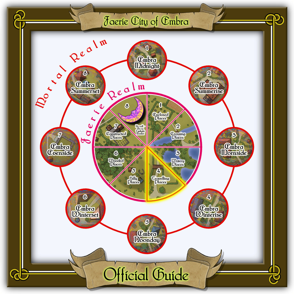
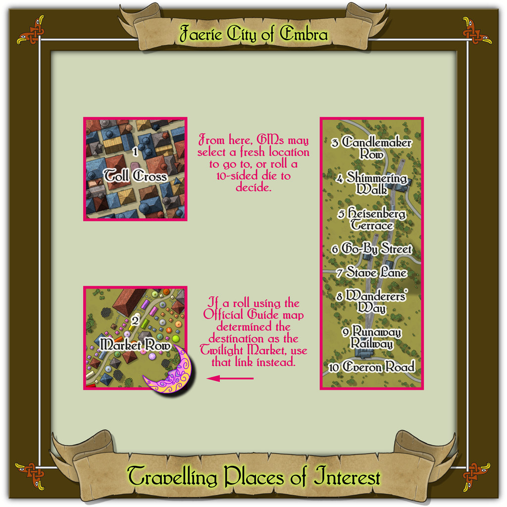
Community Atlas: Embra - Travelling Places
Fourth in the sequence of Embra's "Places" are the Travelling Places of Interest, as usual, accessed from the relevant part of the inner circle on the "Official Guide" map:
This takes us to the link-map, though this time there are just three link-spots on the diagram, two individual locations, and a group of eight "ways", rather than streets, as here, one of the "roads" is actually a railway (which features as the backdrop extract for all eight, primarily because it was a handy size and shape, and in the correct orientation without needing any adjustments):
The map border decoration was kept quite simple, as it seemed best to highlight the "Travelling" concept with something quite clean and direct. I toyed with drawing something quite severe of my own devising for the knotwork, though all that survived of that here was the simple, single line linking the corners (yes, I know, not much to show for it!). The basis for the little knotwork eagle heads - again seeming apt for "Travelling" - came from that famous Dover Clip-Art "Celtic Borders on Layout Grids" book once more, which were handily linked by a single line there too.

![[Deleted User]](https://secure.gravatar.com/avatar/c75d9a245b74d9c59be0999ea81ca541/?default=https%3A%2F%2Fvanillicon.com%2F92add7f8c954488718110edc4896ad39_200.png&rating=g&size=200)
-
Town Map for a Cthulhu Game
Interesting time to be thinking vampires/Dracula, as 2022's the centenary of the classic F W Murnau silent movie "Nosferatu", of course. Wikipedia link for movie in case anyone needs info/a reminder on this film.

-
Ancient maps
That 22-foot Roman Empire map is the Peutinger Table, aka Tabula Peutingeriana, and the Wikipedia page includes a high-res complete image of the whole - may take a while to load, however, as the full-size JPG is about 15 MB. This is the direct link to that Wikimedia image.

-
Community Atlas: Embra - Hilly Places
Map 3 in this set covers Hoolie Hill, yet another Edinburgh-influenced spot, as there is a real-world ancient site near Edinburgh called Huly Hill, which has a tumulus surrounded at a distance by three standing stones set on what seems to be a concentric ring (or perhaps two rings) centred on the burial mound. This though is Embra, so things have to be done a little differently, hence:
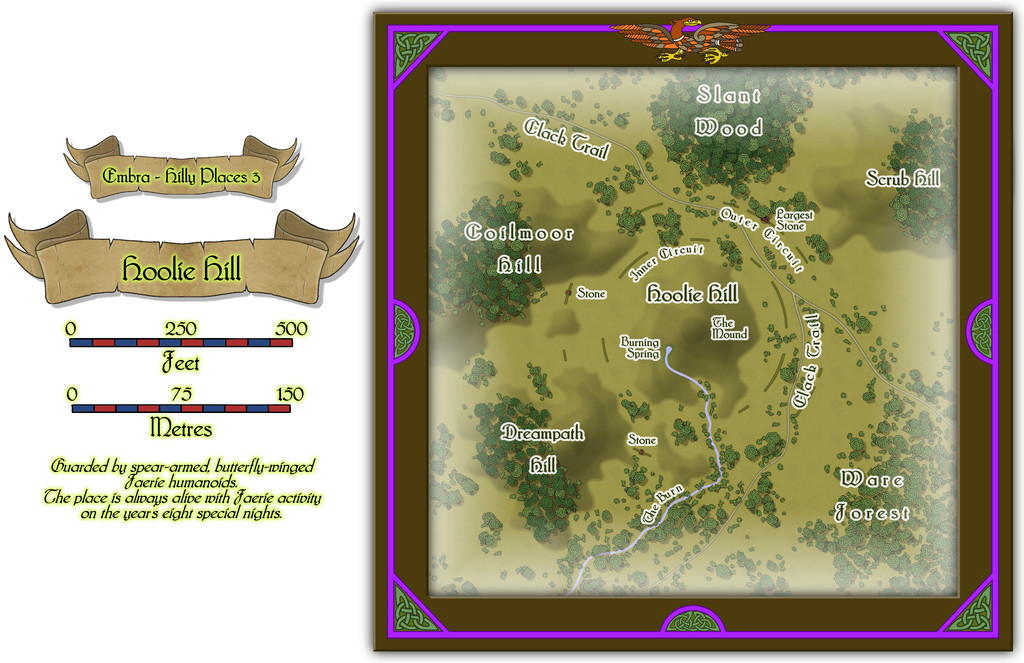
Thus similar, but not the same, and it is a particularly strong Faerie site. The base map used for this one also allowed scope for plenty of surrounding terrain features, so the Hill here isn't necessarily the most obvious feature for those unfamiliar, and trying to find it. The name, while a phonetic variant on the real-world one, was chosen as it can be thought to derive from the Scottish dialect term meaning "very windy", originating in a variant contraction of "howling (pronounced as "hoolin'") gale".
