


Wyvern
Wyvern
About
- Username
- Wyvern
- Joined
- Visits
- 3,266
- Last Active
- Roles
- Member
- Points
- 5,584
- Rank
- Cartographer
- Badges
- 24
Latest Images


-
Community Atlas: Embra - Villages
Continuing the circuit of villages brings us to Embra - Winterise, on the southeastern side:
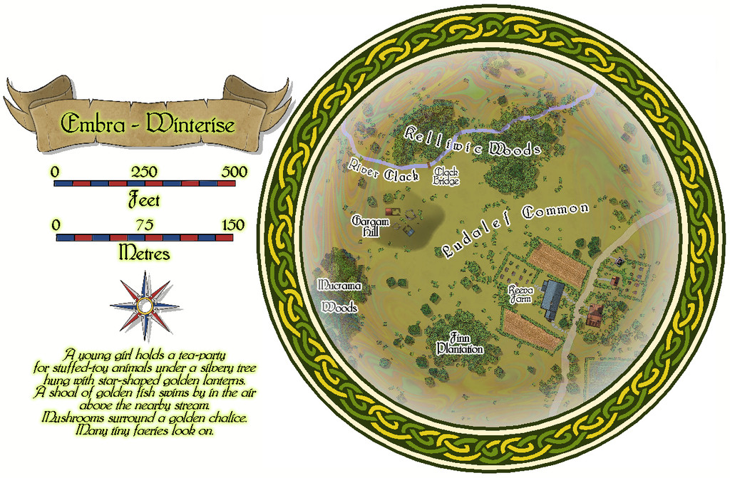
A neat little village on the road, that seems curiously separated from the narrow River Clack here, with its mysterious bridge that no track leads to, and some equally mysterious ruins atop Gargam Hill. This time, the properties are all of only a single-storey each:


![[Deleted User]](https://secure.gravatar.com/avatar/c75d9a245b74d9c59be0999ea81ca541/?default=https%3A%2F%2Fvanillicon.com%2F92add7f8c954488718110edc4896ad39_200.png&rating=g&size=200)
-
Community Atlas: Temple of Nidag, Stormwatch, Emerald Crown Forest, Alarius
With testing completed, the next stage could begin. My original thought was to use the Pär Lindström Horror House Annual mapping style to fit the overall unsettling theme, and because I thought a simpler drawing style would be interesting to use here. Ultimately, this was changed, but this was where I began. First, the hand-drawn dice design was imported:
Then a copied version of the outlinings plus the town wall segment was pasted onto a second BITMAP Sheet, whose placement was adjusted until it approximated to a fit over the dice design:
This view shows the extent of the mapped zone, and how far beyond it other items had been picked to ensure full coverage of the key area. It also indicates that the dice design barely fits the edges of any of the structures from Stormwatch. However, it also finally allowed the choice of area to be shown on the full Stormwatch map, by copying and pasting an amended version of the map border rectangle over to the Stormwatch map (as in the penultimate image from my first post here).
With this complete, I then drew an outline version of the dungeon design's layout, amended to fit the buildings better (at least as far as the nearer- and above-surface parts of the maps were concerned):
That was about the point I realised the surface map (or maybe maps) needed to be drawn in a different style, because the Horror House one doesn't have any vegetation symbols. While some could have been re-used from others, I thought it preferable to stick with a single style, if possible. Which turned out to be the Naomi Van Doren Fantasy Floorplans one. While not monochrome, it is a nice, fairly clean-drawn style, with a limited colour palette, which seemed appropriate for this high-northern (Stormwatch is at about 58°N latitude), somewhat creepy, setting. As we'll see next time.
[Had it been available when I started drawing this map last month, I might have been tempted to make use of Ralf's new Hand-drawn Dungeon Annual style. Actually, it might match quite well with Naomi's style, so you never know...😊]


-
Panzer sample thread
Probably just me, but the latest image looks like a bunch of lost Daleks trying to find their way home from a country walk 😉


-
Community Atlas: Embra - Hilly Places
The next, fifth, group of Embra's "Places" is the Hilly Places of Interest, linked from the highlighted "Official Guide" map's inner circle segment:
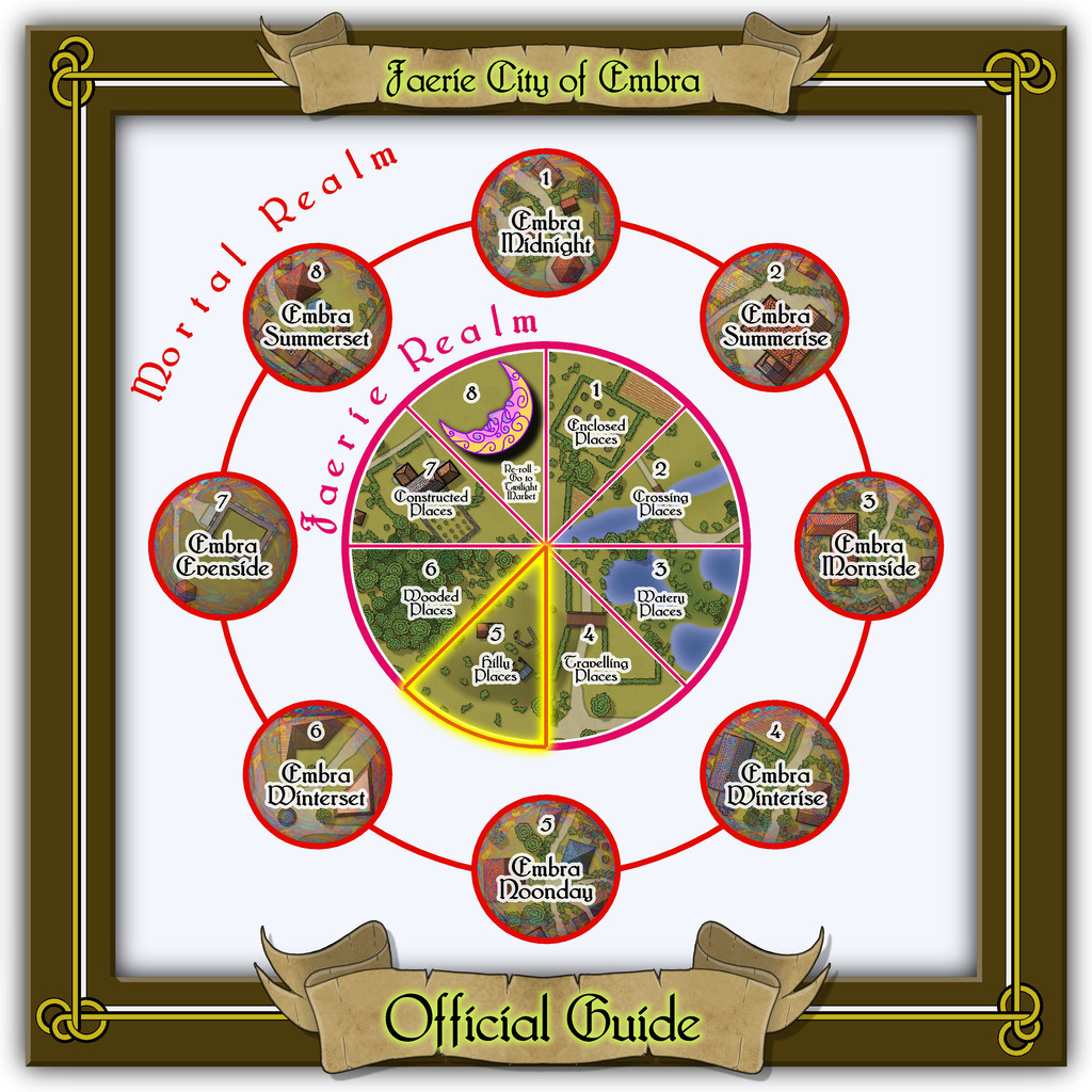
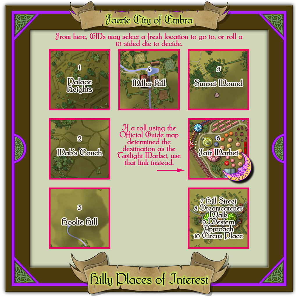
Quite a packed link-map this time, with six individual mapped places to show, as well as the condensed "Streets", even if just four such routeways had to be set-up on one map this time.
Two neat knotwork designs reworked from the Dover Clip-Art "Celtic Borders on Layout Grids" book provided the focal elements in the map frame design here, once rotated, with a simple linear connecting outline to help highlight them, the curved piece and triangle's slope hinting at upland places at least, although another of the figurative Dover book designs, an eagle, was used on the other "Hilly" maps in this set as a further concession to upstanding terrain.
-
[WIP] Community Atlas: Snakeden Swamp, Lizard Isle, Alarius - Dedicated to JimP
So, back for an update today!
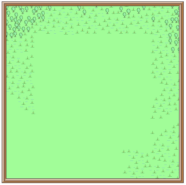
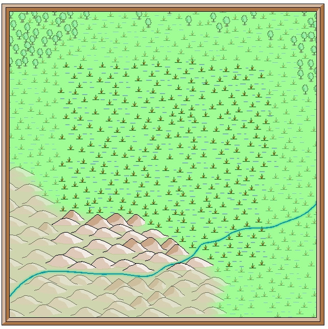
Opening the New Drawing Wizard, and naturally picking the CCPro Overland style, I set-up a 30 by 30 mile square area (to give room around the base 20-mile-square mapped region for a title, possibly some labels, and suchlike), and changed the background colour from its default sea-blue to green, to fit the landlocked swamp I had in mind. Then I went to set-up a new BITMAP sheet and layer to import the base map image into, and was surprised to find there was more than just a single sheet available (which was what I'd expected), and that some of those sheets already had effects on them. I'd been assuming I'd be working without sheet effects (beyond a transparency on the BITMAP sheet, at least). This though opened up some fresh possibilities, as one concern I'd had was that a lot of the early vector symbols and fills use zero-width lines, which tend to vanish when extracting higher-res images. Being able to add elements like glows could help them stand out better, so this was going to be a somewhat more sophisticated map than I'd anticipated!
This is the opening scene with just the imported bitmap image in the map (I'm keeping these opening images deliberately under-sized for the Forum, as there's fairly little detail on them):
And this is it with the transparency effect on:
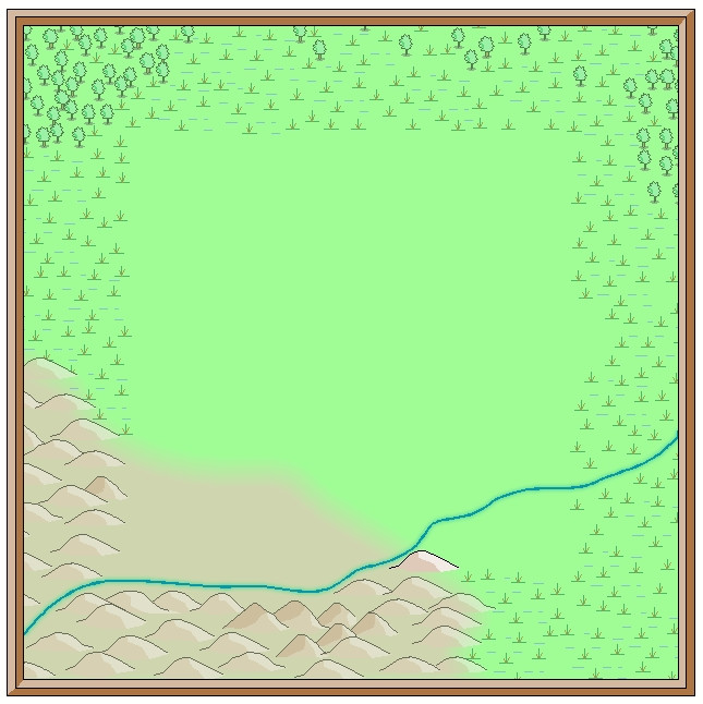
Next, I started sketching-in some base terrain elements beyond the centrally-mapped area, using only symbols, to have more control over their sizes. Here, I'm working with the BITMAP sheet's transparency turned off:
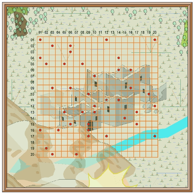
This is the appearance without the bitmap image entirely:
One advantage of this vector mapping style is that you can add effects such as transparency to the symbols sheets, and see - as here - that the symbols fade out a little, which is what I wanted to do for the area beyond the mapped zone, showing the terrain there still, yet without so much detail. There's no need for technicalities like the forced redraw command that would be needed for raster symbols, though these were all set-up on their own new sheet, of course. The symbols, incidentally, were all from the extensive "Filled" vector set available under the CC3+ overland style, which was the default set available on opening the new map.
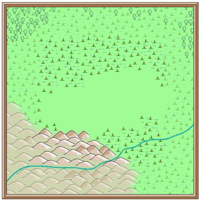
The next snapshot shows this whole border zone completed, with the hills and river added, as well as a background colour showing the full extent of the hills into the central region as well:
I amended the edge fade on the terrain sheet to retain the softer transition at the edge of the hilly area. The perceptive may notice too that one hill seems a little less transparent than the others, as that one's now on the main symbols sheet, that has no transparency effect on it. That difference is a little more obvious as the central area gradually fills-in fully:
With that completed, deciding what symbols would be suitable to highlight the features on the fully-mapped area could begin - next time!

-
[WIP] Community Atlas, 1,000 Maps Contest: Villages in The Whispering Wastes of Haddmark, Peredur
Having thus generated the surrounding wilder lands, it was then time to construct the random, geomorphic-dungeon-designed map, as noted earlier, using the OSR Dungeon style from the 2015 Annual, in the manner established for my immediately prior map, again mirroring that used in the Shadowdark supplements. Since the Inkwell Explorer dice are one of the sets for which no written descriptions are available, I'd had to work up some ideas about the content well in advance, so seeds for some could be planted in the regional Whispering Wastes map. One of the random map designs for this layout was a fairly obvious temple structure, albeit with a curiously crystalline-looking central focus:
Having tried a few random rolls on the main Shadowdark tables, I came up with a cult that spoke only in whispers (which of course ultimately developed into the area's name), but nothing that seemed to match the temple's crystal focus. So I turned instead, and rather by-chance, to a free PDF Shadowdark supplement, created by the online Discord community earlier this year, which allows the design of slightly weird mega-dungeons randomly, on-the-fly. This is called "Shadowdome: Thunderdark" (SD:TD), and was used to create a random mega-dungeon, run through by two teams of players in direct competition, at Gary Con 16 in Lake Geneva, Wisconsin, USA, in March 2024.
I began with a few random rolls from tables in SD:TD, and stumbled onto several items with a crystalline theme that way. Some quick adaptations to extract other related features, more random rolls and a few deliberate choices, and suddenly the layout became The Crystal Cathedral of the Whispering Wastes, or "Crystal Cathedral" for short:
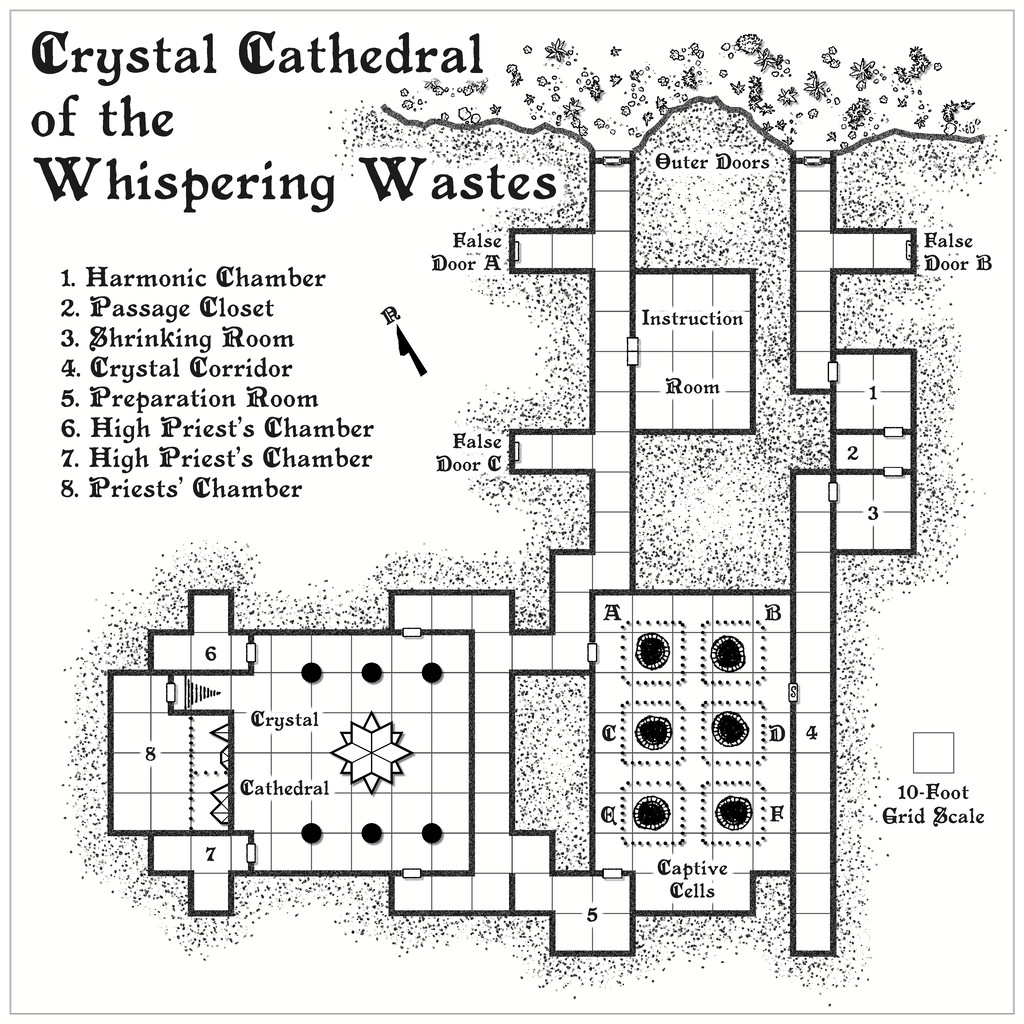
This was located, hidden away and hard to find, in Lightning Ravine, Hex 1002, with the Outer Doors opening onto a ledge partway down one of the side-canyons in said Ravine. It was rather fun to watch the whole coming together from what was provided by SD:TD, with some expansions and a little adaptation in places.
Ultimately, the process provided a gigantic creature, "The Shimmering", that was living in the crystal, and which had descended from the stars long ago, sinking into the earth and creating a protective crystalline casing for itself. It had set-up a cult of humanoids (The Shimmering Cult) to provide living creatures it can feed upon, turning them into fresh parts of the crystalline features scattered throughout this little complex, with a view to eventually having sufficient power and energy to return to the cosmos. (Freely acknowledging here influence from Lovecraft's "Colour Out of Space", and Nigel Kneale's "Quatermass 2", where even the cult acolytes receive a small "mark".) The cultists become transformed into parts of the crystalline structures eventually, gaining extra powers and abilities along the way. Plus parts of the cult can be found in other places in the Whispering Wastes, as the notes for that map, and this one will suggest. Cultists who are always on the lookout for lone travellers and others who seem unlikely to be missed...
Ordinarily, that would have been that, submission ready for the Atlas, and I'd have been moving on to the next small dungeon map in the series, intended for somewhere in the Feralwood Forest of Alarius. However, while I was finalising the notes for both these maps, Remy Monsen dropped-in the 1,000 Atlas Maps Competition. As noted in my first posting here, the Shadowdark hex-mapping system allows the creation of individual sites as well, including settlements, of which there are ten on the hex map, all village or hamlet sized. As I'd already done the basic layout designs for these in preparing the map notes anyway, I decided to try mapping all ten. Whether they'll all be finished before the contest ends is, of course, another matter. I will complete them, if other things allow, regardless of that though.
First village is to come next - Ljungby (Hex 005)!


-
Community Atlas: Embra - Constructed Places
Thanks very much everyone!
And on Quenten's point, the odd thing is the Character Artist portraits take hardly any time at all, by contrast to other types of map.
It is a shame that Character Artist doesn't get the same kind of updates and additions other parts of the CC3+ program suite do; some variant body and face shapes would be interesting, for instance, though I appreciate that would add a lot of extra work, fitting the various costumes and weapons, etc., to such alternate forms. Still, if you don't ask...


-
Postcard Maps
In my accidental "voyage of discovery" of non-standard maps this year, following my learning of the playing card maps highlighted here earlier, recently I came across some old UK annotated postcard maps, not least one that the H P Lovecraft Historical Society reprinted as a physical prop with one of their series of 1920s-30s-style audio programmes, "The Iron Maiden", published early last year. Mostly, these "Dark Adventure Radio Theatre" shows are based on the works of H P Lovecraft and similar horror writers of that period and before. The prop in question was this map of the Isle of Wight off the south coast of England, from the 1920s:
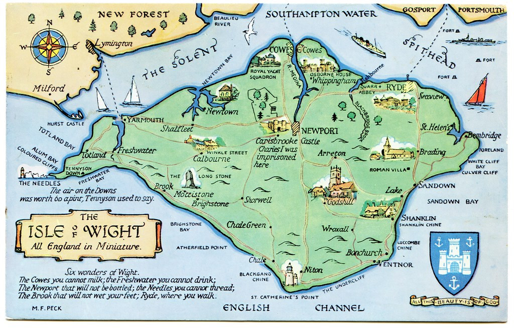
This style of map could be quite easily drawn using CC3+, and I particularly liked the annotations, as elements it would be easy to add to such a small-area map to inspire adventures in a fantasy setting, notably that short list, the "Six wonders of Wight".
Again, like the county playing card maps, this could be something readily adapted for RPG mapping use, I think, to give a fresh twist on how they appear. Of course, a dedicated style, with suitable feature symbol illustrations for CC3+, wouldn't go amiss either!


-
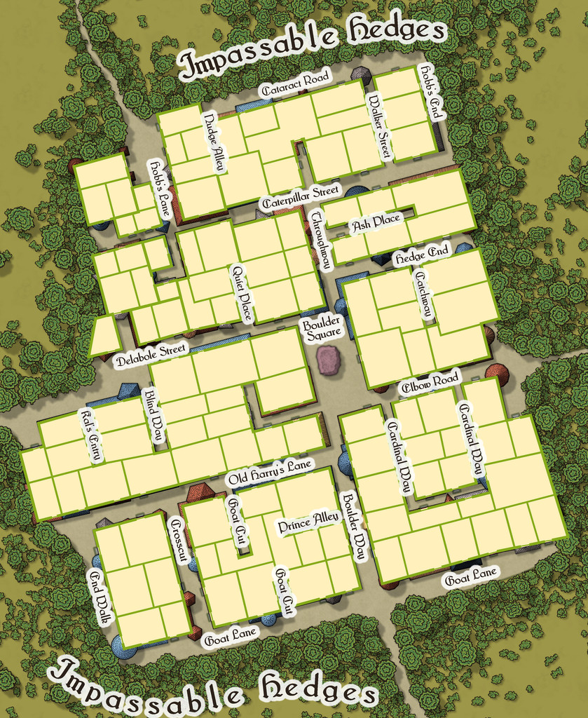
Community Atlas: Embra - Travelling Places
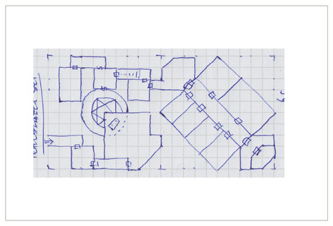
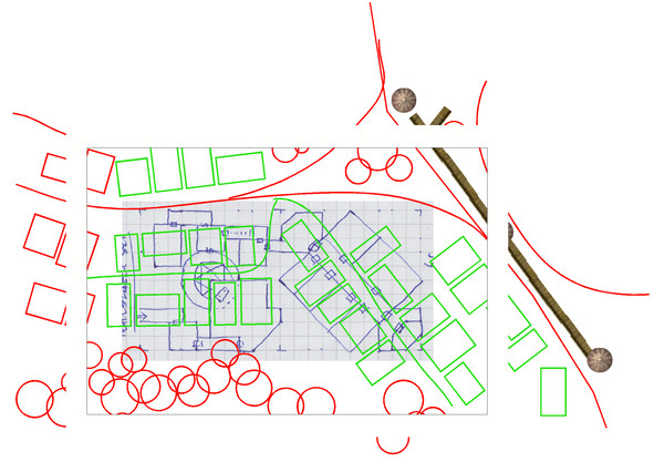
Travelling Place 1 is Toll Cross, which as we see, is an unusually heavily built-up area, surrounded by dense greenery, beyond which is open grassland or moor:
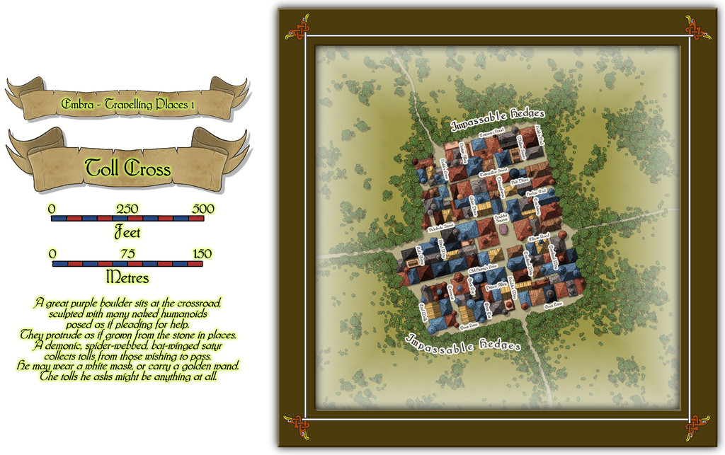
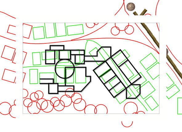
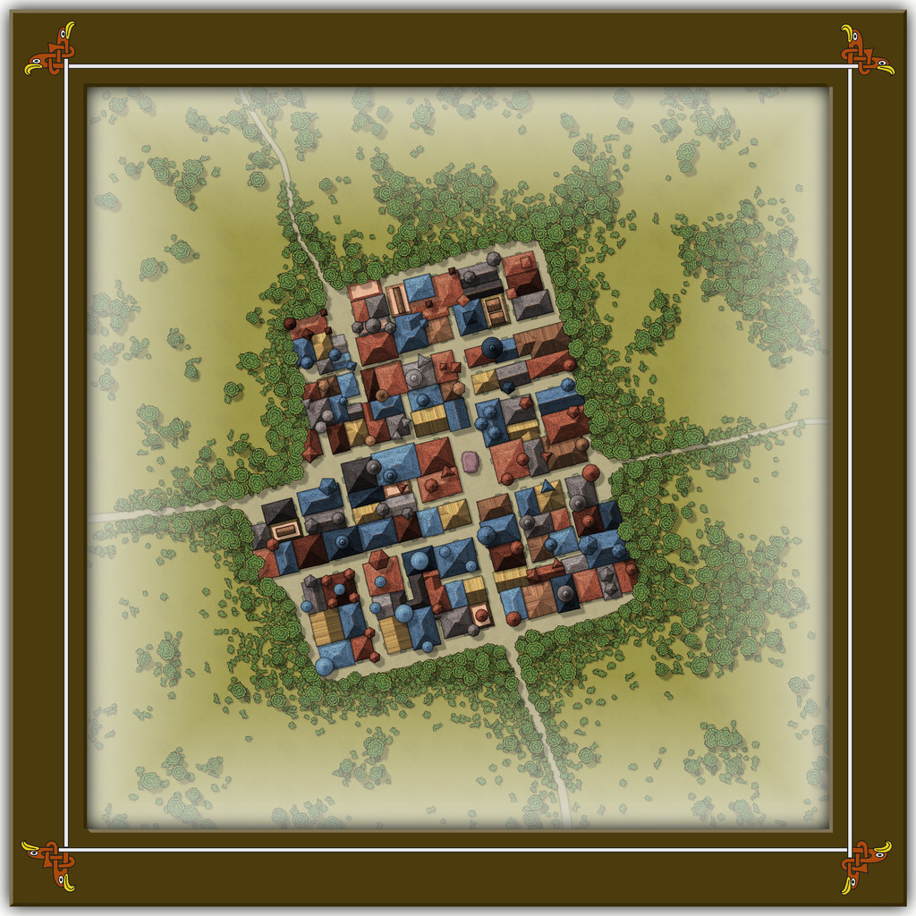
While the base-map was a similarly heavily-urbanised area, the nature of Toll Cross (and indeed even its final name) derived chiefly from the accompanying featured text, and especially that demonic satyr figure. The Impassable Hedges mean anyone wanting to visit the shops or houses here, or even just pass through it directly as a crossroads, is channelled into using one of the four access-routes. Then I adjusted the layout of the buildings slightly in places so those on foot can get to only a fraction of the properties inside unless they pass through the central Boulder Square, where Guess Who waits, like a spider in a web... This view is with the labels turned off to get a better impression of the settlement:
This looks a bit odd (or at least, it's meant to), with some strange rooflines, and what seem to be many towers. An extract from the accompanying text and PDF file may help explain:
There are...many tall spires and tower-like structures of different sizes and forms, some of which are visible above the trees from outside the settlement. These features are all entirely solid, and appear to have simply grown from the roofs and upper walls of the buildings. Few are straight, and many could pass for horns. Quite a number of roofs overhang their properties as well, and can give the impression of being ill-fitting, or as if they were worn as wigs that have slipped slightly. The whole can be quite unsettling for those not used to Faerie, and even those visitors with Faerie blood may feel there is something a little off-kilter about Toll Cross.
Despite the range of building shapes and sizes, they all have just a single accessible storey at ground level inside, as the toggled view to show the building interiors indicates:
This also shows just how much some of the rooflines, and particularly those horn-towers, don't marry-up with the building outlines, yet the buildings, thanks to their lack of internal connections, further help block any attempts to avoid using Boulder Square. And if you try to fly in, it turns out those roofs aren't so immobile as they may appear...
-
Show me your science fiction maps!
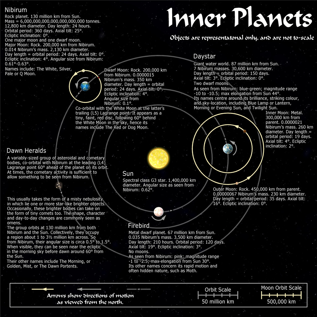
Not sci-fi, since they were all done for the Nibirum Community Atlas, which is all fantasy mapping, but they were done in the general style of planetary-system mapping, so may still be of interest. However, I did a series of maps for said Atlas back in 2018 - Forum thread here, Nibirum Solar System start page here, with a sample map to give you an idea, just for the inner planets:
All these maps are also in my Forum Gallery here.


