


WeathermanSweden
WeathermanSweden
About
- Username
- WeathermanSweden
- Joined
- Visits
- 3,737
- Last Active
- Roles
- Member
- Points
- 459
- Location
- South of Lübeck in northern Germany
- Website
- https://www.astroinfo.se
- Real Name
- André Franke
- Rank
- Surveyor
- Badges
- 6
Latest Images
Reactions
-
Edge Striping and Displace - combining both and the resulting effects
Here is the .fcw for the "pile" with the "water ripples" and its belonging .png filters
Both filter images have to be copied into the ProgramData\Profantasy\CC3Plus\Filters\Images folder to make the map work properly.
The displace filter was generated in Gimp and converted to a normal map in Wilbur (I think you could have done this also in Gimp...) ...and as I use the german version of Gimp the filtername became also german - for me to remember how I created the image...?

The .png does not show up correctly in the preview - black should be transparent... The filter map is inspired by the one @Raiko posted.
The .png file above seems to loose transparency - here the .png as a ZIP file:

If someone is interested I can also post the .fcw for the island/beach/waves...

![[Deleted User]](https://secure.gravatar.com/avatar/c75d9a245b74d9c59be0999ea81ca541/?default=https%3A%2F%2Fvanillicon.com%2F92add7f8c954488718110edc4896ad39_200.png&rating=g&size=200)


-
"The Most Accurate Flat Map of Earth"/"Astrophysicists Design World Map That Looks Like a Vinyl LP"
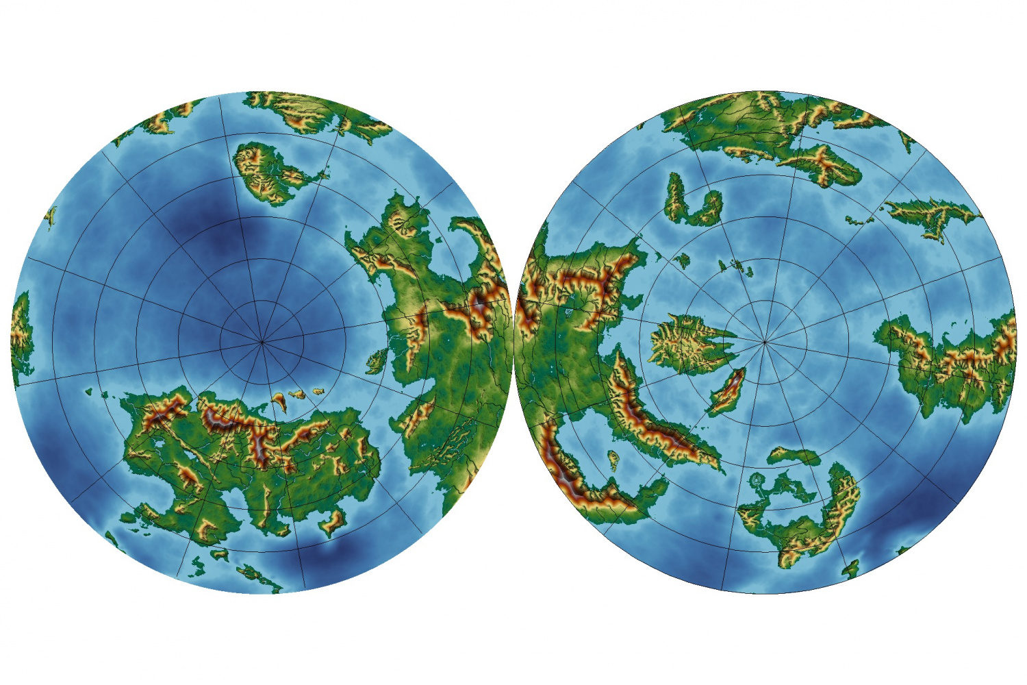
I tested the projection on Nibirum and I think it looks quite interesting...


-
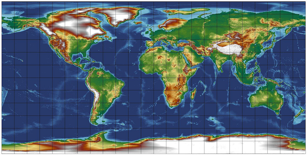
Importing jpg maps into FT3+
The height values of the original data is in meters as well as in the .mdr file for FT3.
I had a quick look at the original dataset you have used for generating your map and it contains erroneous height values up to 10.200 meters that are kept even after conversion to a .mdr file (my program assumes that the original dataset has no errors...). This leads to the effect that you described - that all heights seem to be coloured in a lower level colour (the map looks greener than it should look like).
To get rid of the erroneous heights I loaded the .mdr file into Wilbur (http://www.fracterra.com/wilbur.html) and searched for all heights above 5000 meters and replaced them with the value -5.200 meters which gave a satisfying result. Then I loaded the corrected .mdr file into FT3+ and made an export using Jerion style. But this style is optimised for feets so you have to change the world settings to feet before exporting.
The result in FT3 looks like this:
The result in CC3+ (the colour ramp ist optimised for data up to 30.000 feet but the highest mountains are only about the halv of that height...:
and the belonging FCW is attached.
That the height colours do not match exactly is in my opinion due to the two different setups - one for the colouring of the FT3 map and another for the export.
To get a little more dramatic map of the world I used the global math tool in FT3+ and multiplied all heights by the factor 2. The result in FT3+ looks a little strange, but the exported FCW for CC3+ looks quite realistic.
I only post the CC3+ result here:
and the belonging FCW:
Keep in mind that the heights in the legend are wrong by the factor 2 now...the must be corrected manually....
As you mentioned when you zoom in a map in FT3+ you always have more details as when you do it in CC3+. That is because of the simplifications that have to been made when converting gridded height data into vector lines.
-
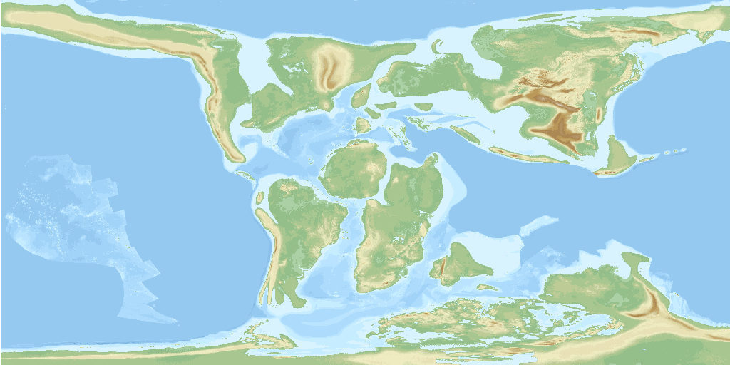
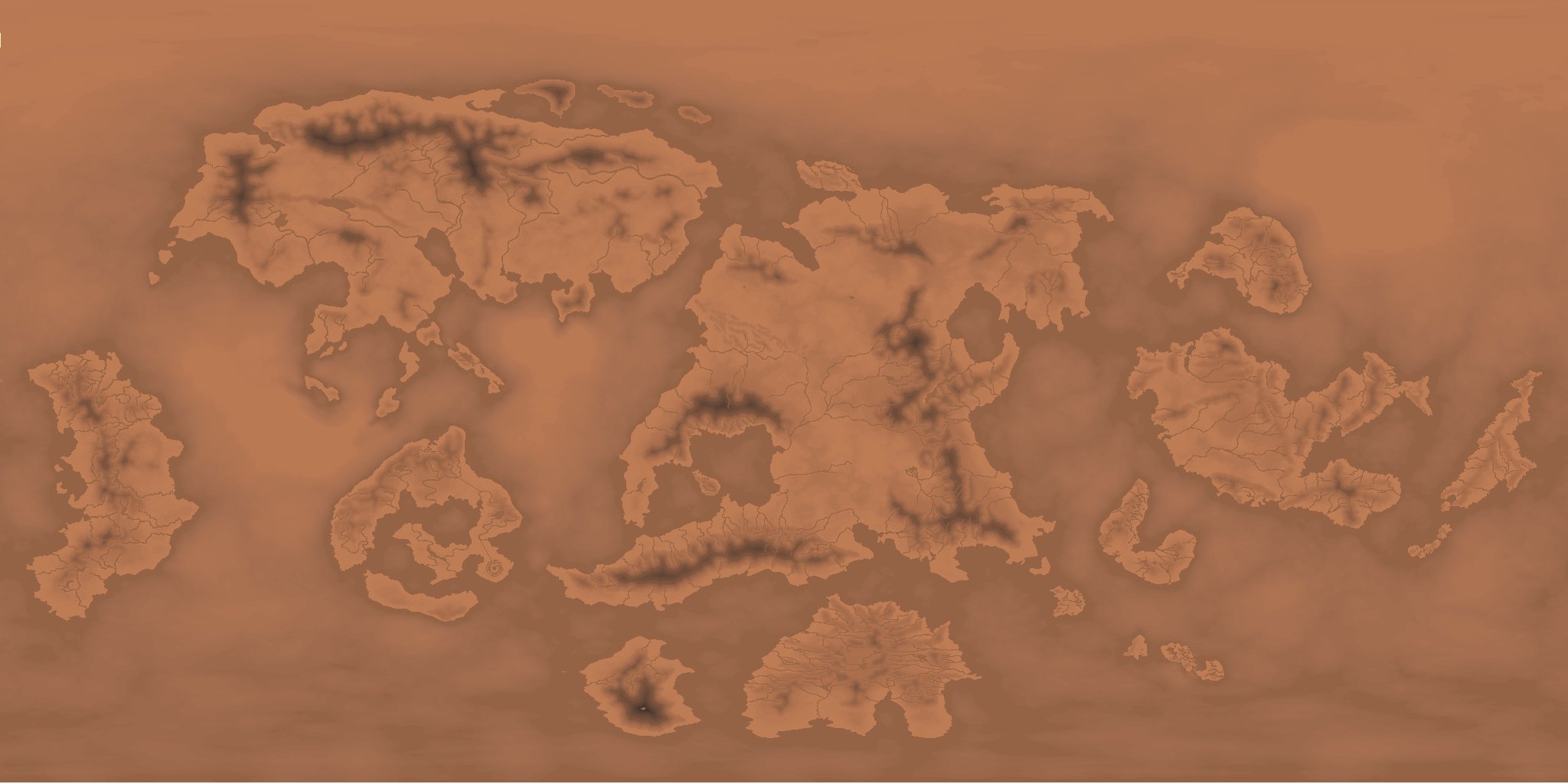
What the world might have looked like 60 million years ago
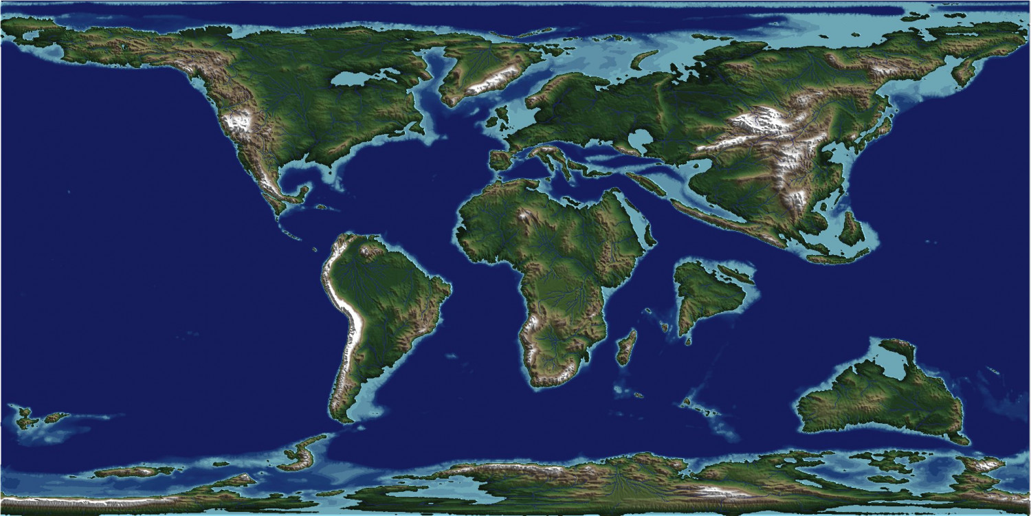
For this map I used the data that can be found here or here. I have converted the data so that can be imported into Wilbur. Within Wilbur I followed the instructions of "One Day World Builder" (Annual issue 155) to make the rather rough data looking more natural. Thereafter I generated the rivers in FT3 and exported the map to CC3+. The above picture is a pure CC3+ output with a layer for shading with a normal-map exported from FT3+.


-
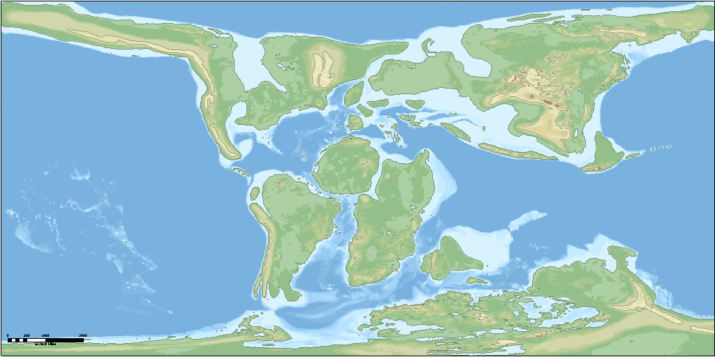
FT3 Real World Data conversion
Not directly as far as I know. But there is a (rather complicated) possibility to transform those datasets into a file format that can be imported into FT3. I gave it a try in Windows (though there might be much more, better and faster ways in Linux/Unix) and have converted one file (Map07 - 20Ma higher resolution) to a .mdr file which looks like this in FT3+:

The data behind this map belong to Christopher R. Scotese and Nicky M. Wright and they are using following licence: Creative Commons Attribution 4.0 International
And the exported map in CC3+ (Jendor-Style):
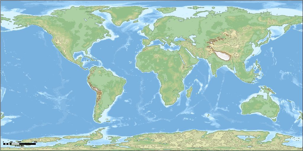
Here is the belonging CC3+ File if somebody is interested...


-
Community Atlas 500th Map Voting Thread - Please vote
The fabulous and fascinating maps presented here show once again a) what can be crated with CC3+ and b) how ambitious and talented mappers here are - all did their best and I think all succeeded very well. ??
...which leads to the the slight "problem" for me as well as for many others here - that it is hard or nearly impossible to decide which maps are best. ?
So if anybody new is asking what you can do with CC3+ or what type dungeons can be created with it - give a link to this discussion to her/him with a plenty of excellent examples!


-
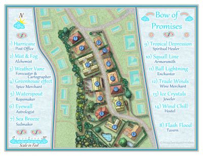
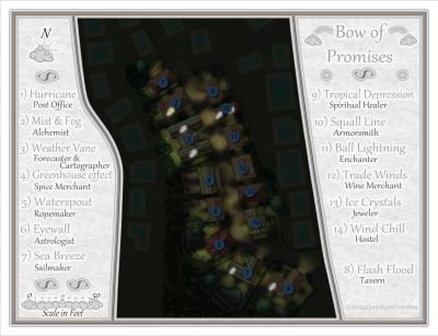
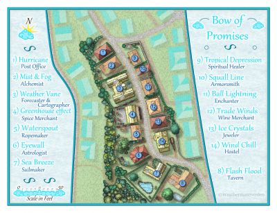
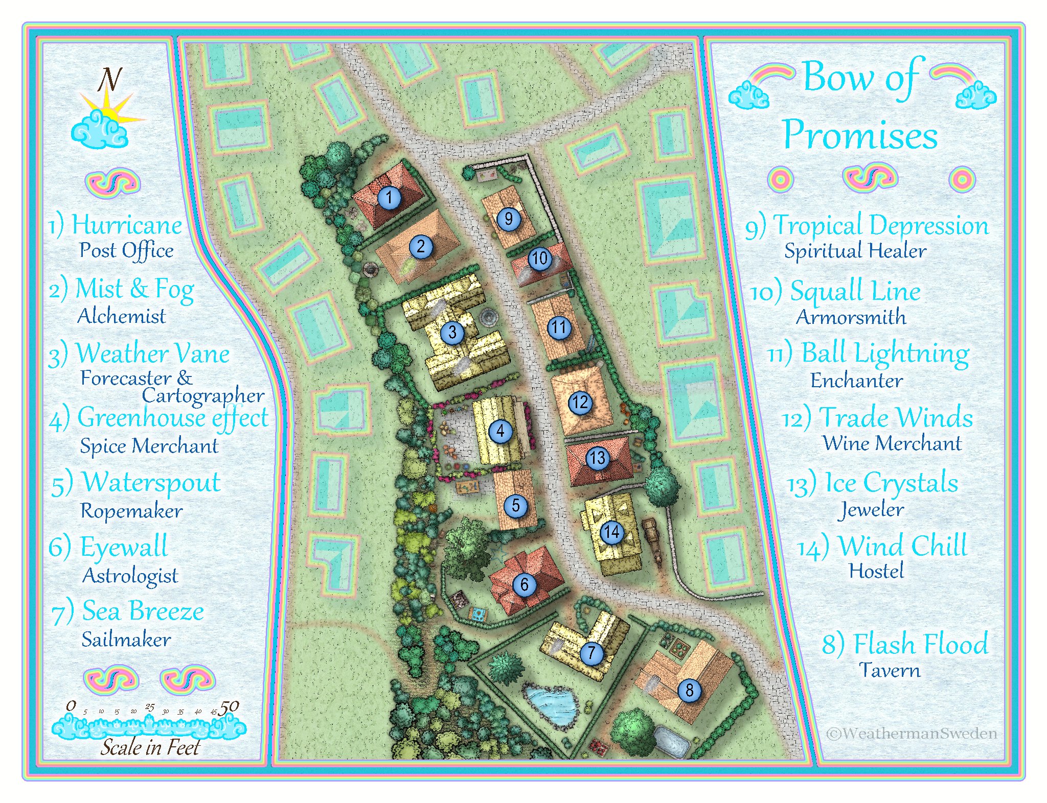
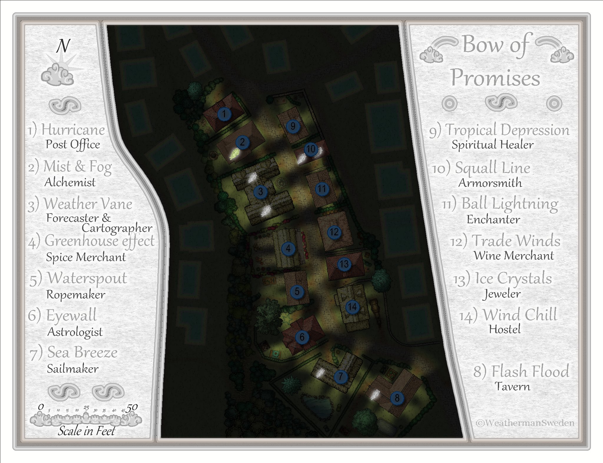
October challenge: Bow of Promises (Street) WIP
@Loopysue - I have now changed the the chimney smokes - thank you for your advice, Sue!
As @Wyvern points out it has to do with coloured symbols - the tend to be somehow self-luminous in the night... ? ...and I did misread your comment:
can't even see the stairs at nightWhat stairs? ? Oh - stars, I see...?Added some more details to the properties - some more things to explore/discover "behind" the houses...
So, I think I have kind of cleaned up my sheets and effects. The only Atlas-incompatibility are my "stripes" but I can post the edge-stripe image as well - it has to be put in the Filter->Images Folder. @Monsen Is that ok Remy?

I will submit the day version "only" - but it contains of course even the night version.
This is how you turn day into night..
BUILDING WALLS:-> Check both Wall Shadow effectsBUILDING OTHER:-> Check RGB Matrix Process -> Change Transparency from 50 to 5SYMBOLS:-> Uncheck Wall Shadow, Directional -> Check RGB Matrix ProcessFor all the following LABELS, BACKGROUND HIDE, TEXT HOUSE NAME, TEXT HOUSE USE, MAP BORDER PACK, CARTOUCHE -> Check RGB Matrix Process@Monsen Where to put this instruction?
-
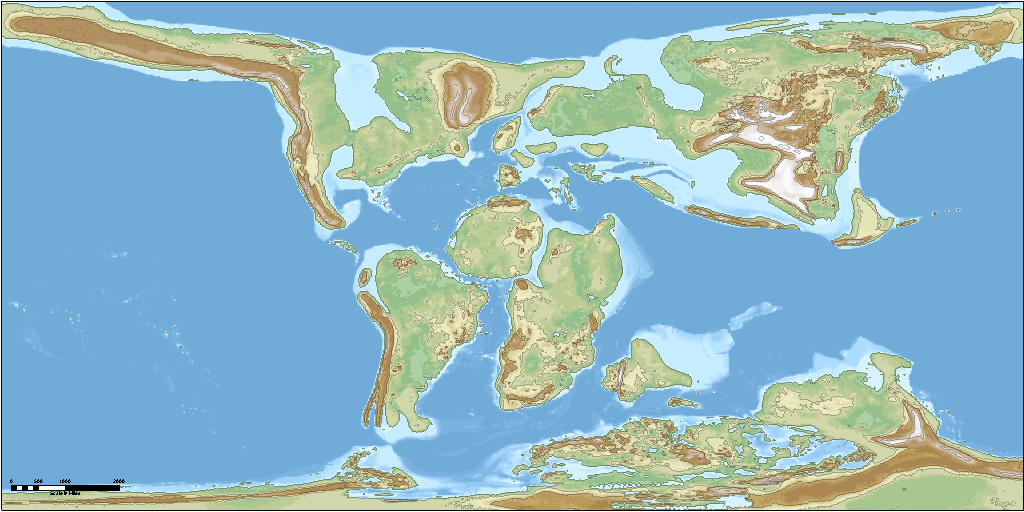
Northern Europe 15.000 before present - how it might have looked like...
As soon as my MDR-converter is more user-friendly I will write a short tutorial as I did for the Paleo-maps.
I also plan to describe the data provided by the authors a little more in detail and some of the problems I ran into when using the data.
This is a great source for everyone who ever wanted to get "real" elevation data for the ice age - though we never will know exactly what our earth looked like plenty thousands of years ago...
Meanwhile - here is what the whole world might have looked like about 15.000 years before present:

-
October challenge: Bow of Promises (Street) WIP
@Monsen Yes, it is ment to be a more peaceful part of the town...but as you say - who knows what is hidden behind the houses in the bushes or the cellars of the houses...
But that is up to the user of the map - that easily can be turned into a "dark-bow" area thanks to the fantastic possibilities with sheet effects. Already by simply turning of the "rainbow-effect" you get a rather neutral map with a slightly cold touch (matching the cities geographical position on Nibirum)
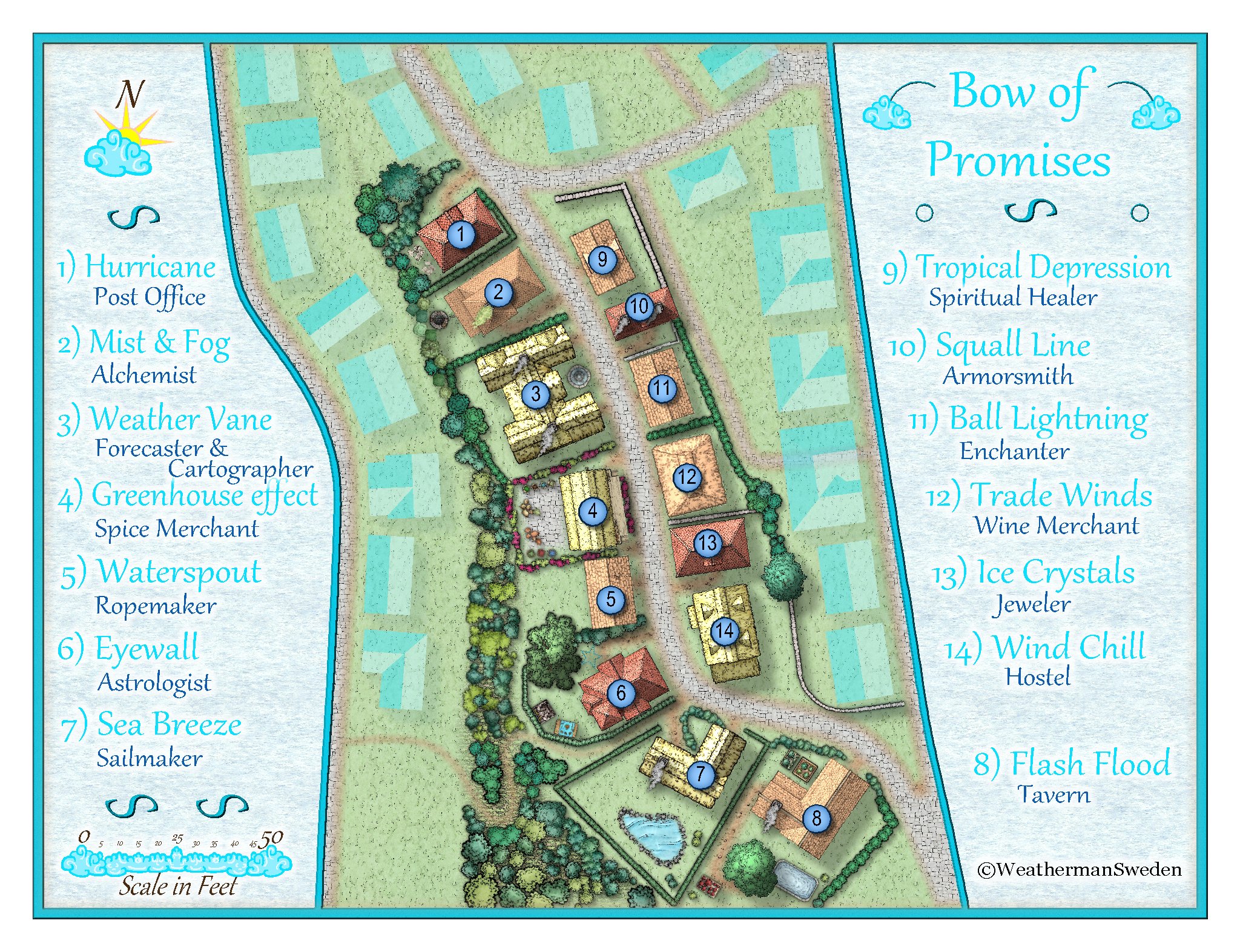
@Loopysue Thank you Sue for your kind words!
For me one of the most difficult things was the decision where to end the map and how much of the environment should be shown. At the same time I felt that the surrounding buildings should not distract to much from the place / street that should be mapped. And most fun was/is testing sheet effects ☺️

-
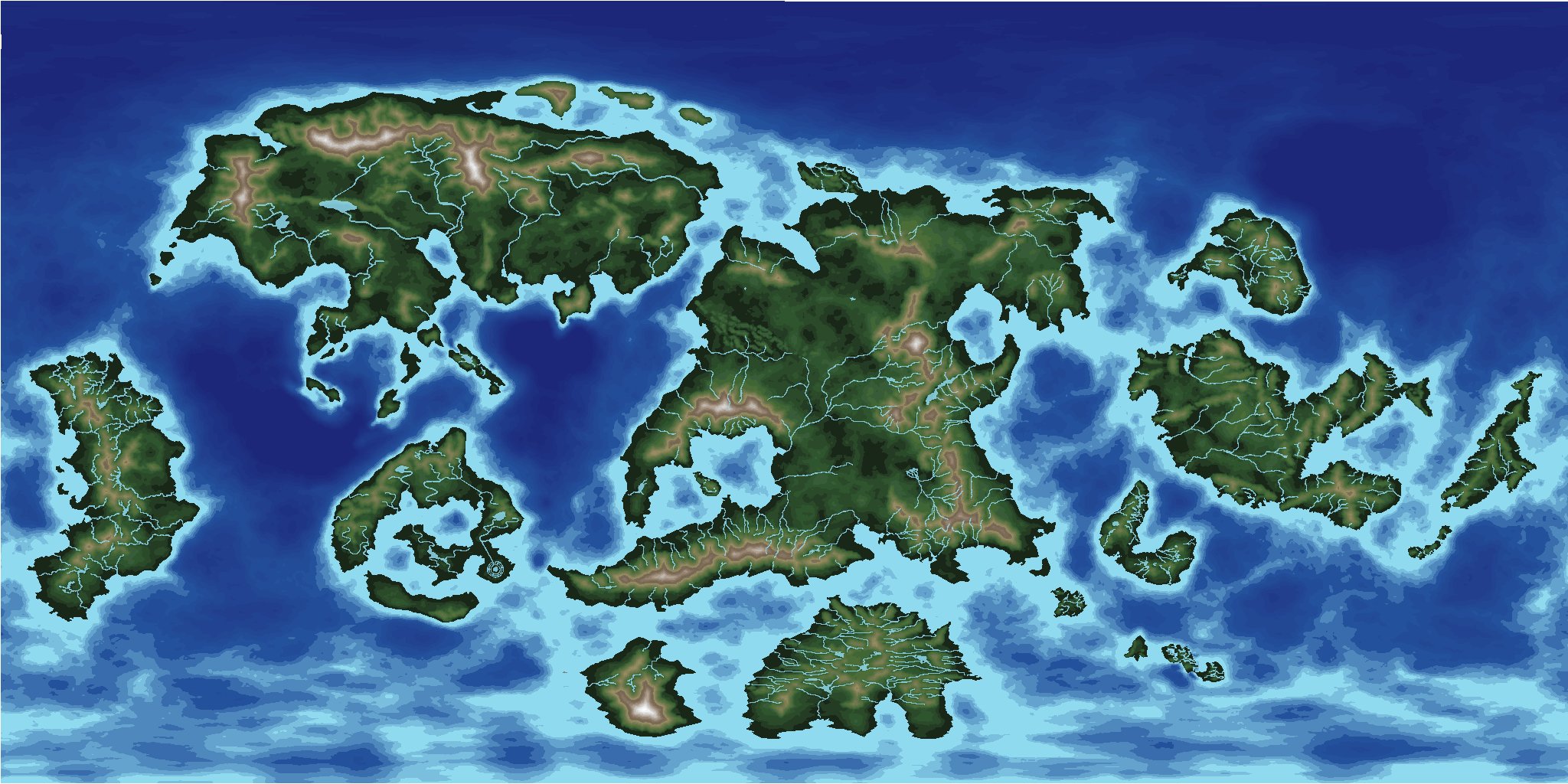
[WIP] Community Atlas - Topographical map of Nibirum with ocean currents
@Monsen Remy, can a script change the colour palette of a map automatically when clicking on a button or something like that?
My map uses (as you already may have suspected...) one of my 32/16 colour schemes (based on Sue's schemes) so that the user easily can change the whole appearance of a map by changing the palette in the FCW file.
Natural:
Desert:
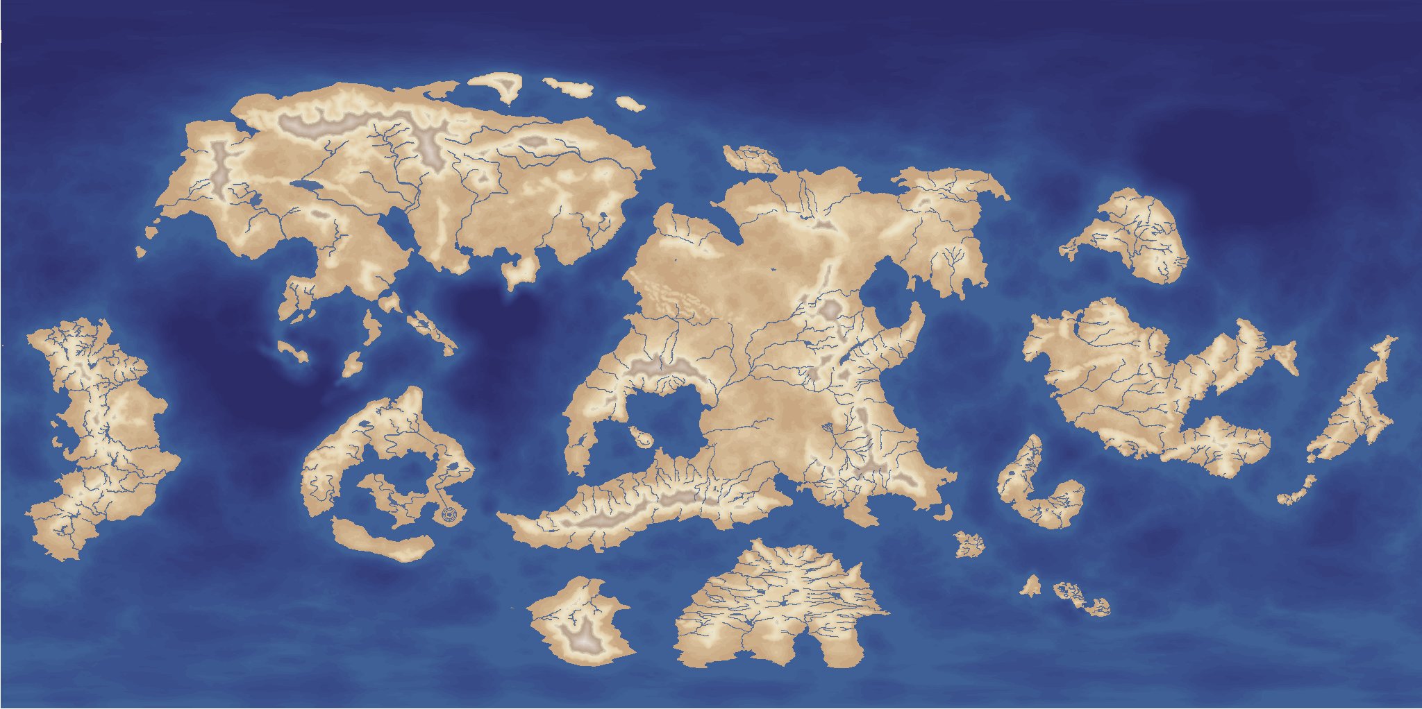
Parchment dark:

and so on...
Or what about just a Mars look like one ?:
Just in case someone has a need / use for this...or over 100 other variants... ?


