


Royal Scribe
Royal Scribe
About
- Username
- Royal Scribe
- Joined
- Visits
- 9,942
- Last Active
- Roles
- Member
- Points
- 3,476
- Birthday
- February 5, 1968
- Location
- San Francisco, California
- Website
- https://legacy.drivethrurpg.com/browse/pub/31814/Royal-Scribe-Imaginarium
- Real Name
- Kevin
- Rank
- Mapmaker
- Badges
- 16
Latest Images

Reactions
-
[WIP] - Sakherma Ruins
Reduced the Lightness Base from 75 to 58 for the HILL sheet and 62 for the HILL 2 sheet (but I'm not sure that a 4 point difference is visibly apparent to the human eye), and added some more dunes.


-
[WIP] Atlas Contest: Village of Djayet (Gold Coast, west coast of Doriant)
After my village of Per-Nezahd grew too large and is rightfully now a town, I went back to the drawing board and created a new village in the same Desert Oasis style. This one is significantly smaller.
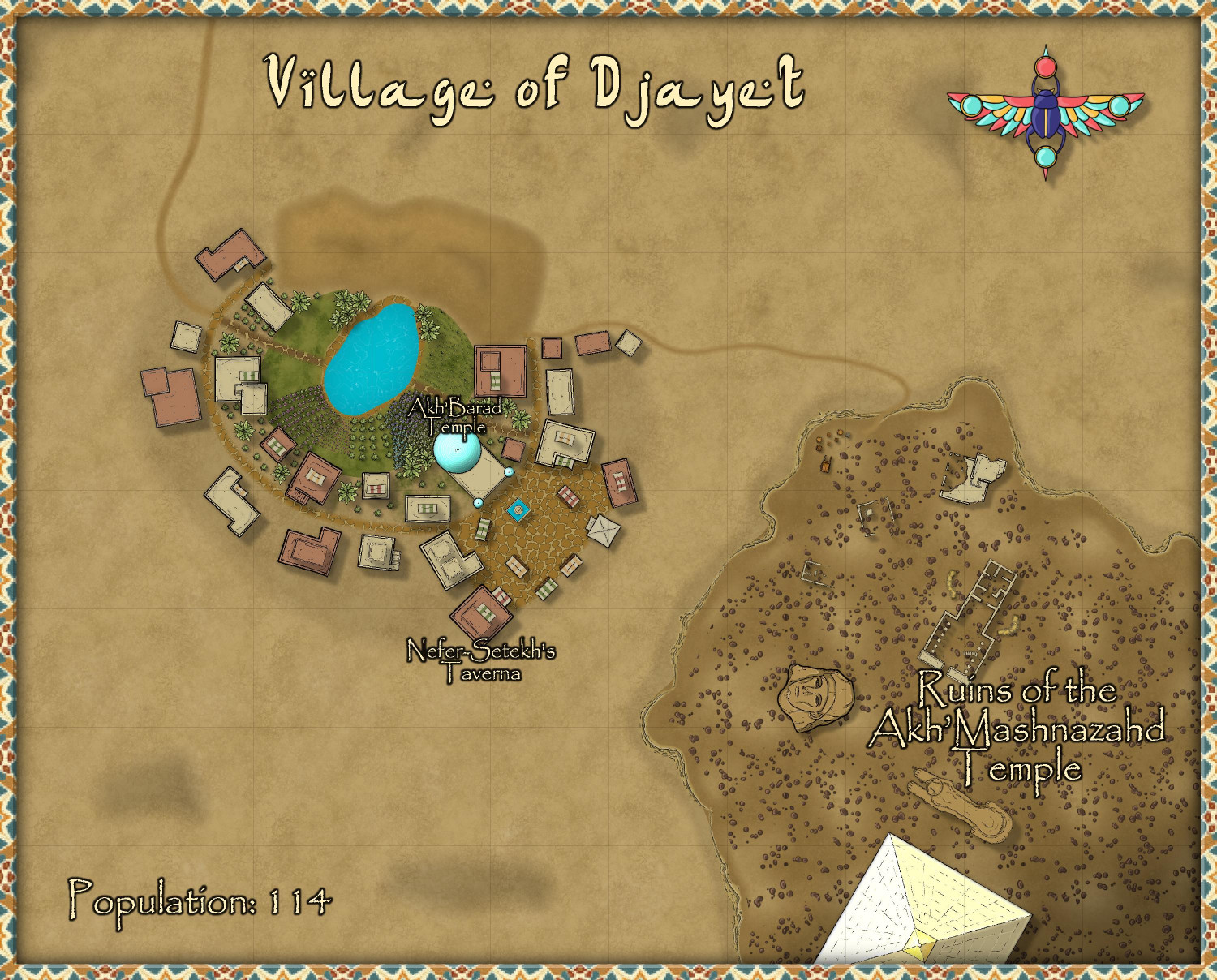
[Note: this is in an area of the Atlas that has not yet been developed. I have parent maps almost ready to submit, and will start a thread later this weekend to submit them. Just finishing up the descriptions for them.]
There are 22 buildings that are either fully residential or mixed-use business/residential. I assumed an average population of 5.2 residents per residence, giving me a population of 114. Does that sound about right? I also spread things out a little more than you would in a walled city or town, but maybe I should spread things out even more?
I used varicolor bushes of different sizes to create crops. I don't know much about desert oases form, but I thought maybe a hill would be needed. I added a darker terrain below the hill to distinguish it from the smaller patches of hills scattered around, which were meant to be sand dunes.
I was going to use a ziggurat from SS5 as the temple, but the temple symbols in this annual were too irresistible to pass over. In the end, the only symbols I used outside of this annual were two broken columns in the ruins from CA49. For a village like this, it didn't seem necessary to label much in the village itself, just the temple and the taverna. I don't think a village of this size could support too much specialization, though there are market stalls available for the use of trade caravans that pass through. I also figured that this village was too small to afford to construct a wall (though maybe I should add a tower or two?).
In the lower right on a bit of an outcrop, I set some ruins of an ancient temple and city. Near the road that reaches the ruins, I placed a cart and scattered boxes and barrels to suggest that maybe an archeological dig is underway? Adventure hooks: maybe the archeologists have disturbed an ancient malevolence that should have remained untouched? Or maybe, Indiana Jones-style, the adventurers need to race to find an ancient artifact before the opposition finds it.
For the title, I used the default font for this annual, but it was too hard to read for other place names, so I used Papyrus for those labels. Is it okay to use a different font for the title? Should I switch the title to Papyrus? I didn't use the scale bar, as pretty as it is, because it says "miles" on it and this map is only 500 x 400 feet. (Although...if I ungroup it, maybe I can delete the "miles" text? I will have to try that.)
Any advice or feedback?


-
[WIP] Greenwood Falls (CA211 Watabou City Revisted)
I was a little intimidated to attempt this without seeing a Live demonstration first, but since I have the day off, I decided to dive in.
My first attempt was just a small village (152 buildings, population of 920), but I can see how a lot of the conversion goes quickly regardless whether you have a population of 500 or 5,000.
Here's what Watabou generated for me (converted from PNG to JPEG for size considerations):
And here's what I was able to create in a few hours:
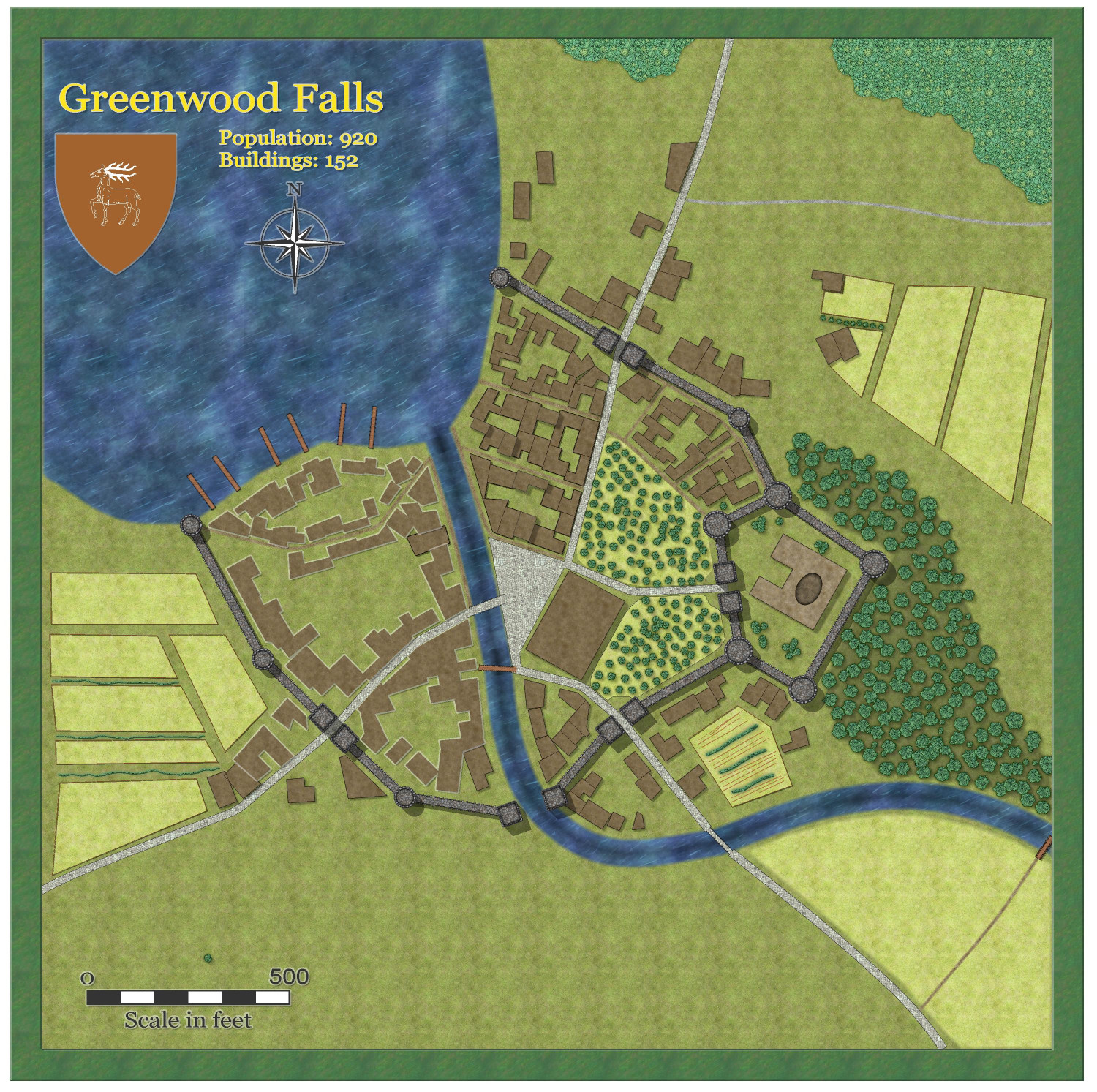
I didn't export the fields or the trees, just added them myself. Didn't do much in the way of adding furrows, etc., to spruce it up -- I can see why, even though it speeds up the process, I could still spend many hours adding lots of flourishes.
(One oddity from Watabou: The exported heraldic symbol that was exported ended up being different that what was shown, one deer instead of three, but no big deal.)
@Quenten and @Ralf, you did a magnificent job with this! What a tremendously helpful service you have done for Game Masters!


-
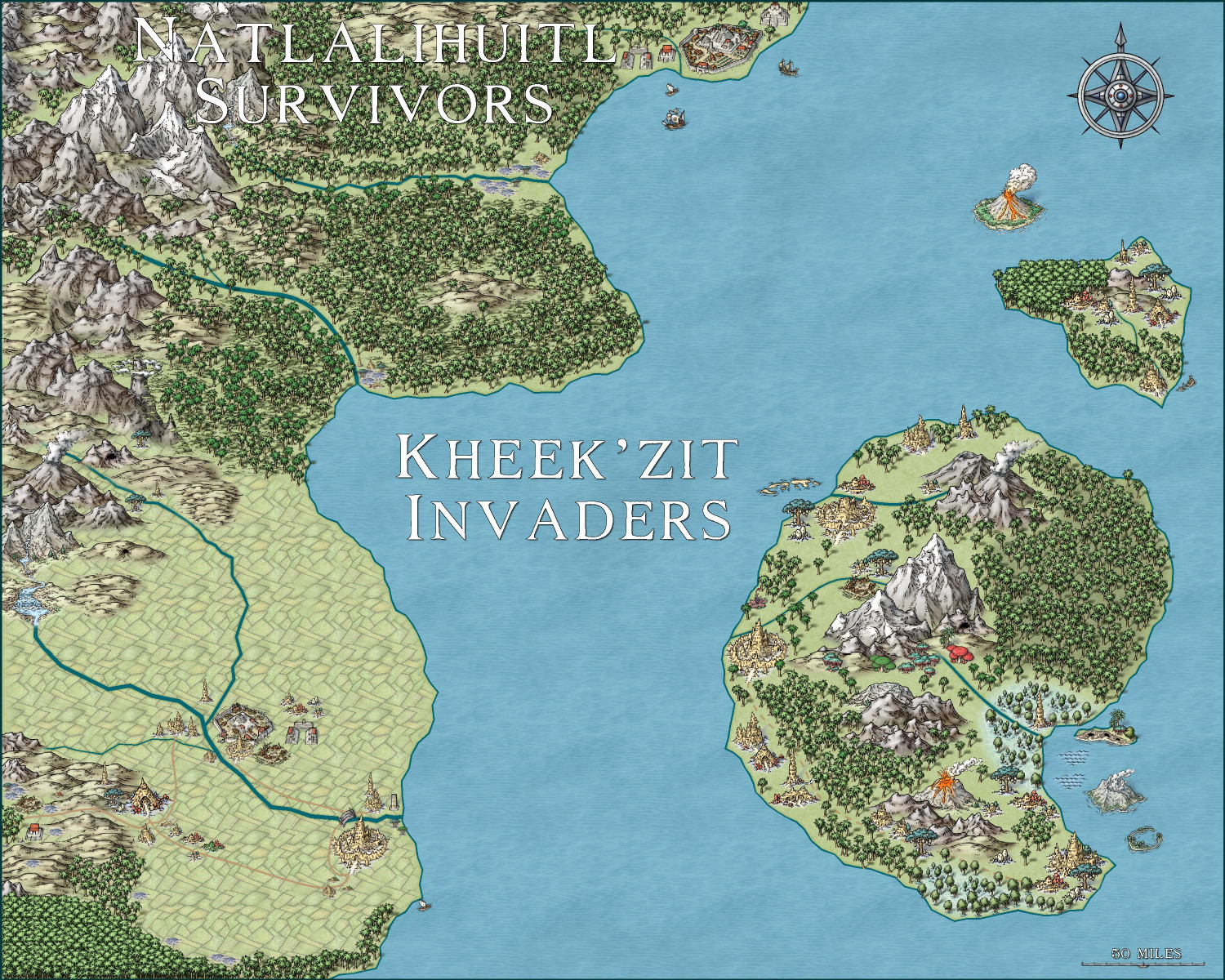
Invasion of the Pod People
Had a little fun with the second Hive monthly released today. The Kheek'zit invaders have made it to the mainland, infecting and destroying the Natlalihuitl Empire's southern cities as they continue to push their way north....
-
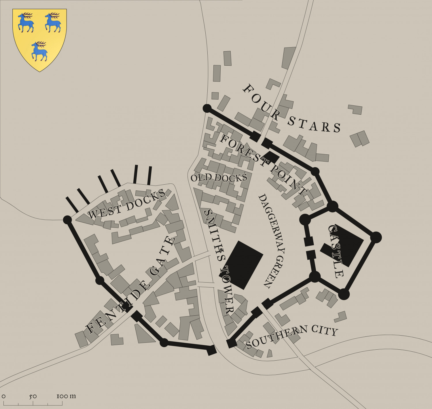
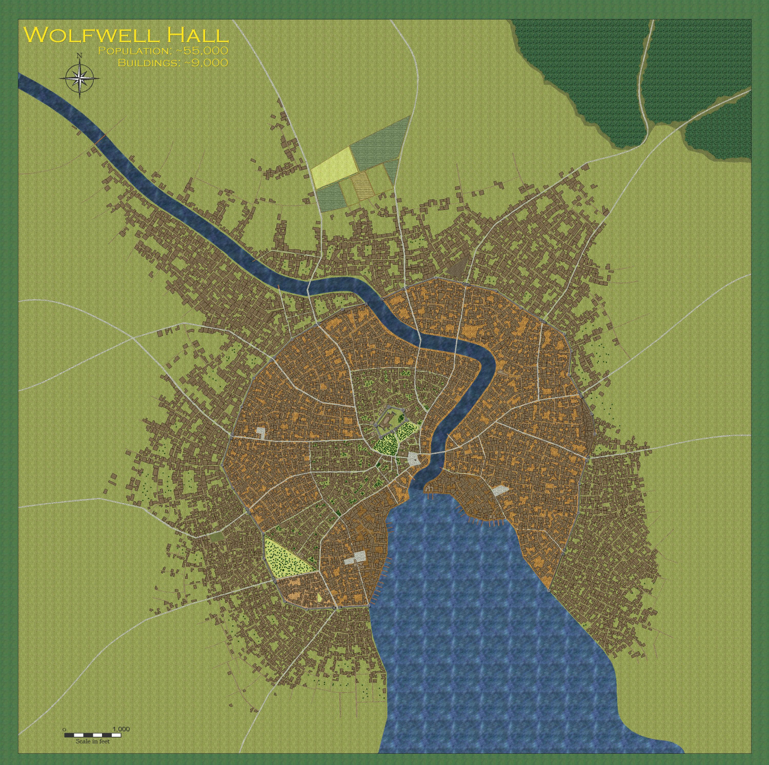
[WIP] City of Wolfwell Falls (CA211 Watabou City Revisited)
Following my test runs with the village of Greenwood Falls (population 920) and Redway Hill Township (population ~3,500), here's my attempt at a major city: Wolfwell Falls (population ~55,000).
This is what Watabou gave me to work with:
And this is what I came up with:
Here's a close-up of the Castle District, which I figure is a bit more upscale.
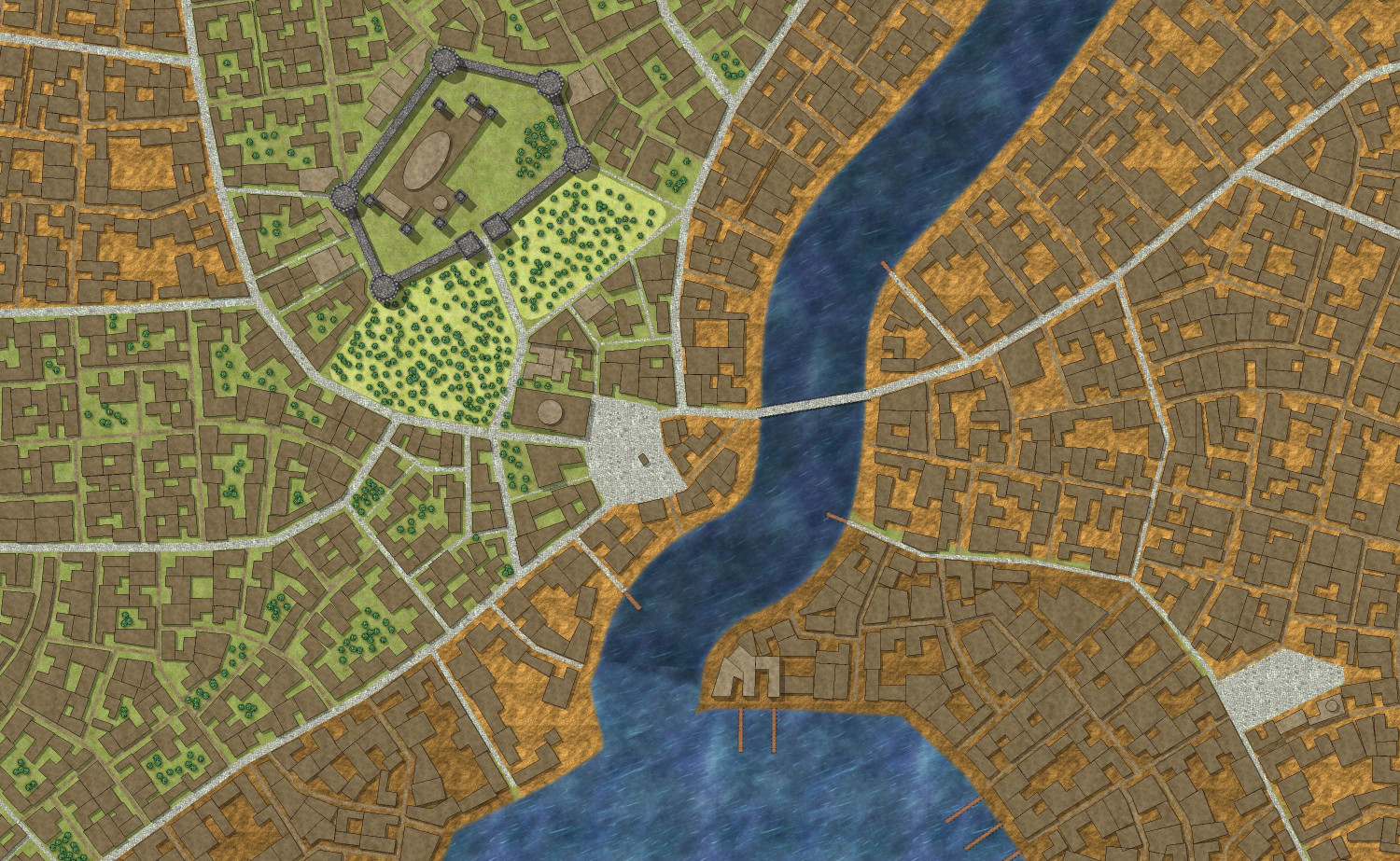
(I kind of messed up the river there. I when I did the "Change like drawing tool" command, I accidentally wasn't on the River/Water sheet, and I think when I fixed it I messed up the top layer or something.)
The nicer neighborhoods have a lot more greenery. Most neighborhoods have more dirt than greenery, and the area by the docks is muddier.
As predicted in the Redway Hill Towship thread, the longest part was redrawing the secondary roads. According to the Info: Count tool, there are 59 paved roads and 948 unpaved roads! I hope I successfully converted and/or deleted-and-redrew all of the roads. I had to do all of that, and also create a handful of special buildings, before being able to convert everything left to be the regular buildings. If you see any really weird buildings, it might be something I didn't properly convert to whatever it was supposed to be before turning it into a building.
I should draw a lot more fields -- the ones on the north side of the city won't be enough to sustain a city of 55,000 people! (Also, I just noticed that I call it "Wolfwell Hall" on the map instead of Wolfwell Falls. Gotta fix that.)
-
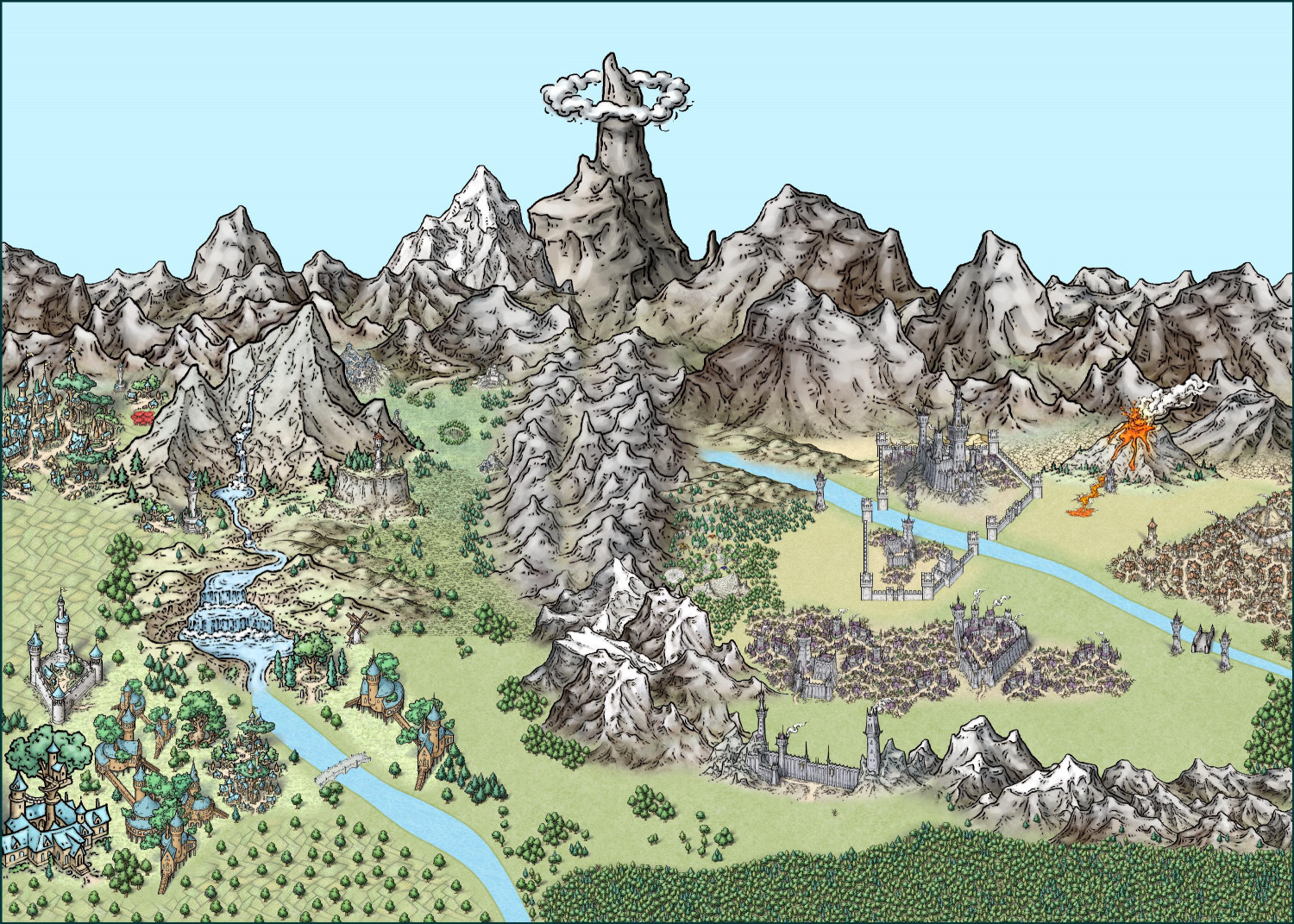
[WIP] Elves v. Dark Empire
Here's the other map. Much smaller southern forest. This map has 2,380 trees -- nine more than the map above.

-
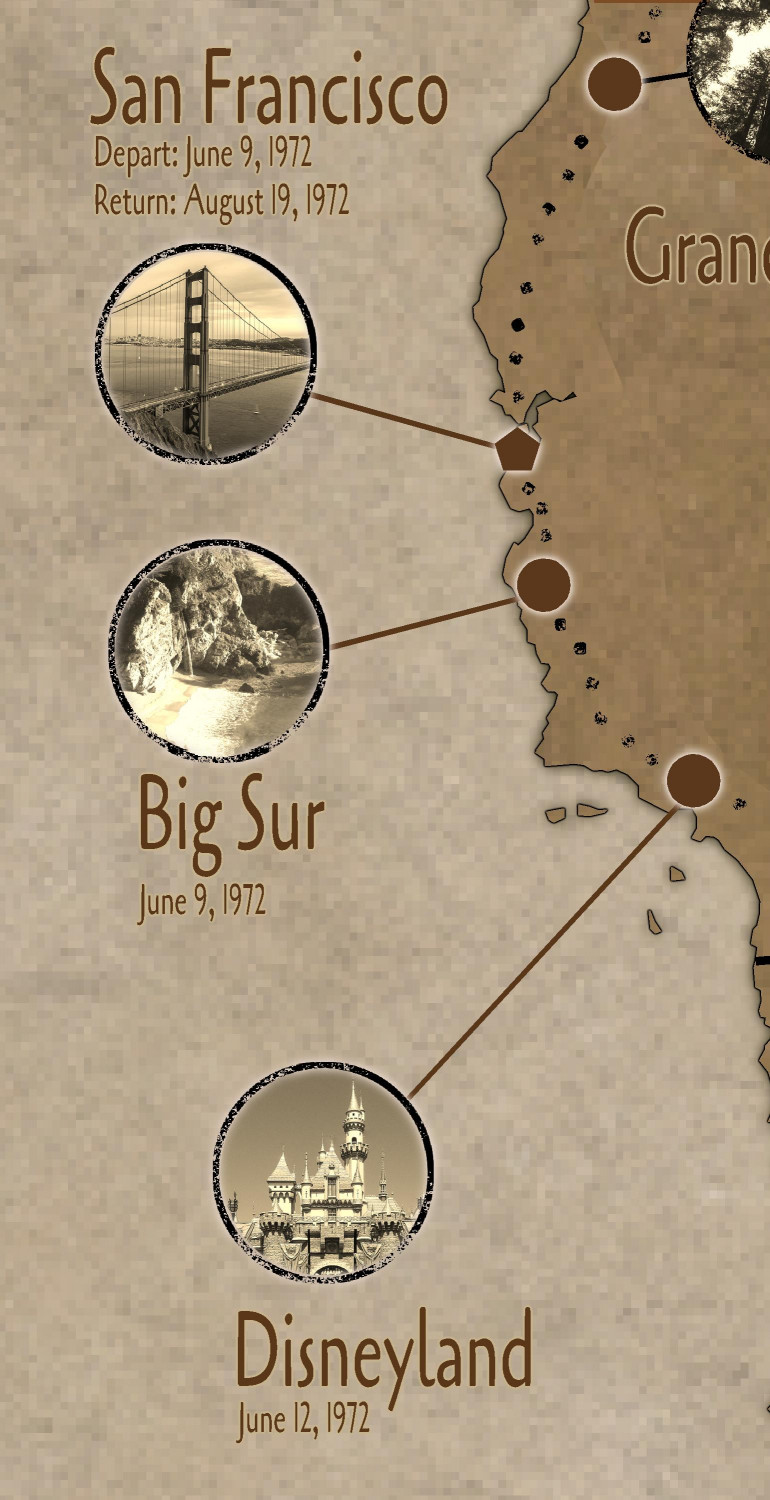
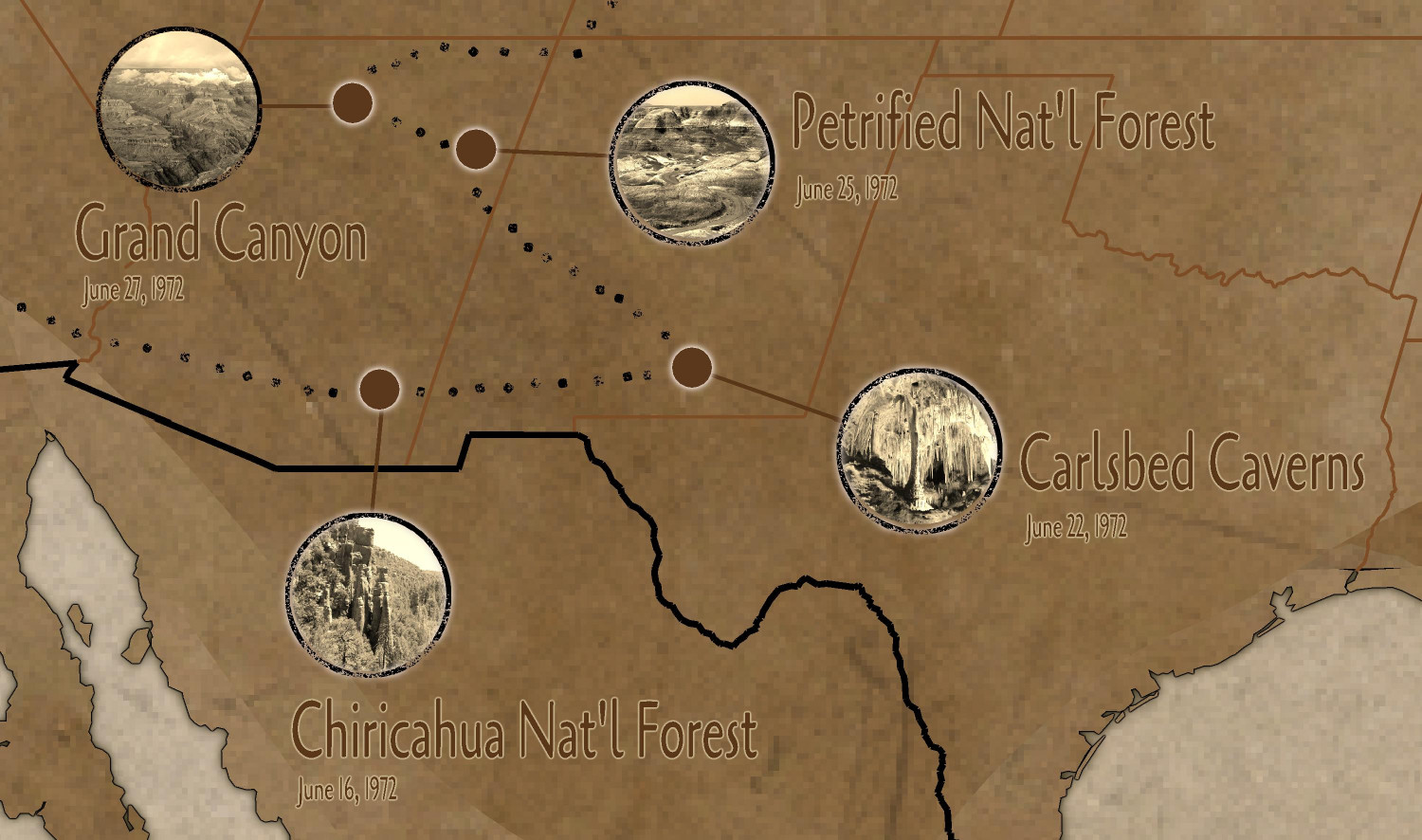
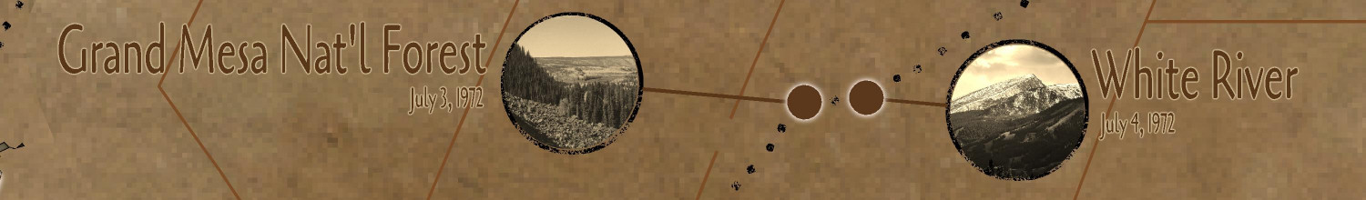
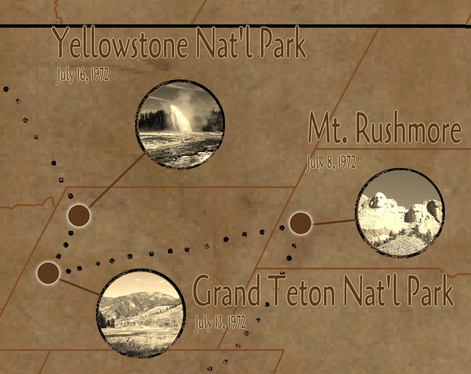
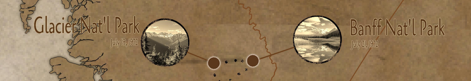
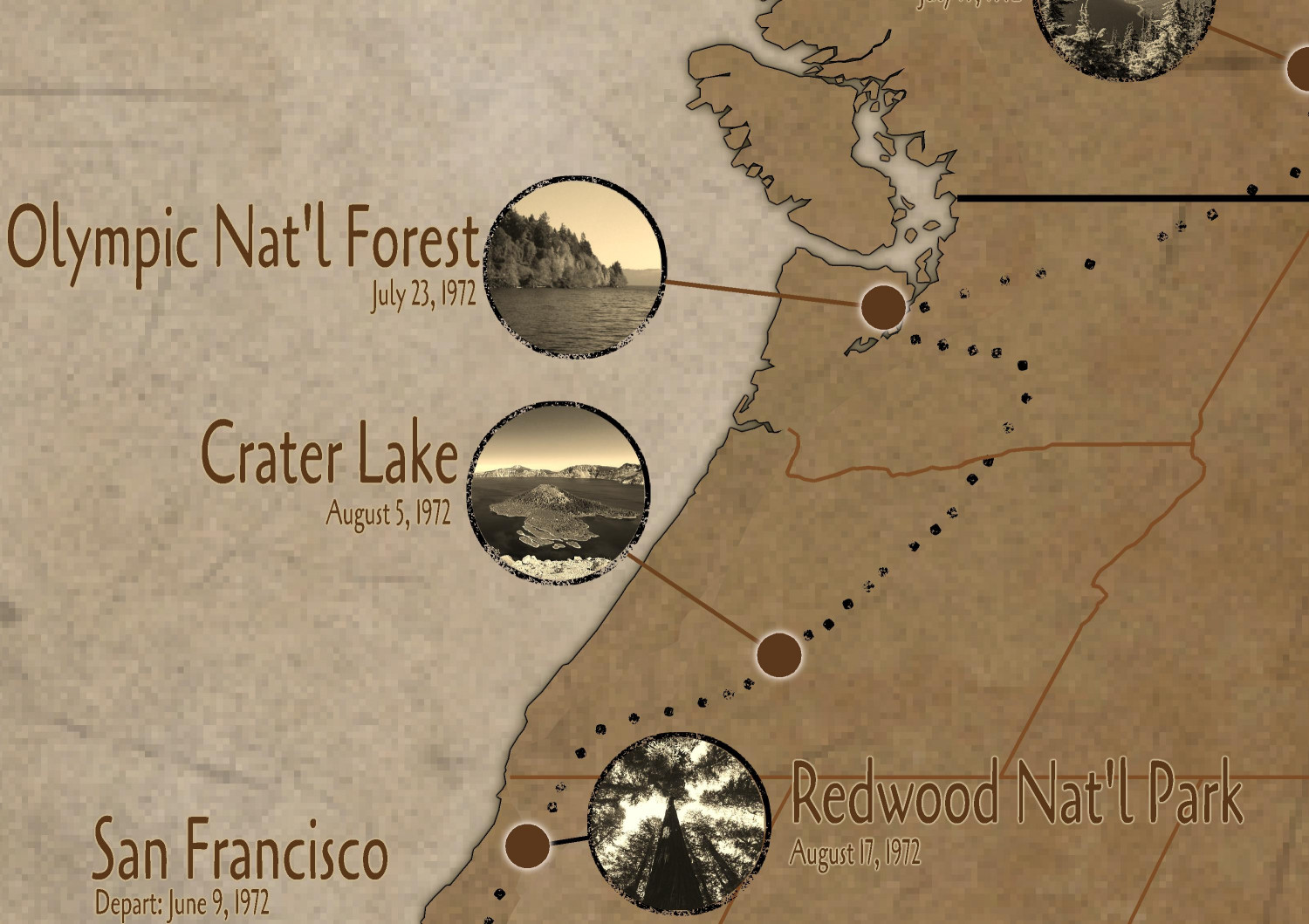
[WIP] 1972 Travelogue (CA93 Modern Journeys)
And here are some zoomed-in closeups:

-
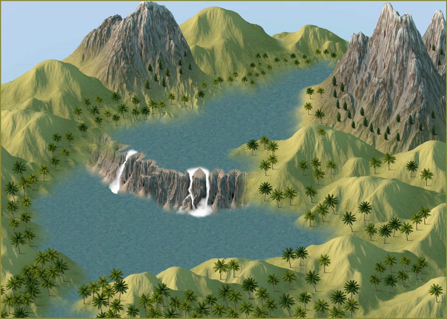
[WIP] Spectrum Overland Waterfalls x 2
Did another approach using Ricko's techniques. (Thank you!) Tried it where the waterline ended before the hills, so they had the sharper edges and edge effects. Then I redrew the water so the edges were under the hills. I rather like the softer effect of the water line. Thought about using the swamp trees but decided to stick with the palms (and a few conifers near the rocky peaks).

-
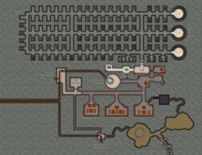
[WIP] Inside the Temple of Fah
Level 6
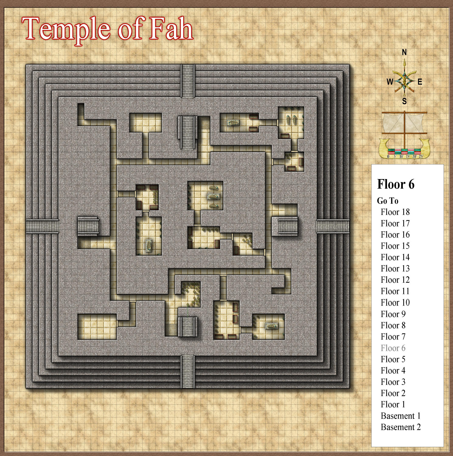
We are now in the lowest of the three sections of the temple. Most of the tombs contain two chambers: a treasure room and a burial chamber. A few will have multiple treasure chambers, and occasionally there may be more than one burial chamber in the suite.
Great pharaohs used to be buried with their wealth, but centuries ago, a new pharaoh decided to keep his father’s wealth, and instead buried his father with colored glass replicas of his jewelry. The pharaohs are generally entombed in a sarcophagus on a raised platform. Other sarcophagi in the room will usually be upright along the walls, but may be occasionally laid flat on the floor, a sign of great honor to the decedent. These are for the final resting places for people important to the pharaoh: spouses, valued concubines, children who did not themselves become a pharaoh, and occasionally even favorite servants like nannies who are treated as family. Those who predecease the pharaoh are reinterned at the time of pharaoh’s internment. For those who live after the pharaoh’s death, the tombs are opened to admit their remains, sometimes decades after the pharaoh’s internment.
Also of note: in this section, the stairs up and stairs down are generally far from each other, perhaps as a way to confuse and confound intruders intending to loot the tombs.
Level 5
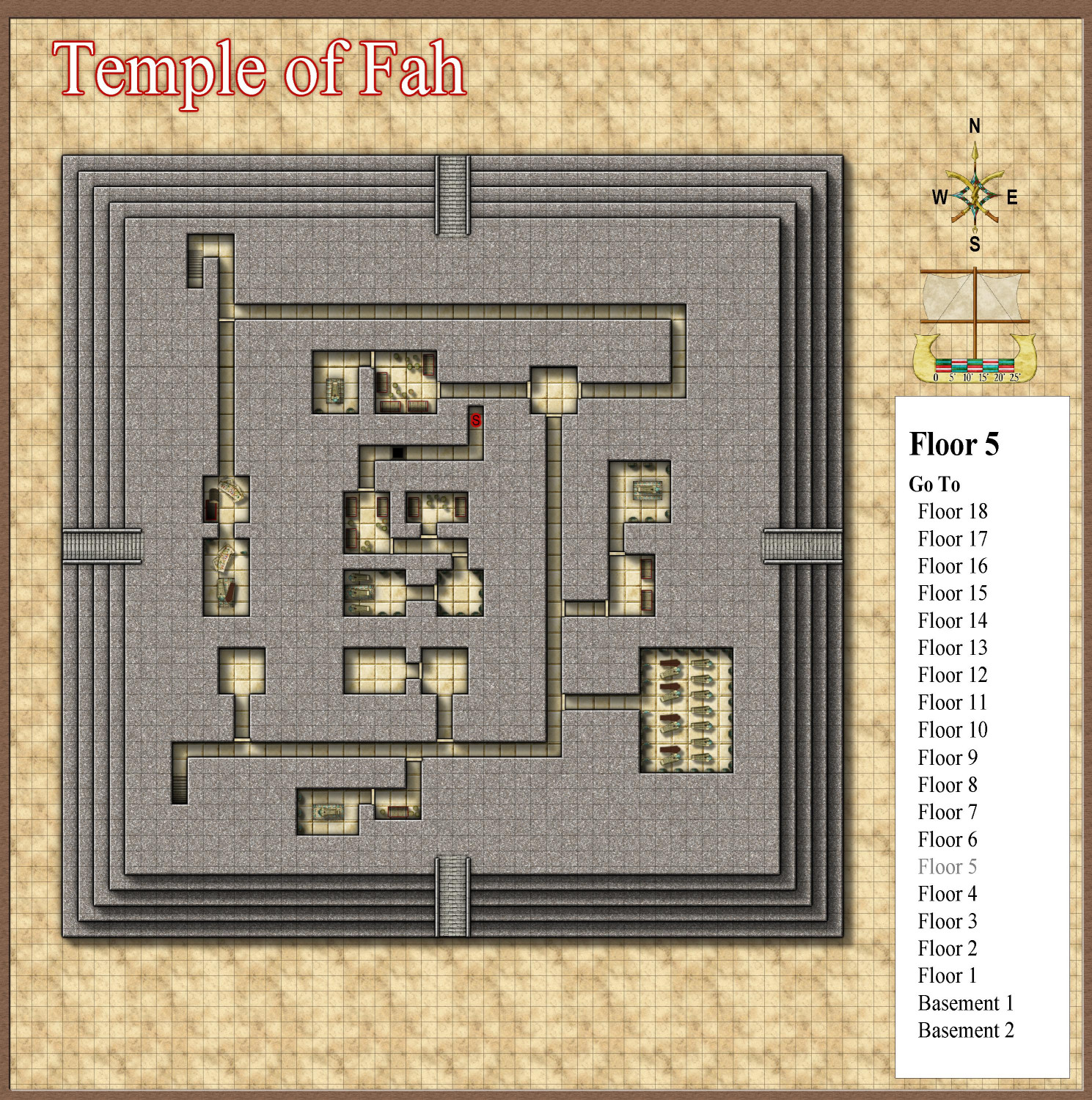
This level has more tombs, but there are a few things of note.
On the west side, there is a burial chamber where the entrance to the treasure chamber and burial chamber have been destroyed, and the treasures and sarcophagus have been looted. The passageway to this section has been sealed but otherwise left untouched. It is the only looted section in this active temple.
Another burial suite is empty, waiting for a future pharaoh.
In the southeast corner, there’s a chamber with a great number of sarcophagi, some still empty. This room is the final resting place for high priests who have been honored to lay at rest near the great pharaohs.
One mad pharaoh had his burial chamber and three treasure rooms hidden behind a trapped secret door. The passageway also contains a covered pit that drops unwary intruders 20 feet to Level 3.
Level 4
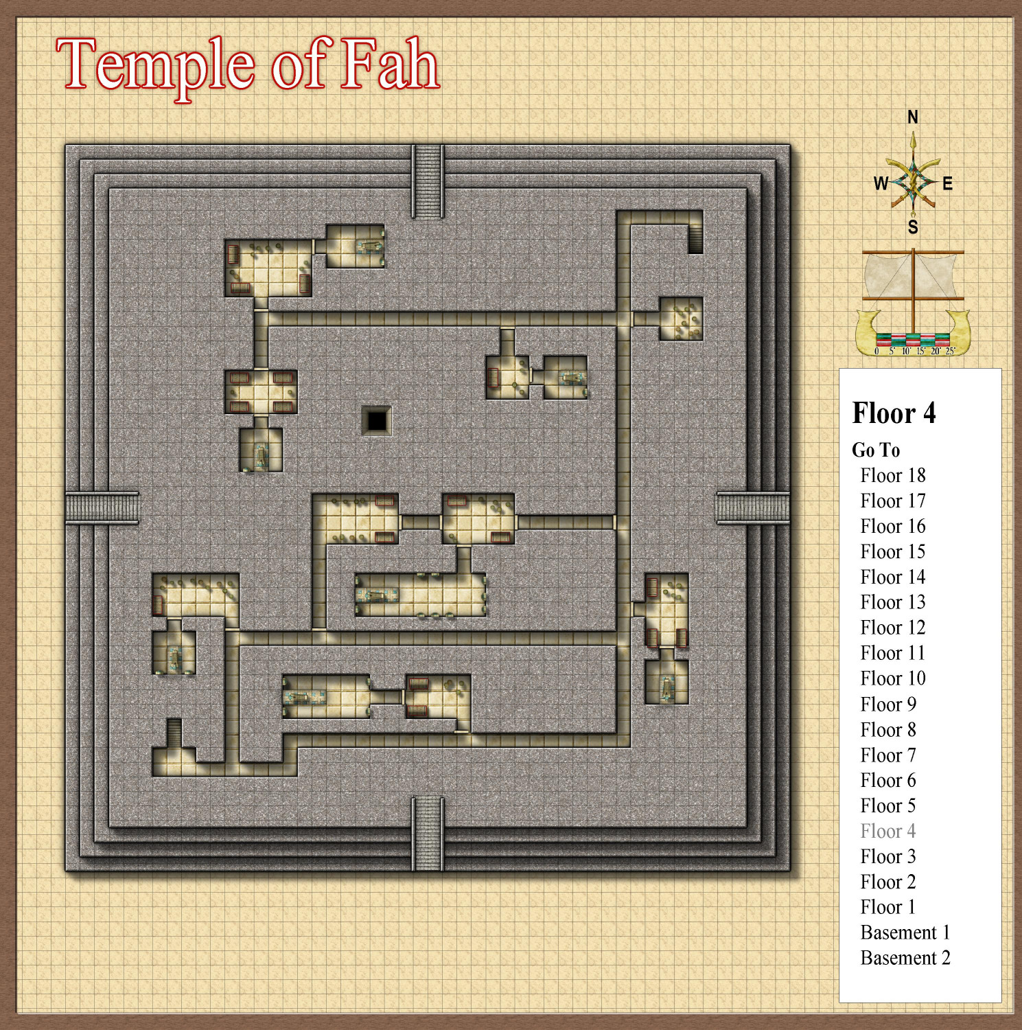
More burial chambers. (Note the shaft for the pit from Level 5 that descends to Level 3.)
Level 3
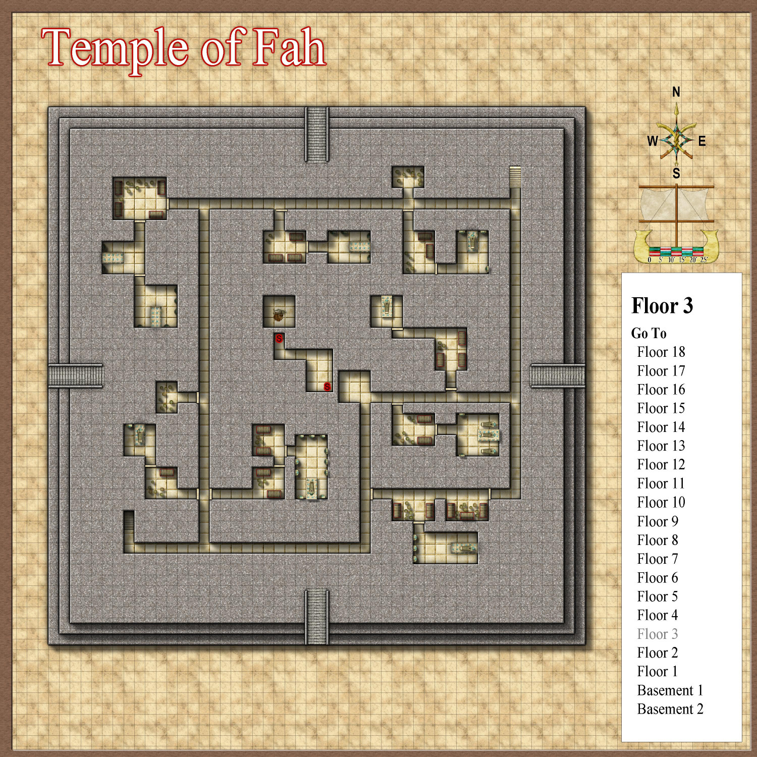
More tombs. (I noticed that some of the raised platforms don’t have a sarcophagus on them. Not sure if I forgot to place them, or if I placed them on the wrong sheet. I guess one of them might be for the reigning Pharaoh, and already contains the remains of predeceased loved ones, but that would only make sense for one of these tombs. Maybe the mummies just walked away?)
The pit trap from Level 5 ends here. Those who survive the 20-foot drop may discover a secret door that leads to another hidden chamber, where another secret door allows escape to the rest of the temple. The skeletal remains suggest that one poor soul either didn’t survive the fall or never found the secret door to allow their escape.
Level 2
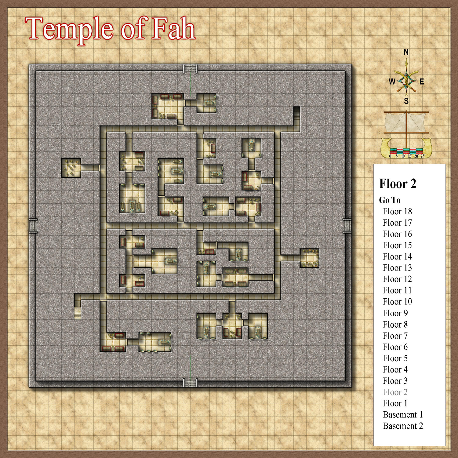
More burial suites, along with some storage rooms for unused pots and urns.
Level 1
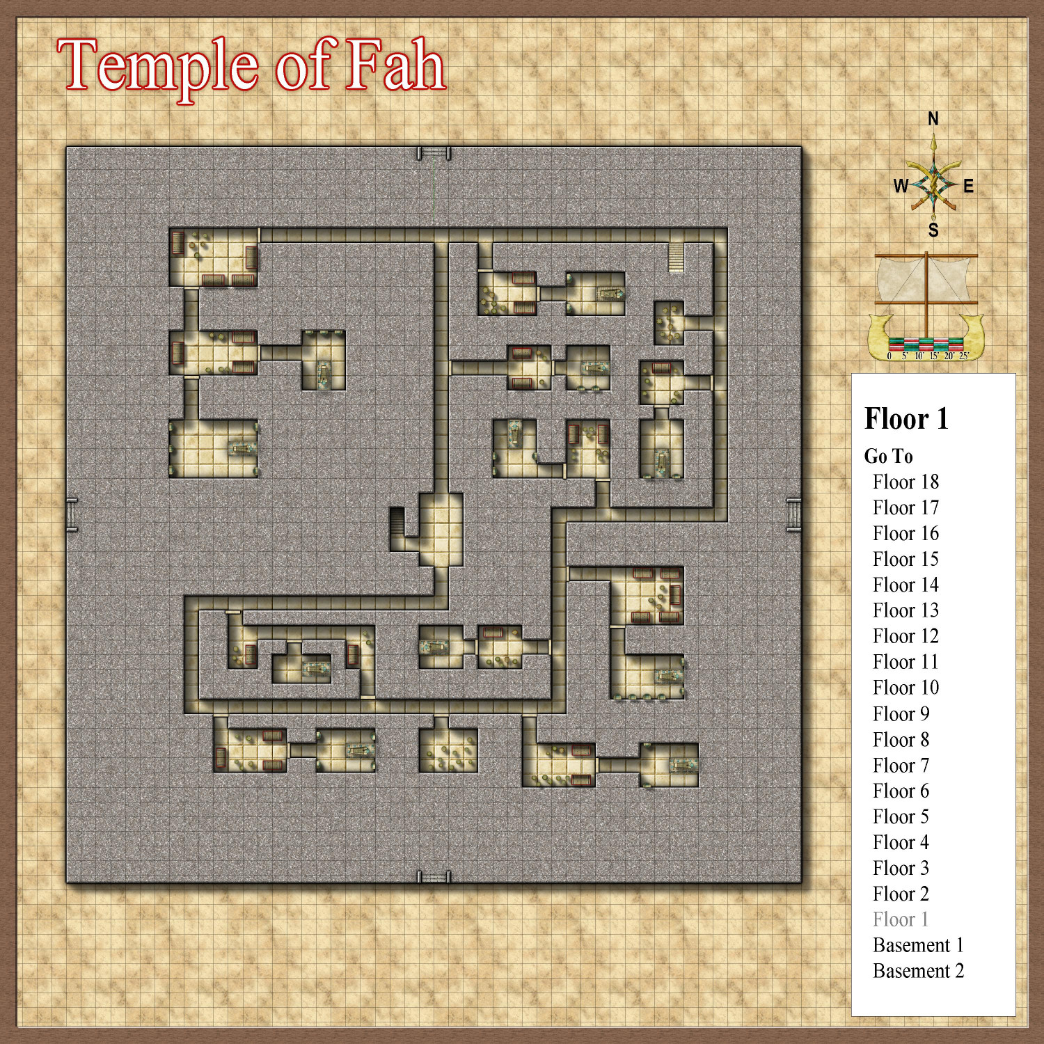
More tombs, along with stairs that descend to subterranean levels of the temple. (What, more levels?)

-
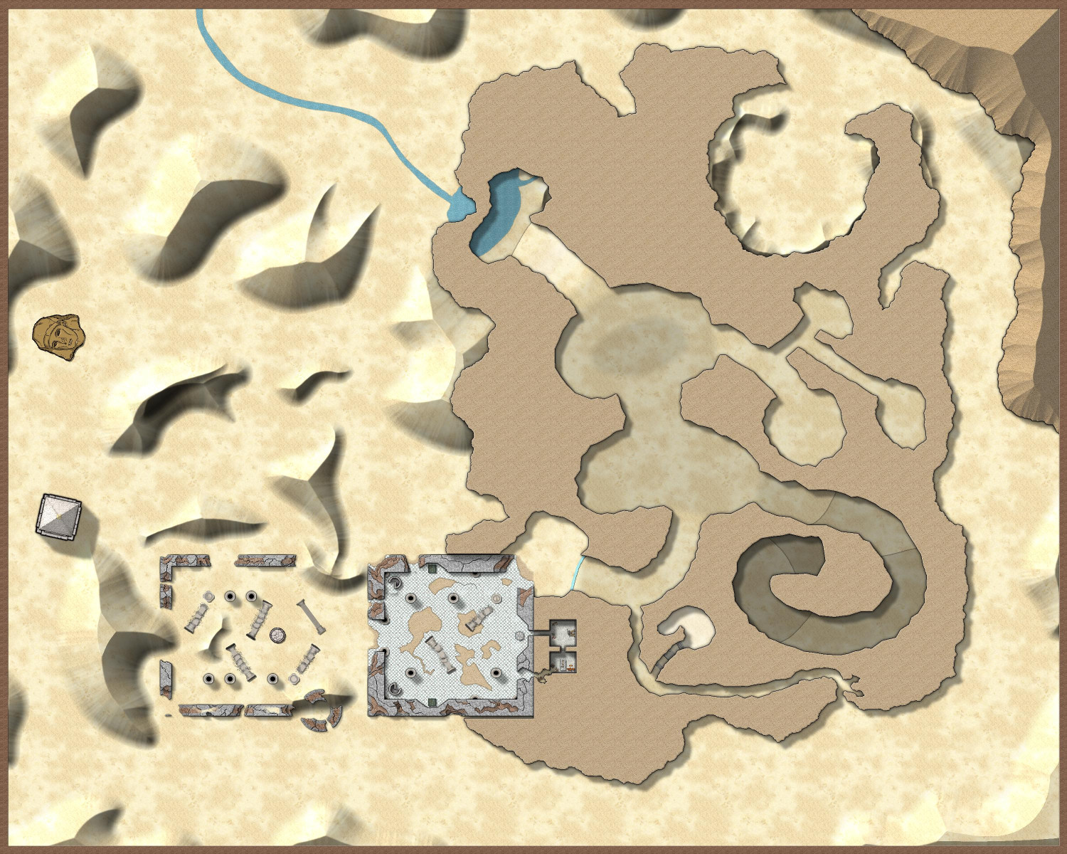
[Atlas Submission] - Doriant - Gold Coast - Eknapata Desert - Kukaar
Hi Remy @Monsen!
I have discovered an Atlas submission for the city of Kukaar that I either failed to tag you in or quite possibly failed to submit at all. My Apologies! This is ready to be added at your leisure.
This is for Doriant - Gold Coast - Eknapata Desert - Kukaar. You'll find Kukaar in pretty much the center of the Eknapata Desert map. It does not have an unusual toggles.
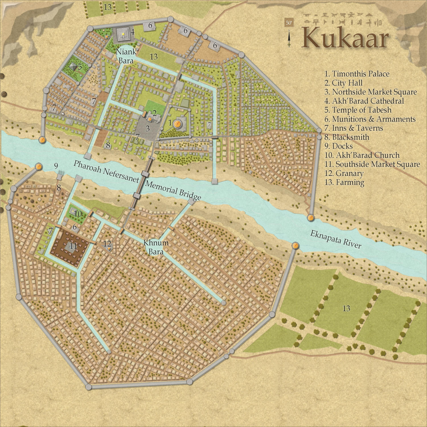
Thank you!


