

[WIP] Greenwood Falls (CA211 Watabou City Revisted)
 Royal Scribe
🖼️ 388 images Mapmaker
Royal Scribe
🖼️ 388 images Mapmaker
I was a little intimidated to attempt this without seeing a Live demonstration first, but since I have the day off, I decided to dive in.
My first attempt was just a small village (152 buildings, population of 920), but I can see how a lot of the conversion goes quickly regardless whether you have a population of 500 or 5,000.
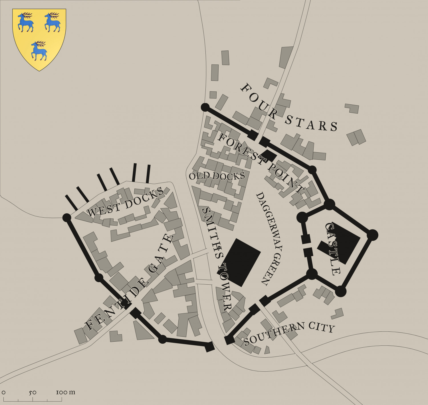
Here's what Watabou generated for me (converted from PNG to JPEG for size considerations):
And here's what I was able to create in a few hours:
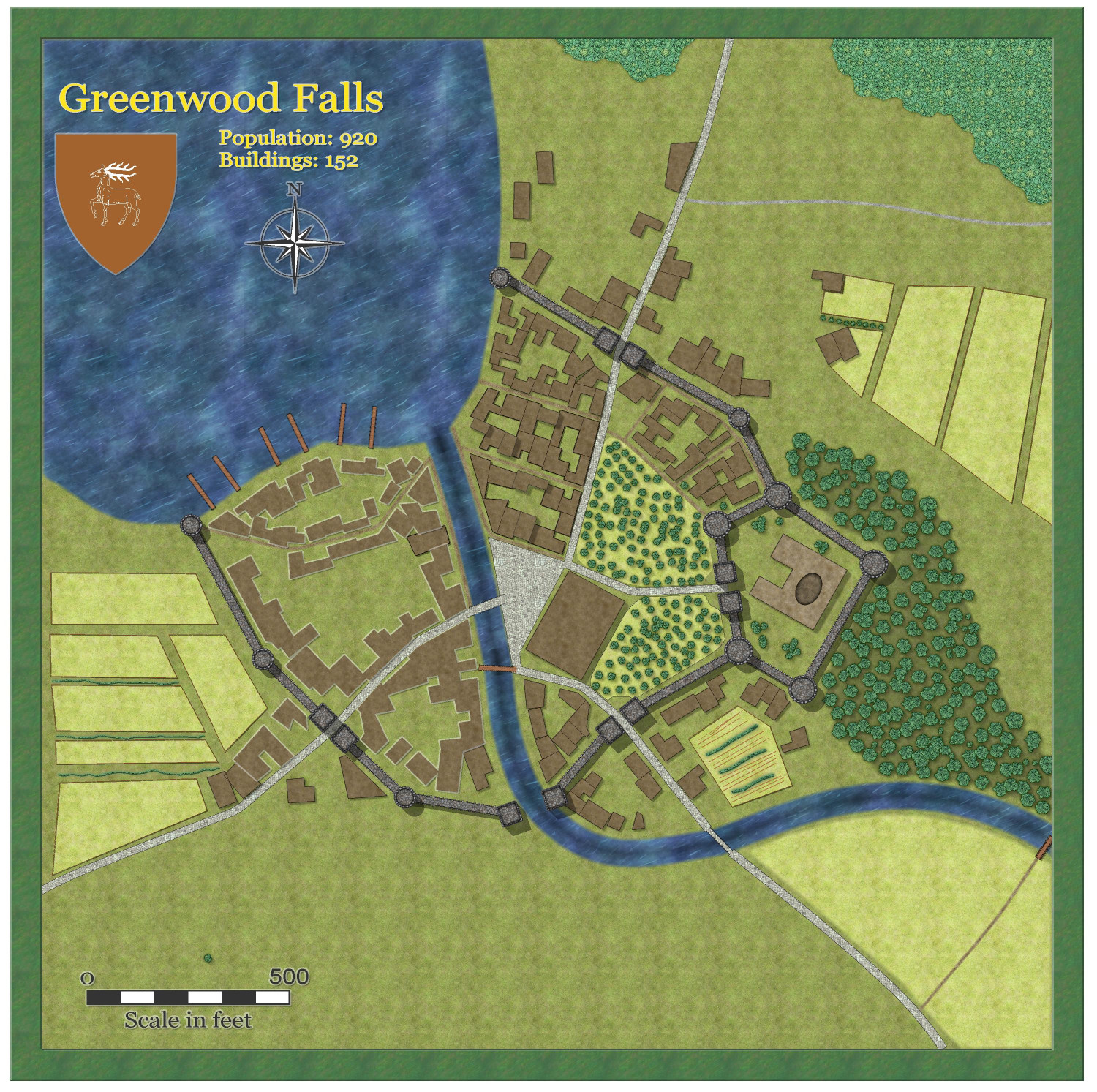
I didn't export the fields or the trees, just added them myself. Didn't do much in the way of adding furrows, etc., to spruce it up -- I can see why, even though it speeds up the process, I could still spend many hours adding lots of flourishes.
(One oddity from Watabou: The exported heraldic symbol that was exported ended up being different that what was shown, one deer instead of three, but no big deal.)
@Quenten and @Ralf, you did a magnificent job with this! What a tremendously helpful service you have done for Game Masters!


Comments
A great relief to see someone else succeed in this. Please share any difficulties. And did you use the drawtools for things like trees, or just add your own?
Yes, I did use the draw tools for the trees - worked great! For the river, I used "Change like draw tool" to change it to the 75-foot river. I also used the "Change like draw tool" for the sea (the straight closed polygon water tool), the three main roads, the round towers, the square gatehouse towers, the docks, the parks, and the buildings. I used the draw tools (but not the "Change like draw tools") for the city walls, the bridges, the trees, the darker grass beneath the trees directly to the south-east of the castle, the fields, the hedges, the dirt roads, the town square, and the forest on the north side of the map. For the heraldic symbol, I did as you advised, moving the components to the appropriate sheets and changing to a solid color. (Interestingly, the deer didn't fill in completely, just the outline.)
There were some minor issues that had to do with how Watabou exported the data. The river was in multiple sections, broken by the bridges, and the stretch between the final bridge and the sea wasn't there at all, so I did that part using the draw tools. The major road coming in from the west continued up the river a bit, so I had to trim off that part. Same with the road coming in from the south: it continued down the river from where I put the wooden bridge. So you just have to pay attention to what's being changed to make sure the right things are being changed properly, knowing that you might have to trim a bit here and there, or use the drawing tools to add a bit.
But overall, worked great! I am going to do a larger town now, and will time it to see how long it takes.