


Mythal82
Mythal82
About
- Username
- Mythal82
- Joined
- Visits
- 781
- Last Active
- Roles
- Member
- Points
- 366
- Rank
- Traveler
- Badges
- 3
Latest Images
Reactions
-
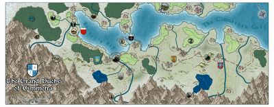
[WIP] Continent Map using CC3+ MS Overland and other resources

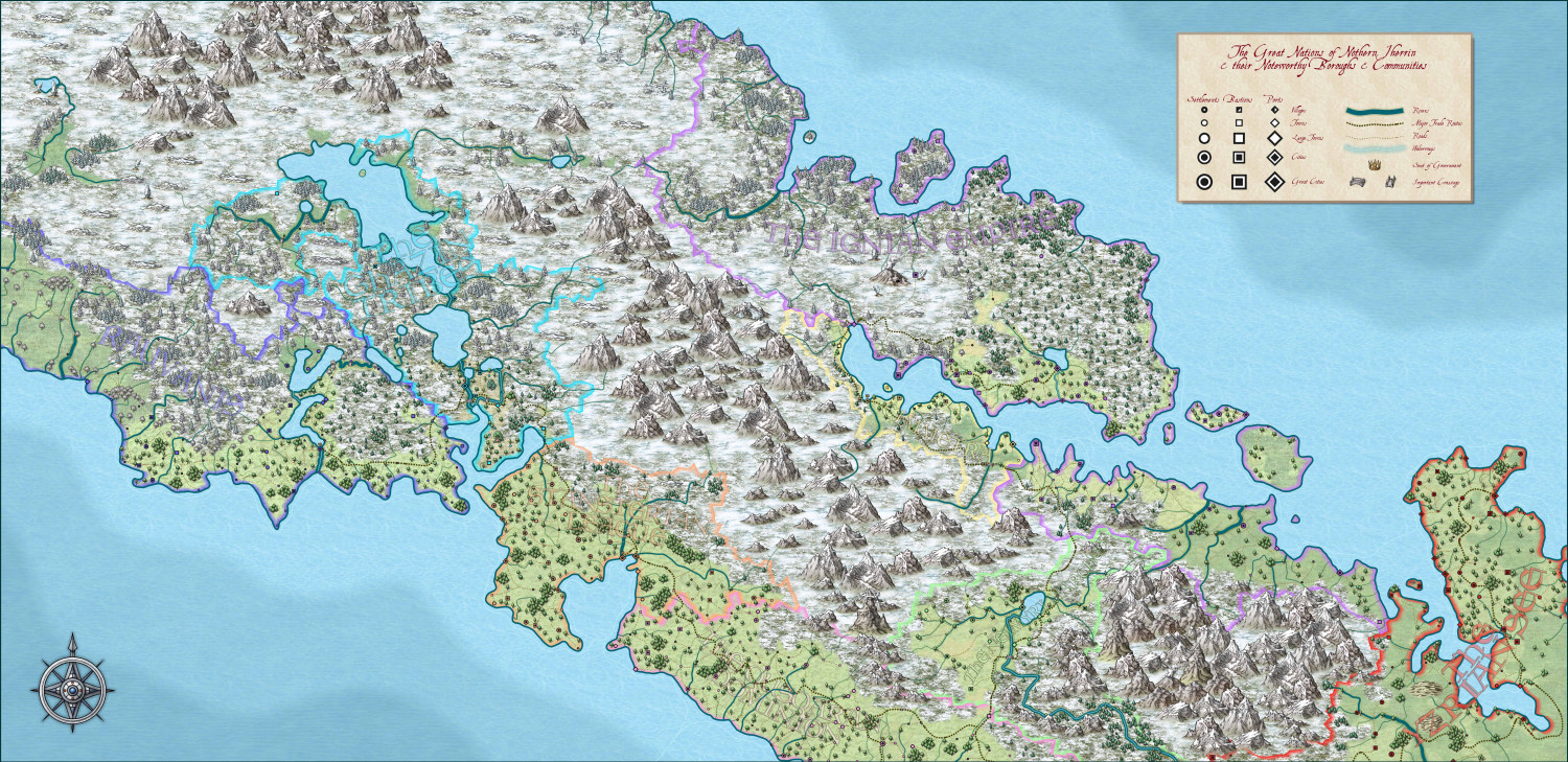
So, this is my first proper attempt at a continent-level map using CC. I used a procedurally generated map of biome cells and sundries, then customised that, then ported it into CC as a tracing layer. Made far more use of land feature layers than I have before, and I'm fairly happy with how the terrain turned out and the overall feel of the result.
Not sure how I feel about the individual country labels - I couldn't really think of a good way to include them, because the map itself is too busy to really spare them any real-estate. Also, I haven't put down labels for any of the towns/cities/etc for the same reason (though since my friends and I generally use a VTT, that's not an issue, because I can add tooltip tags to each town to convey its important data.
All feedback gratefully received, as always


-
Town Map for a Cthulhu Game
I wound up using Photoshop largely because I was getting slowdown/partial redraws when trying to tweak the angles/positions of the custom PNGs and text (and they needed to be freeform rather than snap to grid, because of the tightness of some of the roads) - so it was pretty much a 'me and my PC thing', rather than a "CC thing".
I've continued the development of the town by starting on the saloon/hotel I added in O03. Ominously coffin-shaped (which makes for its own challenges)... I'm using the Dracula Dossier annual for this as I love the style and it seemed thematically appropriate. Wanted to make it clear that there was decking at the front of the place, so made a custom texture to represent planks while trying to keep in-theme with the (amazing) textures in the base style.


-
Annual 2023
I’d love to see a Steampunk Overland and Steampunk/Gnomish City in next year’s annual.
-
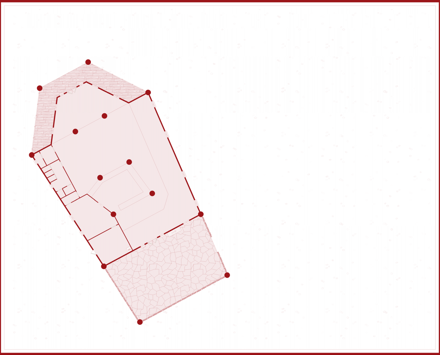
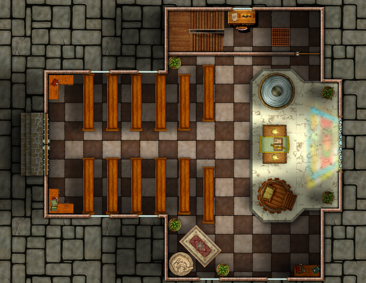
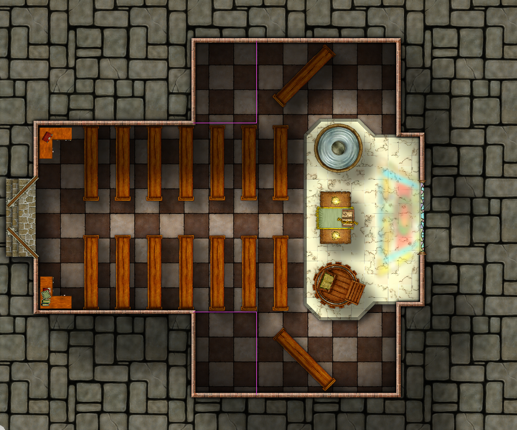
[WIP] August Competition - Temple of [Insert Deity Here]
Updated version of the ground floor. Looking to do a first floor, second floor, and basement (accessible by the grate in the vestry)
![[Deleted User]](https://secure.gravatar.com/avatar/c75d9a245b74d9c59be0999ea81ca541/?default=https%3A%2F%2Fvanillicon.com%2F92add7f8c954488718110edc4896ad39_200.png&rating=g&size=200)


-
[WIP] August Competition - Temple of [Insert Deity Here]
First pass of the ground floor almost done - marked out the interior walls for side rooms, but not sure if I really want them symmetrical.
Was originally tempted to make it a temple to the deity of negotiable affection (a brothel), given how close it is to the Barracks, but decided instead to leverage the fact the sewer passes directly underneath to facilitate shenanigans…

-
[WIP] Continent Map using CC3+ MS Overland and other resources
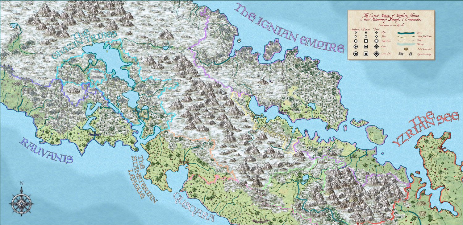
I had a bit of an epiphany following what Sue said, and started breaking the map down into regional chunks - and, in so labelling, realised the solution for the continent labels was to colour code them to the national borders. I also managed to label the capitals, and to optimise the output for VTT such that the important details (locations of settlements and shapes of icons) were clear. I’m embedding the town names and key info in hover-over tooltips for each settlement (but, as Sue advised, doing so in batches and in regional/national sections. Thanks!

-
[WIP] Continent Map using CC3+ MS Overland and other resources
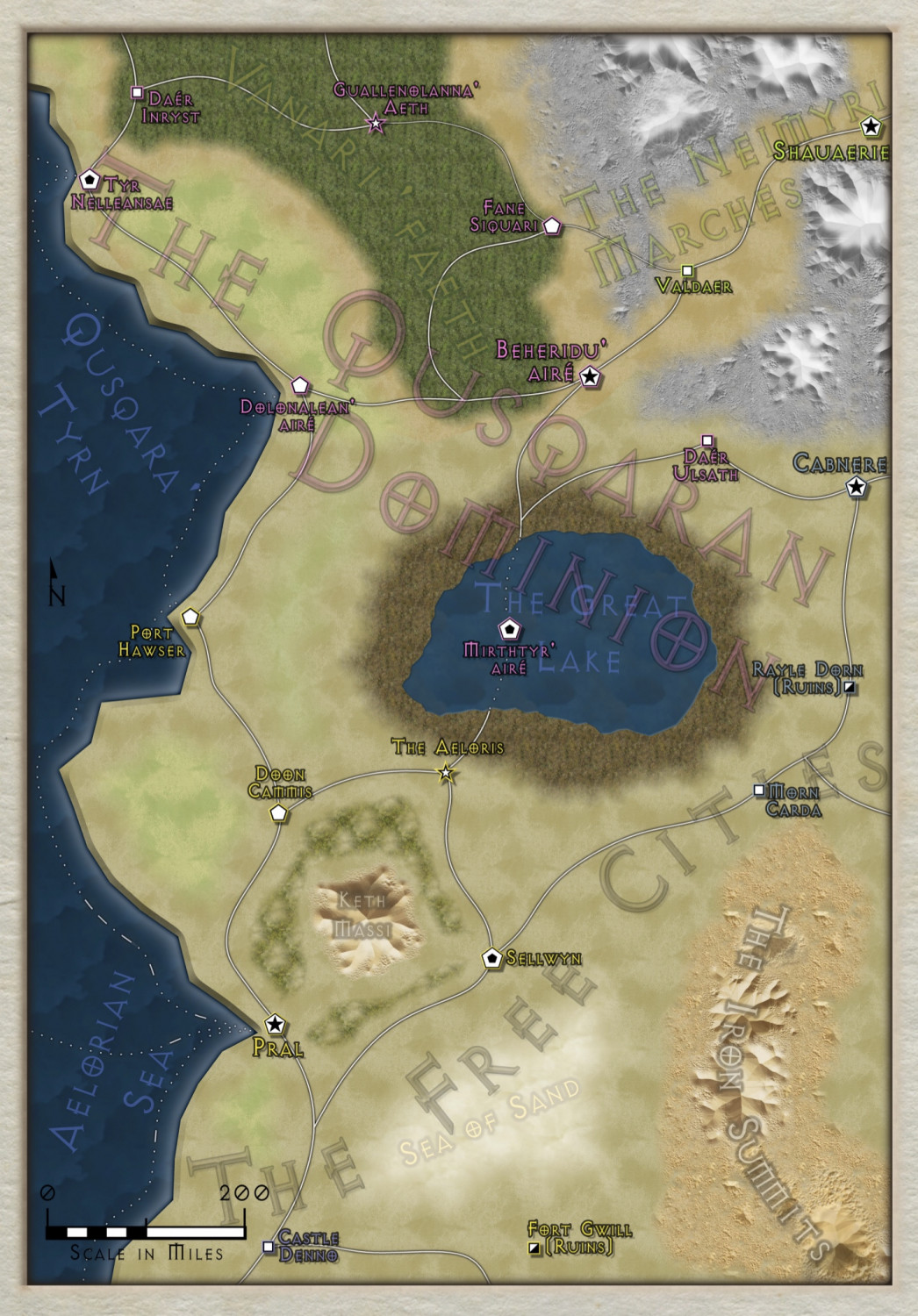
So I took Sue’s advice and revisited the huge Continent-sized map with an eye for not including all detail, just enough detail for players, and breaking it down into regions. That also got me thinking about the notion of maps as unreliable narrators - if players are made aware that maps might not be GPS-accurate in their fantasy world, the act of discovering something which wasn’t on their map can be a feature, not a bug, etc.
Anyway, here’s a portion of the map (and a little south of it) with reduced detail, and making use of the 13th Age Revisited style.
-
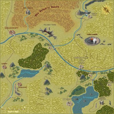
Making a Mountain
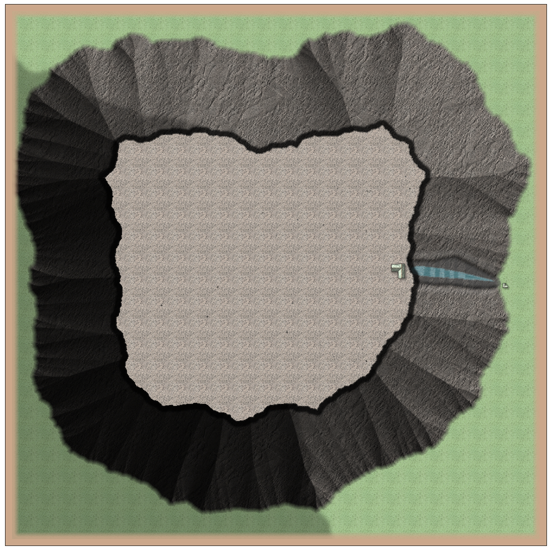
I've tried putting into practise a few of the suggestions made - There're still a few things I can do with lighting and shadow mapping and perspective, certainly, but I think it's a start!
-
Isometric Schley wishlist
This is probably pretty niche, but I’d really like some variety in bridges - either raisable or swing bridges, or even just base plinths which allow for existing bridges to be placed high enough for the ships to pass under.
-
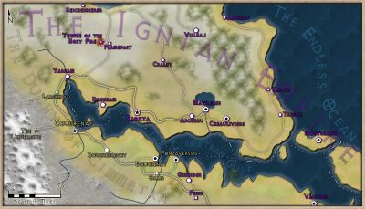
[WIP] Port City Map - Watabou to Ferraris Style
Hi Dak,
I used the Ancient Realms style from the 2015 annual - it’s one of my favourites, mostly due to the hills and the way it handles forests
Cheers,
Mythal82


