Tutorial - Between hills, rivers and trees
 Ricko
🖼️ 107 images Mapmaker
In response to the request, I decided to copy and paste here - as well as add more information, the recent conversation I had with Master Quenten, with the intention of sharing the idea, who knows, it might be useful to someone.
This tutorial is about a way to compose the landscape and help with the depth of the map. I only use images from Mike Schley Overland, but it can be used in any style.
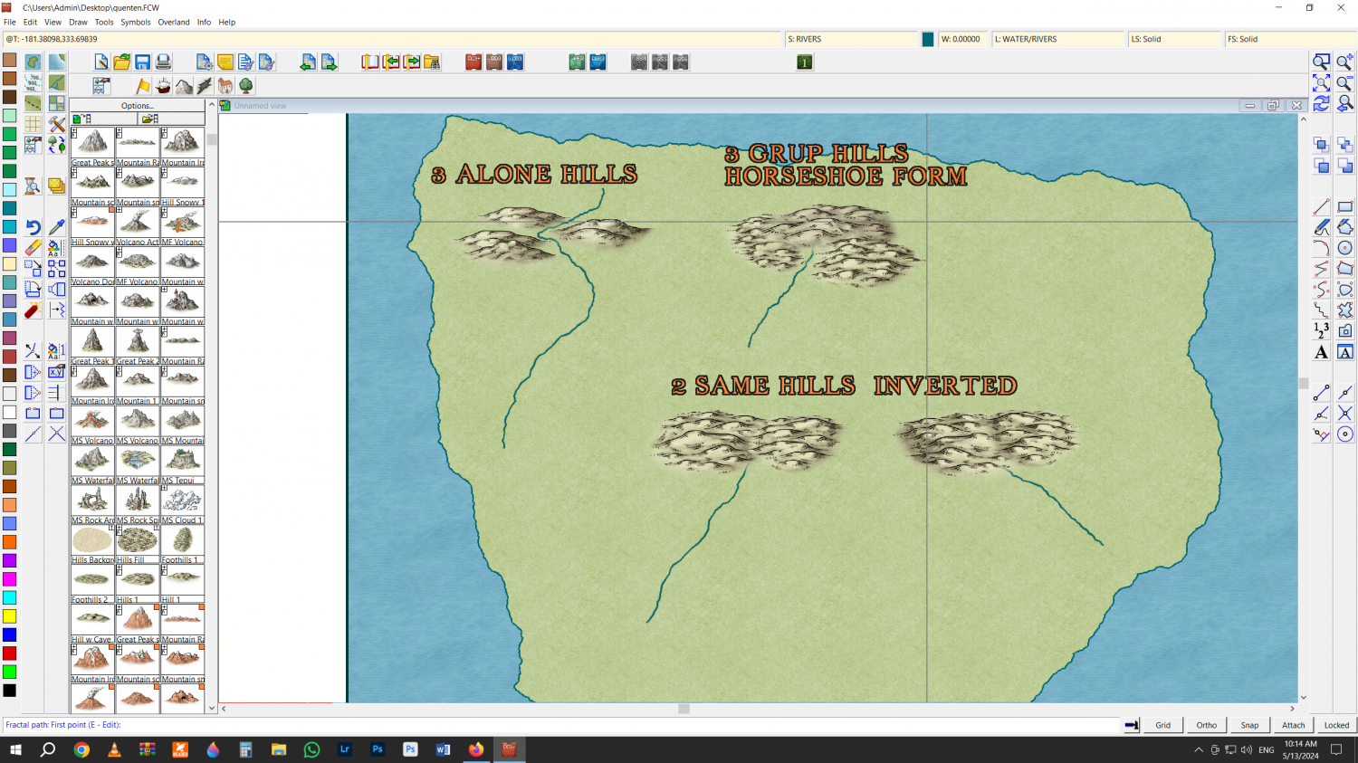
The two images above are made up of 3 hills on the left in a zig zag pattern and three hills in a group on the right, in the shape of a horseshoe.
below I chose the exact same two hills as a group. the left "turned" to the left and the right I clicked mirror to invert the image and place it on the right. Note how this simple inversion of the image also inverts the perspective of the drawing. If my maps go "to the left", I try to invert the images so that they go in the same desired direction... it takes a little more work but I notice a big aesthetic difference.


Comments
Now the next step is obviously to hide the river's imperfections. In my overland experience, the problems always lie at the origin of the river and where it meets the sea. At the origin it's always easy, I always hide it with trees. The next step is to arrange the trees to be compatible with the slope of the terrain. as you can see in the red arrows.
Another option is make a mini valley between hills of groups that go faster. Put a river.
Hide the origin of the river with trees and... now the cat's jump... in this case the river... the biggest imperfections are not its contact with the symbols. These are the curves with strong corners of the fractal node... precisely where I try again to "hide" the imperfection with some icon... in this case trees.
Sometimes the river doesn't fit very well with the coastline, even using the ON tool in the right corner of the program.
Then I place my city or any other icon, and in this case, I use trees to hide the mouth of the river
Big zoom of the image - made in the open CC3 program.
These techniques are very helpful. Thank you! I have a long list of maps I plan to do, and one (well, three-in-one) use the Mike Schley Overland style. These tips will come in handy.
hey @Royal Scribe I shared other information, also using the Mike Schley style, maybe some of it could be useful in your next venture.
https://forum.profantasy.com/discussion/13386/mixing-mike-schley-isometric-city-mike-schley-overland-symbols#latest
https://forum.profantasy.com/discussion/12592/fast-marshes-tutorial#latest
https://forum.profantasy.com/discussion/12585/working-fast-kinda-tutorial#latest
Yes, thank you! I've seen the first one before but it's handy to have the tutorials all in one thread. Much appreciated!
https://forum.profantasy.com/discussion/12581/mini-city-with-overland-tutorial#latest
Greets!
Great info, Ricko!
For the river attaching to the coast, I have 2 other ways of 'getting it right' 😁
1: Use the Node Edit tool on the left; grab the node of the river closest to the coast and manipulate it so that the river aligns as you wish to the coast.
2: Edit>Reshape>Stretch: to pull the end of the river to the desired location.
You could, also, BREAK the river further up from the river end, then STRETCH it to the coast as you desire. Or, BREAK it and redraw the portion that is not aligning, making sure to use F5 to attach the new river line and then F9 to ON it to the coast again.
Cal
I know these procedures, but some of them take longer than "Hide".
@Calibre my friend, you like orientals, have you already downloaded the new monthly content? It is very beautiful.
Thank you for adding even more information to the tutorial.
Cheers
Hmmmm
I don't think I have, my friend.
But I will
Cal