


jmabbott
jmabbott
About
- Username
- jmabbott
- Joined
- Visits
- 2,281
- Last Active
- Roles
- Member
- Points
- 1,846
- Birthday
- March 1, 1963
- Location
- Penrith, NSW Australia
- Real Name
- Jim Abbott
- Rank
- Mapmaker
- Badges
- 12
Latest Images
Reactions
-
Commission WIP!
One step ahead Sue!

-
Commission WIP!
@JulianDracos Thanks for the suggestion, I'll give that a bit of a try, though my gut is telling me it will look odd. Edit: My gut was wrong, it doesn't look too bad and is certainly better than the default sizing (using the street tool). I'm not placing individual symbols on a map this size, except for 'notable' buildings...
Re the paper sizing yes, I'm fully aware of that. I generally always output my maps so they will fit on both US and ISO formats for a given size ignoring decimals, so US Letter/A4 I output to 8x11, D/A1 is 22x33 and so on.

-
Commission WIP!
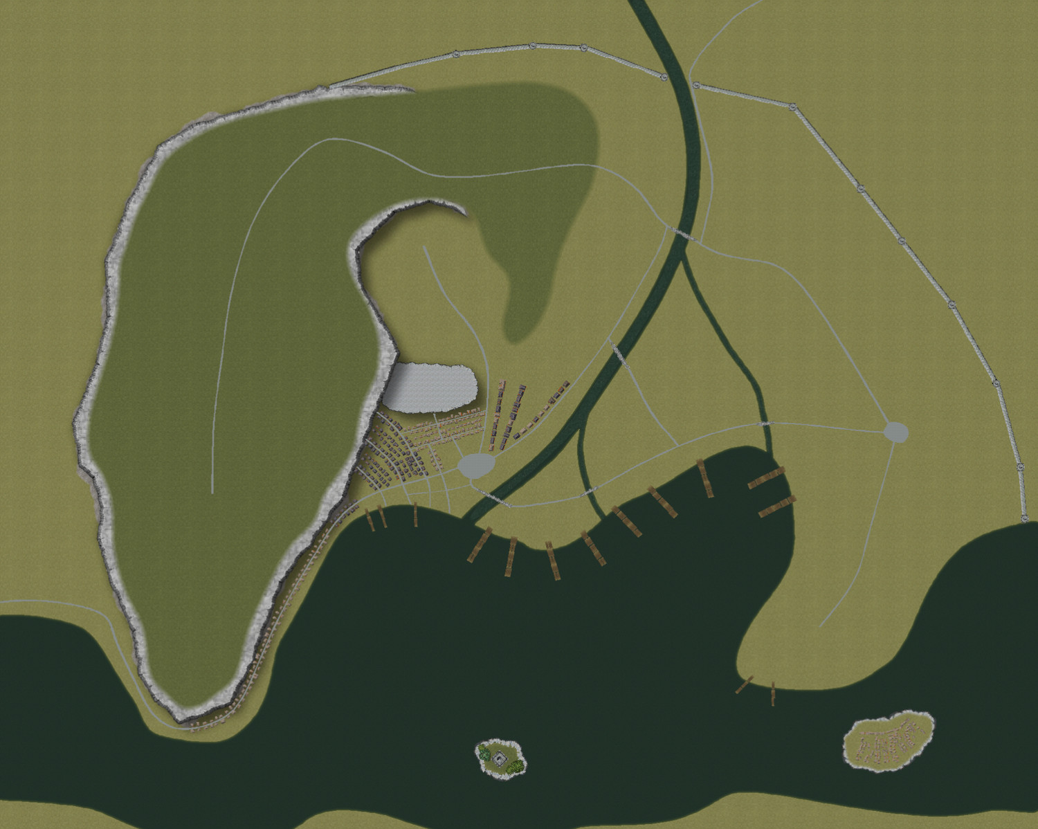
Hi,
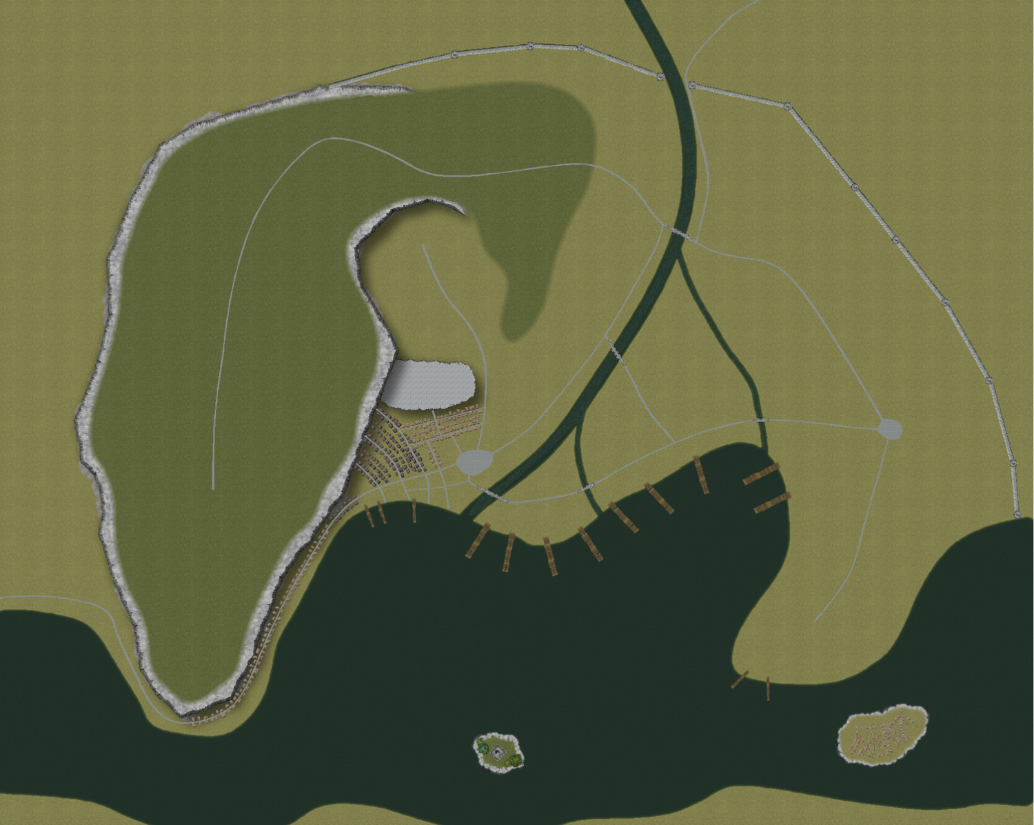
The last map I need to do for this commission (which is actually due tomorrow but that won't be happening...) is a city map. I sent the publisher a sample of the Darklands City map and they liked the style - the issue is the map is huge. It's 3600x2880 meters. I already had the basic shape - based on the authors sketch, I've put the major roads and bridges in and tonight I've started filling in the map district by district. I've partially done one district and to my eye, it looks bloody horrible. Obviously I'll need to vary the terrain fills a little...
Here's what I've got so far. The large body of water on the bottom of the map is a large river with a smaller tributary flowing in. I'm getting the feeling I've picked the wrong style for such a large map. The final image will be a full page US Letter, the attached is cropped to an aspect ratio of 11"x8".
Suggestions thoughts?


-
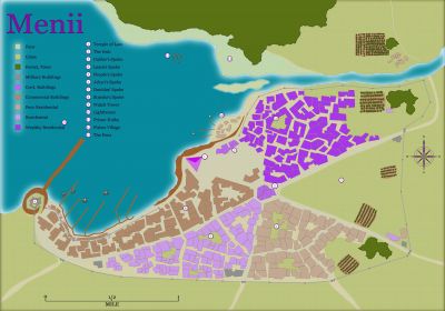
Crypt
I use the colour key method myself, I find it much easier - though some complicated shapes can be a real pain. If it's something you're likely to do often, I highly recommend creating a drawing tool (See page 141 of The Tome) then you can use the Trace function...


-
Scaling Bitmap Fills
A bit of an update...need to tweak a couple of things but this is essentially done. One more map to go and that's a city map...
![[Deleted User]](https://secure.gravatar.com/avatar/c75d9a245b74d9c59be0999ea81ca541/?default=https%3A%2F%2Fvanillicon.com%2F92add7f8c954488718110edc4896ad39_200.png&rating=g&size=200)


