EdE
EdE
About
- Username
- EdE
- Joined
- Visits
- 598
- Last Active
- Roles
- Member, Betatester
- Points
- 582
- Birthday
- February 5, 1965
- Location
- Ohio, USA
- Real Name
- Ed Elce
- Rank
- Surveyor
- Badges
- 5
Latest Images
Reactions
-
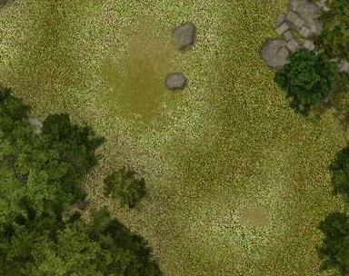
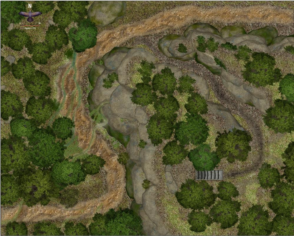
WIP: An encounter site
It's been a while since I posted, life has been busy. Here's an encounter map that the adventurers are currently struggling along a muddy trail, trying to reach the summit of a rock outcropping while orcs rain missiles down upon their heads. Still not satisfied I'm portraying the height difference well enough.


 and 1 other.
 -
Forest encounter area - Forest trails + SS2A
Thank you LoopySue, that was very helpful
-
Forest encounter area - Forest trails + SS2A
Thank you Kevbeck, steal away. I look at a lot of maps others have drawn and I am certain I create very similar content at times either intentionally or not.
-
Forest encounter area - Forest trails + SS2A
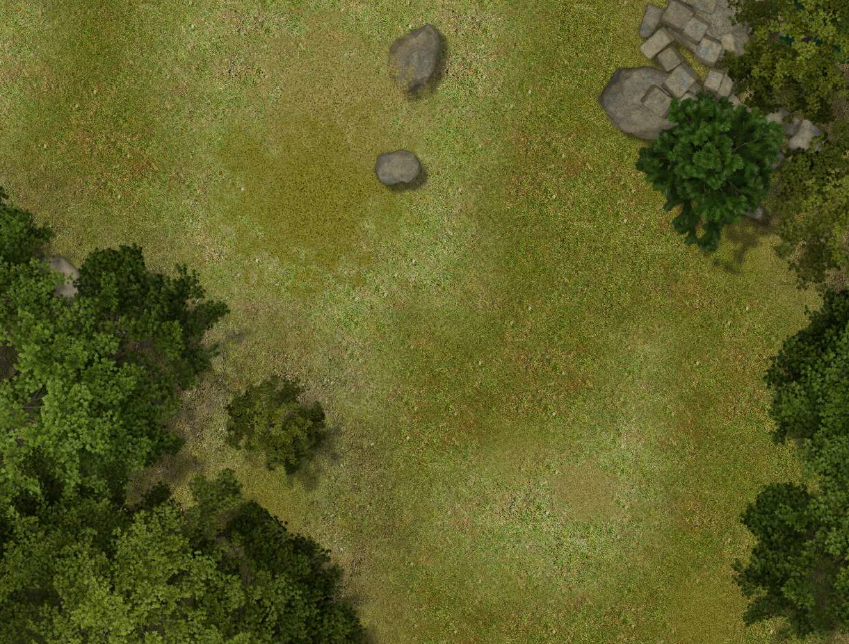
That is likely the issue. My setting sa re below and you are correct about the differences. My anti aliasing is much higher, my size/resolution is smaller and I noticed you don't have the progressive jpeg option active. Using your settings my computer is rendering the jpeg very slowly now but the output is much better.
My rendering is only 2.98GB, the Fantasy Grounds VTT can accept a file that size without choking on it
Thank you. That was very helpful. I will check the Tome of Ultimate Mapping more closely for more on this.
-
Forest encounter area - Forest trails + SS2A
I am likely picking nits. I agree that when I zoom in to that magnification the image is exactly what I am trying for. This is why I really like this style combination. The contrast of the light and dark blends extremely well. But zoom out to the full map (my picture above) and the transition between light and dak areas is much more stark and the light grass looks pixilated(?) There are small dark pixels that pop in the light grass when I do the Save to Rectangular JPEG that isn't there "on the screen" I am trying to figure out if this is a jpeg resolution issue, something I can mediate with transparency, blend, blur or texturize. Or if it's just my old eyes... it may just be the software I am using. This is what it looks like when I try to grab the same area of the map you have.