


mike robel
mike robel
About
- Username
- mike robel
- Joined
- Visits
- 4,196
- Last Active
- Roles
- Member
- Points
- 435
- Rank
- Surveyor
- Badges
- 6
Latest Images


Reactions
-
a large city, I have been putting off, now started
Well Done Jim!

-
Auto generate maps by standardized input files
I make contour maps for my wargames. It is a laborious process, but FT3, for a technically savvy person can use it to import real terrain files, then scale and cut and paste it into CC3. Not me. I can't even get it to import the terrain files - many of which are free. But there are people that can help you learn to do it. I find Brute Force and Ignorence [BFI (TM)] more useful to me.
-
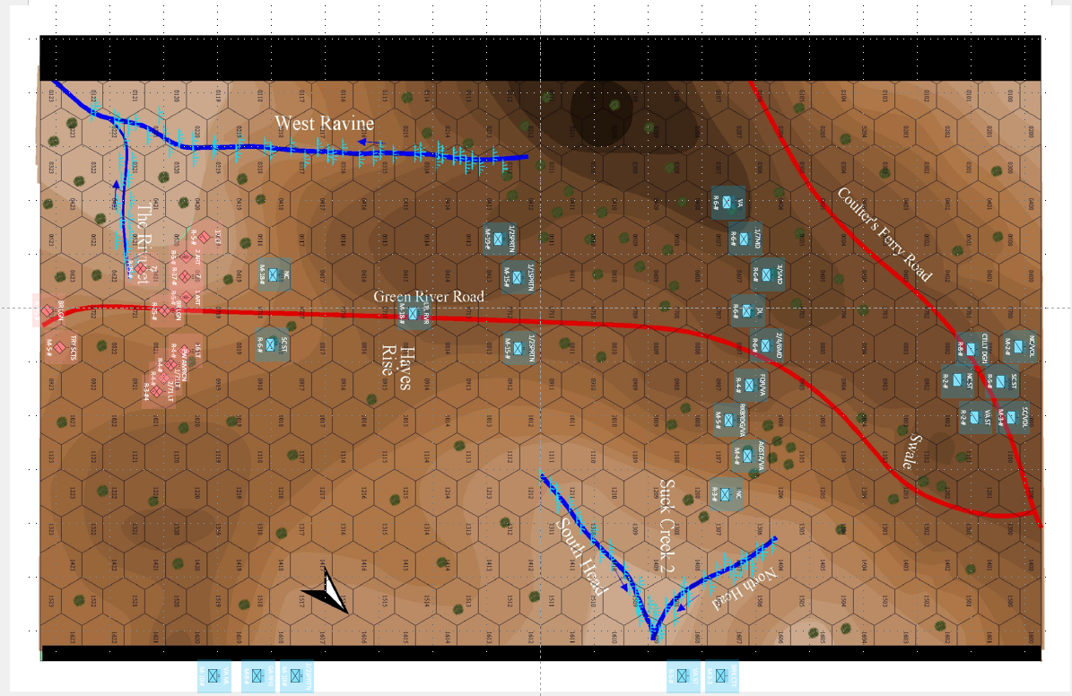
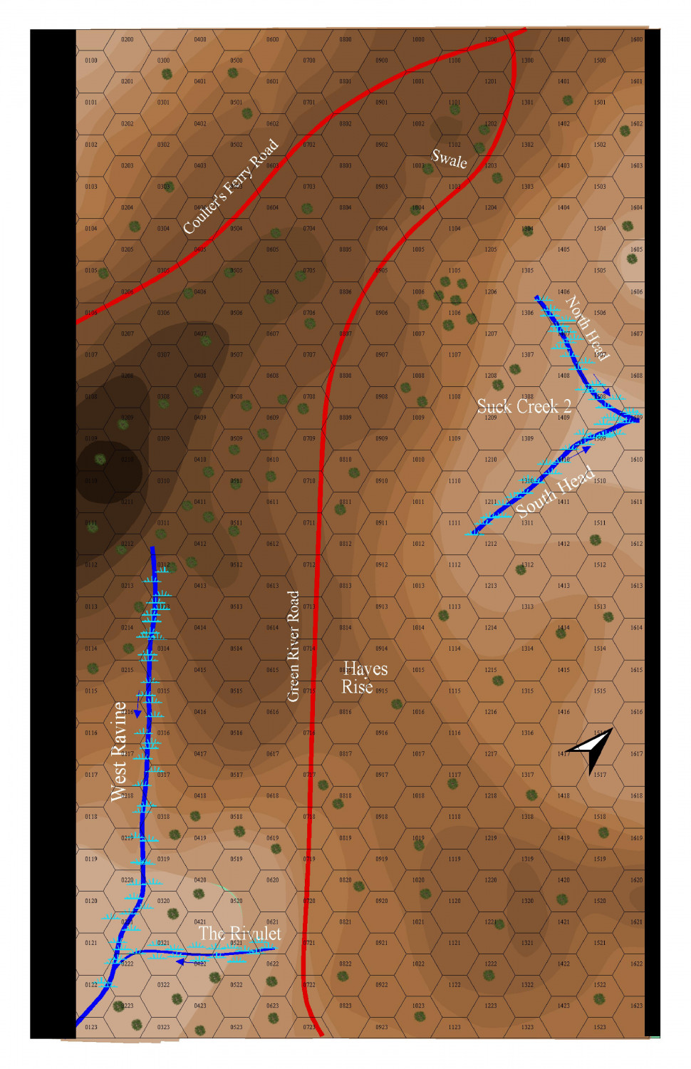
Cowpens Battlefield
This shows the units at the start of the battle (more or less). I am still researching where the units on the side belong.
The R or M stands for Regular or Militia.
The number is the combat strength of the unit.
The # sign represents the movement factor for the unit, probably the game turns are 2 minutes long and that will allow units to march at the Quick Step at 3 Hexes/Turn or speed up to 4 hexes per turn for charging/running. I will also add a range factor since the US had a mess of rifleman that could shoot 400 - 800 feet with a fair chance of hitting.


-
Cowpens Battlefield
I added a few trees - the battlefield was pretty well cleared and branches were chopped off as high as men on horseback could get (and any fences in the area dismantled) to provide fire wood.
-
Cowpens Battlefield
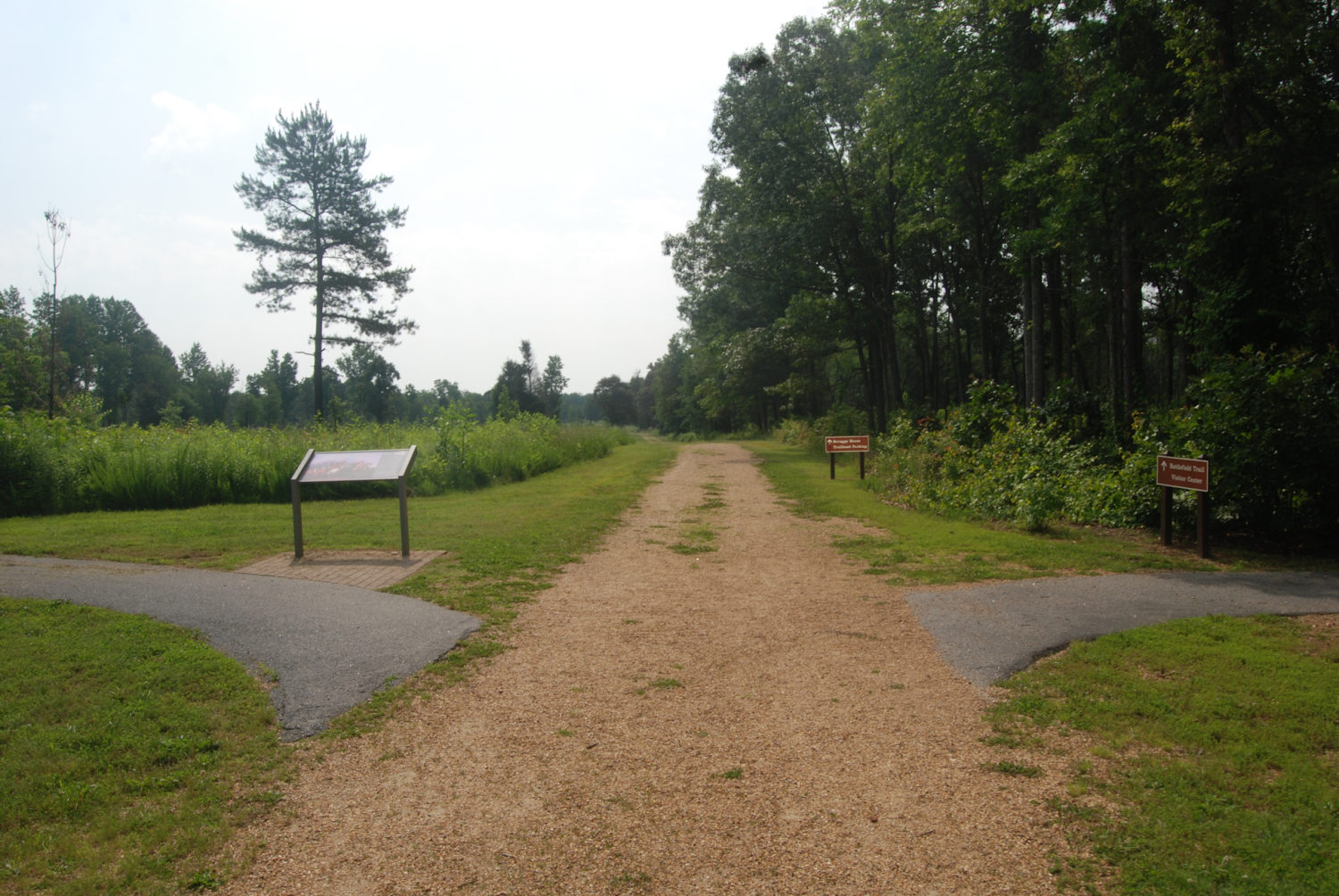
If I was a talented artist, like my oldest daughter, I might try for a look like the photo with a mixture of snow and mud. But since I'm not, I'm just gong to leave it as is. The battlefield was not as forested as it is today and there was no underbrush having been set alight to reduce vermin and encourage pasture for cattle and any wood available within reach used for firewood.
The path is the walkway for the battlefield tour and is not the road that ran through the battlefield.
It was very open, so I will be putting in some trees and that will be that. This was a brilliant double envelopment of the British by the Americans, sometimes called the American Cannae.
I'm also talking with an archeologist who wrote two books on the battle and I've been there 3 or 4 times.
Here is a picture where the Continental Cavalry under Colonel Washington (a cousin of the General) engaged in a melee with Colonel Tarleton's Cavalry Legion probably around HEX 0719 in the map, near the small stream on the bottom left of the map.
