


mike robel
mike robel
About
- Username
- mike robel
- Joined
- Visits
- 4,196
- Last Active
- Roles
- Member
- Points
- 435
- Rank
- Surveyor
- Badges
- 6
Latest Images


Reactions
-
Creating a Template to simulate the Khorvaire Map
@Loopysue I continue to be totally impressed by your skills and your most helpful assistance to budding cartographers!
Well Done!


-
Four weeks later and here's my first map!
A fine start.

-
isometric contours
Here is a region of Germany where I served. The first one shows the area without contour lines. The little symbols are for coniferous and deciduous trees.
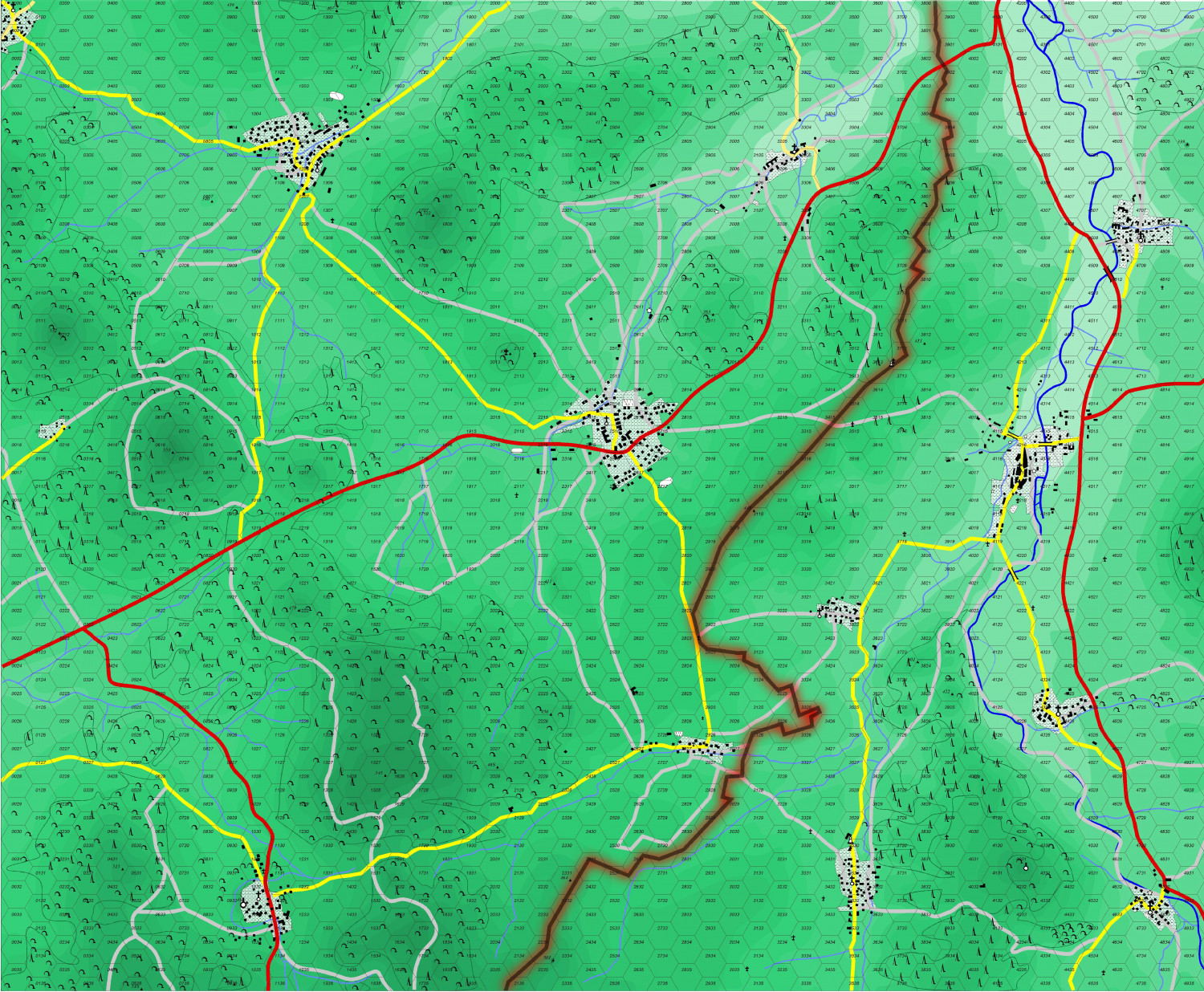
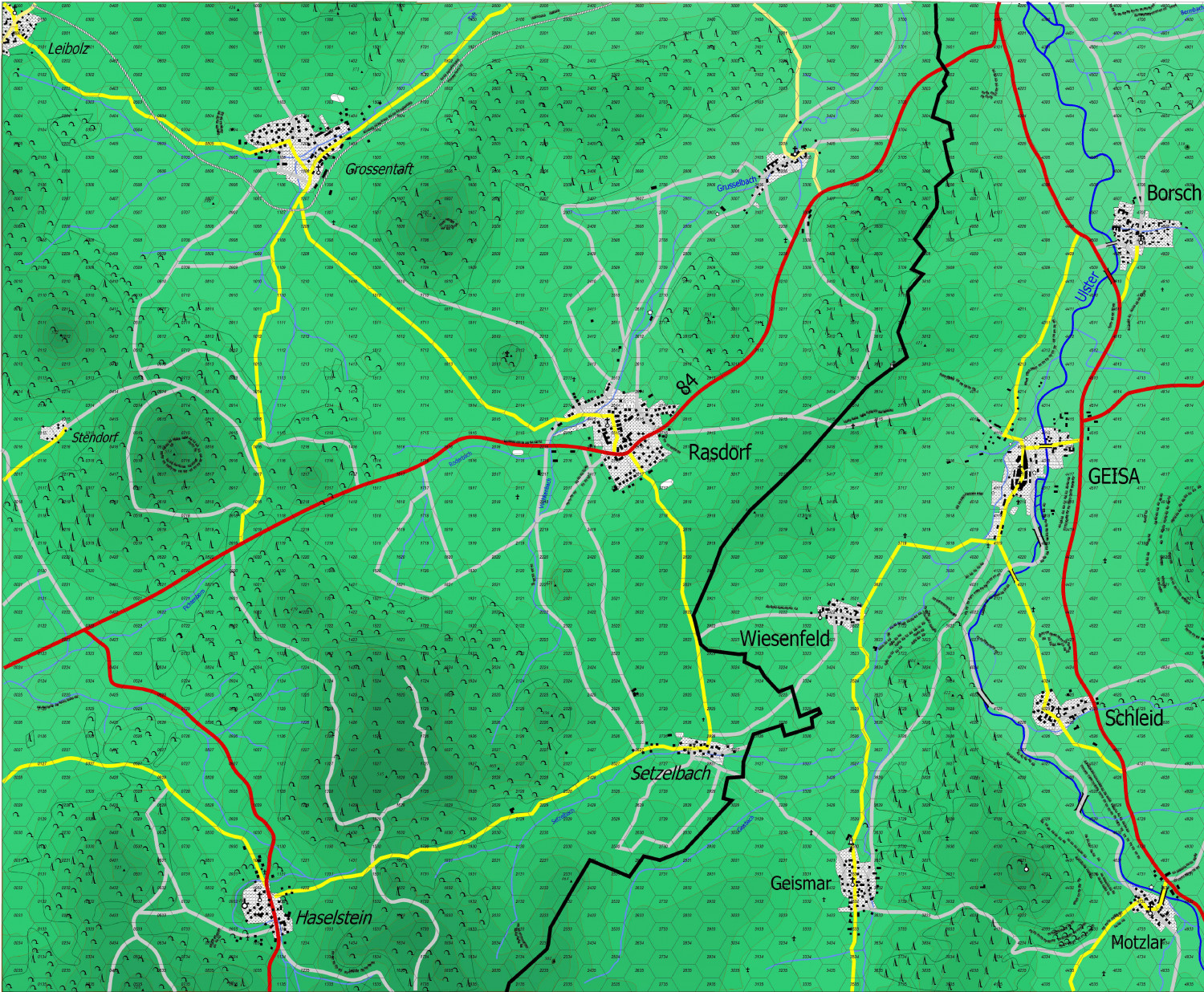
And here I turned on brown contour lines.


-
isometric contours
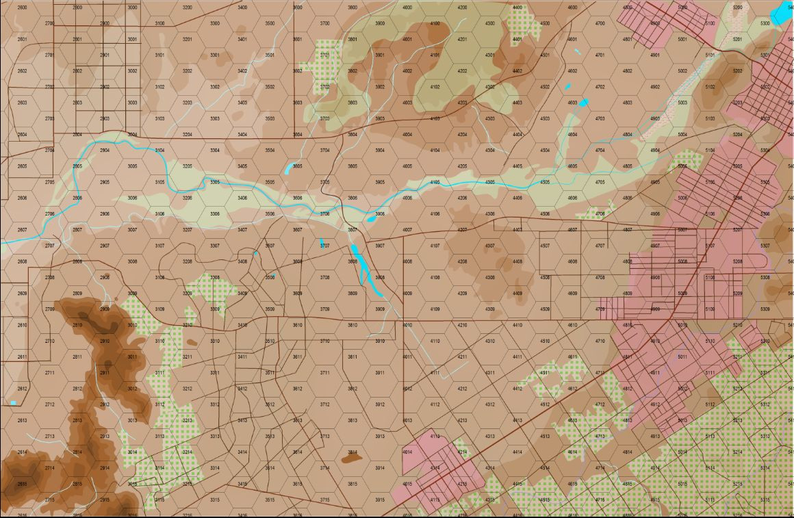
I just use the smooth polygon tool to outline the contour and then fill it with green or brown shades with the contour line being the same color as the fill. To me, darker contour areas represent higher elevation. @Loopysue likes them the to represent lower elevations, but to me it looks like you are looking down a hole. This is a portion of the first map I ever made with CC3.
This is a desert region in California so the ground is brown while green indicates forest or orange groves in this case.

-
World Map
Quadrilateral! 😎


