


mike robel
mike robel
About
- Username
- mike robel
- Joined
- Visits
- 4,136
- Last Active
- Roles
- Member
- Points
- 435
- Rank
- Surveyor
- Badges
- 6
Latest Images


Reactions
-
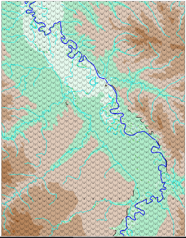
Representing Cliffs and Ridgelines
Here an overall view of the map. The actual map is 34 inches x 44 inches.
![[Deleted User]](https://secure.gravatar.com/avatar/c75d9a245b74d9c59be0999ea81ca541/?default=https%3A%2F%2Fvanillicon.com%2F92add7f8c954488718110edc4896ad39_200.png&rating=g&size=200)


-
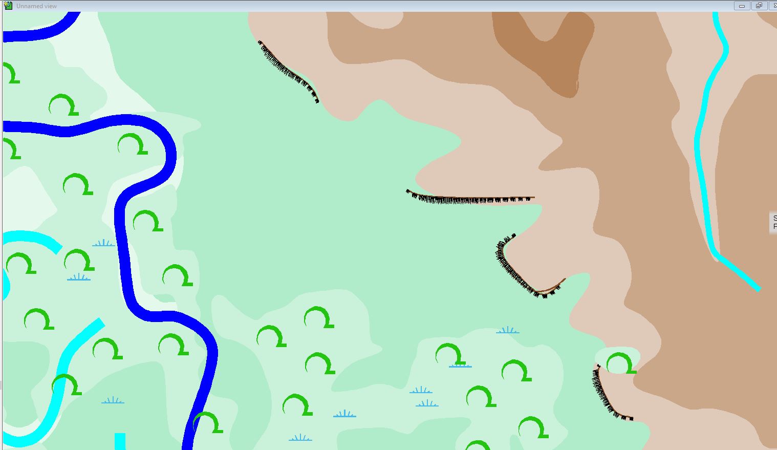
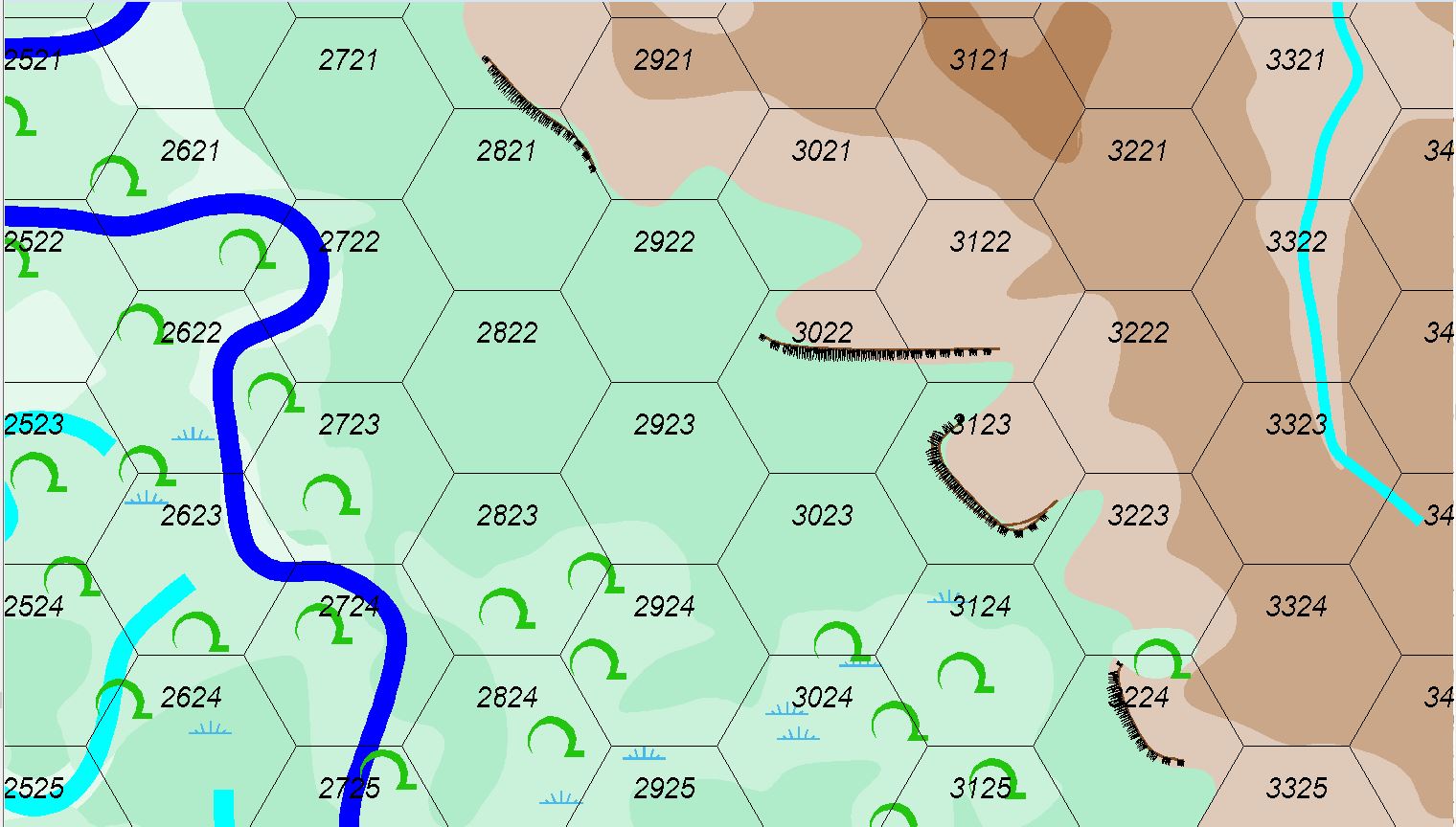
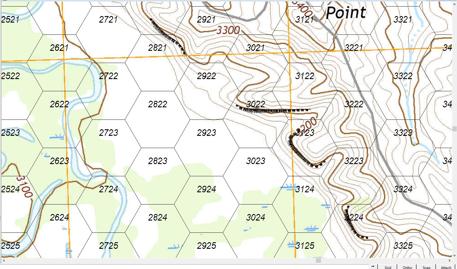
Representing Cliffs and Ridgelines
Here's a version with Sue's Hash Marks which I really like.
First with no grid, then with the grid, then with a look at the real map with the hash marks displayed. Basically a player can move through the bluff but has to declare he is moving up the draw/coulee/ravine in hex 3122 or 3123. The actual route is along the hex edge, but I don' t like to move terrain as I discussed above.
Still thinking about the ridgelines or just drawing closed contours with 0.0 width lines to indicate hill tops to assist with Line of Sight matters. 20 foot contour intervals would be best, but I would go blind.
By the way, after the fiasco with group/ungroup lock/unlock etc. I just did the map over in the last two days. I think it is better this time. I still have to label the features and designate the village and pony herd locations because my hex numbers and map do not coincide with the game map.
-
Battle of Eylau Map (NOT MY WORK!!!!)
This map was for the Battle of Eylau by Rachel Simmons. She was working on a map for the Eastern Front that was just magnificent as was her Gettysburg Map (and all her other ones as well), She retired from wargame design recently and she is answering various questions about her design philosophy, etc. Her games and maps were ground breaking. The attached map does not do it justice. For a better view go to https://www.boardgamegeek.com/image/6188136/simmons-games where you can enlarge it.
I put a larger image (not my work) in my gallery if you don't want to hop to BoardGameGeek.com to see more on her games and her other work.
You can see artwork from her other games at:
Guns of Gettysburg: https://www.boardgamegeek.com/boardgame/36400/guns-gettysburg (I ended up buying this because the map is so wonderful and got it for a reasonable price as well.)
Napoleons Triumph: https://www.boardgamegeek.com/boardgame/18098/napoleons-triumph
Bonapart at Marengo: https://www.boardgamegeek.com/boardgame/15839/bonaparte-marengo


-
Too early for a CC4 wishlist thread, or is it timely?
Other useful features might be Vertical and Horizontal rulers based on the dimensions input in the design wizard .

-
Ideas for future Annuals
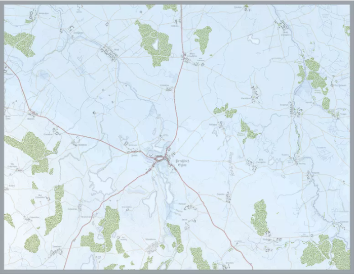
A modern topographical map annual It may be of limited interest, however.
There are elements for this sort of work spread among various templates but a dedicated one would be nice.
Not much is required in drawing tools, but the symbol set could be consolidated and expanded. I know I could construct a custom symbol set drawing them from all the various other sources, but I have had little success with doing this in spite of several attempts.
A custom palette also might be useful concentrating on providing more shading for contours in green (for most environments) and brown/sand (for desert environments). Monson prepared for me a several large pallets of green/brown with 32 and 48 ranges of colors, as well as one that splits the 48 into two between green/brown.
Overhead views of trees and other vegetation would be good as well, allowing one to replace the various symbols with easier on the eyes overhead views of trees for example.

