


mike robel
mike robel
About
- Username
- mike robel
- Joined
- Visits
- 4,196
- Last Active
- Roles
- Member
- Points
- 435
- Rank
- Surveyor
- Badges
- 6
Latest Images


Reactions
-
McMaster University Digital Map Collection
As the title says, this Canadian University has an excellent digital map collection from the 18th century (maybe before) until now. Particular interesting is the World War II collection with 1944 era maps for most of Western Europe, but no theater is left untouched. I have not even come close to looking through all of them even briefly.
You can download *.JP2 maps at medium quality or high quality *.tff that are mostly 1GB or larger and they are bloody wonderful, preserving detail to extrement zooming. (The JP2's, not so much.)
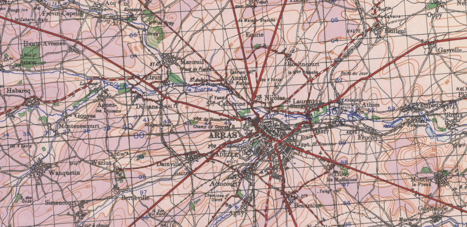
I was gratified to find 1:100000 maps covering the Battle of Arras, which was one of my first maps I produced for a game. The British launched a small counterattack with two tank and two infantry battalions, coming in just behind Rommel's 7th Panzer Division's leading tanks and hit his infantry Regiment, causing considerable havoc. Rommel's aide was killed 5 yards away from him; imagine the consequences. There is also some evidence that Rommel panicked, his situation map has the notation "5 Divisions" with a couple big arrows pointing toward his division. The attack contributed to the Panzer Halt which gave the British the time to get to Dunkirk.
I worked from modern maps and snippets of copies of maps from books and online images and it is just wonderful to have such a map.
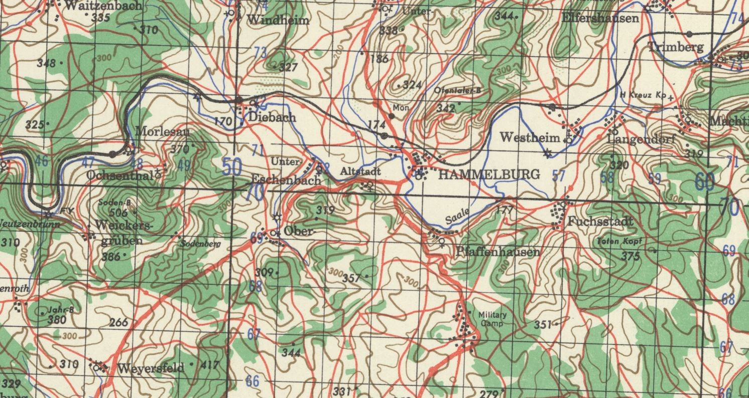
I also got 1:100000 maps covering the path of TF Baum (which included the WW2 company my last command was descended from) Hammelburg, Germany raid . I "walked" and road the raid path several times when I was stationed in Germany, using modern 1:50,000 maps, while while highly detailed, do not show things as they were then. BTW, the raid failed, TF Baum was destroyed and survivors taken prisoner or escaped.
Next is the Battle of Arracourt in France in which the company was destroyed too, and the Break-in to Bastogne, Belgium which the company led (and did not get destroyed).


-
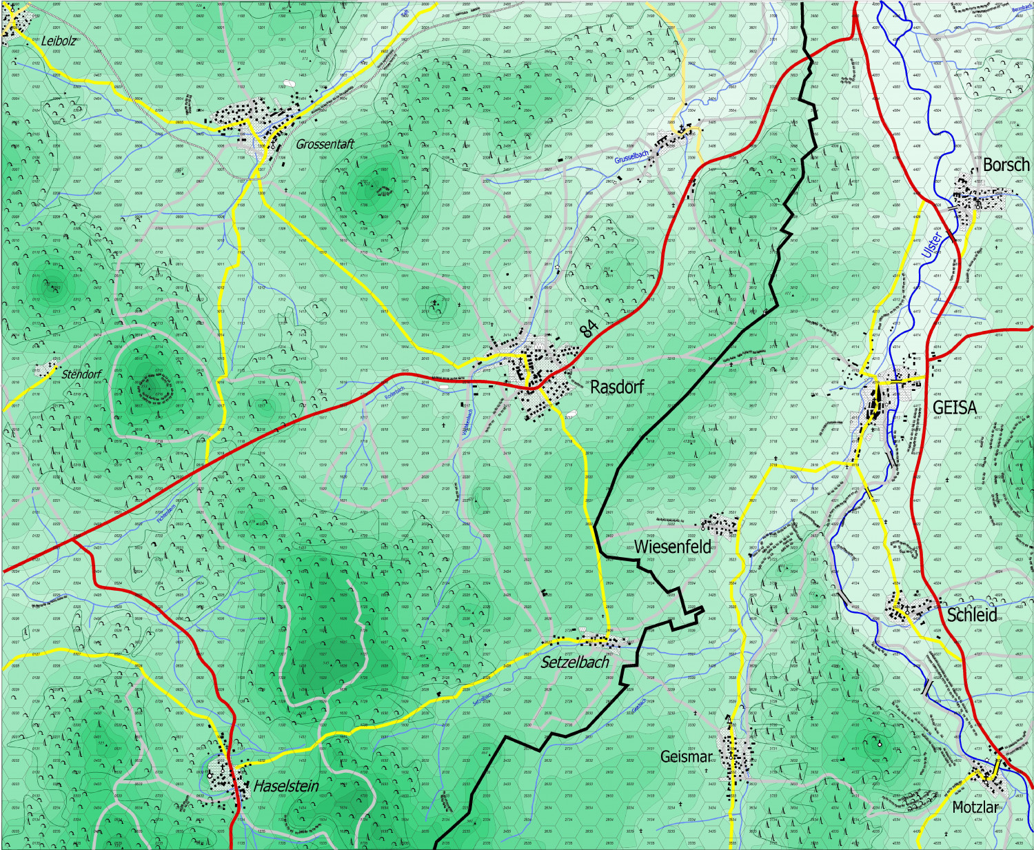
Yet Another Wargame Map set in ...
![[Deleted User]](https://secure.gravatar.com/avatar/c75d9a245b74d9c59be0999ea81ca541/?default=https%3A%2F%2Fvanillicon.com%2F92add7f8c954488718110edc4896ad39_200.png&rating=g&size=200)


-
Yet Another Wargame Map set in ...
and with the Brown Contour lines drawn around the polygons

-
Yet Another Wargame Map set in ...
Well, I think it's done, except for placing the borders on the contour lines and deciding if I want to change the color scheme.
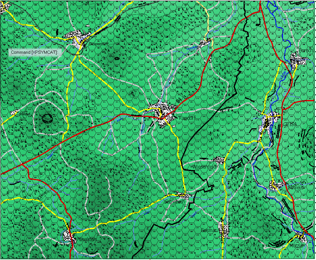
The hash lines represent really steep slopes or embankments, cuts, etc. They provide some protection in a direct fire engagment and stop movement across the hexside. A cumulative effect is provide in the case of gaps. If you are moving parallelly to the embankment, there is no penalty unless you exit perpendicular to the direction of the embankment.
-
Railroads
Alas, Sue. I will probably fare no better at creating a drawing tool than I would at creating my own symbol catalog. Nevertheless, I will give it a go sometime in the [near] future.
