


mike robel
mike robel
About
- Username
- mike robel
- Joined
- Visits
- 4,196
- Last Active
- Roles
- Member
- Points
- 435
- Rank
- Surveyor
- Badges
- 6
Latest Images


Reactions
-
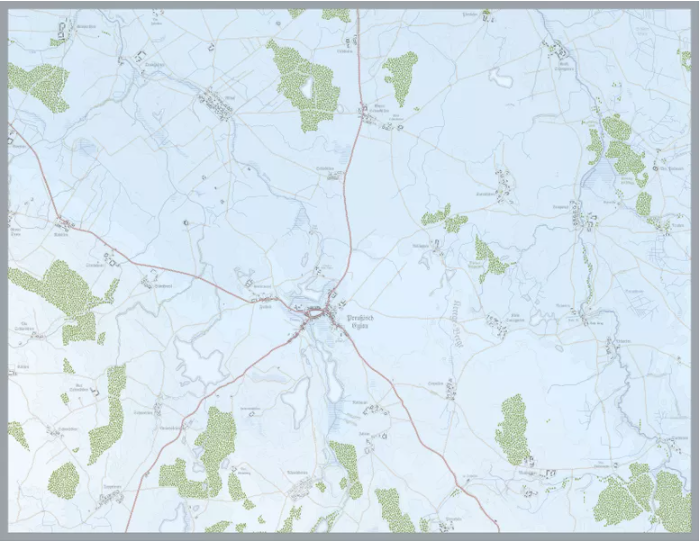
Battle of Eylau Map (NOT MY WORK!!!!)
This map was for the Battle of Eylau by Rachel Simmons. She was working on a map for the Eastern Front that was just magnificent as was her Gettysburg Map (and all her other ones as well), She retired from wargame design recently and she is answering various questions about her design philosophy, etc. Her games and maps were ground breaking. The attached map does not do it justice. For a better view go to https://www.boardgamegeek.com/image/6188136/simmons-games where you can enlarge it.
I put a larger image (not my work) in my gallery if you don't want to hop to BoardGameGeek.com to see more on her games and her other work.
You can see artwork from her other games at:
Guns of Gettysburg: https://www.boardgamegeek.com/boardgame/36400/guns-gettysburg (I ended up buying this because the map is so wonderful and got it for a reasonable price as well.)
Napoleons Triumph: https://www.boardgamegeek.com/boardgame/18098/napoleons-triumph
Bonapart at Marengo: https://www.boardgamegeek.com/boardgame/15839/bonaparte-marengo


-
Chop up a map into even pieces?
My technique is contrary to how the manual tells you to size the map and is normally based on wanting a map set printed on 11 x 17 inch paper.
- Determine the area I want to model.
- Buy or download the topographic maps I want.
- Decide on the hex size I want to use. It is typically 250, 333, 500, 1000, or 3000m depending on unit scale and time period.
- Assemble them digitally. They map at this point will likely be larger than I will need. At this point I note the dimensions of the map. Some of them are quite large.
- Define the area I want to model and cut it out of the main map. When I do this, I determine the map dimensions by ensuring the area I want to be covered. I use a cropping tool to define the map size I want and then move it around so the modeled area is contained. I may crop the map so it is multiples of 11 x 17 inch blocks.
- Save the cropped map as a BMP, JPG, or PNG.
- Open the map in CC3+.
- Using the Grid tool, estimate how big I think the hex has to be. Let's say it's a 1:50000 map and I want the hexes to be 1000m hexes. I make a guess as to how big the grid should be and compare it to the grid squares on the map. I want either the side to side or top to bottom lines of the hex to line up with grid squares. When I to that point, then I save the map and print it to CutePDF in however many 11 x 17 sheets I want it to be in.
- I print out the first map sheet and then measure the grid. I check the grid to make sure the counter size fits in (typically 1/2 inch, but I am going bigger now). I undo and construct the grid as necessary to get the hex to be the size of the grid square. (Grid squares aren't squares, their trapezoids.) The grid needs to match only in height or width
- If the hex fits the counter I start working on the map. If not, have to redefine the size of the map.
- Repeat as necessary. sometimes, the map might only be on a single sheet. If so and the map is smaller than 11 x 17, I just resize the base map so it is that size, which may make it bigger that the original map scale. The happy thing here is the hexes are now larger, but the counter stays the same size, so there is more room to to play. Sometimes I have to reduce the size of the map, but the main thing is I always want it to be a multiple of 11 x 17.
- I did one map the way the manual tells you to do it, so let's say I had a map that was 125km tall and 80km wide. That distance might work on well for the hexes, but when it comes to printing out the map I get a lot of white space around the borders and I don't want that because it wastes money when I start printing.
I don't care about the distance measuring abilities on the CC3+ map in the program, because the scale is defined by the hex, for example 1 hex = 500m.
So when you print out the map as a PDF and specify the tiles, say 4 wide x 5 tall and 11 x 17 inch paper, the printing process to CutePDF spits on 20 sheets sized at 11 x 17. I then export the pages as JPG. Then I center them on a 12 x 18 inch size sheet of paper together with cut marks and send to the printer and they cut and fold the map for me.
It may not be pretty, but it works for me. One of my home printers easily prints edge to edge, so I don't have to go through all that crap if I am just printing for myself. Of course, I may choose to print the map out on 12 x 18 or 13 x 19 inch paper in order to make the hexes larger. In that case, I may have to trim the maps.

-
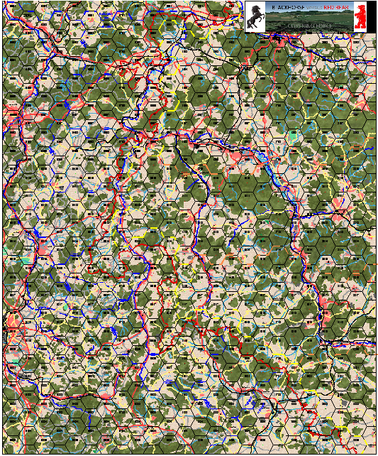
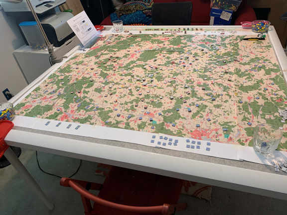
Game World Wall Map
I have maps I have developed for gaming which are almost 5 feet square.
The Little Bighorn battle area. Each hex represents 1 kilometer
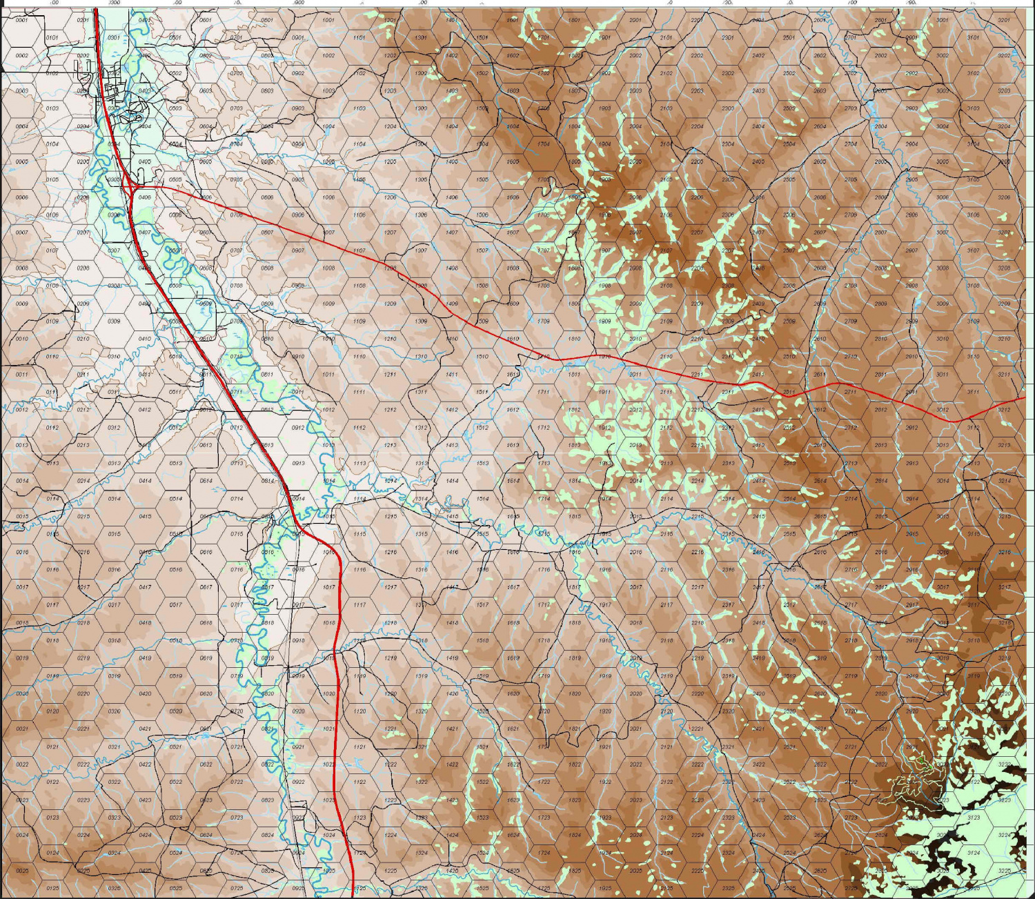
The 11th Armored Cavalry Regiment's Covering Force Zone in 1980. Each Hex represents 3 kilometers.


-
Topographical map of the Ice bed of Antarctica
Choppinlt: Apparently, you can download data from that site. I have no idea how. If so, perhaps it can be manipulated via Fractal Terrain 3, which went beyond my desire to master. I found it very frustrating, even when following the tutorials.
This thread https://forum.profantasy.com/discussion/9720/ft3-to-cc3-mapping-issues#latest has some details. In the end, I gave up on FT3 - it wasn't an expensive gamble for me - and decided to just use Brute Force and Ignorance to work my way through using CC3. BFI has its own reward.

-
Desert map for a commission
Ah. Thanks for the correction.
