


mike robel
mike robel
About
- Username
- mike robel
- Joined
- Visits
- 4,196
- Last Active
- Roles
- Member
- Points
- 435
- Rank
- Surveyor
- Badges
- 6
Latest Images


Reactions
-
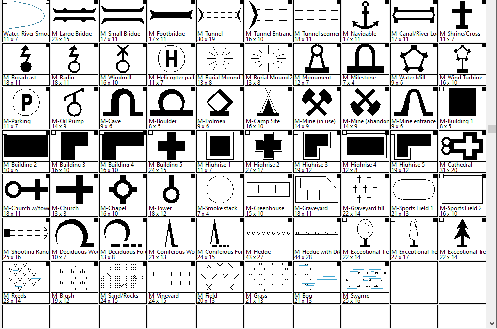
Searching for Specific Symbols
SS3 Overland has some many modern mapping symbols including active/inactive mines, as shown below. There are a few other modern type symbols in various other symbol sets, most of which I have to rediscover when I want to use them because my pitiful attempts to make a custom catalog continually fail.

-
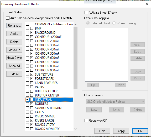
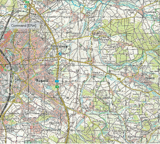
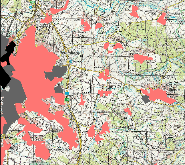
Changing Properties and Importing SRTM Contour Lines from FT3
Polygon fill: Make sure you have the line width set to 0.00000 or it does not fill in. I trace urban areas as you describe, but I put them on their own sheet. In fact, I may have 3 sheets. Urban Center, Suburbs, and outskirts. Sometimes an Industrial one as well. Generally, I start from the outside in, with the outside sheet being on the bottom and the Urban Center on the top. You can see it below: Gray: Industrial, Black: Center, Red: Outskirts
-
Elevation Lines on Small Maps
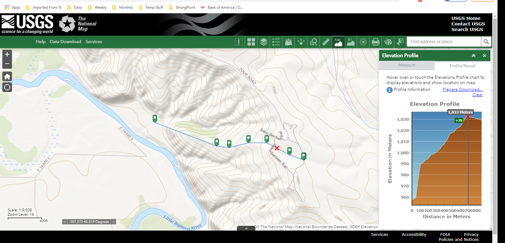
You can go here to the National Map https://apps.nationalmap.gov/viewer/ and select areas in the US and zoom in pretty far and you can display the contour lines. There are measureing tools so you can see how far a given path is and a profile tool so you can see the roughness of the terrain. However, the height is exaggerated so it looks like you are climbing mount everest, but it can give you a good idea of how things are in relative terms.
The closer together the contour lines, the steeper the slope. If they come together, or are very dense, or even end, with just one contour along a spot, then you have reached a cliff. Here's a screen shot which may help.
There are similar sites that provide information in other ways.

![[Deleted User]](https://secure.gravatar.com/avatar/c75d9a245b74d9c59be0999ea81ca541/?default=https%3A%2F%2Fvanillicon.com%2F92add7f8c954488718110edc4896ad39_200.png&rating=g&size=200)
-
Topographical map of the Ice bed of Antarctica
While there may be some way to get topographical data from those maps, I don't know where one would start or have any idea about how to do it..
That said, you apparently go to OpenMap.com/DE and get a bootable map that allows access to data. I'm away from my computer right now and will have to check the link and update it if I'm wrong.

-
WIP: BD-like - a process output extravaganza
@Lillhans Geeze. You are a genius. I have trouble enough just trying to duplicate topographical maps for wargames. It's a good thing contour lines are not straight or gentle curves, cause I can't draw straight lines without a ruler or graceful curves with a French curve, even assuming I don't slip. Exceptional and very artistic work.
I also wish I could punch Like, Awesome (a word which is overused today), and Insightful all in the same post.

