


Wyvern
Wyvern
About
- Username
- Wyvern
- Joined
- Visits
- 3,266
- Last Active
- Roles
- Member
- Points
- 5,584
- Rank
- Cartographer
- Badges
- 24
Latest Images


-
Live Mapping: Cosmographer System Map *** NEW second attempt ***
Changing/adjusting line styles is one of those things that might be worth demonstrating in a video too, though, as it's one of the trickier elements to adjust and get right quickly, I've found.
And glad to see I didn't jinx tonight's stream by being able to turn up for it live for once 😊!


-
Returning to mapping
OK, this is what I'm seeing:
All I've done here is open the file, and take a screenshot, and this is what I have.


-
SVG exports?
Fractal Terrains can export as an SVG, apparently, BUT it's not available as standard, and it may not work properly. There's a trick to it, and caveats - see this Forum post by a certain J Slayton from 2022. Your safer bet though might be using an online converter from one or other of the CC3+ "Save as..." options instead, as Scott mentioned already.

-
Returning to mapping
Ordinarily, if there were a lot of symbols there that your computer can't find, you'd end up with a load of shapes filled with red X's. As there aren't, that doesn't seem to be the issue here.
Have you tried doing a List command using "Select all"? That should tell you exactly what is actually in your drawings.
There are various possibilities for why so much seems to be missing from your drawings, and it may help if you're able to post copies of the FCW files here for others more expert than me on the Forum to examine, to try to identify what's going on here.
-
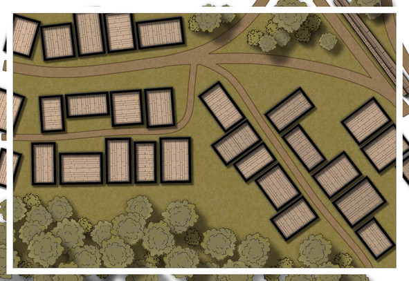
Community Atlas: Temple of Nidag, Stormwatch, Emerald Crown Forest, Alarius
With the style selected, it was time to copy over the linear elements to a new map, after a few further minor changes (mostly to avoid copying the symbols for the town wall again):
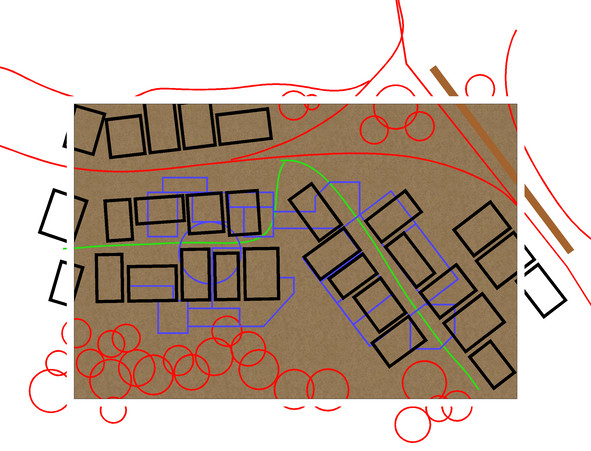
The building walls have already been changed closer to the new map style, although without any sheet effects on at this point. The dungeon design lines have been changed to blue as well. Several copies of this CC3+ drawing were saved, in case of later problems, and so the above and below ground map designs would match.
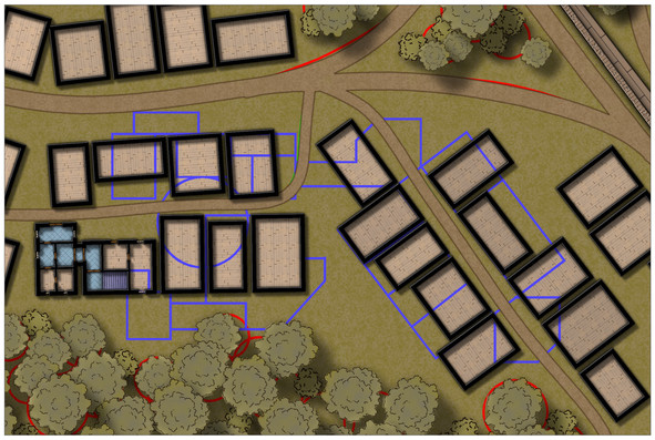
Next, the roads, town wall and main vegetation were all added for the surface map:
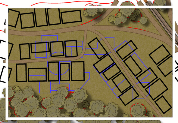
The background bitmap fill has been changed too, as the roads were getting a little lost in the earlier dirt brown default fill. Effects have been tweaked here to outline the pathways better, although the trees and bushes still need a bit more work.
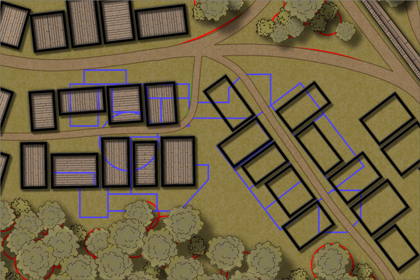
Now, the building outlines have been switched to the WALLS sheet, and the first pine floors added (using angle-by-edge on the flooring polygons, and adjusting the shading's pitch and angle to tone-down the wood-plank colouring, although this felt too dark and similar to the surface cover, which meant further experimentation with several aspects of that pine plank fill to reach this stage:
Still not 100% sure about the floor colouring, but I can see what's happening in the buildings now at least (particularly with the BITMAP sheet outlines all hidden). The vegetation has been adjusted by adding a further TREES sheet, and moving some of the taller trees onto it. All still subject to further tweaking, of course, though the tree cover looks less 2D now, at least.
Next began a trickier stage (given virtually none of the mapped wall lines work with the "Ortho" setting), the process of showing what the buildings contain, and how they link to the subterranean features. New floor textures (and a tweaked pine floor one too), wall-lines, doors, windows, stairs, etc., were added, in a limited section only at this stage, which gets us up to date with progress on this map:
The BITMAP lines are back, so I don't start fitting the stairs and entryways to the wrong properties, (in theory). The two buildings done so far are the main public access points to the underground temple, and as you can see, I've already taken slight liberties with the original Stormwatch map, by connecting two of the surface buildings to better work as such. Lots more to do, however, not least the fact I'd forgotten to copy over where the chimneys are before starting these interiors, so there may be even more tweaking by next time!

