


Wyvern
Wyvern
About
- Username
- Wyvern
- Joined
- Visits
- 3,267
- Last Active
- Roles
- Member
- Points
- 5,585
- Rank
- Cartographer
- Badges
- 24
Latest Images


-
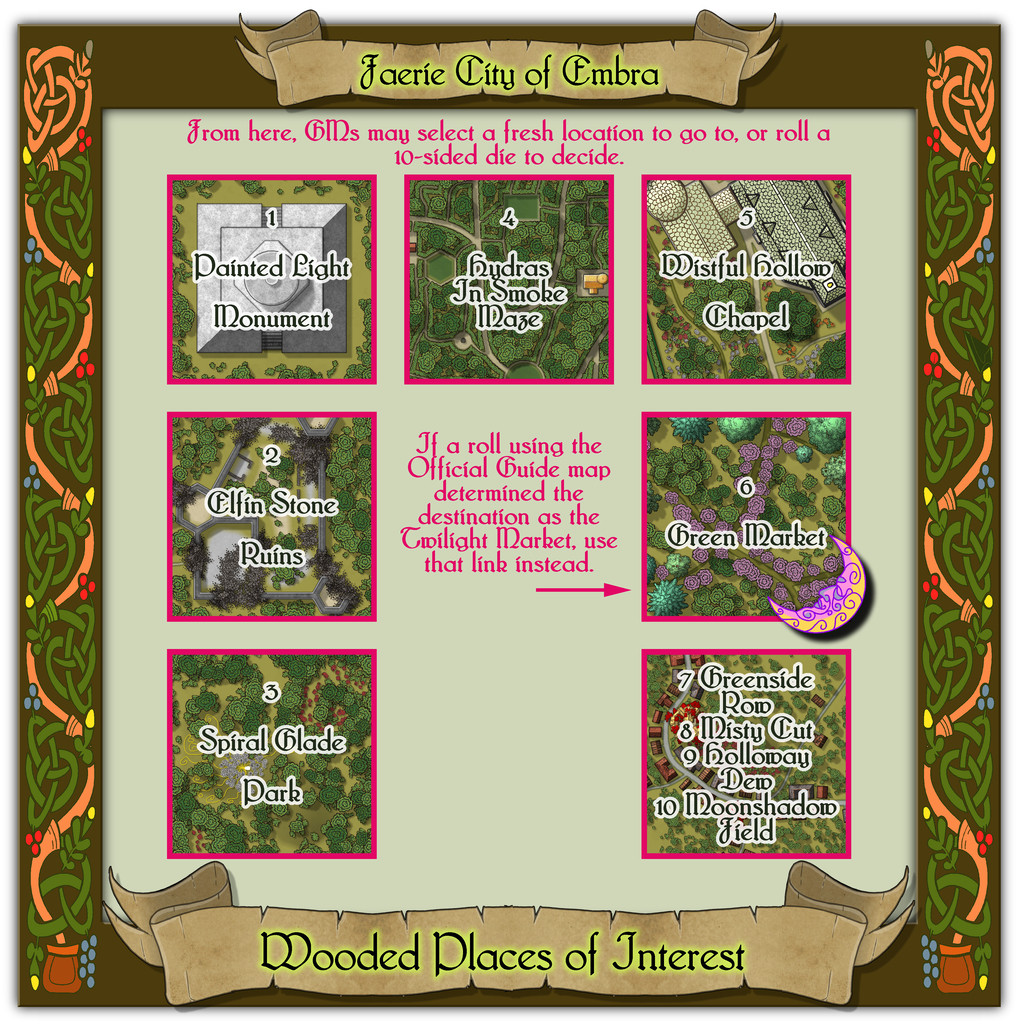
Community Atlas: Embra - Wooded Places
Approaching the end of this "guided" (?) tour of Embra, the penultimate group of sites to visit comprises the Wooded Places of Interest, approached via the relevant central pie-wedge from the "Official Guide" map, as usual:
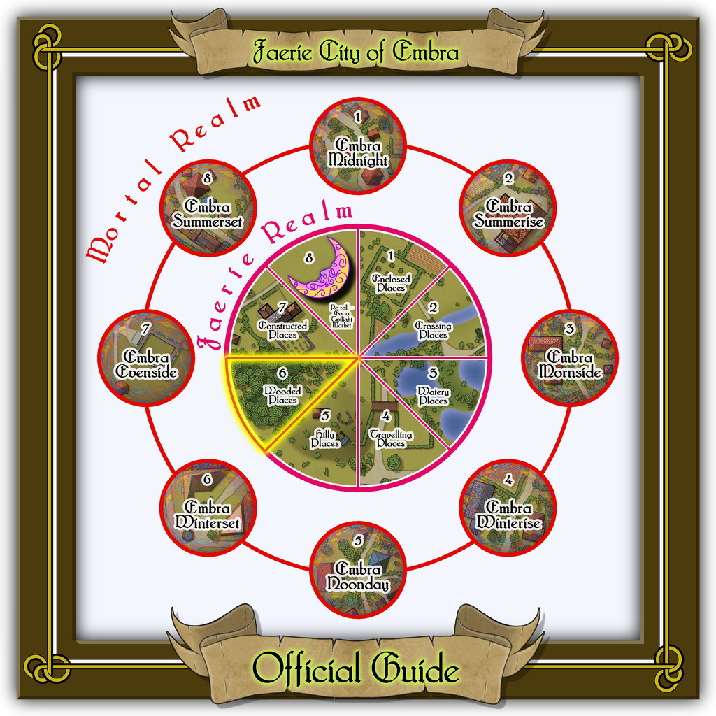
This set, like the Hilly Places, has half-a-dozen individual mapped locations to connect, plus a seventh map for its four "Streets".
From the start with the Enclosed Places at Embra, it always seemed likely I'd be revisiting the foliate borders used there for these Wooded Places map frames too, as nothing else I'd come across seemed to fit the bill quite so well, this time with a reworking of the colours. As we shall discover however, I couldn't resist another couple of the knotwork creature designs from that page of those also in the Dover Clip-Art "Celtic Borders on Layout Grids" book...


![[Deleted User]](https://secure.gravatar.com/avatar/c75d9a245b74d9c59be0999ea81ca541/?default=https%3A%2F%2Fvanillicon.com%2F92add7f8c954488718110edc4896ad39_200.png&rating=g&size=200)

-
Watabou City Updates?
@malvernas & @Quenten - I think this may be the post Quenten was intending you to see Malvernas.
Oddly, it didn't come up for me on an initial search either, but knowing it was here somewhere meant I just kept trying alternatives.
If another item was meant, I'm sure Quenten will be able to advise you further. Good luck with your mapping!

-
Community Atlas: Embra - Hilly Places
Thanks very much Sue!
I wanted the cliffs here to look different to yours, which I'd already decided to use for the red sandstone types at Embra, as the Palace Heights ones are meant to be a harder, volcanic type of rock. Actually, a Faerie type of volcanic rock, which has different properties and abilities to "ordinary" volcanic rock, so I also wanted the forms here to act as a reminder that something a little different to normal was involved. I also used a similar style of cliff drawing in one of the Crossing Places Streets - the Rocky Vale under Seafield Road there, again because the Vale is a weird place that can't be reached, another reminder of something odd happening there.
-
Community Atlas: Embra - Hilly Places
The final Hilly Places map condenses the last four items, the streets, into one sketch:
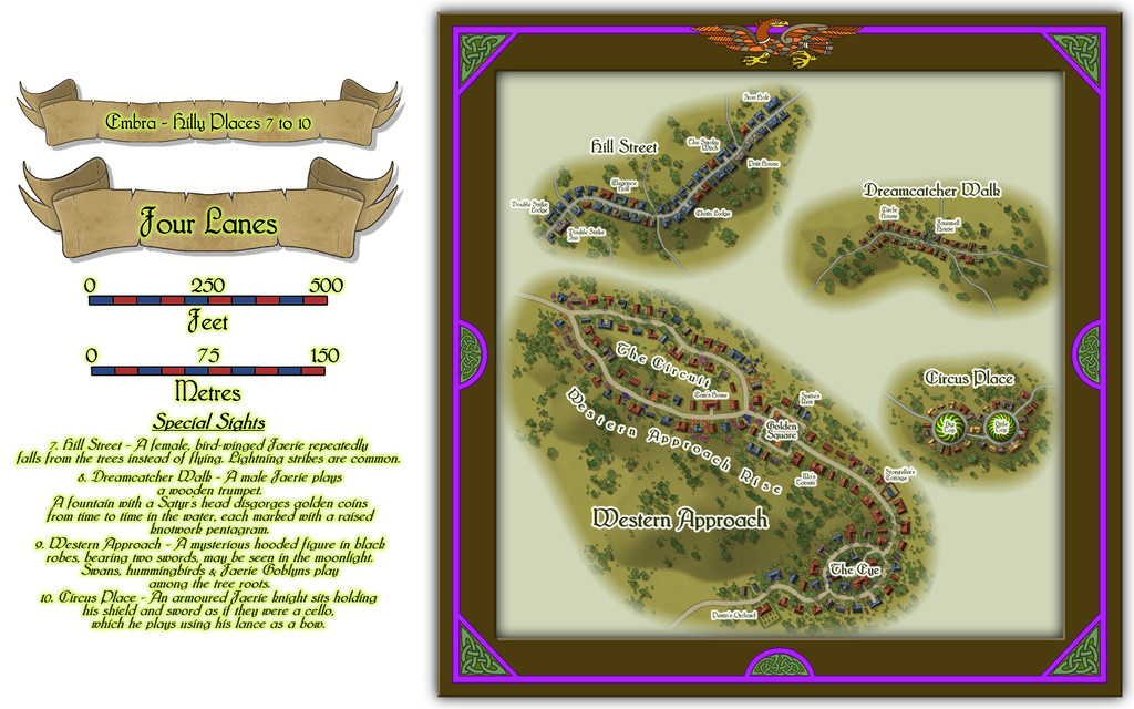
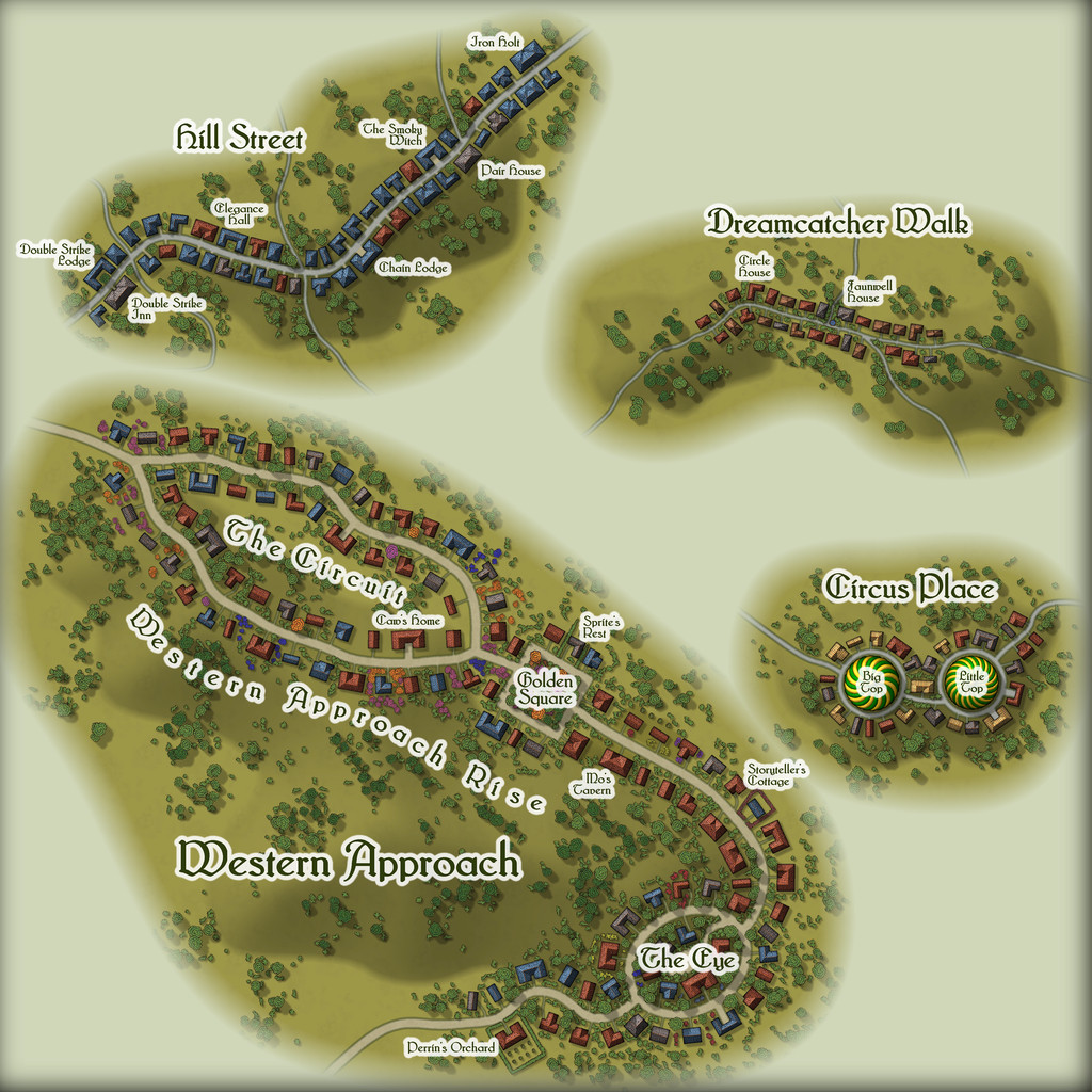
These have a different random design mechanic behind them to the individual-place maps, and it became a particular fascination for me to see what patterns came out of this system. Here, I had to fit hills to the streets so-created, but that wasn't particularly difficult. Some features along the routes could be added based on the various featured texts, while others simply came from the street names, or the shapes the system produced, if sometimes with a bit of adjustment, or inspiration that struck while drawing them. Circus Place though just happened to look like a huge pair of spectacles from the outset - and what greater spectacle than a circus? Well, two circuses! Not saying it definitely did, but that might have influenced the final appearance of The Eye in Western Approach as well! Plus how apt was it that Western Approach can be approached only from the west? Sometimes, you start to wonder if randomness is truly "random" after all...

-
Community Atlas: Embra - Hilly Places
Next is another Edinburgh-influenced location, this time based on the huge, semi-wild, volcanic-rock hill of Arthur's Seat. In Embra, this becomes the large hill named Mab's Couch:
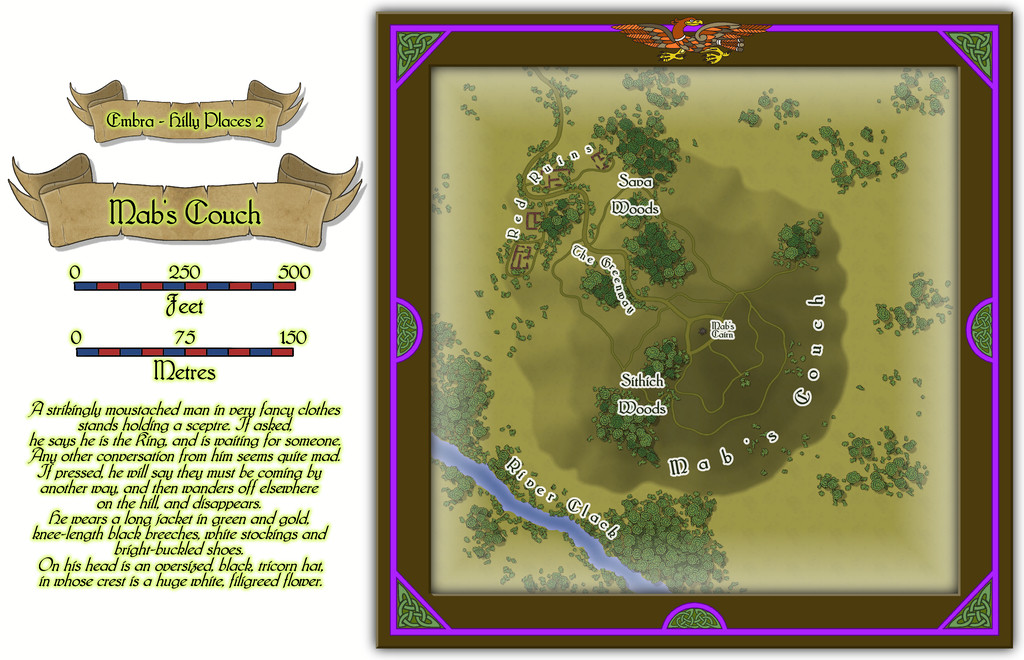
As Arthur's Seat has a number of walking trails across it, it seemed reasonable Mab's Couch should have some as well, and the focal point of a stone cairn at the top. The red sandstone ruins that might never really have been buildings are a purely-Embra aspect though, as is the oddly-dressed madman (?) of the featured text. When thinking of suitable place-names, I felt it might be apt to add something with a perhaps more tangible frisson for potential RPG character visitors, hence Sithich Woods, as, from the accompanying PDF and text notes for this map:
A Sithich is a mischievous upland sprite that uses deadly weapons made of flint-like stone. Such flinty stones can be found lying scattered in places throughout these woods, although only the more unfortunate might encounter an actual Sithich as well.

