


Wyvern
Wyvern
About
- Username
- Wyvern
- Joined
- Visits
- 3,266
- Last Active
- Roles
- Member
- Points
- 5,585
- Rank
- Cartographer
- Badges
- 24
Latest Images


-
Community Atlas: Embra - Travelling Places
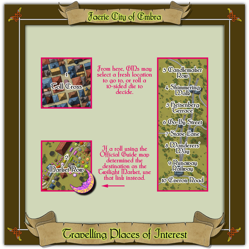
Which brings us to the last map in this group, covering the eight "ways":
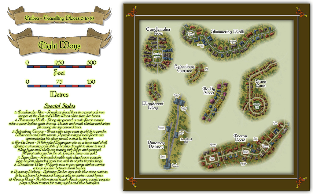
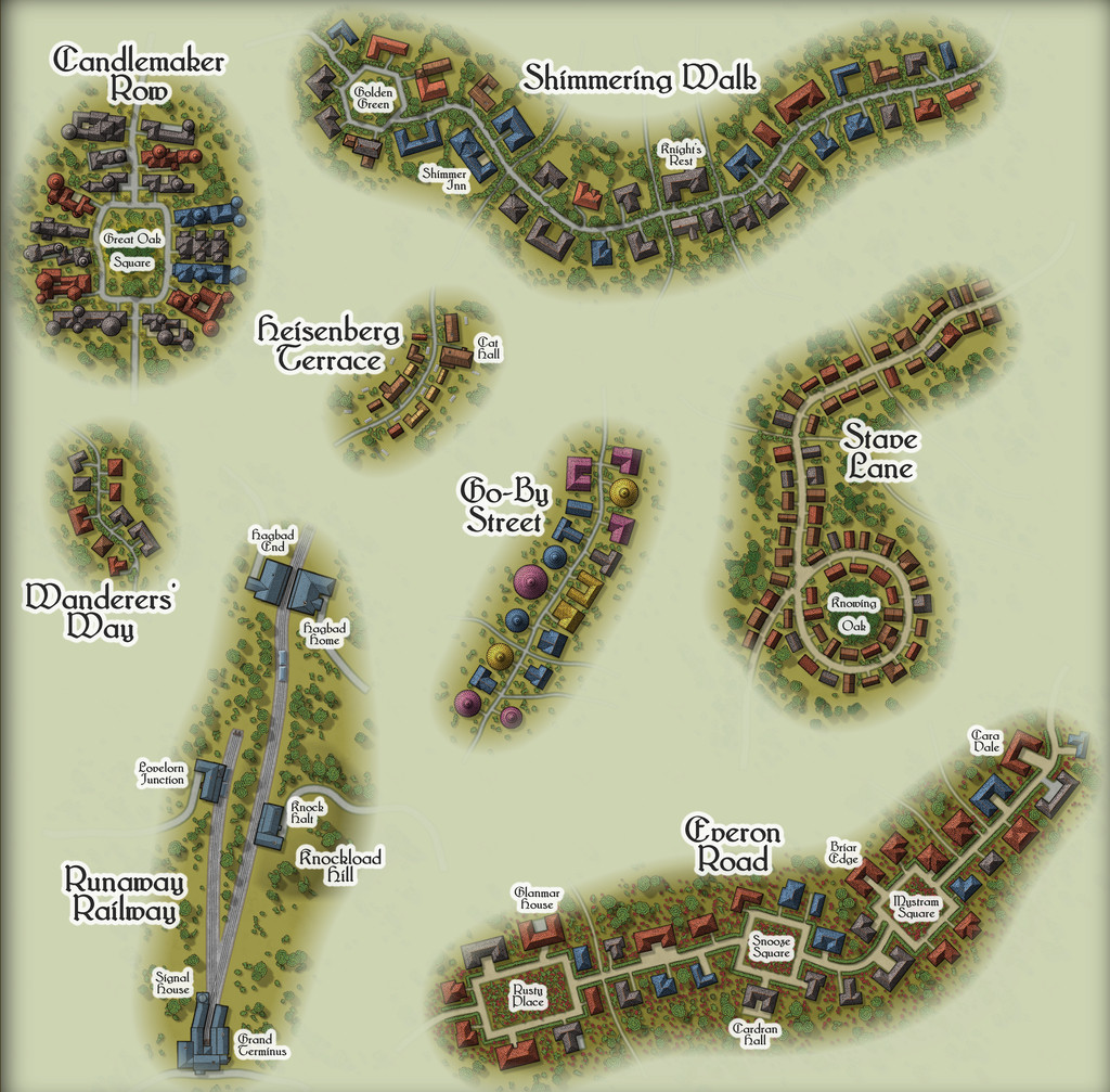
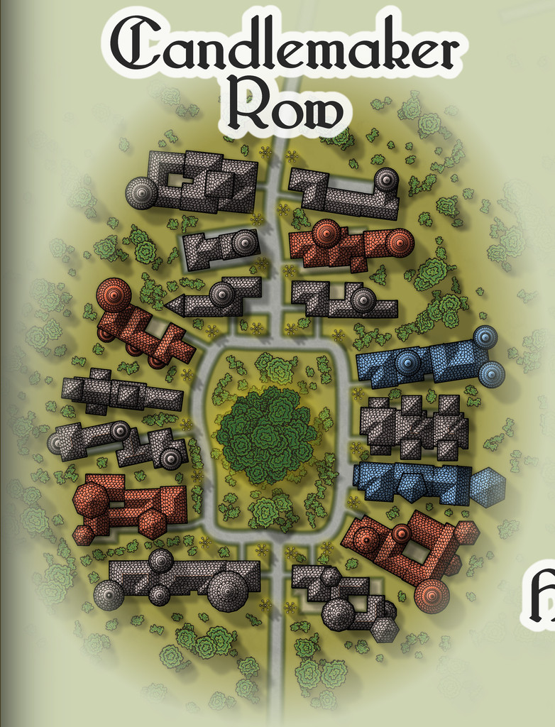
While the seven streets were constructed randomly from the simple system I'd devised and used previously, the railway needed some further adaptations, reducing the angles turns and junctions could have, and such like. In drawing the final maps, I kept the roads deliberately free from as much obstruction as possible (vegetation and the proximity of the properties along each), since the essence of Travelling Places relates to movement. In the accompanying notes, I've suggested GMs should allow speedier normal movement when using any of these routes, as long as the party sticks to the way itself. And naturally, there are oddities. Such as the large, complex building shapes along Candlemaker Row, where sadly, I fear the giant standing candelabra that light this route at night will be barely visible, and likely unidentifiable, at the Forum's resolution on the above maps. So let's try this view instead:
That weird loop in Stave Lane came from the construction process alone, which was a pleasantly amusing surprise when I plotted-out what the dice had rolled for the first time, especially as it made Stave Lane - a name yielding expectations of being straight and direct - one of the most convoluted of Embra's mapped streets!
Heisenberg Terrace, naturally, isn't always there, while the bazaar in Cat Hall is run by a humanoid feline, Shrew Dinger... Go-By Street is easily missed too, without care (aside from being a test for people's knowledge of fantasy literature; a good spot to place The Genuine Magic Shop, perhaps - despite its different author). The literary origins of Everon Road's name might be an easier test though.
As for Runaway Railway, aside from the real-world city of Edinburgh (very loosely the inspiration for some of Embra's place-names, as well as its actual name) being a major railway centre in Scotland, it also has the surviving remnants of a far earlier horse-drawn passenger rail-line, the "Innocent Railway", so I felt I had to include a railway of some sort in Embra. It's obviously short and simple, though as with everything else in Embra, its size can be as deceptive as GMs require. Rather than get bogged-down in detailing the line's operation, I chose to have the rolling stock run by the magical forces of electrickery (see Wyvern Citadel on this, if necessary). Conveniently, the featured text - and remember, these things were chosen randomly! - involved lightning flashes, which made that decision very easy.


![[Deleted User]](https://secure.gravatar.com/avatar/c75d9a245b74d9c59be0999ea81ca541/?default=https%3A%2F%2Fvanillicon.com%2F92add7f8c954488718110edc4896ad39_200.png&rating=g&size=200)

-
Community Atlas: Embra - Travelling Places
Moving on swiftly from the dubious delights of Toll Cross brings us to the cheerier Travelling Places segment of the Twilight Market, Market Row:
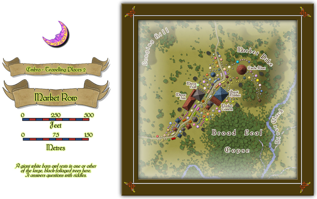
A colourful scatter of tents, wagons and stalls spills along and beyond the road here, and there's even a group of buildings, since for once, there is a more fixed settlement alongside the Market (or perhaps it grew up because the Market was here). Though the footprint of several buildings is large, particularly when contrasted against the much smaller market stalls, I opted to make them all merely single-storey structures, so the Market didn't get lost among the houses. Only the buildings have been provided with internal floorplans, which also helps clarify which they are, of course:
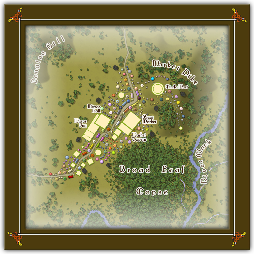
The individual darker trees are to match with the featured text notes, and I think something of the strangeness of Toll Cross lingered with me, as I decided not to name the open land between the two "Mirror" properties and the foot of Longing Hill, which the Market also seems to avoid, and simply kept it as an empty place the locals become evasive about if anyone asks. Quite why I've left for GMs to determine, however...
-
Community Atlas: Embra - Travelling Places
Travelling Place 1 is Toll Cross, which as we see, is an unusually heavily built-up area, surrounded by dense greenery, beyond which is open grassland or moor:
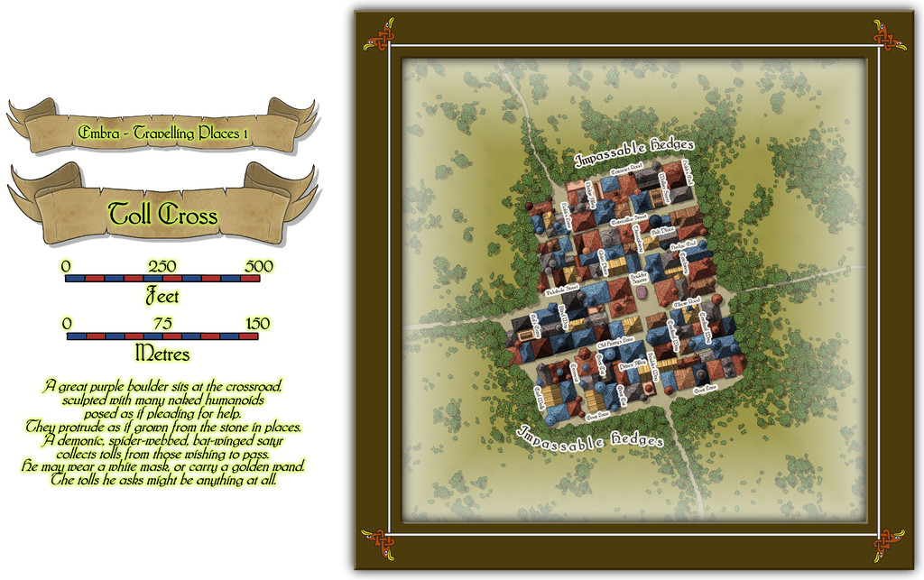
While the base-map was a similarly heavily-urbanised area, the nature of Toll Cross (and indeed even its final name) derived chiefly from the accompanying featured text, and especially that demonic satyr figure. The Impassable Hedges mean anyone wanting to visit the shops or houses here, or even just pass through it directly as a crossroads, is channelled into using one of the four access-routes. Then I adjusted the layout of the buildings slightly in places so those on foot can get to only a fraction of the properties inside unless they pass through the central Boulder Square, where Guess Who waits, like a spider in a web... This view is with the labels turned off to get a better impression of the settlement:
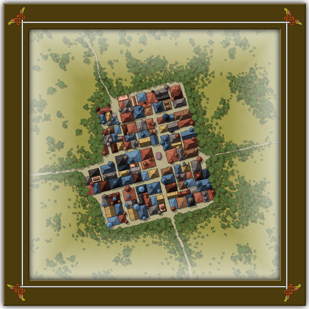
This looks a bit odd (or at least, it's meant to), with some strange rooflines, and what seem to be many towers. An extract from the accompanying text and PDF file may help explain:
There are...many tall spires and tower-like structures of different sizes and forms, some of which are visible above the trees from outside the settlement. These features are all entirely solid, and appear to have simply grown from the roofs and upper walls of the buildings. Few are straight, and many could pass for horns. Quite a number of roofs overhang their properties as well, and can give the impression of being ill-fitting, or as if they were worn as wigs that have slipped slightly. The whole can be quite unsettling for those not used to Faerie, and even those visitors with Faerie blood may feel there is something a little off-kilter about Toll Cross.
Despite the range of building shapes and sizes, they all have just a single accessible storey at ground level inside, as the toggled view to show the building interiors indicates:
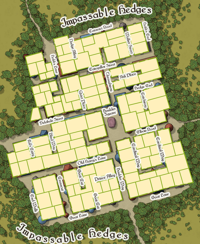
This also shows just how much some of the rooflines, and particularly those horn-towers, don't marry-up with the building outlines, yet the buildings, thanks to their lack of internal connections, further help block any attempts to avoid using Boulder Square. And if you try to fly in, it turns out those roofs aren't so immobile as they may appear...

-
Community Atlas: Embra - Travelling Places
Fourth in the sequence of Embra's "Places" are the Travelling Places of Interest, as usual, accessed from the relevant part of the inner circle on the "Official Guide" map:
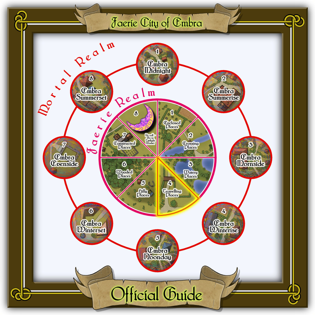
This takes us to the link-map, though this time there are just three link-spots on the diagram, two individual locations, and a group of eight "ways", rather than streets, as here, one of the "roads" is actually a railway (which features as the backdrop extract for all eight, primarily because it was a handy size and shape, and in the correct orientation without needing any adjustments):
The map border decoration was kept quite simple, as it seemed best to highlight the "Travelling" concept with something quite clean and direct. I toyed with drawing something quite severe of my own devising for the knotwork, though all that survived of that here was the simple, single line linking the corners (yes, I know, not much to show for it!). The basis for the little knotwork eagle heads - again seeming apt for "Travelling" - came from that famous Dover Clip-Art "Celtic Borders on Layout Grids" book once more, which were handily linked by a single line there too.

-
Community Atlas: Embra - Watery Places
Last among the Watery Places maps is one condensing the final five streets into one drawing, the second illustration below showing just the streets for a bit better clarity at the normal Forum resolution:
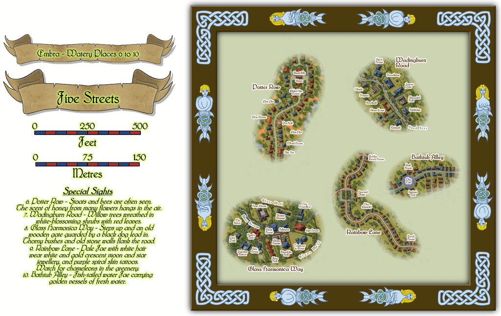
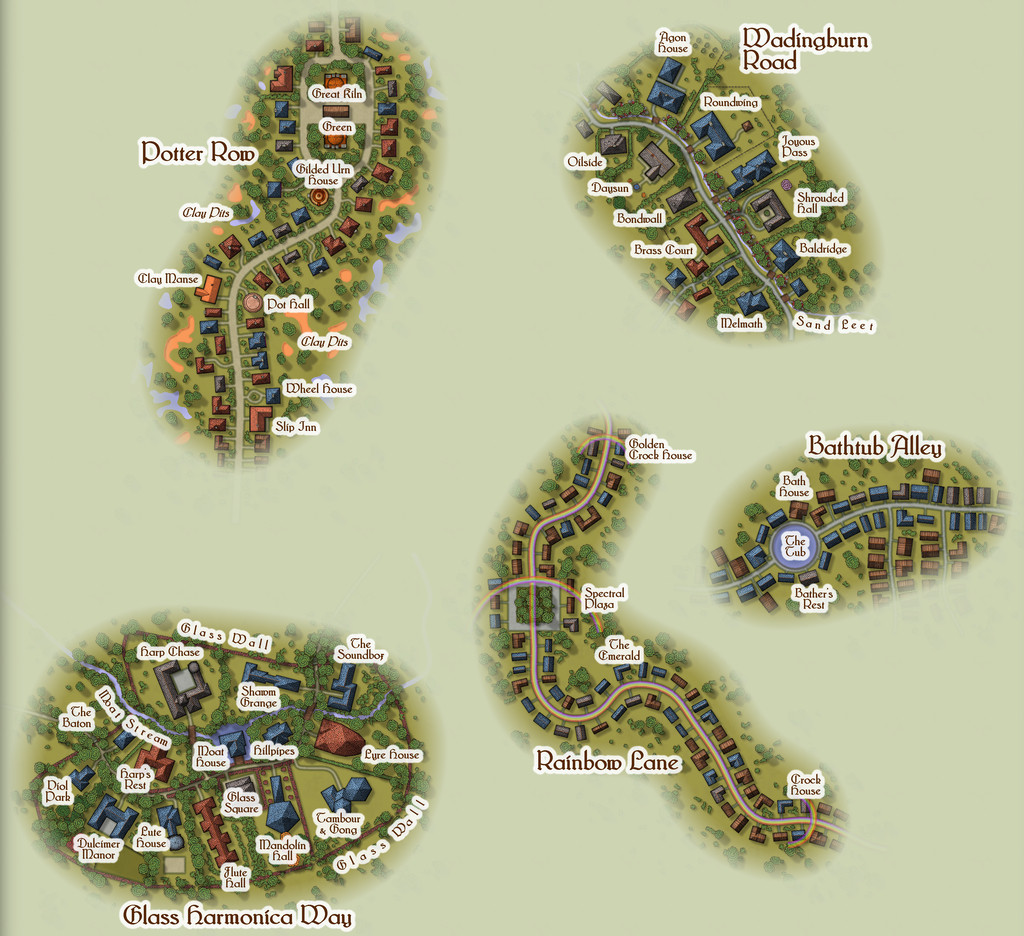
The roadways were constructed randomly, as described in the Enclosed Places Forum notes, with the final appearances and features determined sometimes by the street names, sometimes by other factors. Potter Row is of course where the great ceramic craftsfolk live and work, several in houses built of pottery - a couple even in the form of gigantic pots (this is Faerie, after all). The featured text for Wadingburn Road suggested a willow-lined stream, and fancier properties. Rainbow Lane had to have rainbows along it - even to the roadway itself - while Bathtub Alley cried out for a large pond or pool to be added for those water faeries to be in. And then we have Glass Harmonica Way...
I mentioned in the introductory Embra topic that music had been one of my primary influences on how a Faerie city should be presented, and maybe one of the most "faerie" real-world instruments should be the glass harmonica, as well as being one that requires extraordinary skill and ability to play. So having come up with the street name near the start of developing Embra, it was always clear this was going to be a community of musicians, instrument makers, composers, and the like. The random nature of my street design mechanism meant the available area was smaller than I might have preferred initially, though the whole point of using random systems is to work with whatever that may throw at you, and adapt accordingly. The featured text provided an interesting adjunct, suggesting this wasn't going to be an ordinary street at all, but one closer to a gated community in the real-world, and from that everything else simply flowed (appropriately for a Watery Place, perhaps!). The one downside to the final map is that because I wanted everything clearly labelled, the small area meant the labels ended up concealing quite a lot of the area's character. However, the toggle option in the FCW Atlas file to turn off the place-names means it is possible to get a better view of the whole:
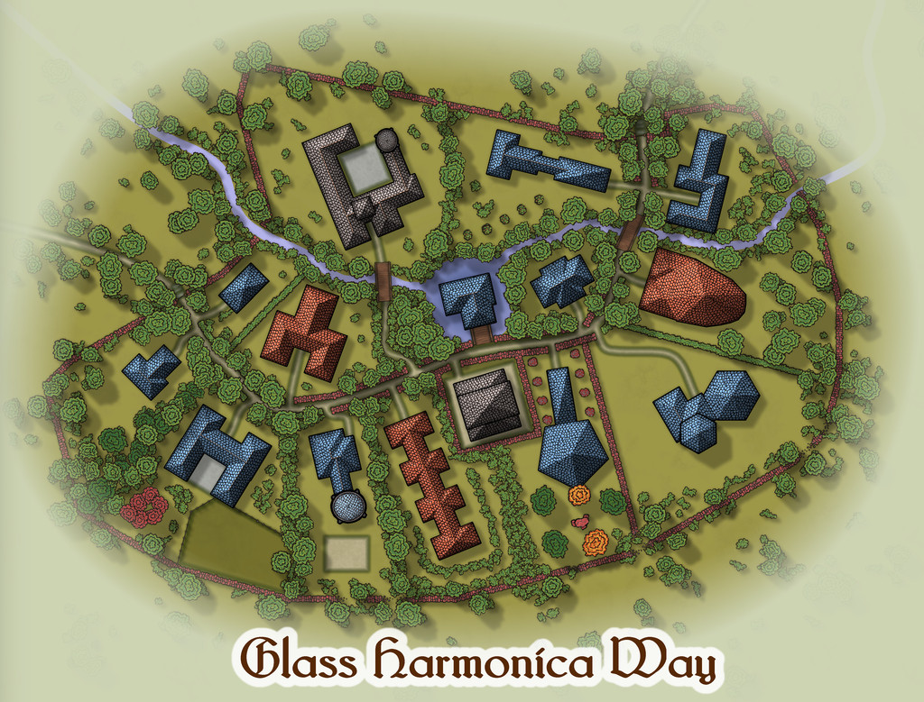
From which we can all again play "spot the red sandstone components" - and hopefully get a clearer impression of the final layout. And yes, the street was originally populated with random CD3 houses, which then got moved, adapted, redrawn and converted to their final shapes here.

