


Wyvern
Wyvern
About
- Username
- Wyvern
- Joined
- Visits
- 3,266
- Last Active
- Roles
- Member
- Points
- 5,584
- Rank
- Cartographer
- Badges
- 24
Latest Images


-
[WIP] Community Atlas: Snakeden Swamp, Lizard Isle, Alarius - Dedicated to JimP
Following the recent death of our long-standing regular Forum contributor, and most active Community Atlas mapper, Jim Pierce (JimP), I felt it would be appropriate to bring forward this small group of maps from my sort-of Dungeon24 project for the Atlas (now of course Dungeon25), and dedicate them to Jim's memory. They were already being planned while I was preparing those recently completed for the Demosthenes Swamp region in Artemisia, as while drawing the Seer's Hall Village map, I decided to use as its base the design from the Inkwell Ideas Dungeonmorph Dice "Cities" dice-face 6R, even though the "Ruins" dice-face 6R* version of that design was already intended for Lizard Isle, off southern Alarius. Working on the intact version set me wondering about the ruined one too, and ideas started to coalesce for that as well. Ordinarily, the 6R* map would have followed only much later in this project otherwise.
When I looked at the Lizard Isle map in the Atlas, I discovered it had been mapped by Remy Monsen for the second anniversary of the Atlas using the original CC2 mapping style, and the variant CC2 fantasy overland style from Symbol Set 1. That decided me to also construct this small set using similar "early CC" mapping styles, as something I'd not attempted before. The reason this linked with JimP in my mind was because such early styles reflect Jim's longevity as a CC mapper - longer than those still active as mappers with the program can now recall - and his longevity with role-playing games going back to the very earliest days, which latter was similar to my own. In addition, Jim was often keen to go with "no frills" mapping styles to sketch his ideas quickly, which again is reflected in the relative simplicity of such early drawing modes.
Further to that, although I'd already derived lists of items I wanted to include on the maps and in their descriptions, and decided where things were to go at least loosely, I'd not begun any CC mapping, so this topic is going to be something of a work-in-progress effort, something else Jim was noted for on the Forum, albeit I cannot match either his speed in mapping, nor his regularity of posts here. So as with this being a sort-of Dungeon25 project, this is a sort-of WIP topic!
This is where Lizard Isle is:
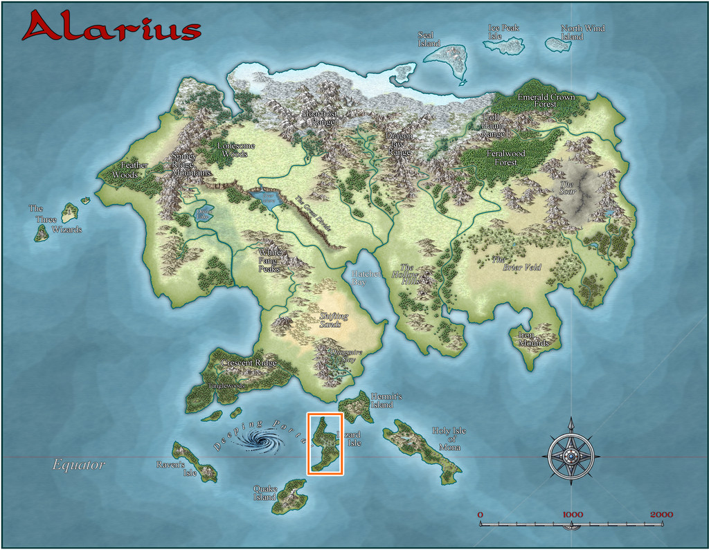
And this is how it was mapped, along with the location I chose for these maps, the small orange square in the north-central area of both versions. "Small" is relative at this mapping scale, however, as that square is really 20 miles per side. The fancier SS1 map is shown in the second image below:
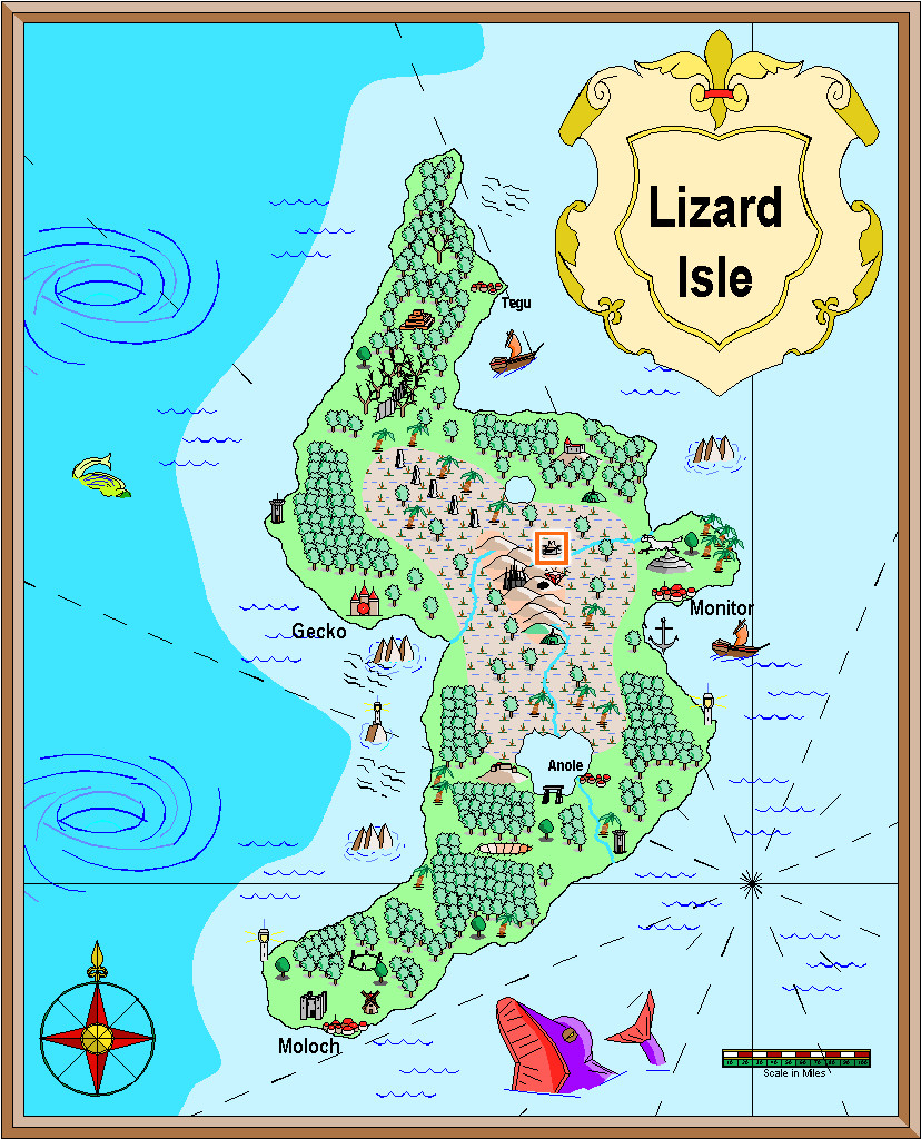
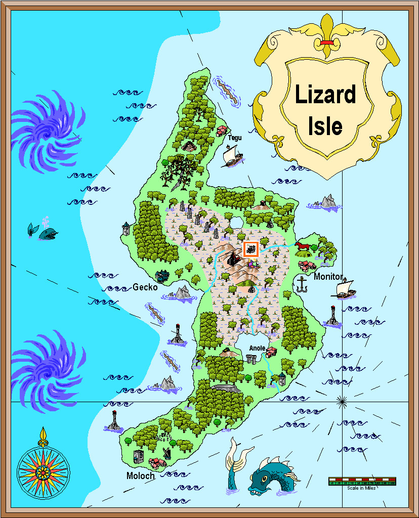
It may not be obvious at this resolution, but my chosen feature is a ruin symbol, as might be expected, given the base map I'm working with is also a ruin. The first shows a large ruin (there's also a small ruin in the style), while the SS1 map has a ruined town symbol (and there are ruins available in the style from city down to hamlet, castle, keep and tower in size), so that helped establish better what would be appropriate here.


-
Community Atlas: Aenos Isle North, Demosthenes Swamp, Artemisia
The final stage of this group was the lower level partly beneath the Great Temple, which both sections of the upper underground complex link into, Thalagos Cavern:
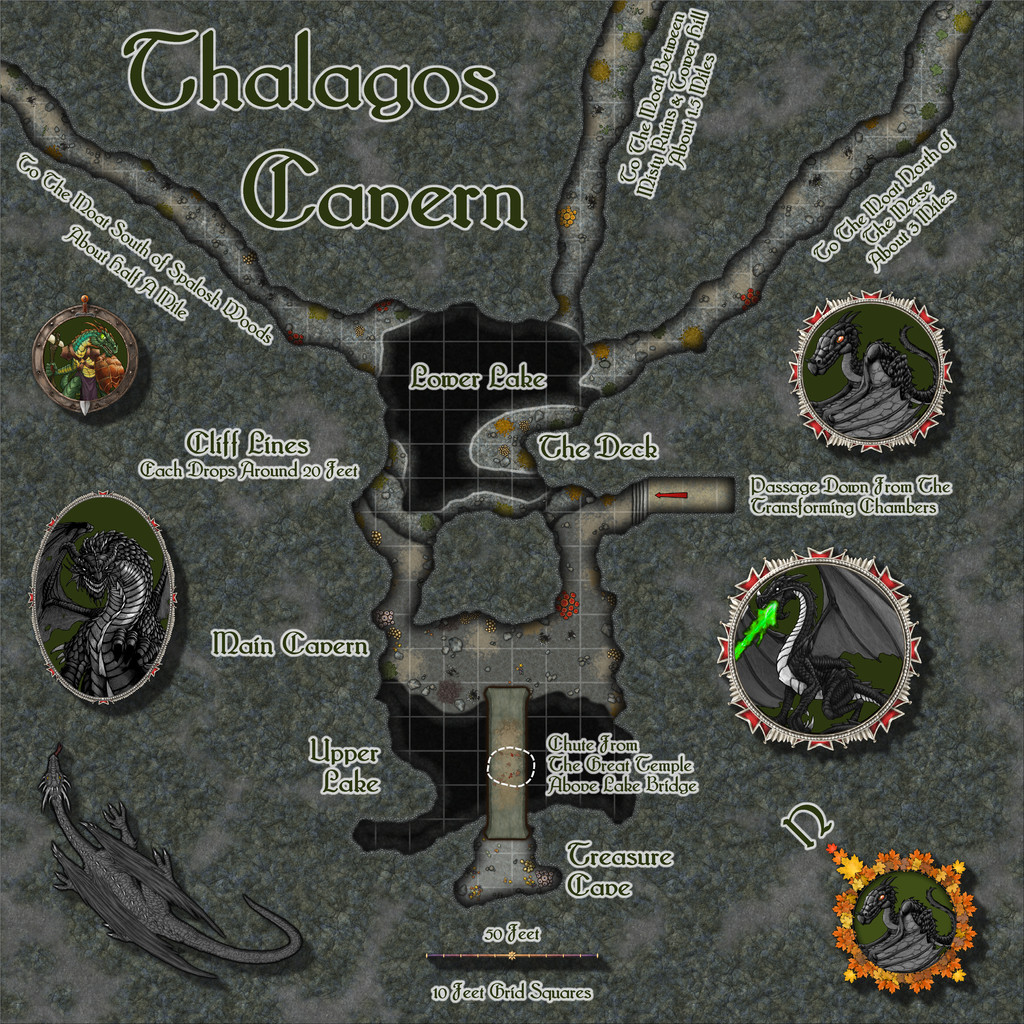
The base layout was from the Inkwell dice, as noted in my first posting above, with a few minor tweaks, notably extending those three straggling exit passages, which lead off-map for some considerable distance to the inner edge of the swampy Moat surrounding the higher area on which Threshorsh is set. The passages are all mentioned as being flooded in their latter stages in the accompanying notes for the Atlas version, and all emerge under the swamp, so there is no easy means to access the Cavern from outside that way.
Since the Inkwell dice designs are set on a geomorphic grid, that does make it quite easy to connect with other such layouts above and to the side like this. Indeed, I simply copied and pasted over the chute from the Great Temple and the floor from the Cavern Access passageway in the Threshorsh map to this one (both of course are drawn to the same standard Dungeon "in-feet" scale), to make sure everything linked properly.
Creepy Crypts was the base style used for the map, giving some interesting additional rocky textures, and while the walling system takes a little getting used to, it had the advantage in this map of allowing me to very easily add those steep-drop Cliff Lines simply by copying the sheet effects to a couple of new "Walls-but-not-really-walls" sheets (I didn't call them that!). Then by tweaking the water effects a little, it became possible to show the shallower sloping shores around Lower Lake too - the pale lines - leaving the shadowy darkness of the cliff-drops to show where those were - including all round Upper Lake.
Fun times were had adding all kinds of patches of mould, assorted splats and stains, and a few small treasure piles, to parts of the floors, along with some significant clumps of fungi. Some of the moulds and fungi are bioluminous too, which were among the randomly-obtained features to add to this map. And yes, sacrifices do occasionally find their way down from the Great Temple to the bridge top above Upper Lake (though not perhaps as often as you might think). The trickiest element was the scaling grid, largely because this never seems to work well in narrower, variable-width cave passages. I did try it as more strongly visible at one stage, and considered a toggle to let it be turned off (as it just looked too strident). Ultimately though, I felt this subtler version worked OK, and should anyone need to brighten the grid, the FCW will always be available in the Atlas.
There was a lot of space around the layout too, so I added some of the DD3 "holey" textures to change it up a trifle, and added a few more, and larger, TT1 options than I'd anticipated at the start - even a varicolor DD3 dragon, if maybe one a bit too robust and "wing-y" for the Swamp Dragons as I'd been thinking of them. I did consider reducing the length of the exit passageways, but I wanted to keep the labels for them on the map, so left things alone finally. Plus I did rather like the vaguely spiky-tentacular look this gave to the whole. Though that's probably just me!
Ordinarily at this point, I'd mention where I'm off to for the next "Adventurer" dice set of designs. However, we're having a short excursus from that, as I've brought forward the mapping for the "Ruins" 6R* dice-face design (which you may recall I mentioned when using the unruined version of this, from the "Cities" dice-face 6R, for the Seer's Hall Village map previously). That will be going onto Lizard Isle, a large island offshore of southern Alarius.


-
Hey Everybody!
If you need electronic image versions to trace into a CC3+ map, North Carolina Maps may help, if you haven't bookmarked their site already, that is!
-
Anyone have the Llankmarh fcw?
After some protracted hunting online, the best I can find are some CC2 versions of just the geomorphs on this very old website. I can't seem to find this map in CC2, although it's almost certainly based on the old TSR module "Lankhmar City of Adventure", which came with non-CC2 versions of both this map (in more usable detail) and a separate booklet with just the geomorphs. I also stumbled upon a set of PNGs for the geomorphs (only - again...) on Box here. The first site just has GIFs as well as the CC2 options, but the PNGs may be more useful if you wanted to convert them to symbols.
Otherwise, yours may be the only surviving FCW version of the whole city map available online!
-
Project for a friends world.
The original has a fascinatingly "windblown", swirling vibe to it overall.
And as someone who often copy-traces by hand/mouse scanned hand-drawn maps into CC3+, the tenacity to make such things a reality is something I can readily appreciate!

