


Mythal82
Mythal82
About
- Username
- Mythal82
- Joined
- Visits
- 781
- Last Active
- Roles
- Member
- Points
- 366
- Rank
- Traveler
- Badges
- 3
Latest Images
Reactions
-
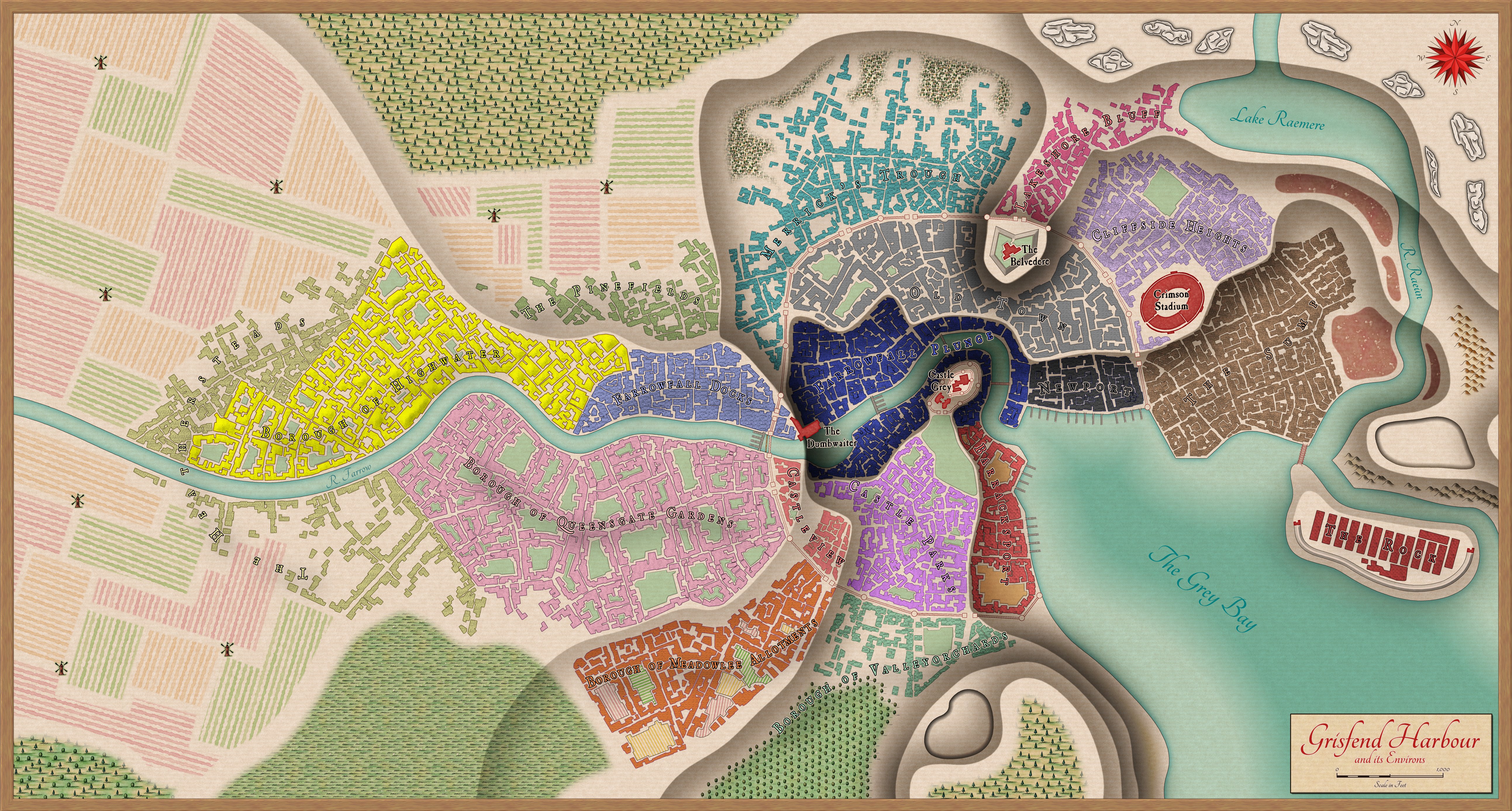
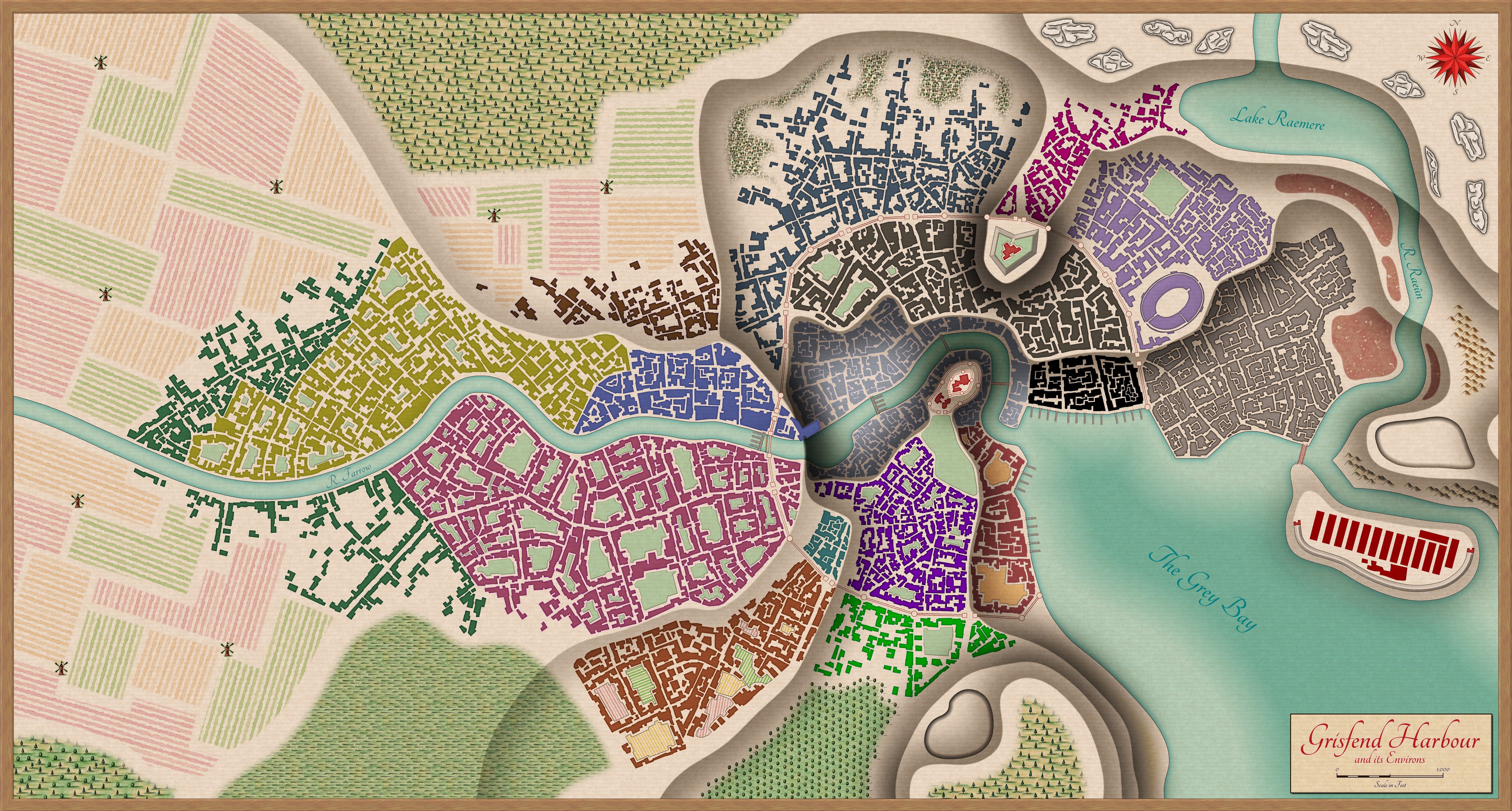
[WIP] Port City Map - Watabou to Ferraris Style
So, I thought I was done with this map, but I decided to experiment with something inspired by the amazing maps of Alyssa Faden. I created some new building tools and layers, and applied some slight texturing, to try and mimic the way she does roofs. This allowed me to recolourise the Districts a bit brighter, and to give them (I hope!) a bit more character. Lastly, I labelled it all up with the district and borough names, and highlighted some key buildings.


-
[WIP] Port City Map - Watabou to Ferraris Style
And here's the final product - thanks for the input!


 and 4 others.
 -
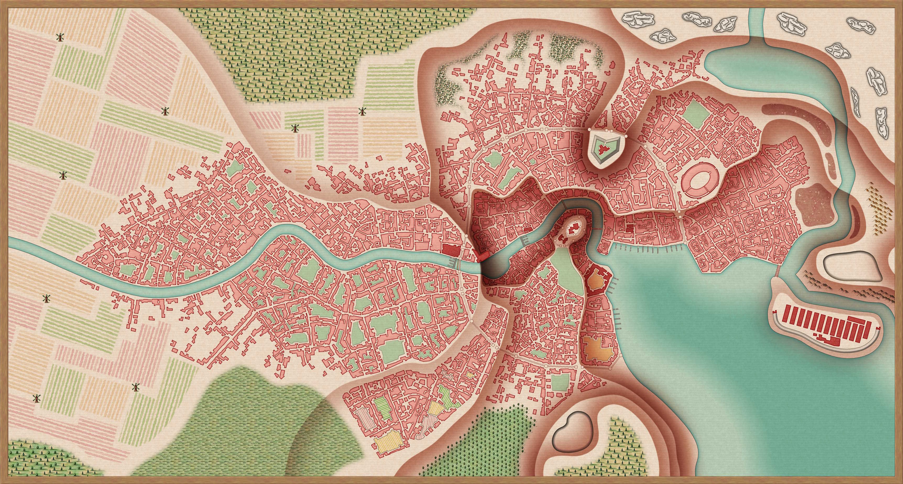
[WIP] Port City Map - Watabou to Ferraris Style
Here's the last WIP image - I've added every feature I planned to add, and all that's left (I think) is to colour code the buildings by district. Of course, if there's something I've missed, all suggestions gratefully received:


-
[WIP] Port City Map - Watabou to Ferraris Style
Almost finished with the urban blocks - only the basin to do - then it's on to additional features (city walls, interior fortifications).
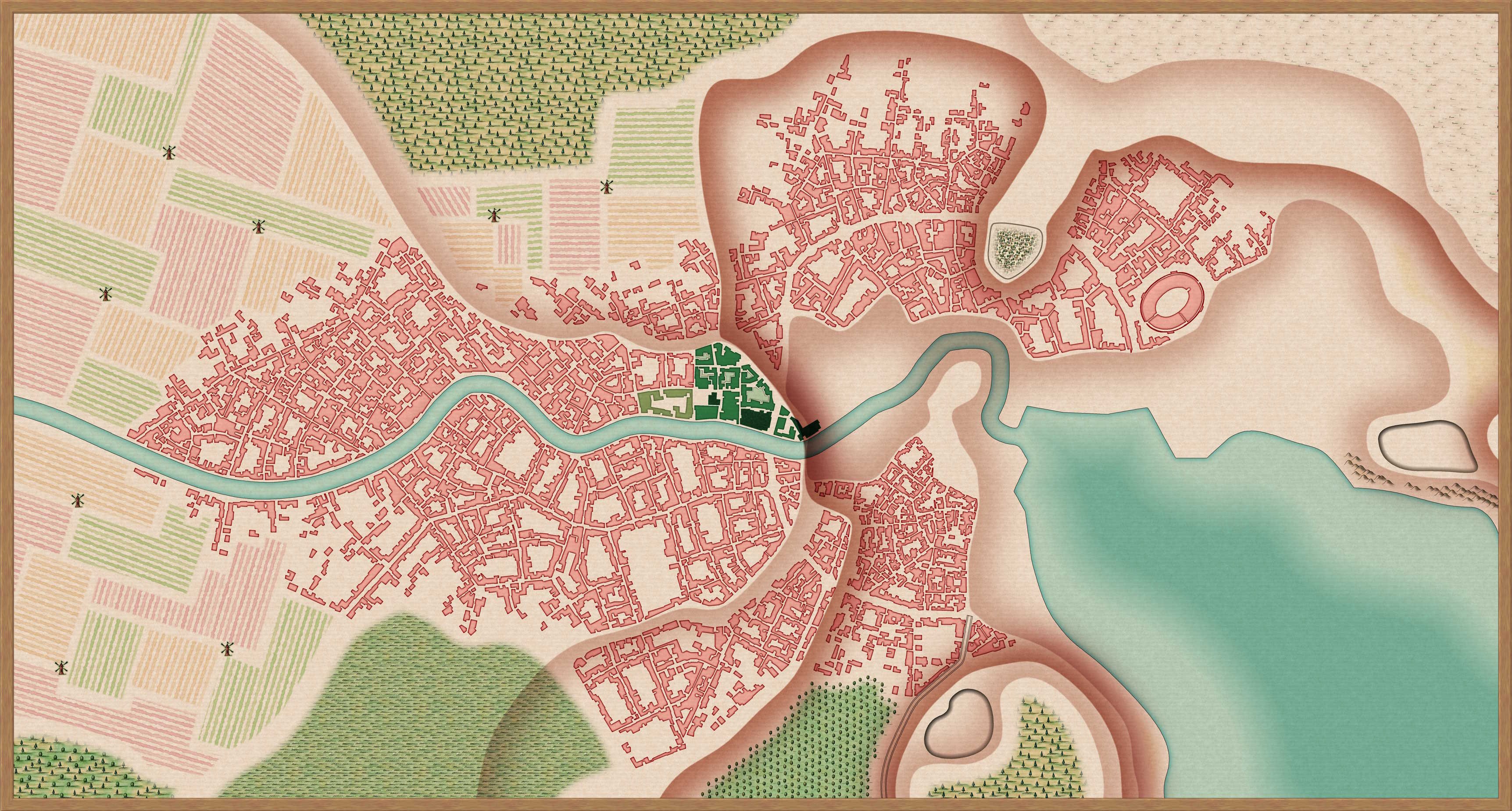
Definitely feel like it's starting to take shape...

and 1 other.
-
[WIP] Port City Map - Watabou to Ferraris Style
I’m tracing over the png - it takes a little time (the above was an evening’s work, off and on) but I didn’t really have another option since I wanted the layers of relief in the map (which means editing the block layouts to avoid houses going over cliffs, etc).
In terms of the methodology I’m following:
- Trace the water features
- Informed by the Watabou blocks (but not limited by them) decide on my contouring and insert the contours.
- Add farm land to the outskirts (I tried a little visual trick here where the highest elevation farms are all bigger than the handful of mid-elevation, just to emphasise the idea that the highest elevation is closer to the eye)
- Add other non-urban features. I made some edits to the terrain sheet edge fades, since for a map of this scale the defaults looked a bit too crisp for my liking.
- Duplicate the buildings layer, once for each district (I’m using my own districts, not the ones Watabou generated). Add a colorisation effect to each (different colour for each district) and edit the inner glow effects to match that district’s colour.
- Trace urban blocks, making adjustments for the contouring and what that means for cliff side roads, etc. Also Watabou sometimes places blocks over the edge of water, so trimming to avoid that.
- Once all urban blocks are traced, move blocks in bulk to the correct district sheet.
- Add final urban features - city walls, fortress, piers.
I’ll post updated WIPs in the thread, let you know how it goes ^_^

