


mike robel
mike robel
About
- Username
- mike robel
- Joined
- Visits
- 4,196
- Last Active
- Roles
- Member
- Points
- 435
- Rank
- Surveyor
- Badges
- 6
Latest Images


Reactions
-
WIP Commission, Ancient Tombs
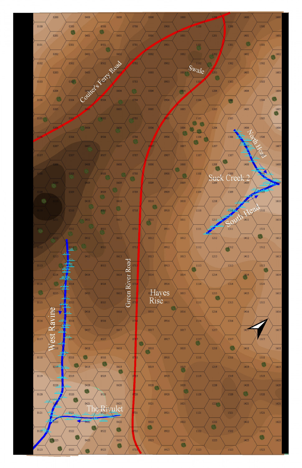
Sometimes, if you don't like the way something looks, you just have to start over. For example, my covering force game map. 3 times.
Painful, but sometimes necessary.
On the other hand, some paths through the desert would probably not hurt. Saudi Arabia had rocky deserts and there were Tels in places that we set up near that stood out in what was otherwise flat ground. But, as I remember, it was pretty flat until we got close to the Tigres/Euphraties.

-
Cowpens Battlefield
I added a few trees - the battlefield was pretty well cleared and branches were chopped off as high as men on horseback could get (and any fences in the area dismantled) to provide fire wood.


-
What kind of music do you listen while mapping?
If I listen to anything, it is classical.
![[Deleted User]](https://secure.gravatar.com/avatar/c75d9a245b74d9c59be0999ea81ca541/?default=https%3A%2F%2Fvanillicon.com%2F92add7f8c954488718110edc4896ad39_200.png&rating=g&size=200)

-
a large city, I have been putting off, now started
That's all really nice work Jim. As a lover of large maps, I really like it. I want to make topographic isomorphic maps, but my imagination just doesn't work in creating them. I also have thought about trying to make the large maps out of the individual map sheets, but I find the trapezoidal nature of grid "squares" and alignment of features to be a real bear, particularly when I have to 'cut' the map portion out of the full map sheet.
I keep lusting after a large format scanner, but I can't justify it and a laser cutter might be more effective for my work, but they cost too much for a hobby, too. Sigh.
-
Ok, weird question. Someone has asked me to buy one digital copy of one of my maps...
Well, you could call Kinkos and see how much they charge for the map.
I recently bought a custom map from mytopo.com of the Little Bighorn area that was about 4x5 feet with grid lines and elevation shadows for 29.95. Satellite photographs are more, around 100. A combination contour map was 79.95 and was nice to look at, but hard to read.
Incredibly to me, the. Company lets you download a full size PDF and save it so you can print it yourself. So does the national geologic service and their maps run 9-15 bucks.
For physical objects, there is an informal rule of thumb of three times the cost of materials
One has to think of the amount of time you put into it.
My daughter charges people by the square inch for paintings. 0.50 for her friends and 1.00 for others. Larger paintings can be more.
You can go to the wargame vault. They printout digital maps and you can see what they charge.
I find it difficult to price my games because volume is low and I am not well known.
Hope this helps.
-
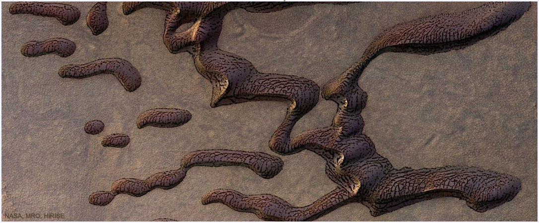
Martian sand dunes
-
WIP: BD-like - a process output extravaganza
@Lillhans Geeze. You are a genius. I have trouble enough just trying to duplicate topographical maps for wargames. It's a good thing contour lines are not straight or gentle curves, cause I can't draw straight lines without a ruler or graceful curves with a French curve, even assuming I don't slip. Exceptional and very artistic work.
I also wish I could punch Like, Awesome (a word which is overused today), and Insightful all in the same post.

-
Fractal Terrain Mapping colour to altitude
That subcontinent reminds me somewhat of the aliens in the movie Independence Day.


-
Topographical map of the Ice bed of Antarctica
While there may be some way to get topographical data from those maps, I don't know where one would start or have any idea about how to do it..
That said, you apparently go to OpenMap.com/DE and get a bootable map that allows access to data. I'm away from my computer right now and will have to check the link and update it if I'm wrong.

-
Topographical map of the Ice bed of Antarctica
Choppinlt: Apparently, you can download data from that site. I have no idea how. If so, perhaps it can be manipulated via Fractal Terrain 3, which went beyond my desire to master. I found it very frustrating, even when following the tutorials.
This thread https://forum.profantasy.com/discussion/9720/ft3-to-cc3-mapping-issues#latest has some details. In the end, I gave up on FT3 - it wasn't an expensive gamble for me - and decided to just use Brute Force and Ignorance to work my way through using CC3. BFI has its own reward.

