


mike robel
mike robel
About
- Username
- mike robel
- Joined
- Visits
- 4,196
- Last Active
- Roles
- Member
- Points
- 435
- Rank
- Surveyor
- Badges
- 6
Latest Images


Reactions
-
Live Mapping: Modern Atlas
You should be married to his Sister, Torill, as I am. 😜


-
What games do you use ProFantasy to create maps for?
I used to create the maps for the following games:
The below map is finished, but not the game. Design in progress since 2014.
The below is played with the Legion Games Battle of the Little Bighorn game, but I made a custom map for it to explore a tactic in which Custer might have tried to disperse the Pony Herd (ala Captain Biddles' (John Wayne in "She Wore a Yellow Ribbon" instead of trying to attack the Indians directly. (P.S. My wife wears a yellow ribbon for me sometimes and I give her yellow roses on our anniversery, because I am an armored cavalryman.)
This map is going to be used for a Hammer's Slammers Game (based on the the work of David Drake (and with his permission) if I can get the mercenary flavor done right. A portion of the same map will be used for another episode of Alien Invasion pitting the 116th Armored Cavalry Regiment against a Martian Invasion, partly inspired by a twilight zone episode.


-
Little Bighorn Battlefield Map
When (IF) it ever gets published as part of a game, there will be a terrain effects chart depicting elevation, water courses, road, vegetation types, terrain types (ford, bog, etc) and their effects on movement, combat, and spotting (if any).
-
Project Spectrum - Part 2
So, when I look at your mesa just above, I can turn it into a mesa or canyon by switching my focus slightly.
MAKE IT STOP!!!!

![[Deleted User]](https://secure.gravatar.com/avatar/c75d9a245b74d9c59be0999ea81ca541/?default=https%3A%2F%2Fvanillicon.com%2F92add7f8c954488718110edc4896ad39_200.png&rating=g&size=200)

-
Little Bighorn Battlefield Map
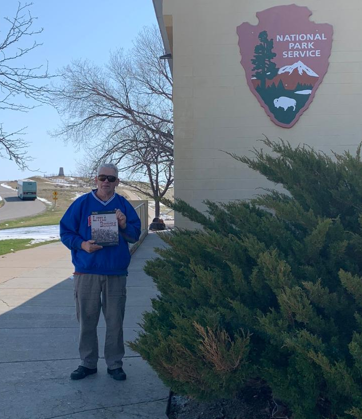
For various reasons, I flew to Seattle and was able to visit the Little Bighorn as I drove back. Weather and some other issues conspired against me so I only had two hours on the battlefield. Here is a photo of me at the visitor center with the Little Bighorn Game I like best.
This view is from Calhoun Hill to Last Stand Hill in the distance. It's kind of hard to see, but it is sort of in the center of the picture and there is a small group of trees to its left where the current cemetery is.
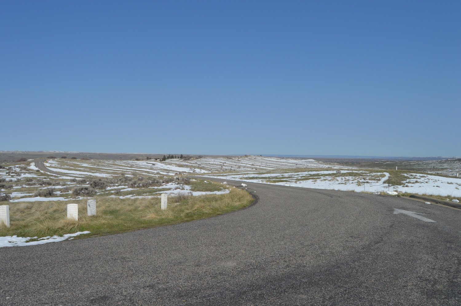
The units were unable to support each other and so were all destroyed individually by the Sioux and Cheyenne.
This is the area where I took the photo. Calhoun Hill is South and I was standing on the highest point on the hill top.
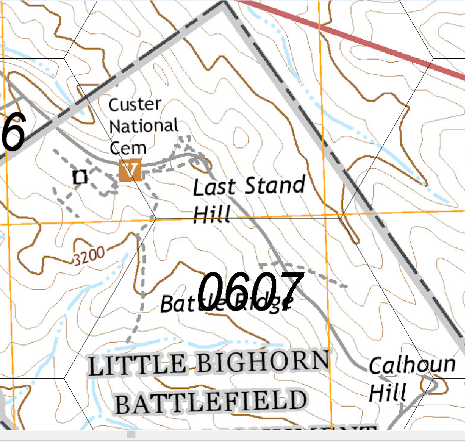
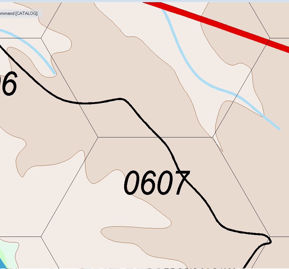
This is the map I drew in CC3 of the same area. Due to the contour interval I selected for the map (100m vice 20m), Calhoun Hill, the small hill where the 7 is, and Last Stand Hill are all obliberated. Drawing all the 20m mines would probably overtask the software given the size of the original map to say nothing of the number of nodes required.
I don't think I'll be going back. It's a long dang drive from Merritt Island to Billings, the most civilized city near the battlefield and back. Covid forced me to cancel my 5 - 7 day trip I had planned before. Sigh.

-
Ancient maps
An intersting article detailing 6 maps from antiquity. Some are quite simple (world map from Greece) but another is 22 feet long and details the Roman Empire's road network; not to scale but with mileage between points and landmarks.
https://www.discovermagazine.com/planet-earth/6-of-the-worlds-oldest-maps

-
Yet Another Wargame Map set in ...
Yes, I would be using the game Assault to play. I used it when I was in the Army to train my officers and think about tactics.
https://www.boardgamegeek.com/boardgame/8284/assault-tactical-combat-europe-1985
![IMG_0748[1].JPG](https://forum.profantasy.com/uploads/867/SSE0G750NX6V.jpg)
![IMG_0749[1].JPG](https://forum.profantasy.com/uploads/844/GM81WHNDAWEL.jpg)
-
Little Bighorn Battlefield Map
I printed and assembled the maps and you can see them below with some counters on them for effect. The game is a long way from being published. There are 2 or 3 more things in the queue before I get to this one. The table is 5 feet square. The boards are the anti-cat and wife protection for another game underneath.
The third photo shows a close up of the high contours with the transparent vegetation. I think it might be okay like that when printed out.
The fourth and fifth are just other views of the battlefield.
-
Yet Another Wargame Map set in ...
and with the Brown Contour lines drawn around the polygons

-
Yet Another Wargame Map set in ...
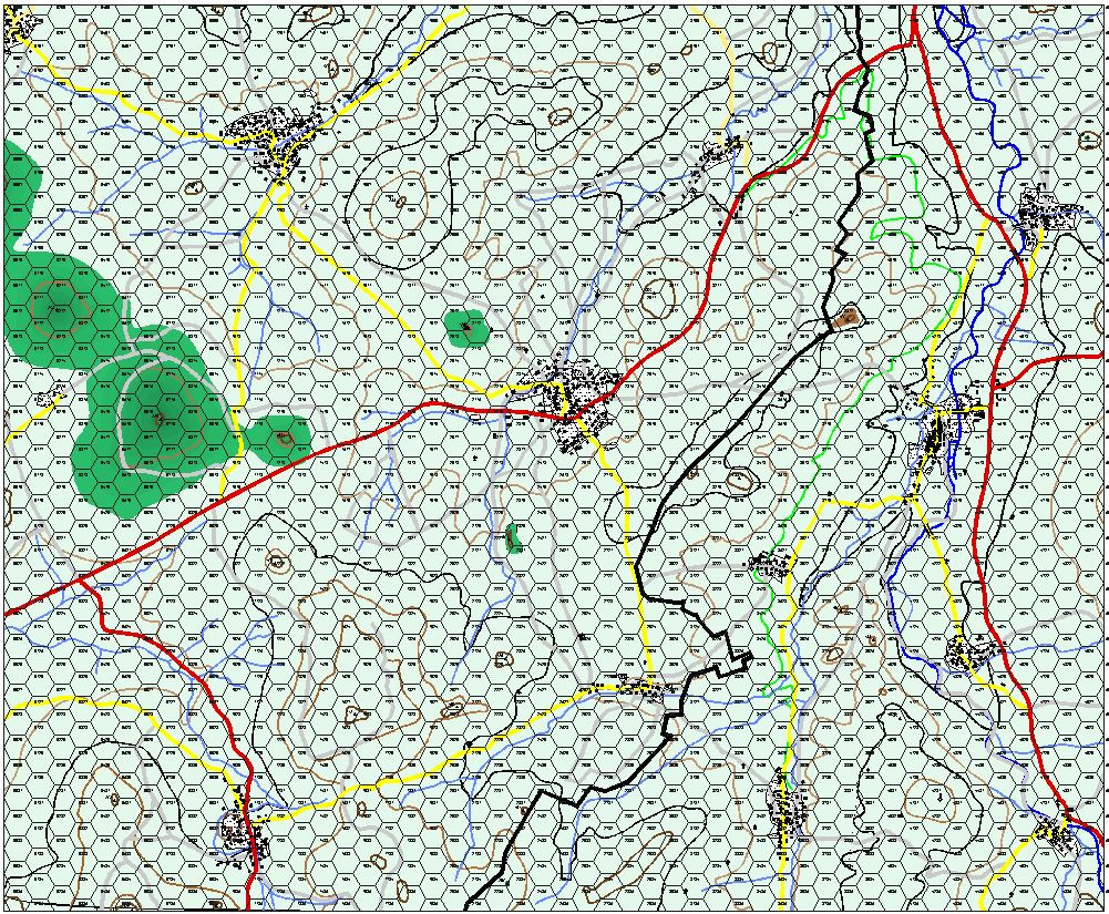
Well. I decided to fill in the contour lines using the special palette Monsen made me with 48 shades of green and changed the contour interval from 50 meters to 20 meters. The 50 meter contours are still in there. Because I have trouble following contour lines, I decided to work backwards from highest to lowest. I thought I was saving regularly and saved the thing this morning a little while ago because its the 29th, not the 28th, but I obviously failed to "early and often" because the thing crashed and so I lost about an hour of work.
At any rate, here is an overall view of how things are. It will look much better.
The black lines are the 400 meter contour interval. When those are all changed, they contours will start to meander more and spread across the map. When I am done with this I will have to decisions to make. Switch to the 48 brown palette Monsen made for me and/or skip a color between contour lines (instead of 196-197-198 go to 196 - 198 - 200) to make the elevation change easier to see for my poor eyes.
Sue will be annoyed because darker is higher. :)
, but I will be able to focus better on where they go.

