


mike robel
mike robel
About
- Username
- mike robel
- Joined
- Visits
- 4,196
- Last Active
- Roles
- Member
- Points
- 435
- Rank
- Surveyor
- Badges
- 6
Latest Images


Reactions
-
New Map
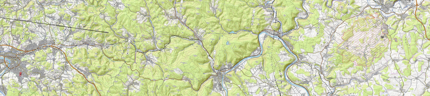
I changed the map so now it will be 12 x 54 inches long and each hex will be about 1 km (at the moment). I also trimmed it and rotated it so N is to the upper right. This improved the resolution so I can see the watercourses better as well as the contours to guide me. Still need to break it up into terrain compartments and decide how to proceed. Aschaffenberg at lower left, Hammelburg at upper right. The actual training area is the slanted red lines. In WWII it was the German Anti-Tank School. The TF had the misfortune to assemble on a tank range so the Germans had very precise ranges from known firing points. When I was there it was the I think it was the Infantry School (84-87).

-
New Map
After thinking about this more, I have determined a possible solution.
I am making a map with the Overland Hex style and fitting the hexes to the contours as best as I can (about 100 m contour intervals on the real map, I can make them anything I want when I finish). You can see a beginning here. I cringe every time I place the hex on the map. Each hex is 250 meters while the game hexes will be 1000 meters (about 1 inch).
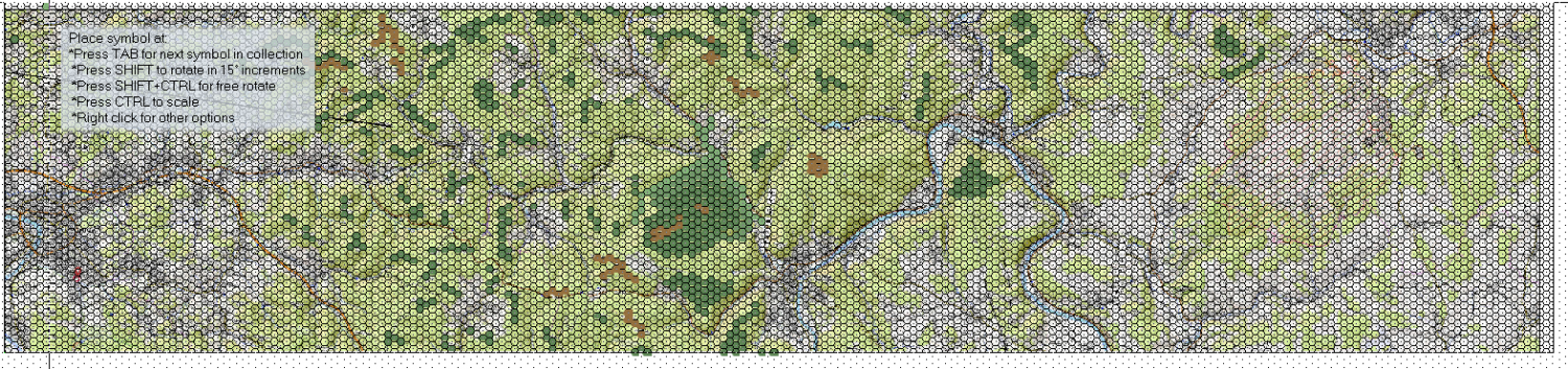
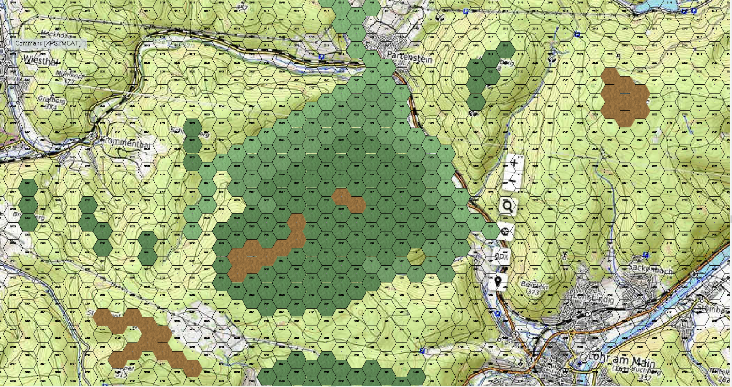
Here's a close up of the central area.
After I finish the 'hex map" I'll turn off the snap grid and small hexes and draw contour lines based on the various hex groups, then add the roads and rivers, etc. I think this will get me a 'style' in between a 'pure hex' map and a "contour map" and reduce the polygon count. Perhaps I'll draw the contours with the fractal polygons then smooth them so they don't look too regular.
This idea helps me with this map, but doesn't do me much good toward figuring out how to do the geomorphic map, but one step at a time.

-
Crater Time - Spectrum Overland 5/5
Very Nice Work. 😲 I'm agog.

-
Live Mapping: Contour Shading (Annual Vol 2) CANCELLED TILL NEXT WEEK
I will try to be there for this. Right up my alley and my needs.

-
Huge Archive of Military Maps released
Over 3,000 military maps, views and prints collected by King George III have been digitised and published online free to visit by the Royal Collection.
complete story at the link:
https://www.ianvisits.co.uk/blog/2020/01/29/huge-archive-of-old-military-maps-published/
The site has a cool viewer that really lets you get down into the weed and has information about the map and the mapmakers.
Link to the site: https://militarymaps.rct.uk/
Two examples. Yorktown. Another place I have GOT to get to. My two attempts were frustrated by personal issues.
And then one of London.
Be prepared to lose some time.
-
Searching for symbols for WW2 and modern military vehicles, artillery etc.
This web site lets you compose the appropriate symbols for unit and equipment using the NATO/UK MS2525 and APP 6 Standards documents.
This site has several files you can download that provides NATO and other symbols/vehicles/planes/etc.
And this web site has many diagrams of ships, ground vehicles, and aircraft in constant scales.
-
Reset Origin
Another update.
I find if I move the cursor just up the left hand side, the image goes inside the map rectangle instead of going the other direction so sort of draws correctly.
-
How do you convert cartography conundrum map into useable image?
I frequently have cartography conundrums when working on maps. Fortunately, Brute Force and Ignorance [FB&I (TM)] get me through the crisis.
🤪
-
Panzer sample thread
Very nice work!
-
Simulating a hand-drawn line
I think all my lines look hand drawn, since I failed lines, coloring, and penmanship way back when.

