


Wyvern
Wyvern
About
- Username
- Wyvern
- Joined
- Visits
- 3,230
- Last Active
- Roles
- Member
- Points
- 5,507
- Rank
- Cartographer
- Badges
- 24
Latest Images


-
Forgotten Realms Interactive Atlas repairs.
Hi @Hildebrando Santos !
I don't have the old FR Interactive Atlas, so I'm not sure what the "white text" in English after you've translated it may be.
However, so far as I'm aware, you can open any older version Campaign Cartographer map in CC3+, so you don't need to convert any to CC3+ at all. If you redraw any map using CC3+, it will then save the file in that format, but that would only be a potential problem if you used an older version of the software to try to open the new map file.
You may find it easier to keep track of replies to any further questions you have by starting your own topic, or topics, on the Forum; with long-running topics such as this one, there's always the danger things will get lost along the way otherwise!

-
Community Atlas: Gruvrå's Mine, Serkbergen, Peredur
Thanks RS! I've done this quite a few times for my Atlas mapping. It's worth noting that when you're doing thumbnails, if there isn't room for the full figure, or it doesn't look right, you can always simply choose to copy over just the head and shoulders bit of the portrait, although depending on how you've created the CA3 portrait, you may need to hide some of the clothing and torso on your other map. That's what I did with the Lich Queen's Temple Tomb map in Tlok-Pik recently, for instance (link's in my posting today, just above here).


-
Community Atlas - Forlorn archipelago - The Bleakness, 2 villages and 2 keeps
Glad you'd got the test resolved Jim; not ideal news from the result, obviously, but great to see you were in good spirits, and it can be fixed.
Been offline till today myself, or I'd have commented sooner.
Best of luck for the next appointment, and beyond, naturally.
-
New user from the Netherlands, nice to meet you all!
Welcome on-board!
The advice from everyone above is very sensible, and should help you get started.
The main problems I found early on with the software related chiefly to being more familiar with how desk-top publishing and graphics manipulation software works, whereas CC3+ is genuine CAD software, which works in a very different way. Equally though, it's also far more powerful and - once you get into its apparent quirks - far more useful.
I found the Joe Sweeney videos the most helpful, as I started with CC3, but the more recent videos (which didn't then exist) for CC3+ by Ralf (the live mapping streams) and Remy are just as useful.
Best advice is once you're familiar with the basics, through video tutorials and/or the Manual, just make some maps of your own, and learn from that - including making mistakes, and working out (or asking here!) how to correct them. Good luck!

-
Trying to create a simple style
Glad the shaded relief concept has helped - and very nicely executed too!
In case you haven't seen it, there is this Annual issue that deals specifically with watercolour-look map designs using CC3+ too. You may also get more ideas on this theme by searching through posts on the Forum by Lillhans, who was for some time our resident expert on creating this type of drawing style.
-
My new City Style (Sumerian Kinda)
Happy I could help a little!
For a "proper" Sumerian settlement though, you need some canals passing through it, and maybe a bit less city planning 😉!
-
My new City Style (Sumerian Kinda)
You could also have the canals running directly through the city (or connecting inside it in a variety of ways). Keeps the water flowing through, so it stays fresher, basically. From Sumerian archaeology (albeit very little's been done on this aspect), harbours in the cities could well have been placed a bit like market places - wherever there was convenient space and a couple of canals (or more) met, say. Water transport was just so vital for bulky, heavy or large cargoes there (e.g. nearly all timber had to be imported), it's arguable their canals and waterways were more important than the roads. Rulers seemed always to comment on having improved, or "built" (usually meaning something nearer "rebuilt" or "repaired" in many cases, given how many different rulers claimed to have "built" the same thing over time), with rather less emphasis on roadworks, beyond making them safe for travel (i.e. keeping the bandits away). That's probably too historically/archaeologically "real" for this setting, however 😁!
-
[WIP] Temple of Fah (May Annual: Stairs and Steps)
To my eye, the pockmarks are too regular in the image to work as weathering. Plus you may find that at different image resolutions, they don't always look the same anyway.
If you want the ziggurat to look more weathered, I'd suggest using fewer neatly-straight lines. Try drawing them instead with a new tool using a low-level fractal polygon, at least in places, and you might want to show some areas of greater damage if the structure has been standing for hundreds to a few thousand years (take a look at the Egyptian pyramids for ideas, for example, and, given the grey colouring, it may be worth looking at some of the more worn examples of diorite statues from the same region for ideas of how they look too). If it's been repaired in places, that might be an excuse to some some subtly different grey stonework over a few "stone/brick" equivalent areas.
Just a thought, but if there are four main staircases, shouldn't they each have a road/track leading to them (even if those are old, worn and hard to make out completely)?
The dunes aren't really working to me, because while everything else is seen top-down, they're viewed side-on. I'd be more inclined to experiment with some terrain drawing tools and textures instead, including trying some of the various darkness Solid bitmap fill options with a suitable bevel or lighted bevel effect to make them look sufficiently hilly and dune-like.
-
[WIP] Temple of Fah (May Annual: Stairs and Steps)
I've found the fractal settings can take a lot of playing around with to get right; commonly now, I either just go with the default drawing tool settings, or simply use the straight polygon options instead. Every now and again, there'll be a glut of problematic lines show up, simply because the fractal tool has added too many nodes in too small a space (possibly because I've needed to set two "click" points too near one another to get the shape right).
What you can do is just draw a straight guideline you need the fractal bumps to be behind first, and then as each new stretch of line comes up, if it looks wrong, just hit the spacebar key to try another fractal option for that part. (And keep hitting the spacebar, only to wish there was an "undo" option to go back to the one you've just spacebarred past, in my case...😏)
-
Community Atlas: Map for the Duin Elisyr area, Doriant
A little further on now, and the cave's starting to look a bit more lived-in:
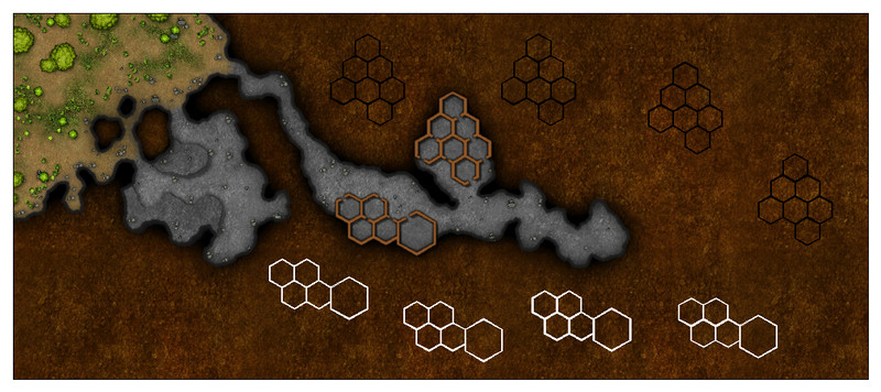
Getting the effects to look right for the two raised rock platforms in the southern front cave took quite a while, and may need further tweaking. I also tried adding some texturing patches to the cave floors in places, but they started to feel a little too much for the drawing, so were removed after a while. Might have a rethink on those later, perhaps.
I was happier with how the hex-room walls worked out, again after quite a bit of trial and error. Being the basal level here, they're attached directly to the cave floor, and I did add - and left there still - some texture patches inside those rooms. All I did beyond that was move them to a new sheet with some suitable effects, broaden the lines a little and change their colouring. And then cut some narrow doorways using the :CC2BREAK: command. Working on the principle the humanoid bee-folk are slim and not too tall, so they don't really need large doorways!
Upper levels to start after this. More when it's done!

