


Wyvern
Wyvern
About
- Username
- Wyvern
- Joined
- Visits
- 3,266
- Last Active
- Roles
- Member
- Points
- 5,585
- Rank
- Cartographer
- Badges
- 24
Latest Images


-
Free Late Victorian PDF Maps From Chaosium
We've mentioned before on the Forum that Chaosium provides a lot of free PDF resources that you can download from their website for the various RPGs and supplements they produce. Today, I picked-up a physical copy of their latest Call of Cthulhu book at my FLGS, "Cthulhu By Gaslight - Investigators' Guide", the updated version of an earlier work for the line in which our own ScottA had a hand back in the day!
With the book comes a beautiful fold-out map of late Victorian London drawn by Alyssa Faden, a name doubtless familiar to some here, especially those who have her style pack from the 2014 Annual. You can download a free PDF version of that London map (and a set of the players' maps from the book, which share a similar look) via the links on the Cthulhu By Gaslight webpage here.


-
The Writer's Map
Dragging this topic back into the light, as I recently discovered this book was reprinted in all its glory in 2024 (the original is dated 2018). It's an astonishing, and beautifully-illustrated, collection of essays by various authors. It's been on the shelves in my local bookshop since at least December apparently, though I only saw it in detail for the first time today.


-
Community Atlas: Embra - Wooded Places
Wooded Place 2 is the Elfin Stone Ruins, now with extra map-border creatures (don't you just love "Mirror Copy" sometimes?):
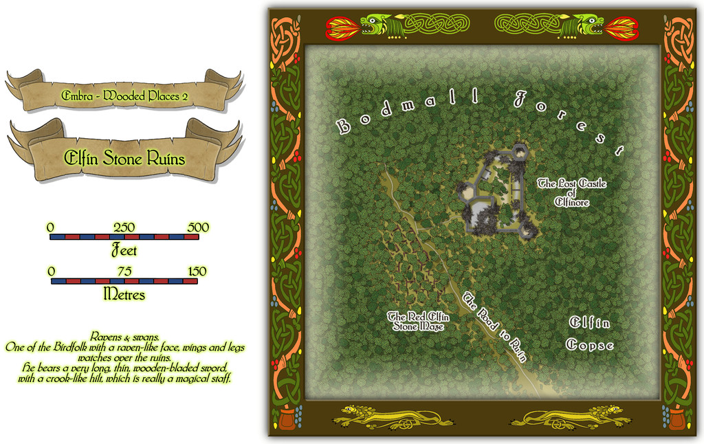
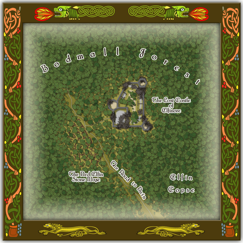
Which also shows I finally gave-in and decided to actually map one of the castles from the original base map as a genuine castle for once - or rather, a ruined version of one. Sort of... As a close inspection will suggest though, the castle doesn't seem to have had an actual gateway. A slightly better resolution image may help:
As for The Red Elfin Stone Maze, that's difficult enough to see on the actual CC3+ map, albeit quite deliberately so, since the adaptation of the original base map's features here called for something odder than just ruined walls of somewhat poorly-constructed peasant housing (my reasoning behind the wall-lines on the hand-drawn JG original not being entirely straight in places). If the ruins give the impression they may have been built that way, and are not of earlier buildings that have decayed and fallen apart, that might well be correct.
Oh, and there really is nothing to distinguish that part of the dense woods labelled "Elfin Copse" from any other part of the Forest nearby, incidentally. Come on - this IS Faerie, after all!
![[Deleted User]](https://secure.gravatar.com/avatar/c75d9a245b74d9c59be0999ea81ca541/?default=https%3A%2F%2Fvanillicon.com%2F92add7f8c954488718110edc4896ad39_200.png&rating=g&size=200)
-
My first completed map utilizing CC3+
Not really seeing too much looking "wrong" with your map, to be honest.
As with most styles, there will be things that seem to work better than others sometimes, and it's often just a question of knowing what options there are, and what (sometimes quite small) tweaks will help make things look closer to what you were hoping for. Sue already covered your points regarding forests, settlement placement, and terrain fill blending, I think.
For your point 3, symbol scaling, sometimes the "correct" symbol scaling just doesn't look right - or maybe not for all the available symbols - so you simply have to rescale the ones that don't look so good to fit more with how you envisaged them looking at the scale of the whole map (not zoomed-in though!).
Point 5, unknown areas. You could add areas of a standard terrain fill with no symbols or other features, and maybe add a new Sheet with a pale single-colour polygon - like a grey or white - drawn over the unknown region, and add a Transparency Effect to that, perhaps with an Edge Fade as well. Or you could try a Blur Effect on the terrain fill itself - again set it on its own Sheet so it's not ALL the terrain that does this! Blur can make the file uncomfortably large if used too frequently, however. Just trying things out with the Sheet Effects is always worth doing, so you get a better feeling for what they can do. If there are terrain features that must be in the region too, you can also partly hide them this way. It really depends what you want the area to have the players might know about in advance.
-
Community Atlas: Embra - Wooded Places
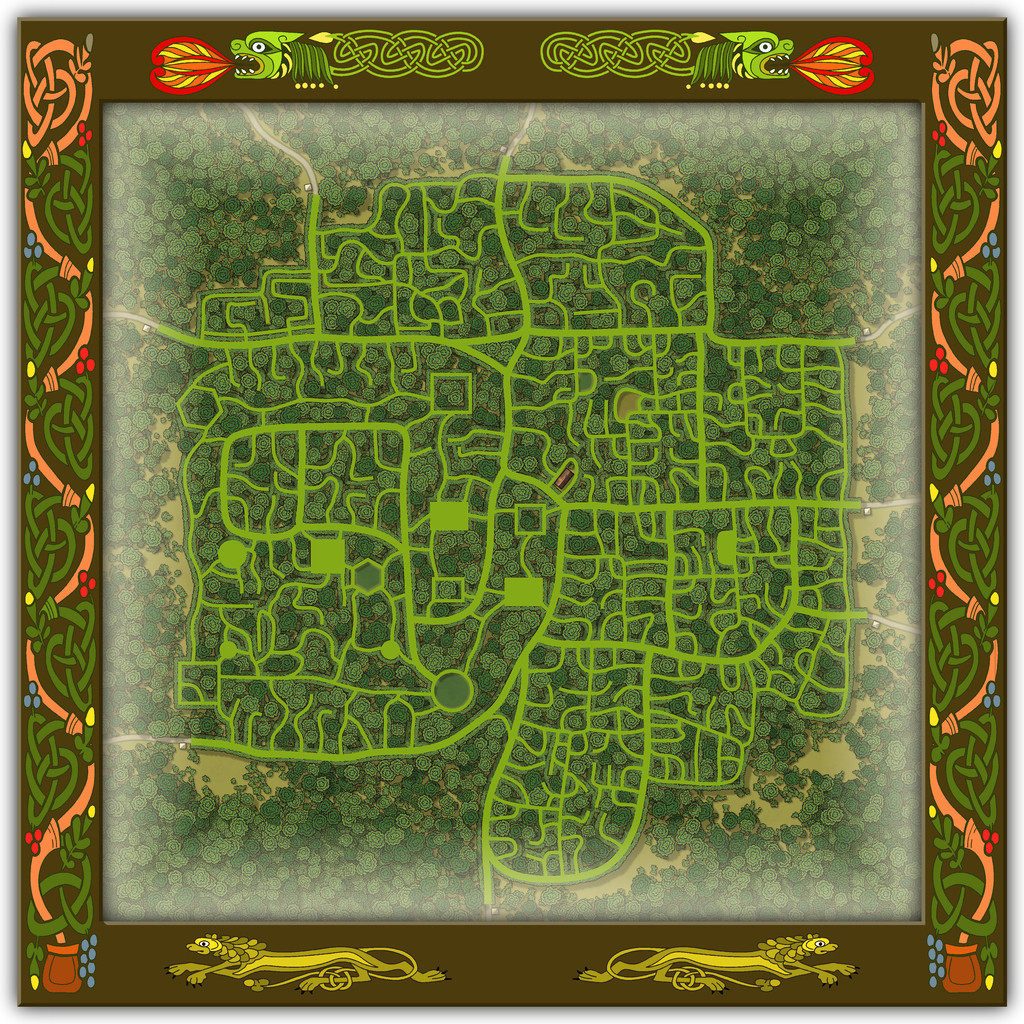
Not content with the complexities of a spiralling maze-like design, Wooded Places map 4 was to be a complete maze, the Hydras In Smoke Maze, no less. An apparently overblown title, though one that may make more sense if you consider the woods hereabouts are always notably misty - hydra/hydro-"smoke", or very loosely "water-smoke", if you will... This one DID take quite some time to complete, as it's a big maze. Firstly, the whole map:
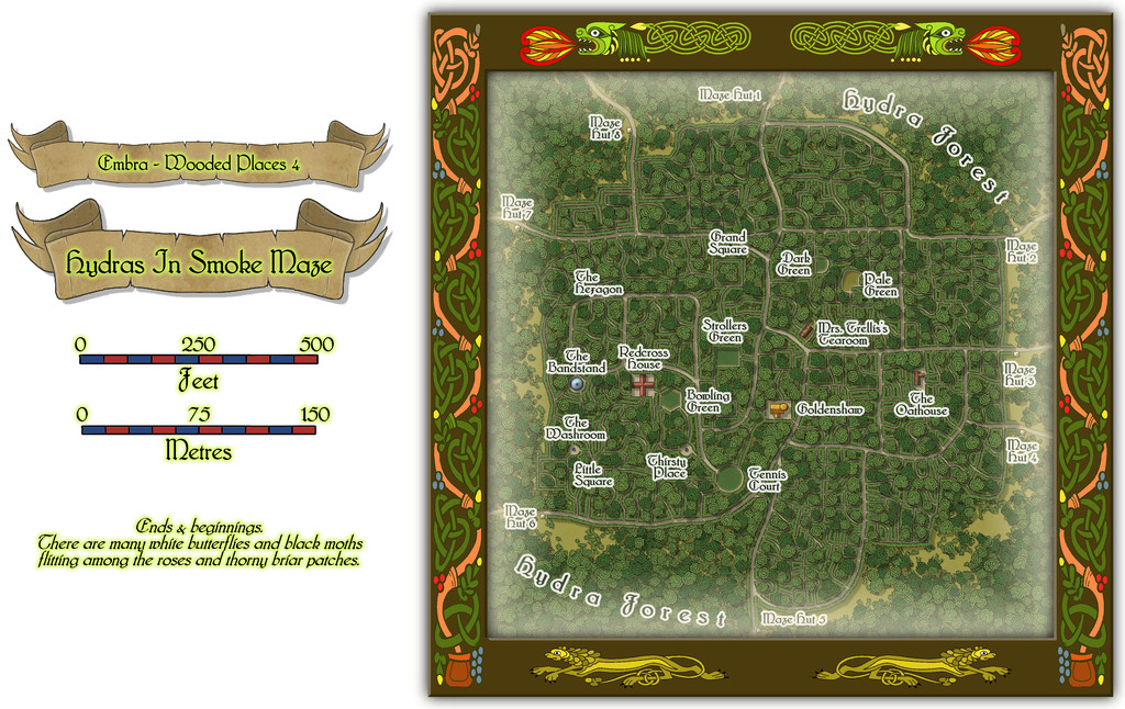
Then a closer view of just the mapped place:
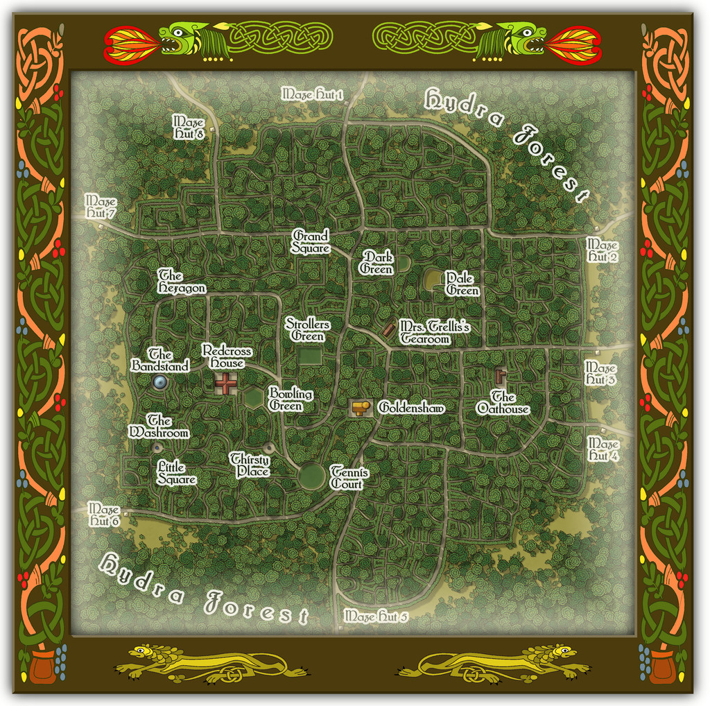
And for anyone wondering, yes it's THAT Mrs. Trellis (from the very long-running "I'm Sorry, I Haven't A Clue" BBC radio comedy series for those unfamiliar; don't worry if this is strange territory, as she features in the series only occasionally in confused, reported written speech). Here, she comes complete with a strong North Welsh accent, now and then lapsing into full Welsh when stressed, albeit also transformed into a powerful Faerie being, serving the most exquisite cream teas.
The handful of buildings have interior views as well:
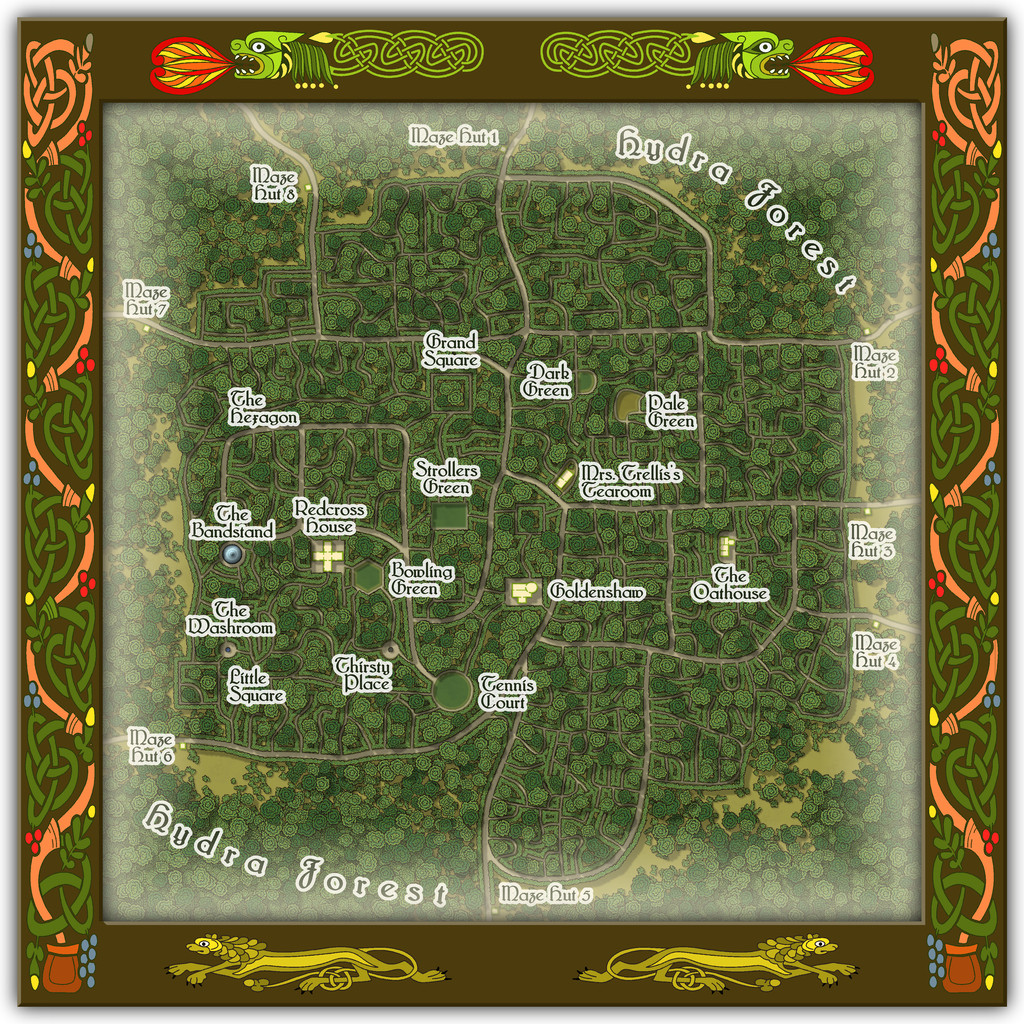
To help anyone struggling to define the maze pathways, there should be an extra toggle in the Atlas FCW file to show just that layout:
As you'll likely have realised, the choice of what went where within the Maze was very deliberate, such as the circular Tennis Court, the hexagonal Bowling Green and the Bandstand with no room for anyone to sit and listen to the music nearby, when other locations would have been clearly far more "suitable", had this been anywhere other than a Faerie city, at least.
-
Hexcrawling starter maps
There's an obvious couple of problems here. One is there isn't a great enough diversity of symbols to cover even the fairly small range of non-settlement features that might be useful, and which only an expansion of the style (either by PF or personally) would solve. [There is a further issue here too, in that none of the location symbols actually work to the standard snap grids used in this Annual. I'm not sure if that may have been amended since I downloaded my copy, however. I ended up having to place most by eye alone, certainly.]
The other is that anything placed in a coastal hex looks as if it's really in the sea, because that's just how hex maps of this sort work. That though is something I could resolve. Plus as I'd been randomly rolling terrain up, I'd noticed there was no "Hills" option in the current ShadowDark tables, so decided to tweak that a little to include some.
So the maps, and additional keyed terrains, came to look like this:
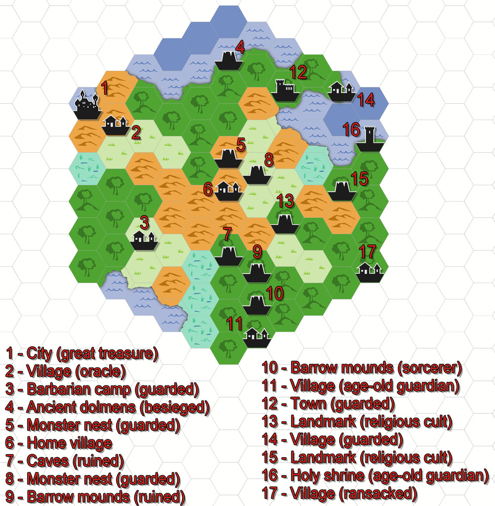
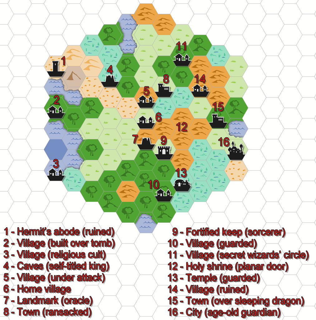
All I did for the coasts was add a small section of land from each adjacent hex over the coastal sea.

-
Issue 199
Yeah, nothing with computers is ever easy, is it, Jim? 😏
@Mike Vermilye - I've just done a very quick test new map with my own reinstallation, and am not seeing the problems you've mentioned. However, I didn't do an uninstall, I just deleted the files and folders that Ralf referred to:
Once I'd done that, I simply installed the replacement Monkey Frog Annual as new.
I'd suggest going through the three places in Ralf's list, removing both any surviving Silverman AND the Monkey Frog versions, and then try a fresh installation of the new Monkey Frog version of the Annual, to see if that resolves things. Failing that, you'd probably be best advised to contact ProFantasy support (through your account page) - unless someone else leaps in here with an alternative. I am NO expert with computers, so that might be your better option now!
-
Community Atlas: Embra - Wooded Places
Wooded Place 5 is Wistful Hollow Chapel:
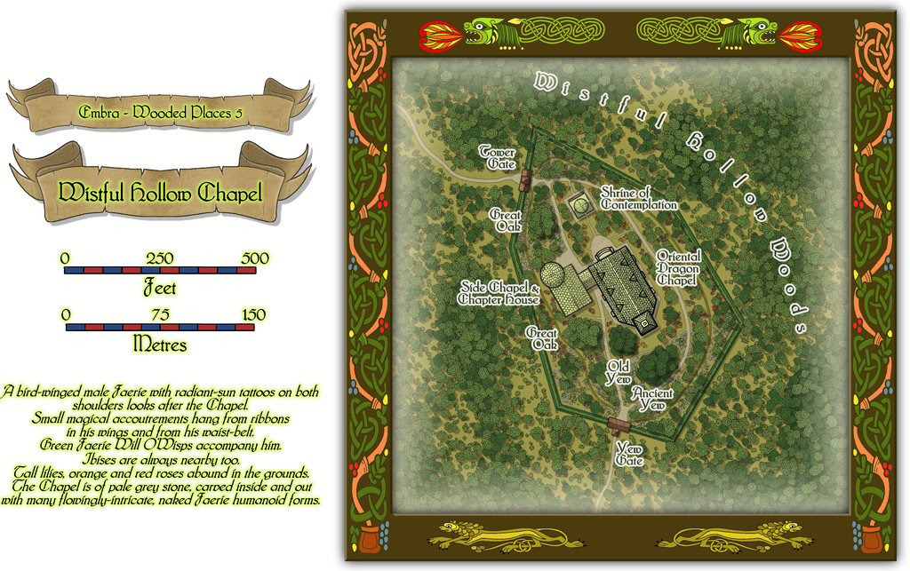
This was naturally somewhat easier as a drawing, with more random than planned vegetation, if still with a few substantial trees, and a lavish scattering of flowers across the Chapel's grounds. I picked the base map - yet another castle-form, who'd have guessed? - because the outline for what became the grounds looked like a very sketchy drawing of a prehistoric stone hand-axe, even though that has no bearing on the map or its contents at all!
Indeed, the Chapel's primary inhabitant (not even mentioned in the featured text) is a living, golden, Oriental Dragon that provides advice to the deserving who come here. That wasn't simply on a whim, but because there's a genuine church (the High Kirk of St. Giles) at the real-world city of Edinburgh that has a Chinese Dragon decoration in it. It wasn't hard to see that Embra needed something similar.
The map ended-up looking rather different to a lot of the larger Embra maps too, as the size of the buildings needed to be on a suitable "draconic" scale, so they almost look as if the map's in one of the smaller border frames, for all the map scales alongside clearly show it isn't.
Not all the illustrated structures are full buildings, as the "Interiors" toggle view demonstrates:
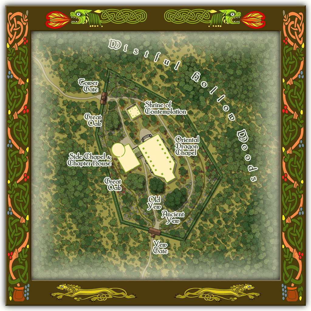
The Gates to the grounds are simply covered gateways, lychgate-style, while there's a tiled-roof walkway crossing the path between the Chapel and Side Chapel, not a linking building.

-
Community Atlas: Embra - Wooded Places
The third map in the Wooded Places set gave me an opportunity to try something I've wanted to do for a long time, map some spiral patterns in woodland. Those sufficiently familiar with fantasy fiction might guess the idea originated in the "Mythago Wood" tales by Robert Holdstock (the original novel, "Mythago Wood", was published first in 1984), which made a lasting impression on me from when I read them back then. The final map though bore only a mild, passing resemblance to its original base. Thus came to be Spiral Glade Park:
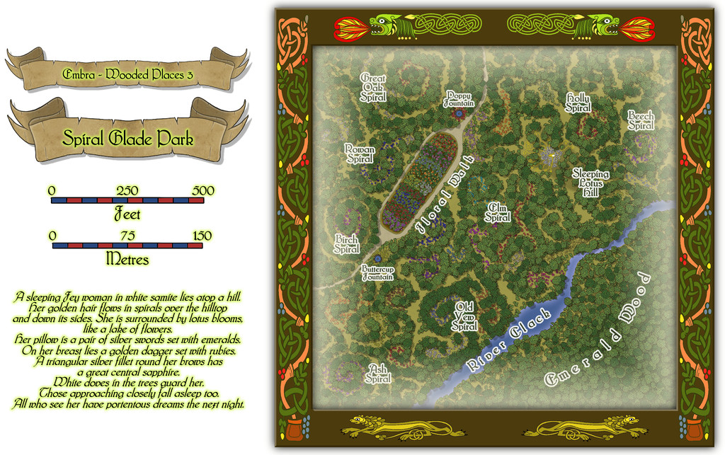
The details are a little tricky to see at this resolution, so again, we can try a somewhat closer view of just the map part:
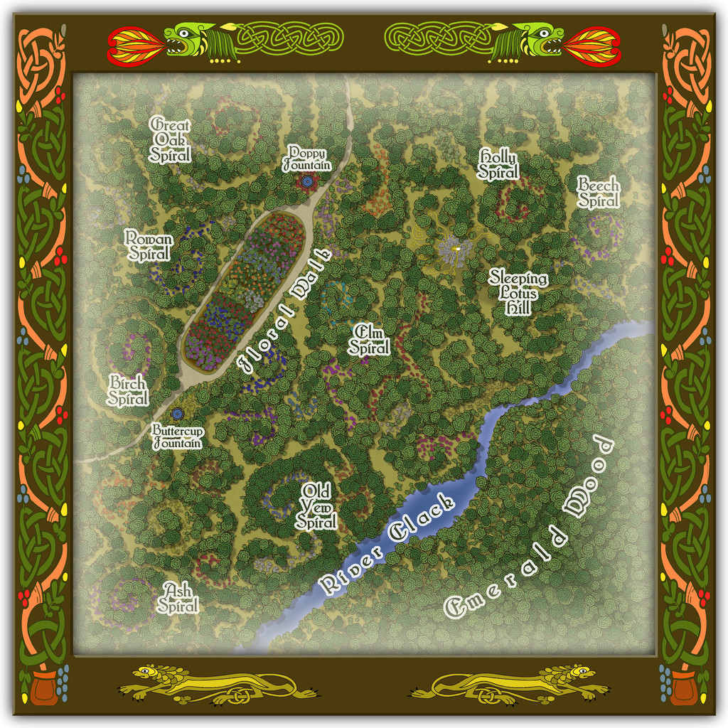
For those wondering, yes, Sleeping Lotus Hill does have a simple sketch of the sleeping Fey woman in white of the map's featured text, and her spiralling golden hair, surrounded by lotus blossoms. There are also a lot more flowers scattered across this map, as with several other of the Embra Places, of course. The PDF and text file notes suggest some possible benefits from traversing the spirals, and a warning regarding the curious grassy hummocks mostly hidden by the lotuses...
-
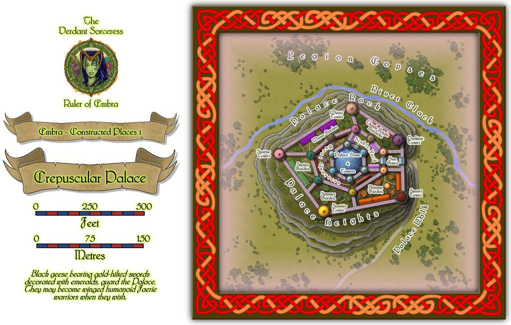
Community Atlas: Embra - Constructed Places
Constructed Places map 1 is that for the ruler's Crepuscular Palace at Embra. Well, I say "ruler", but she's actually more the physical embodiment of Embra made magically real and living, The Verdant Sorceress, who flies on wings made of summer flowers. Something like the Archfey of D&D, though really more like the deity of/being who is Embra in power and abilities here. The name and flower-wings came from random rolls using tables in A Wanderer's Guide to the Feywild, by Heavenly Spoon, available on the DM's Guild download site (Pay-What-You-Want). The rest is more "me", however. I'd added some details to the PDF and text files for the Crepuscular Palace map before I realised it would be feasible to provide a CA3 drawing of the Sorceress for the Atlas as well, something that needed quite a bit of late revision of both texts and the Palace map. Although there wasn't space to add the full CA3 drawing to the Palace one, I did want to add a suitable link-spot by it. So this is the final Palace map:
And this is the lady herself:
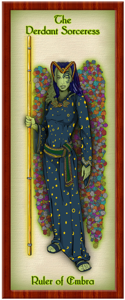
Of course, this is only how she appears in her Elf-like humanoid form, when out and about meeting people, and not trying to terrify visitors unnecessarily. She could seem equally to be anyone else in Embra, or anything at the city - such as a flower, a shrub, a tree, a building, a pond, a floral meadow, a path, a hill, a forest, a cloud, a rainbow, colours in a cloud, the River Clack, or a blade of grass. In a real sense, she IS Embra, in all its aspects, positive and negative. (Oh, and this means the final tally of Embra drawings for the Atlas is now 58, not 57...)
Those who've been following this lengthy series of posts regarding my Embra mapping closely may recall the Palace Heights map among the Hilly Places, and spot the resemblance to this Crepuscular Palace one. That would be scarcely surprising, as they're the same place, here with the Palace a living, still fully extant, building, rather than grassed-over ruins. With an interior:
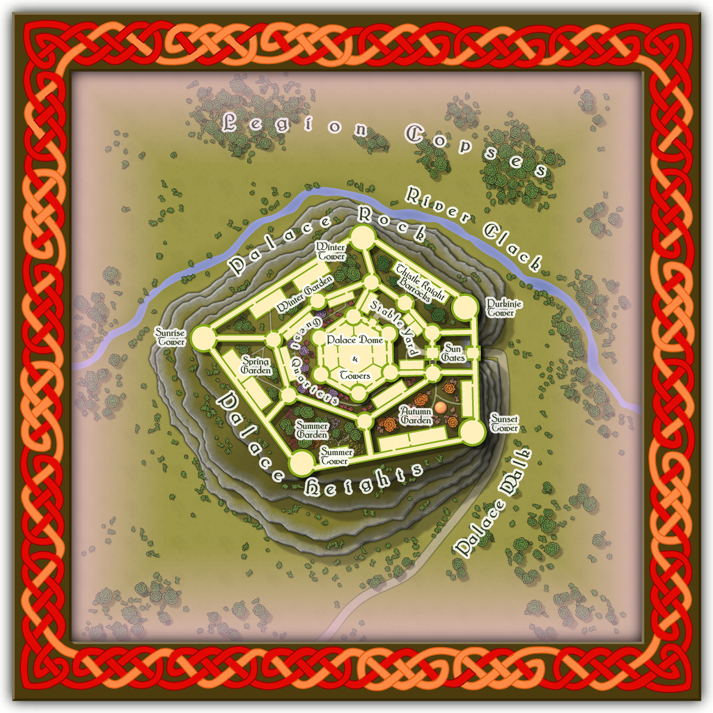
However, the interior is shown only for the ground level. The upper storeys - which all the towers, walls and great central dome have - are left for GMs to determine, if required, as the elements in it change from time to time.

