


Wyvern
Wyvern
About
- Username
- Wyvern
- Joined
- Visits
- 3,266
- Last Active
- Roles
- Member
- Points
- 5,584
- Rank
- Cartographer
- Badges
- 24
Latest Images


-
Community Atlas 500th Map Voting Thread - Please vote
I second Sue's comments; this was an extremely difficult vote, as there are just so many fascinating maps produced in such different styles.
Hopefully, everyone contributing enjoyed their mapping, and perhaps learnt something fresh along the way.
It's certainly been a delight reviewing them all again now!
Get voting folks!


-
Advice on what looks better, please, on a completed map
Yeah, as someone who's been preparing illustrations, diagrams, graphs, etc., for print publication for decades, draw it in black and white from the start, and keep things simple. Some of the delicate lines and shading on the cliffs, for example, may not look great on a BnW print, especially if the size is to be reduced to something like a typical paperback novel page, and the mottled fill will likely end up looking just grubby. Line clarity is often key too; the use of ruled-line hatching and dot-shading in printed drawings and maps didn't end up that way by-chance, after all.


-
Hexcrawling starter maps
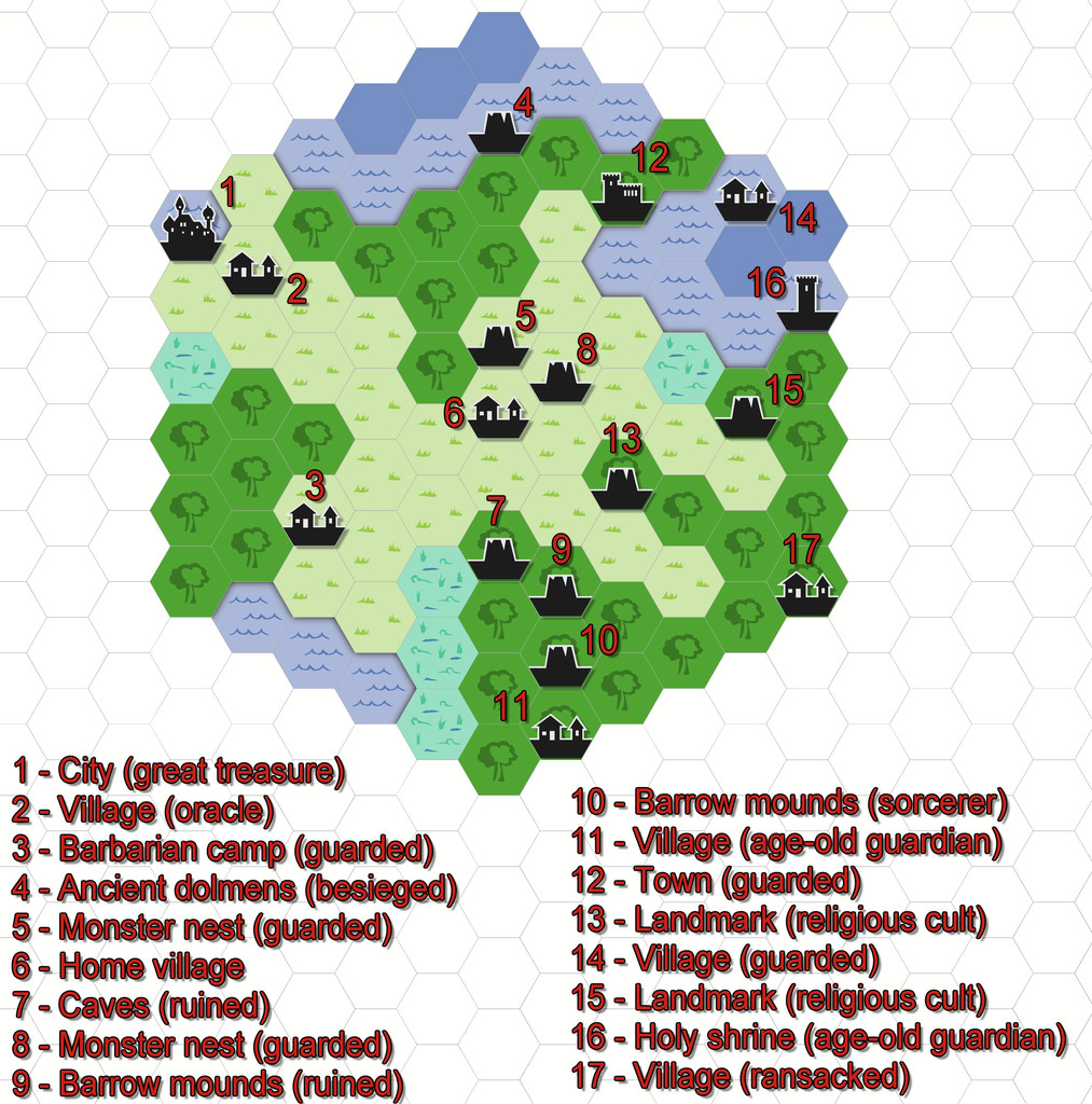
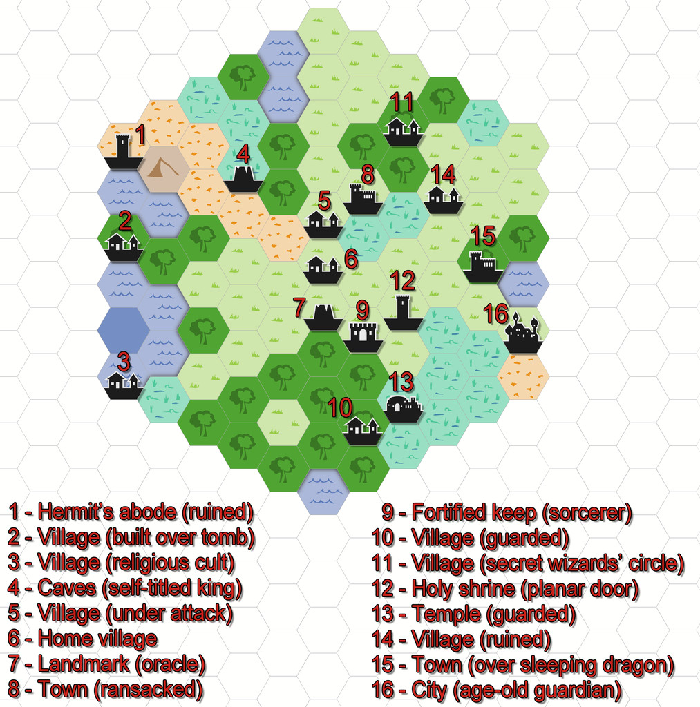
Just to make sure I'm not leaving anyone behind here, some brief explanation. From the early days of RPGs, those running the games have been encouraged to design areas for the players to explore, frequently using random generation systems to do so. "Hexcrawling" is the overland version of this, where each hex represents a fixed distance (if sometimes a little vaguely defined, given a hexagon is not the same size from its centre all around), commonly 5 or 6 miles, though larger or smaller sizes than this are not infrequent. What are now called "Old School Rules" (OSR) RPG systems often make use of this technique, and these have seen a particular upsurge in popularity this year, following ongoing problems from the current owners of "Dungeons & Dragons".
One of the unexpectedly phenomenal successes of recent times in the OSR line has been a new RPG called "ShadowDark", which presents a very streamlined update on the OSR theme, that incorporates improvements from modern RPGs more generally. I've been very taken with the whole ShadowDark RPG conception, particularly as the Core Rules include everything needed to play the game, such as a random generation system for hexcrawls.
Last weekend, I did a couple of small test areas, to see how the system worked (hexes here are 6 miles in size), and although the system which will appear in the printed Core Rules has been tweaked a little since then, I prepared the maps in CC3+ through the week, to see how they'd look, using the 2010 Overland Hex style. These are the basic maps as generated by the random system rolls, with a list of their contents, and a separate key:

-
What B&W Styles are Suitable for Large Maps?
Don't forget there's also the standard CC3+ B&W overland style, CC3 Vector BW, and if you have SS1, there's the Fantasy - Monochrome and Handrawn - Hollow (varicolor, so choose a suitable black for the lines) options. It's easy to forget these amongst all the many Annual options, I know!
Some of the varicolor sets can also be changed to actual, or more-or-less, B&W too, with a bit of experimentation.
Plus, depending on what sort of area you're intending, it may be possible to enlarge the symbols to keep them clear enough when resized (although this can lead to pixellation).
Depending on what style you're using, you may also be able to add a Whole Drawing Greyscale effect using the RGB Matrix to shift everything to look black-and-white.


-
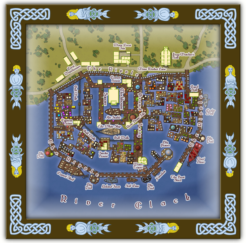
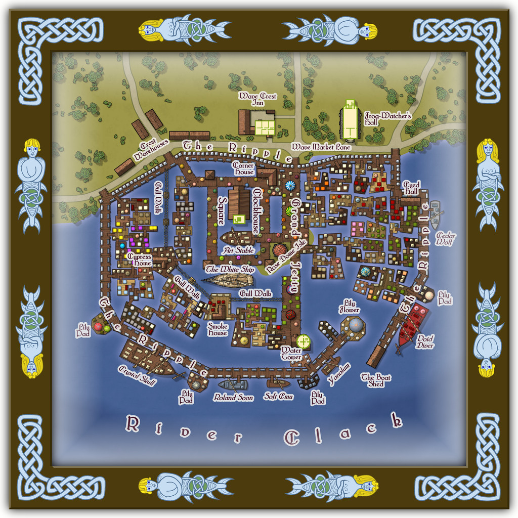
Community Atlas: Embra - Watery Places
For anyone concerned the Watery Places maps have been quite simple, easy-going, places, let us now move on to the part of the Twilight Market among this group, Wave Crest Market:
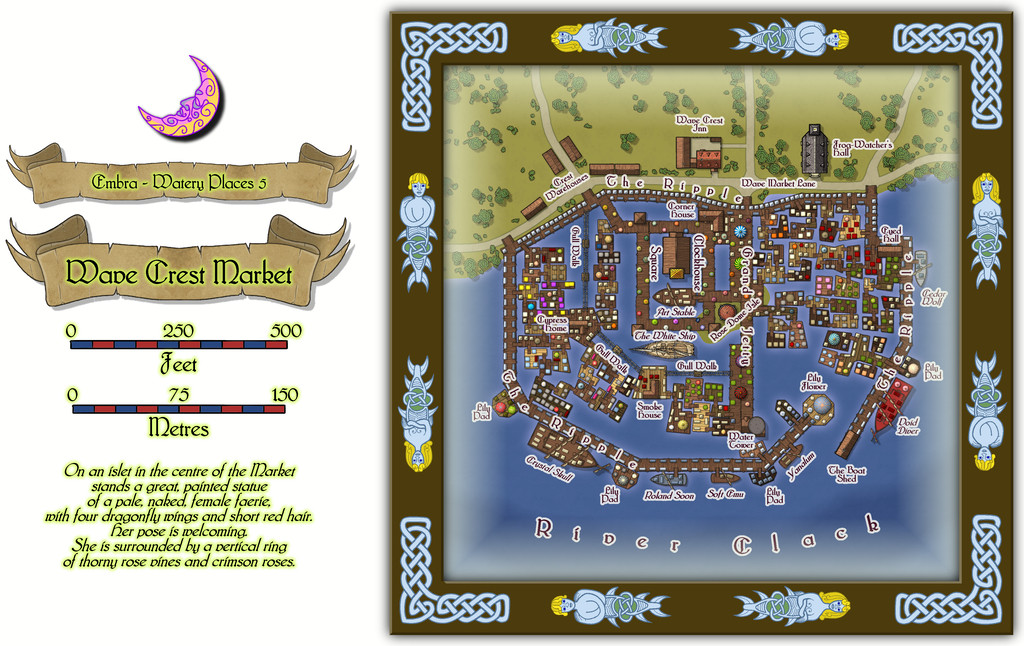
This gives the variable appearance of the River Clack another kick entirely, to the point where the far bank doesn't even make it onto the map at all! And while the shape may (correctly) suggest another, if much more substantial, castle map was at the base of this one, it's always interesting to see what can be done by using the shape, but converting the purpose to something quite different.
I always intended this part of the Twilight Market to be quite a complex mapping project, after seeing the original plan I'd be working to, though this one grew into a larger undertaking than I'd expected. Indeed it was one of the maps that took the greatest amount of time to complete, just setting-up all those floating platforms, market stalls/tents, and making sure there were walkway links to all the separate parts on the river.
There are buildings here as well, and not simply on land:
Some of which have a second storey:
One even has a further upper storey (close-up on the northeastern part of the map now):
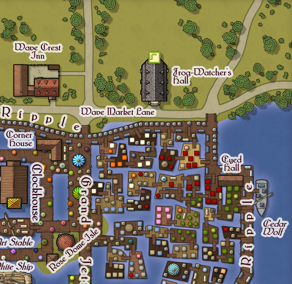
This latter image has the advantage of giving a better view too of how the floating platforms, gangways, ramps, tents and stalls have been applied, as well as showing the great dome on the little island in the Clack, covering the statue which is mentioned in the featured text for the Market. There's a detailed set of PDF and text-file notes to go with this map, as might be anticipated.
![[Deleted User]](https://secure.gravatar.com/avatar/c75d9a245b74d9c59be0999ea81ca541/?default=https%3A%2F%2Fvanillicon.com%2F92add7f8c954488718110edc4896ad39_200.png&rating=g&size=200)
-
Trying to create a simple style
Shaded relief might be the way to go to be more convincing on the higher or more rugged terrain. There's this Cartographer's Annual from 2008 that would help in that regard, if you have it, or if not, try this free PDF tutorial by HadrianVI from 2017, elsewhere on this Forum.
-
Town Map for a Cthulhu Game
Not sure why you had to use Photoshop for any of this, as from the looks, the whole could have been achieved in CC3+ too. Appreciate that if you're more familiar with Photoshop, that could have been the reason though!
Regardless, nice-looking map. Not keen on the newcomer to town though...

-
Community Atlas: Errynor Map 01 - The Cliff
With the new undersea symbols ready, finally I could begin constructing the first map. Logically, this was to be my original Map 1, at the top left corner of the Errynor map:
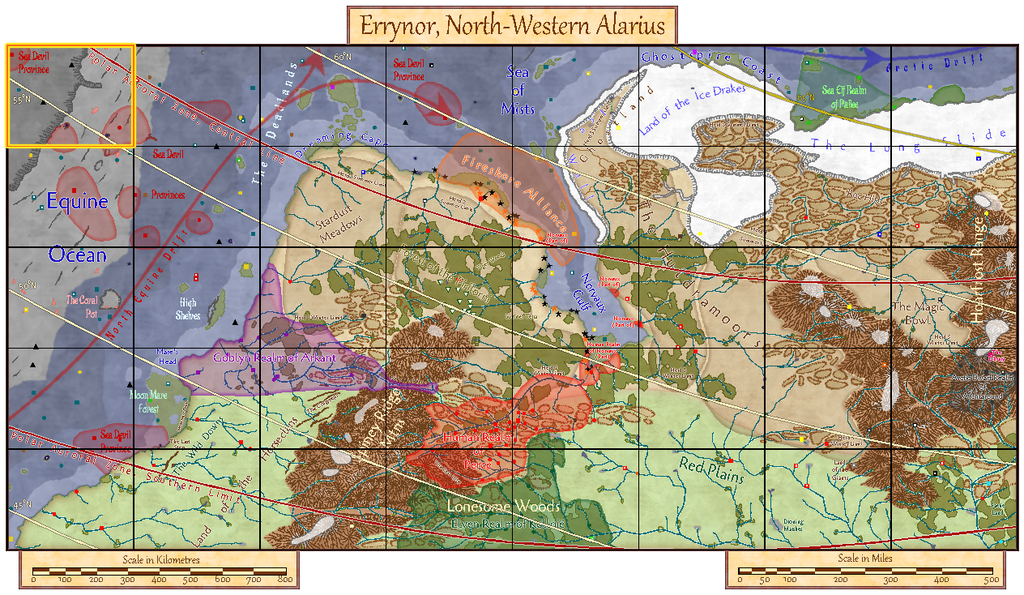
Clearly, the seabed was going to be the primary aspect here, with just two tiny islands above sea level, so that's where I began:
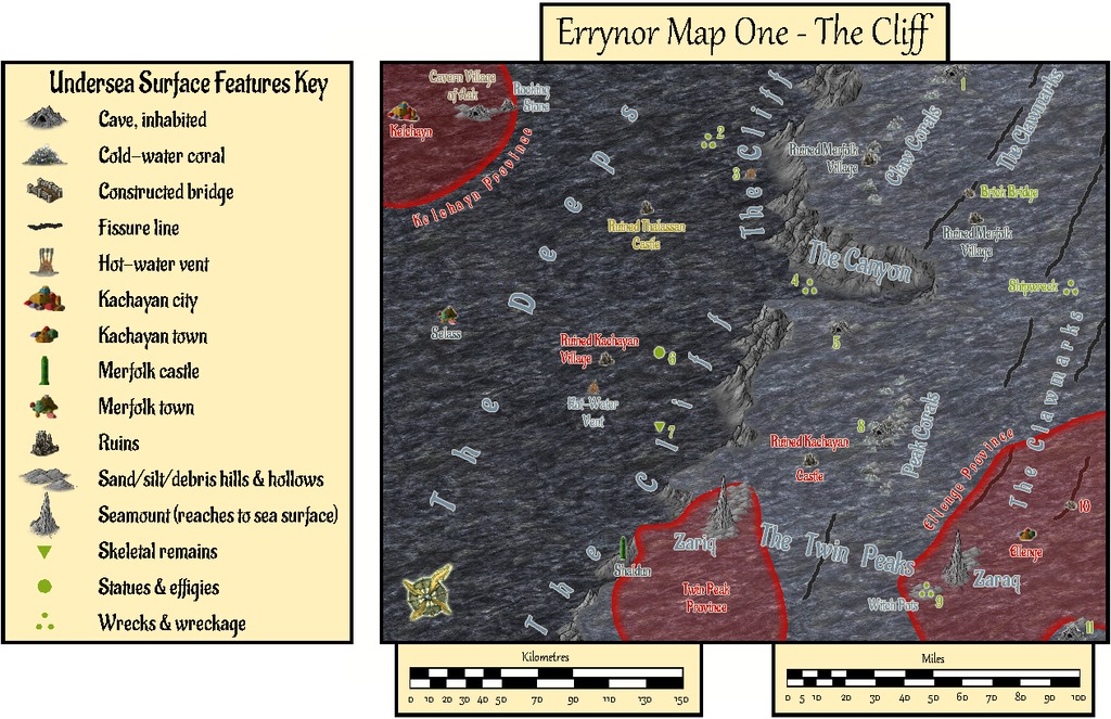
The tremendous cliff at the continental shelf edge is so dominant here, that had to become the map's name, while the relative sparsity of other undersea surface features had been a deliberate choice from the initial planning of the main Errynor map. What items are shown, are thus those more easily found by new travellers to the area, or those whose presence is more influential for whatever reason. This also reflects the apparent nature, as far as can be established, of Earth's own ocean floors. The shallowest seabed mapped here, towards the lower right corner, lies below some 300 m (nearly 1,000 ft) of seawater, for instance. It further fits with the idea of the relative smallness of the undersea intelligent populations in the region, compared with the vastness of Nibirum's oceans, as I'd envisaged them. There is the further advantage that plenty of space is available for GMs to add extra points of interest, should they wish.
The red-limned regions are Kachaya/Sea Devil provinces, incidentally.
I added a SOLAR/GEOMAGNETICS Layer overlay to show lines of latitude for each 1°, and the midline for Nibirum's polar auroral zone. This option should be available by a toggle for the Atlas version.
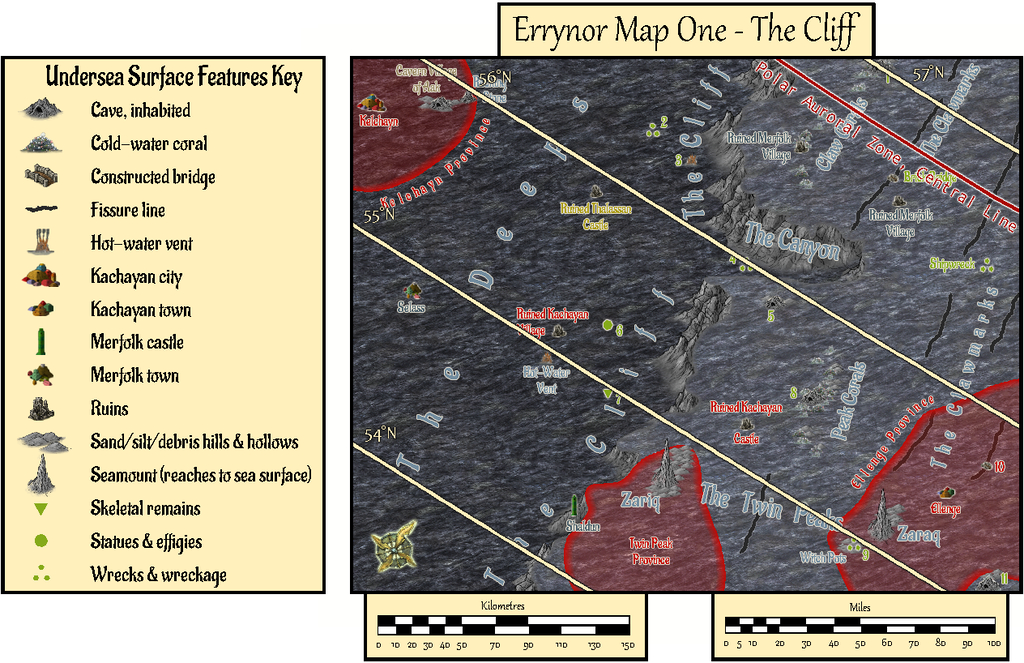
These 250 x 200 mile maps are small enough for the north direction to be fairly consistent across most of the area covered, so I'd been able to add a compass rose as well, which hadn't been possible for the main Errynor map.
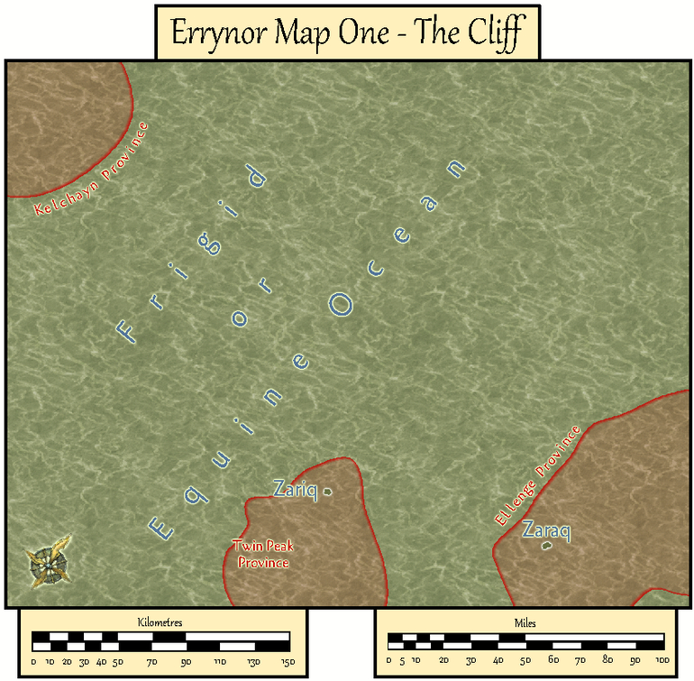
When designing the hand-drawn paper maps at the start of this project, a selection of larger/more interesting/more dangerous creatures (and things, for the solid surface) that could be encountered had been randomly included. Many of the undersea types were free-swimming. For RPG use, it's naturally important to know where these are not merely for the sea and undersea land surfaces, but in the water column between too. Hence another map toggle, activating the UNDERSEA WATER COLUMN Layer, is intended to shift the view to that water column (it's best to turn off the TEXT, SURFACE UNDERSEA Sheet for clarity first):
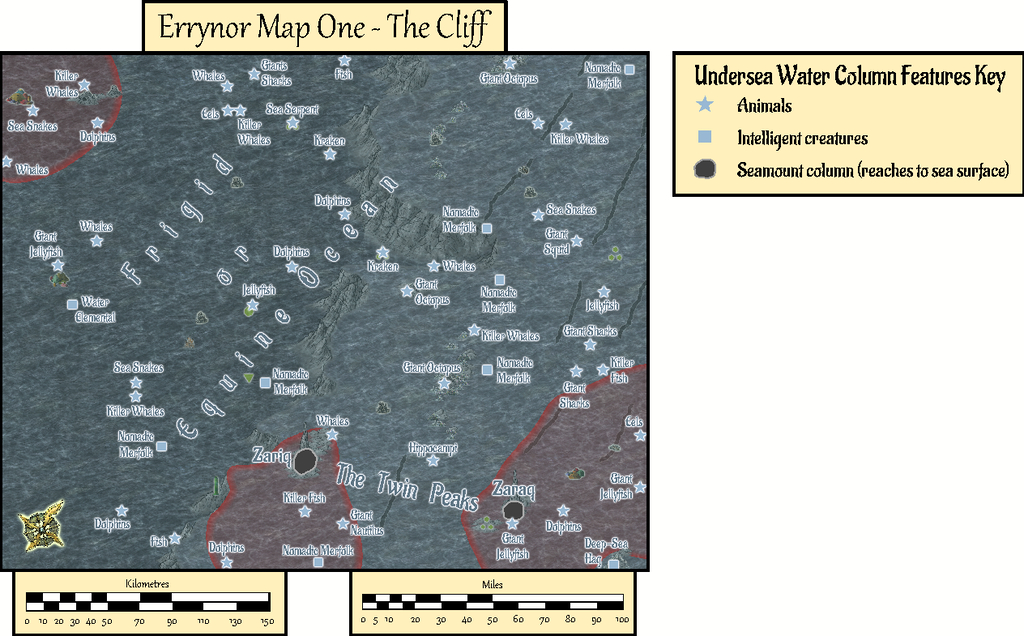
This view isn't at a fixed depth below the sea surface, simply to illustrate in general what can be found somewhere in the water column. Thus although the great seamount rock columns of Zariq and Zaraq have been given physical dimensions here, those are representative only. An 11-page PDF of the map's accompanying text-file notes explains this, together with detailing various of the other more noteworthy features shown.
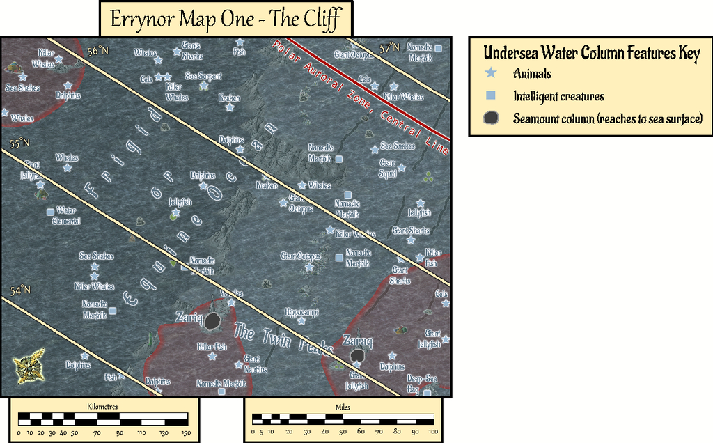
A third toggled view, turning on the COAST/SEA Layer, shifts us to the sea's surface, where the seamounts have become small islands, and the midwater denizens have been joined by several ghost ships and an area where floating wreckage collects from time to time:

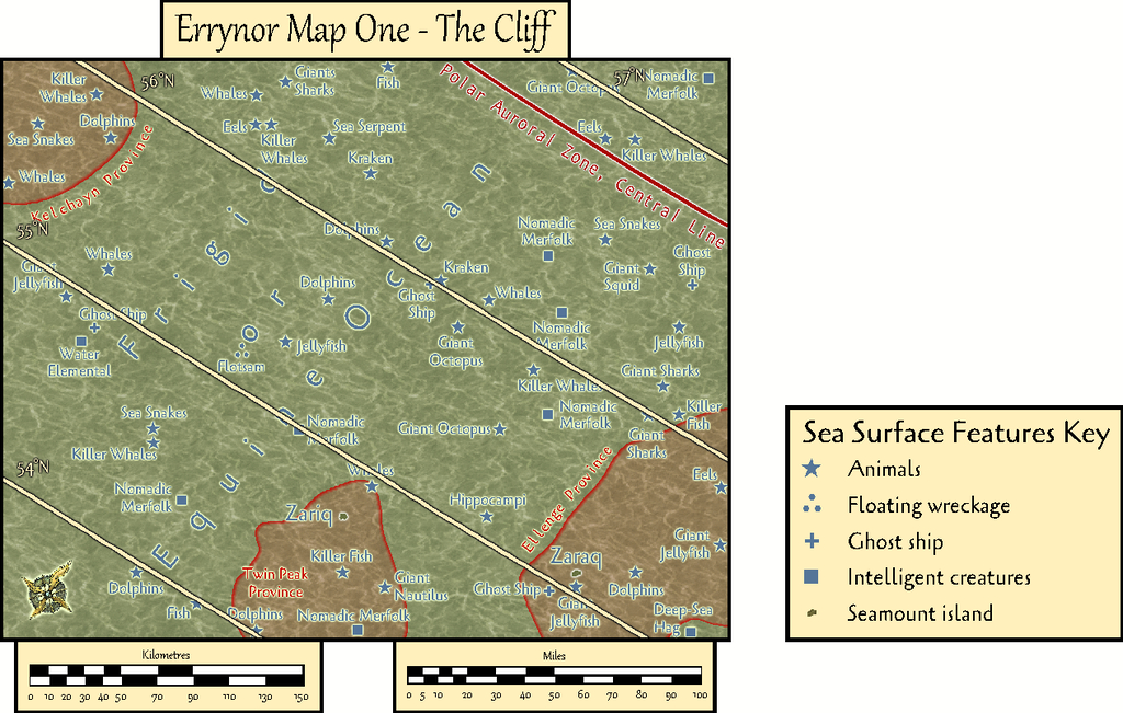
By turning off the SYMBOLS, SEA SURFACE Sheet, the paucity of sea surface features is very clearly seen!
GMs here may be unsurprised to learn I became distracted by some of possibilities of this map while drawing it into CC3+, as I've hinted in some of my more recent Forum posts here. Consequently, instead of progressing immediately to the next Errynor sub-map, I embarked on a group of feature maps from this one first. Plus, it also seemed unhelpful to not provide some guidance regarding the nature of the undersea features, especially the sea-bed settlements, for future mapping, as this is something scarcely touched-upon by published RPG settings and adventures. Thus this one map has become merely the first in a package of around twenty from this one area, which explains much of the delay in getting them ready for the Atlas, given I felt the whole group needed to be finished before any were submitted, in case changes were needed to those prepared earlier in the sequence - and that has happened along the way.
In fact the maps were prepared relatively quickly in each instance with CC3+. The most time-consuming aspect has been preparing and checking the detailed write-ups for them, as these are what has particularly allowed me to explore and expand upon ideas regarding fantasy undersea environments that I've been mulling over in part for decades.
Rather than drop the entire set on Monsen at once, my intention is for a gradual "release programme" with a new map or map-group only every few weeks. Maybe this will give me time too to complete more of the "Errynor 40" maps along the way, hopefully not taking quite so long each...


-
Community Atlas 1000th map Competition - with Prizes [August/September]
The fifth map in my Whispering Wastes set is the weird necropolis setting of Osalin Village:
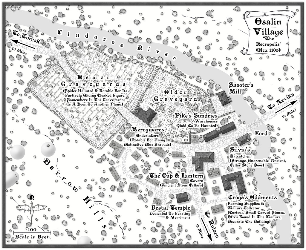
I've added some fresh notes about it to my WIP topic, and there's a higher-res map in my Gallery for this place too. Meanwhile, the FCW and PDF notes files are here:


-
Community Atlas: Embra - Watery Places
The first two Watery Places were drawn as smaller maps than usual, based on the reduced-size template designed for the Lawn Market map. This was because, as with Lawn Market, both base maps were generated from randomly-selected maps in the old Judges Guild "Temples Book I". As noted previously, this book used a much smaller scaling than the other old JG works I was drawing on for inspiration in creating the Embra maps. The first of the Watery Places then is the Bittersweet Basin Swimming Pool:
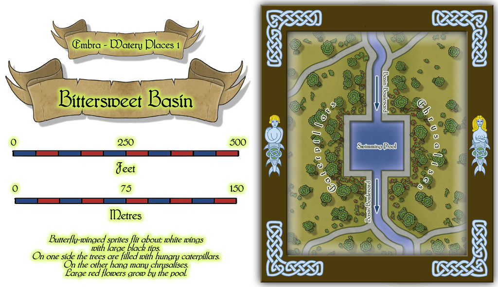
This is a remarkably simple area by comparison with many of the previous Embra Places maps, though of course variety is important in constructing an array of maps of this kind, to prevent things becoming too predictable. The featured text notes were used to add to the details shown here, without taking away any of their oddness. It's perhaps worth noting that as a mapper, it's equally important to have a few maps that are easier to produce like this, again helping avoid things becoming too stale and "samey". Especially as not all the Watery Places maps were going to be so "quick and easy"...


