WeathermanSweden
WeathermanSweden
About
- Username
- WeathermanSweden
- Joined
- Visits
- 3,755
- Last Active
- Roles
- Member
- Points
- 459
- Location
- South of Lübeck in northern Germany
- Website
- https://www.astroinfo.se
- Real Name
- André Franke
- Rank
- Surveyor
- Badges
- 6
Latest Images
Reactions
-
Combining Different SRTM Maps
My unzipped SRTM files have all the extension
.hgtso maybe the.bilfiles (that you have) are in another format?The files are about 2,75MB.
Here you can find 3" zipped SRTM's for almost the whole world. Just download a few, unpack them and try to load them in 3DEM.

-
Grimdark Fantasy (renamed "Darklands") - development thread
@Loopysue You know that I am a big fan of all your art, all your ideas and creations. Therefore and because of me not being a real artist it is hard for me to question something you show here.
With that said I wonder if the almost photo realistic ash clouds of the very impressing volcanoes match the main part of the style which consists of a beautiful stylized environment. What I mean is that realistic clouds match the Spectrum Overland style more while here maybe a little more stylized clouds could match somewhat better? ☺️ But I may be totally wrong...
Greetings, André


-
Practical use of the new Fractal Terrains Profantasy Normal Map in Campaign Cartographer?
But @jslayton would it not be a good idea if the whole normal map could be used as a layer and or effect - when imported to CC3+ to use it for shading of the whole map (a flat atlas map, not shaded exported from FT3) to shade the map inside CC3+ using the global sun direction (without having to create single shaded mountain symbols)?
I think @Loopysue has experimented with shaded mountains symbols using normal maps earlier. I have also given it a try for some time ago to create some shaded volcano islands. If I remember correctly we both encountered some problems at the symbol edges with the transition from the symbol to the background due to transparency issues.
-
Map Scale
I have been thinking all the time that this is a screen-resolution and paper size thing - most monitors had a resolution of 800 x 600 (1: 0.75) back then and DIN A4 297mm x 210 mm (1 : 0.71) - so 1000 x 800 is close that - but I may be totally wrong ?

-
October Community Challenge - City Streets - VOTING POLL in first post
@Lillhans Congratulations! I like your map and your special technique.
I think that all participants did their best!
...and still there are some more interesting maps that did not make it in time out there ?

-
October Community Challenge - City Streets - VOTING POLL in first post
I would like to take location 6, please.
-
[WIP] Community Atlas - Topographical map of Nibirum with ocean currents
Thank you Sue and Remy for your input.
On Shessars world map there is a scale - I will adapt it in some way in my map. I like the scale on your world Jerion - @Loopysue - maybe I can use that one? Or will my map then look to much like a copy of yours?
What do you think - should the map also contain the names of the continents and should major drifts be named?
For the latter, however, I have to admit that I lack the creativity for creating fantasy names...?
-
Displace moving everything to the left
Glad that this issue comes up again - I almost forgot about it. I had the same problems already when I created ripples around poles and noticed the left shift. I tried to minimize it but could not get rid of the left shift - so you still notice it even on my images...
-
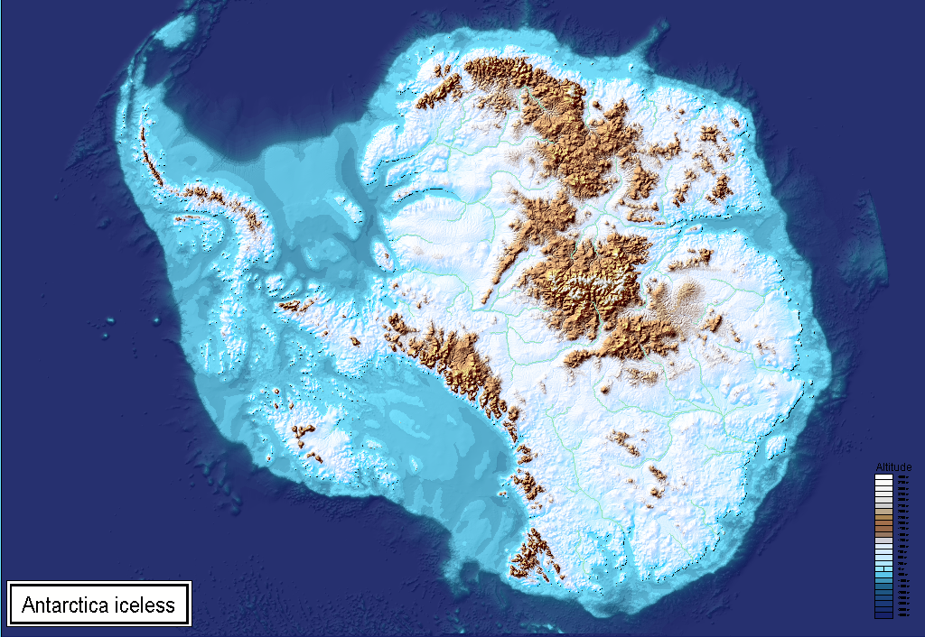
Topographical map of the Ice bed of Antarctica
And here the zipped FCW with the belonging images for shading. They have to be placed in the same folder as the fcw file. Then it should work...
Antarctica_iceless.zip
Without Sheet-effects you should get the above version without shading.
With effects on you get this one.
If you want the darker version above, change the blender mode effect in the CONTOURS (LAND) sheet from "Hard Light" to "Multiply".
Greetings,
André
-
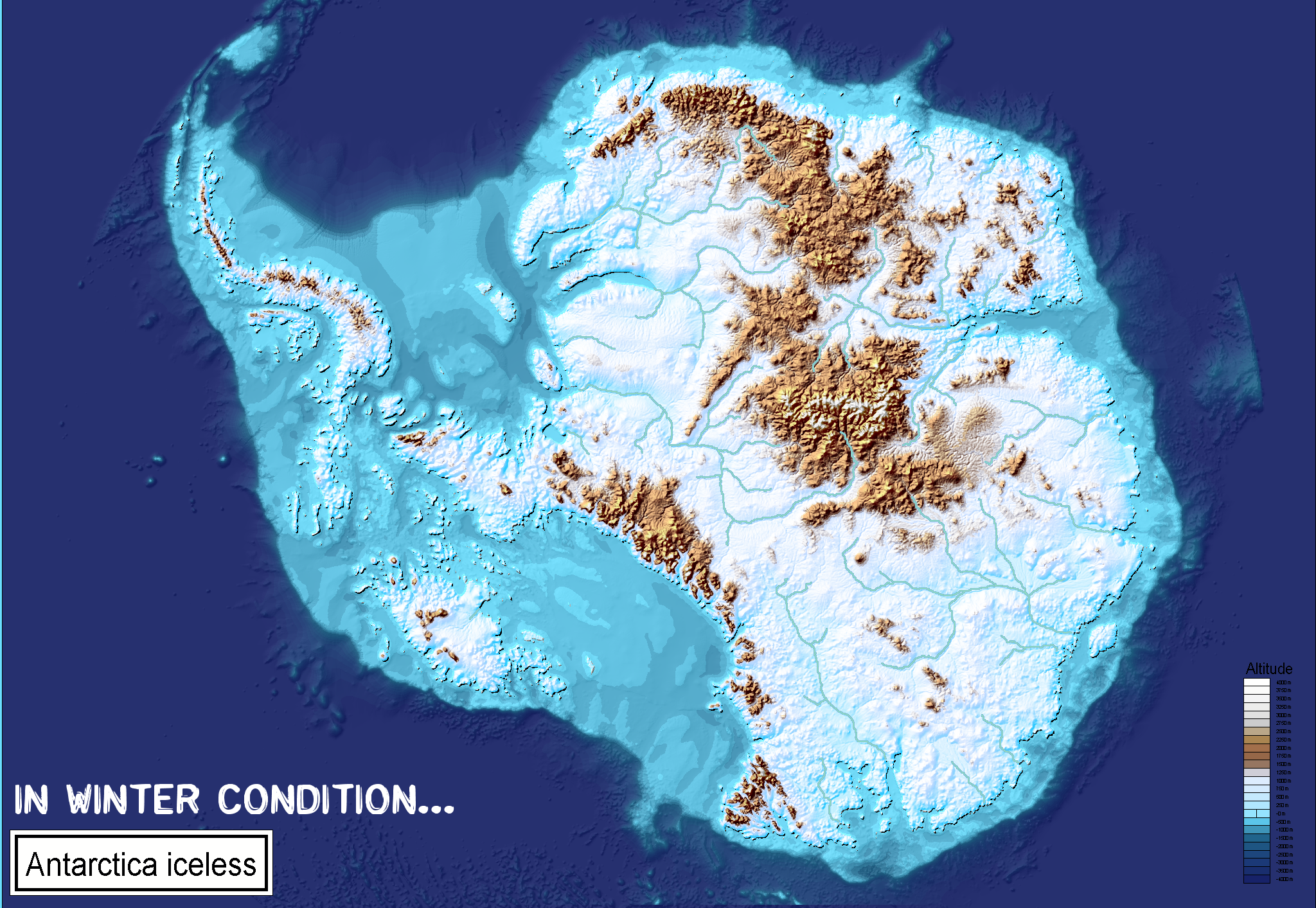
Topographical map of the Ice bed of Antarctica
Shared this also on Facebook - and here for those not being on FB:
I love your colour styles from Sue's November Annual - so just by a few clicks and changing the colour palette of the map we can create winter conditions...