WeathermanSweden
WeathermanSweden
About
- Username
- WeathermanSweden
- Joined
- Visits
- 3,755
- Last Active
- Roles
- Member
- Points
- 459
- Location
- South of Lübeck in northern Germany
- Website
- https://www.astroinfo.se
- Real Name
- André Franke
- Rank
- Surveyor
- Badges
- 6
Latest Images
Reactions
-
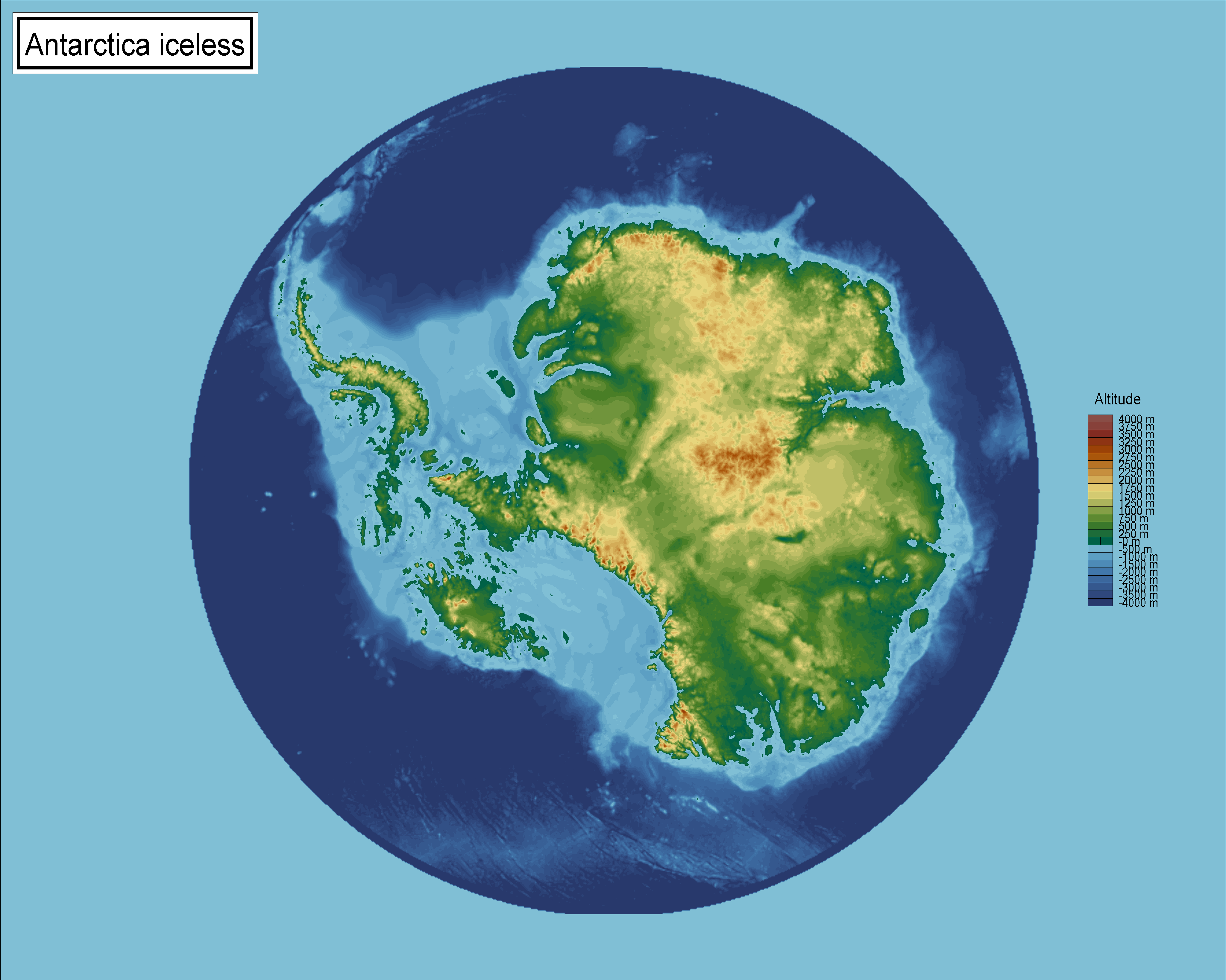
Topographical map of the Ice bed of Antarctica
So here is a FCW version of Antarctica without ice (after the land has risen...)
We got a fantasy world - based on real world data with some adjustments...
Antarctica_Iceless.FCW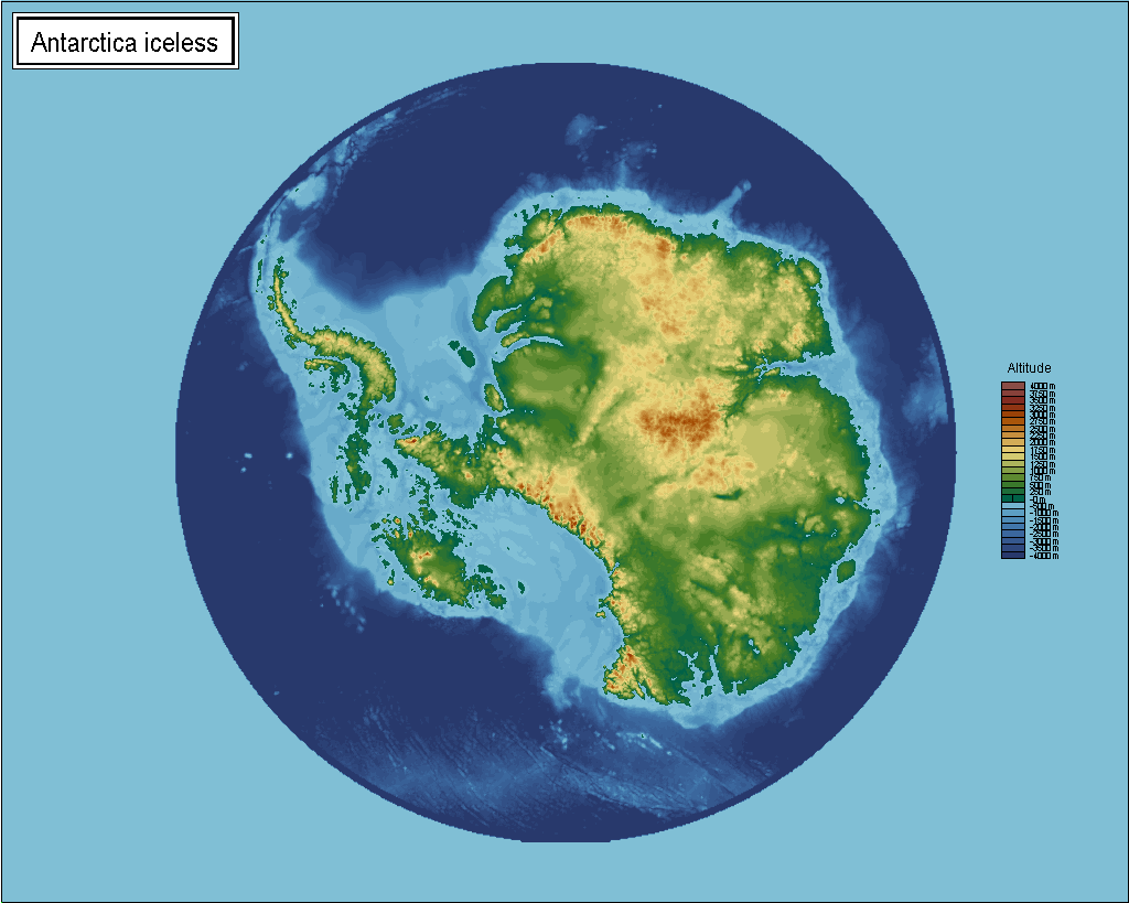


-
Grimdark Fantasy (renamed "Darklands") - development thread
@Loopysue You know that I am a big fan of all your art, all your ideas and creations. Therefore and because of me not being a real artist it is hard for me to question something you show here.
With that said I wonder if the almost photo realistic ash clouds of the very impressing volcanoes match the main part of the style which consists of a beautiful stylized environment. What I mean is that realistic clouds match the Spectrum Overland style more while here maybe a little more stylized clouds could match somewhat better? ☺️ But I may be totally wrong...
Greetings, André

-
Combining Different SRTM Maps
My unzipped SRTM files have all the extension
.hgtso maybe the.bilfiles (that you have) are in another format?The files are about 2,75MB.
Here you can find 3" zipped SRTM's for almost the whole world. Just download a few, unpack them and try to load them in 3DEM.

-
Combining Different SRTM Maps
Maybe @jslayton can answer this question in case there is a possibility to import more than one SRTM file into FT3 directly.
Just in case if there isn't a direct way, here is my approach...
There are surely plenty of programs out there that could shorten the process but most of them are quite expensive.
My goal was to use only programs that are free.
There is on the one hand WILBUR by Joe Slayton the creator of FT3. And he recommends on the other hand the pc software 3DEM on his website.
3DEM is a tiny but powerful tool that can combine e.g. SRTM's. The program has been abandoned and can be a little bit tricky to find - but a search on the internet still gives one or two places where you can download it.
The process in short:
Start 3DEM and choose SRTM data (second option). The dialog box opens when starting the program or can be found under File->Load Terrain Model.
Select all files that you wish to combine.
In 3DEM choose File->Save USGS ASCII DEM and save your data.
Start Wilbur and load the file: File->Open and choose USGS DEM Surface (*.dem)
The bridge between Fractal Terrains and Wilbur is the so called file format “.mdr”
There is a slight issue when exporting the file because when importing it to FT3 it will face up-side-down. To correct this we will flip the map in Wilbur before saving it.
Surface->Rotate->Flip Vertically
Now we can save the map: File->Save As MDR Surface (*.mdr) and save the file.
Start FT3 now. Choose File->New
Select Binary File
Press “Choose Elevation File”
You have to change the file type at the bottom to MDR Files (*.mdr) to see your file
Go to the right location on your drive where you saved your map and select it.
In the dialog box values will be filled in from the file.
Press ok and then proceed...
-
Scale and Projection Questions
The size of a SRTM field is always 1 degree x 1 degree.
If you export a complete singel SRTM field from FT3 to CC3+ the distance between the northern and the southern limit of the resulting map is always approximately 111 km (= 1° / 360° * 2 * PI * 6357 km) - where 6357 km is the radius of the earth at the poles.
You get almost the same results when using a mean radius of the earth (6371 km) or the equator radius (6378 km). With this in mind you can estimate the distance between the western to eastern limit of the map to 1° / 360° * 2 * PI * 6371 km * cos (latitude in degrees). This is not totally mathematically correct - because the radius of the earth is a function of latitude, too (but this can be neglected here).
At the equator the distance is 111 km and at the poles it becomes 0 km.
Export of a part of a SRTM
When you only export a part of a SRTM you have to note the "upper left" coordinate and the "lower right" one in the FT3 map and then you take the differences between the latitudes and insert the result in the first formula instead of "1°". Take the difference between the longitudes and put the result in the second formula (replacing "1°"). Take the absolute values of your differences of course.
Regarding your second question: When changing the projection the shape of your map changes. But as long as latitudes and longitudes in your map still are approximately perpendicular to each other - you can use the method I described before to estimate distances in your map and from that the scale, too.
Greetings,
André
-
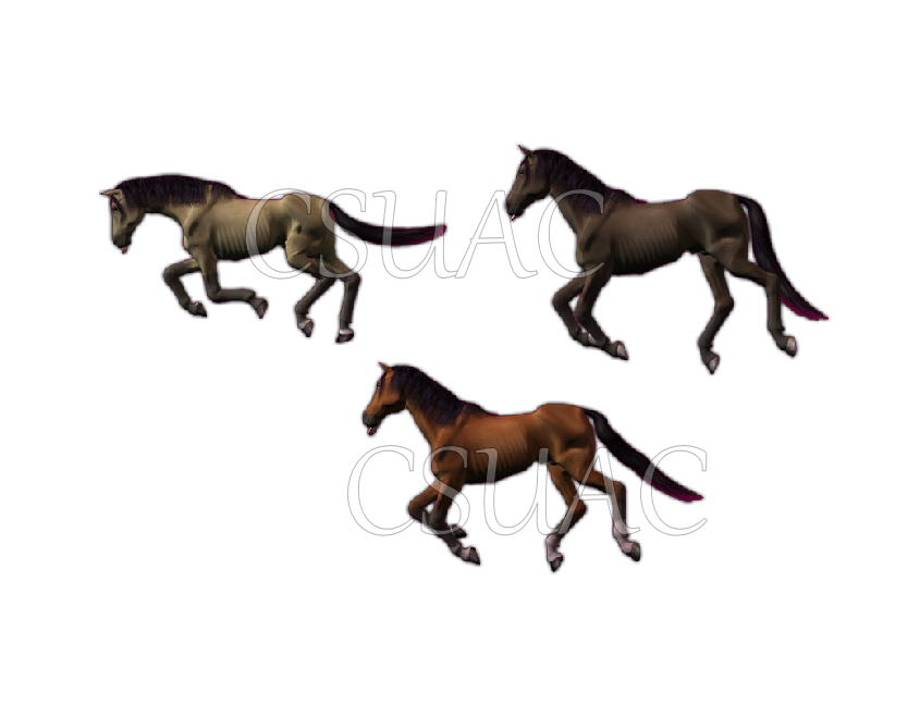
Looking for a dead horse symbol for a battlemap
In the monthly extra content of Mike Schley's symbols (month 3) there is a dead horse on a battlefield.
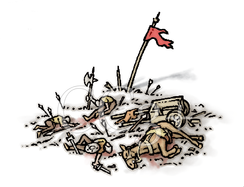
Or the CSUAC for CC3 has some:

-
Turn off shading?
The darkness of the shadow of the cliffs can be set in the sheet effects with the effect Wall Shadows, Directional by setting the opacity to a low value or changing the colour from black to gray - can't it?!


-
[WIP] Community Atlas - topographical map of Nibirum
The community project started with the FT3 world (1)
Shessar created the great CC3+ world map (2)
...and my aim was to transfer the CC3+ back to FT3 to make it more consistent with the CC3+ map...
After months of thinking how this could be done...I never came anywhere - until yesterday...
This is what I got during the last day so far... (3) (I know, it appears rather flat...)
Tell me what you think...
Greetings,
André -
[WIP] Community Atlas - topographical map of Nibirum
Thank you JimP, Sue and Remy.
Sue left a comment on FB:Posted By: Loopysue That flatness beyond the mountain ranges makes it look like a map that has been made specifically to illustrate where the mountains are. It's also pretty difficult to estimate altitude where the CC3 maps have not shown any hills.
That is exactly the problem I am facing right now - when I try to fill the "endless" planes of all continents...
I am still experimenting with blending the old FT3 file and it's heights with my new map -> result below...
Looks ok from far away but a little bit more horrible when getting closer...
Remy: I can give it a try to tackle even climate and so on - but it will take a while, maybe some months - I usually have more time during wintertime...
At first I want to be satisfied with the topographical map...
Greetings,
André -
Gettysburg
@mike robel The purple belongs to the "non existing" 16 colours that the 32 colour scheme not make use of. Both the brown and the green palette schemes use 48 colours, but the brown-green scheme does only use 32. I have now sent you a 48 colour version of that scheme in a PM. That should work and replace the purple area with dark brown colours.