


Royal Scribe
Royal Scribe
About
- Username
- Royal Scribe
- Joined
- Visits
- 9,939
- Last Active
- Roles
- Member
- Points
- 3,476
- Birthday
- February 5, 1968
- Location
- San Francisco, California
- Website
- https://legacy.drivethrurpg.com/browse/pub/31814/Royal-Scribe-Imaginarium
- Real Name
- Kevin
- Rank
- Mapmaker
- Badges
- 16
Latest Images


Reactions
-
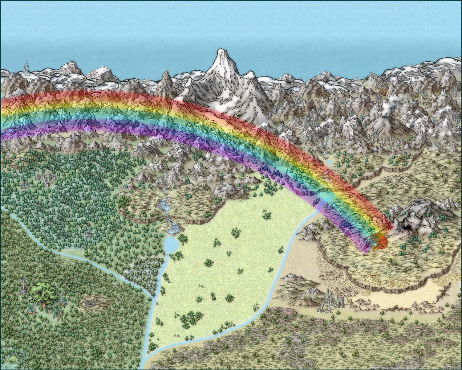
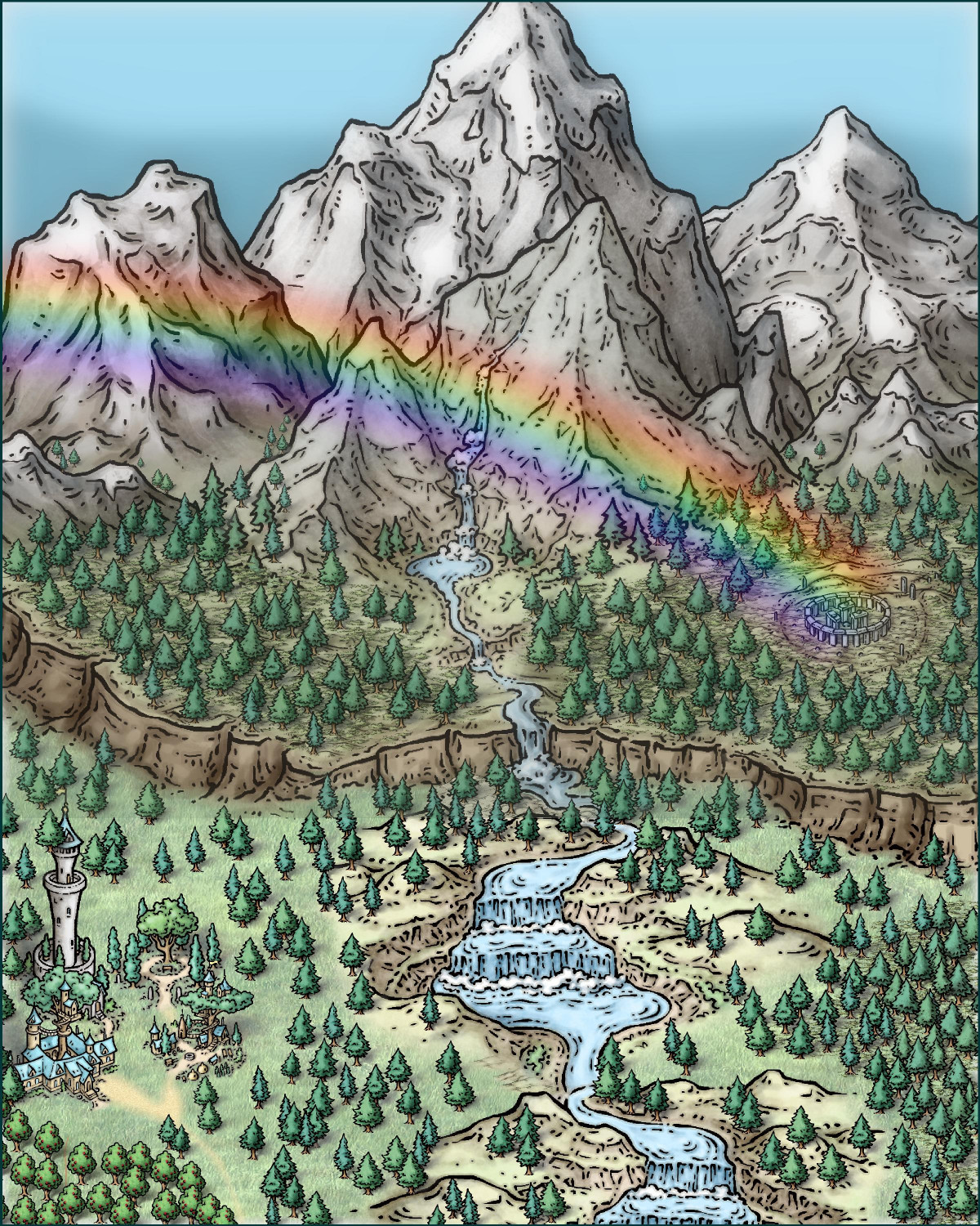
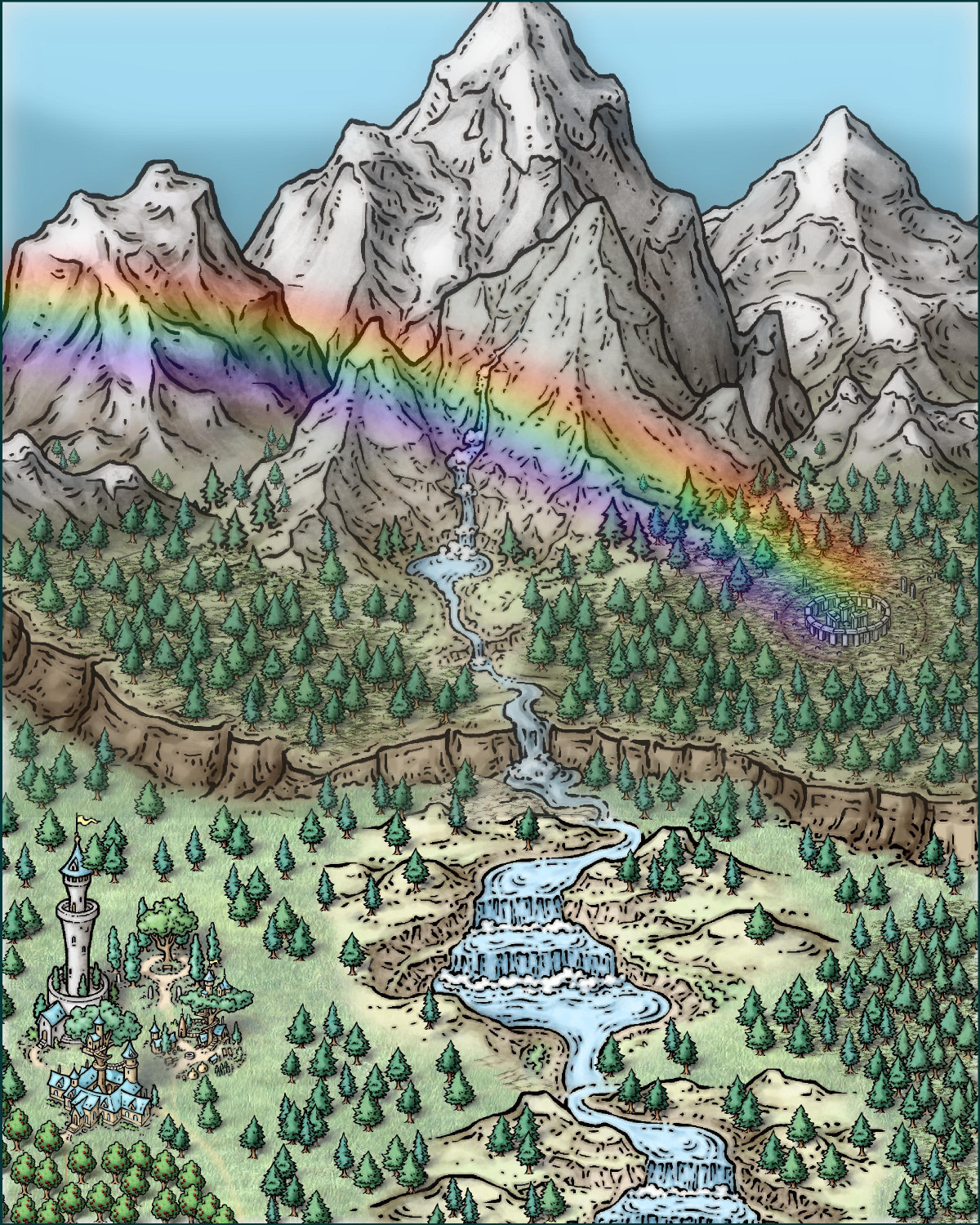
On leprechauns and rainbows and pots of gold
Ricko gave me some great tips -- fixing the waterfall in the first image (it needed to be more in the foreground), rotating some of the elven buildings to face the road, and adding trees to conceal where terrain/symbols connect. I hope I found all of the spots that needed trees! Here are my adjustments:


-
On leprechauns and rainbows and pots of gold
When I was ready to revisit the idea with the Mike Schley style, I took inspiration from Ricko Hasche's gorgeous maps that combine Mike Schley's Overland style with elements from the Cities of Schley Isometric style. I kept thinking about gold and leprechauns. Who else covets gold? Dragons, of course! So this rather large overland map has the rainbow ending on a dragon's nest with her golden egg. (Originally it was going to be a gold dragon, but the red one popped on the screen better.)

I will post some zoomed-in versions in my galleries.
Although I was pleased overall, it doesn't have the impact that Ricko Hasche's gorgeous maps do. I decided to make another attempt, this time with a much smaller area and going vertical. I'm much happier with this next attempt, although I need a ton more practice to get mine looking a fraction as nice as Ricko's.

-
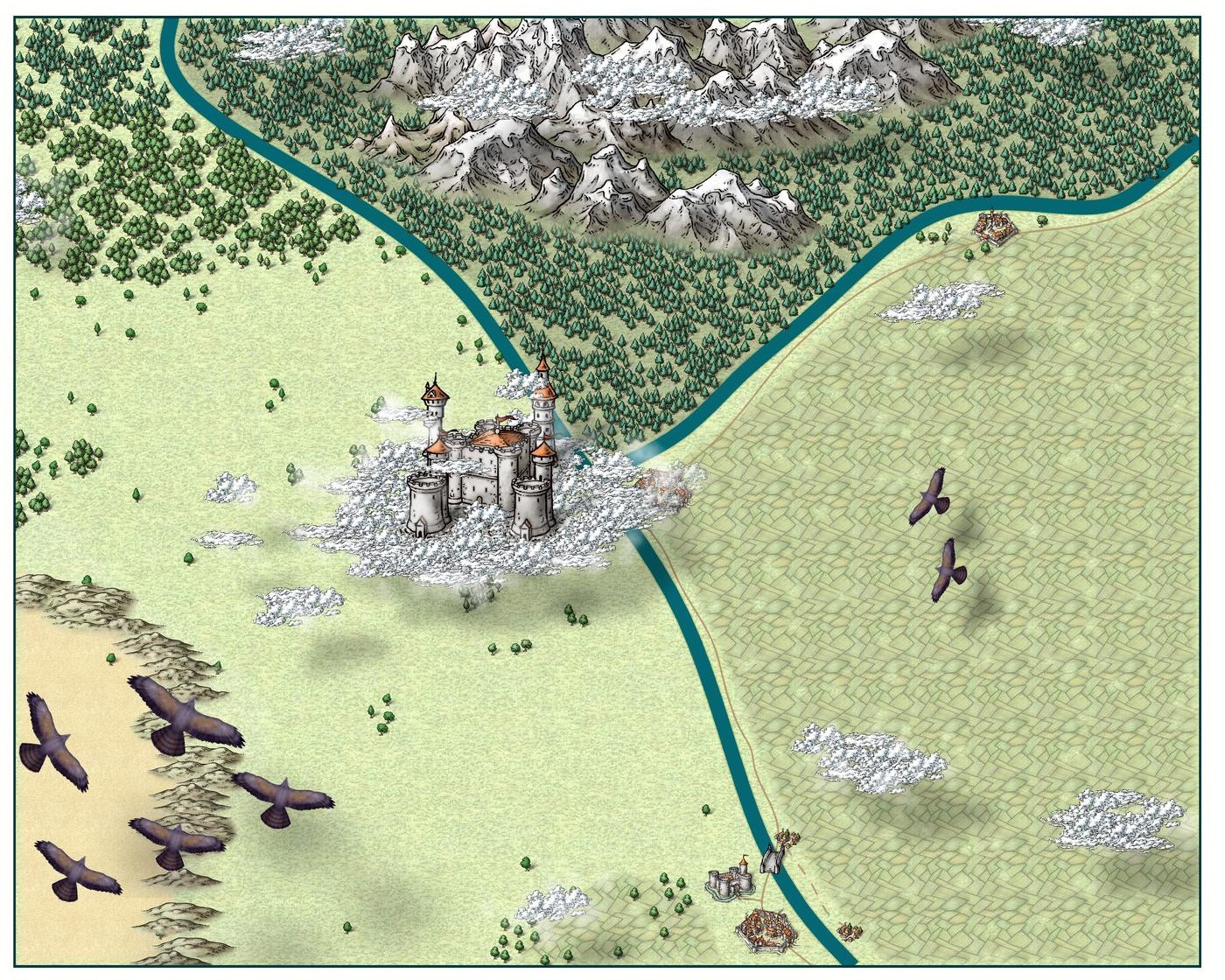
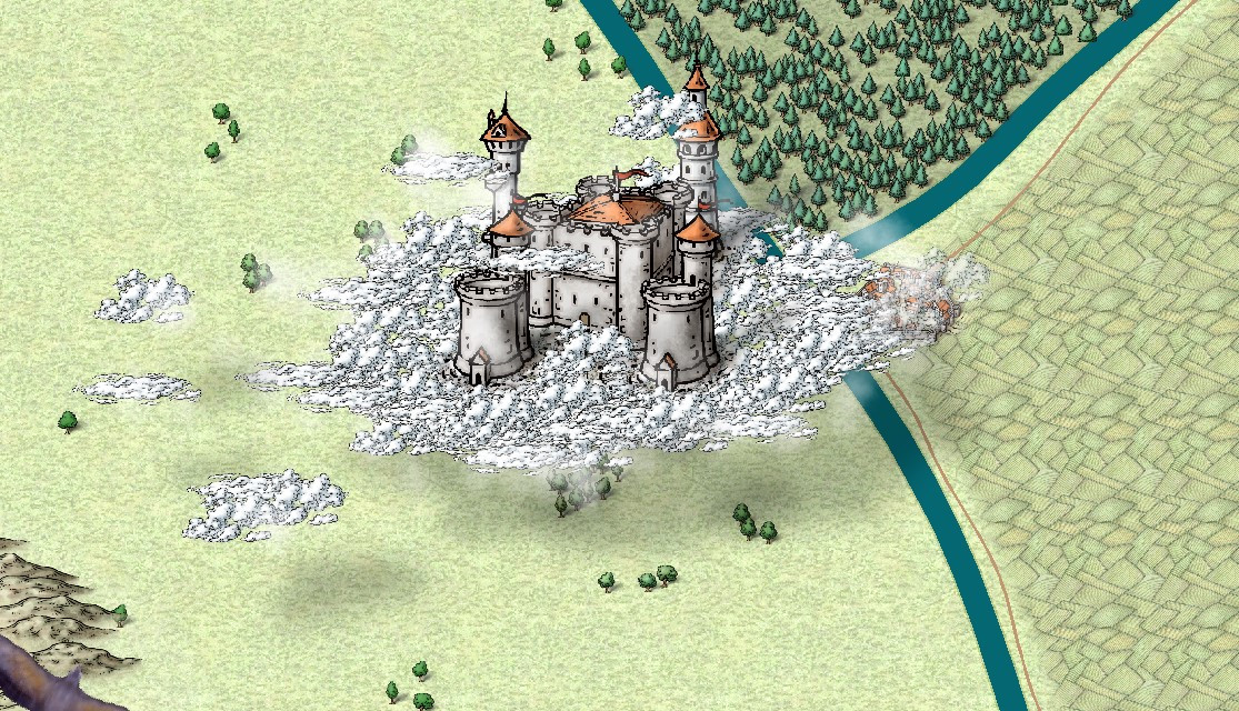
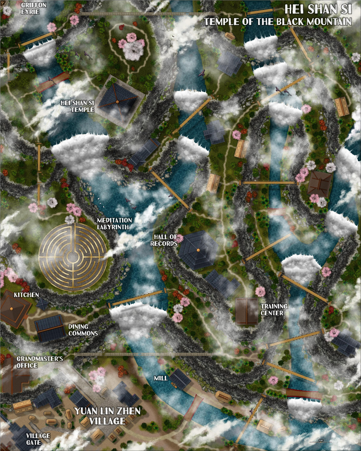
Castle in a Cloud
I am going to try to install the Dundjinni symbols that Wyvern recommended.
In the meantime, I switched the clouds from the Forest Trails rapids to the Mike Schley clouds, as they are consistent in style with the rest of the map. I may try the Alyssa Faden clouds later but I don't have that Annual yet. I put the clouds on a sheet above and below the "Symbols on Cloud" sheet to give them a 3D effect (and also cover up the walkways/roads to the castle that are part of the symbol). I also added some of the "waterfall clouds" from the Forest Trail to the periphery of the Mike Schley clouds -- they aren't very noticeable but give a nice misty semi-obscurity to the trees and other symbols below. I tried having another cloud sheet for the edges that would allow me to use the Mike Schley clouds with a transparency effect added, but I didn't like how it looked.
I had the same problem that Julian did, in that the castle didn't always look like it was floating. I hope the drop shadows with the Mike Schley clouds rectify that.


-
[WIP] Greco-Roman Inspired Temple
Revisiting this old Greco-Roman temple, one of my early maps.
A friend of mine is GMing a campaign that I am not in (he and I are also players in another campaign). My friend's campaign is Greco-Roman flavored, so when I mentioned this map, he was interested in using it for his campaign. I'm dusting it off, fixing the gardens, and adding crypts that he really wanted.
Above
At the time I designed this, I only had a handful of annuals. I used Marine Dungeons for this with a little bit of Forest Trail and Darklands City. My botanical gardens were a weird mix of styles, including some of Mike Schley's stuff that's really beautiful but doesn't mesh with the more magic realism style of the rest of this map.
Now, though, I have all of the annuals. I ripped out the flower beds and replanted using trees and bushes from the Japanese Temple annual.
The temple always had stairs going down, but I never actually designed what they lead to. Now I have.
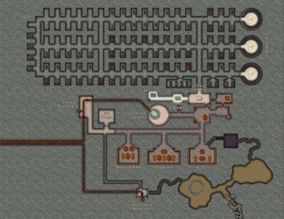
Underground
This is the "show everything" version of the underground map, including removing the lids from the sarcophagi and showing the secret areas that are on the GM's map.

This has a sacristy where the priests can change into their vestments, and a common area where they can assemble, practice their sermons, and get into formation before the religious ceremonies.
This map shows where municipal pipes bring water in for the fountain and the aquagarden (the gardens have a pool with coral and sea anemones). It has a "Purification Chamber" -- I imagine that's used for acolytes to do some sort of ritual purification before they are ordained. There are three libraries: the Muniment Room, where records like births, baptisms, and marriages are stored; the Scriptorum, where scribes transcribe and make copies of books and other records; and the Archives.
Much of this underground area is dedicated to the dead. The Putridarium is the chamber where bodies are cleaned up before burial. The Shrouding Chamber (a term I invented because I couldn't find a better one) is where the deceased are dressed in the attire they will be buried in. And the Chapel of Rest is where they lie in state before being entombed.
Then there are the crypts. There are a few gated tombs but the rest are open niches, with some vacancies in the northwestern area. On the eastern side, there are three circular columbaria, where urns with the ashes of the cremated are maintained.
This version of the map shows that there are secret doors connecting the Water Garden Maintenance Room with the Archives. Could be used for all sorts of things: a crime lord's hideaway, perhaps, or a ritual chamber for an illegal cult. A passageway heading south is caved in. It's just there to give the GM options. It could be easily cleared away to provide access to another underground area, or an escape route out of town. Or it could be permanently closed off if the GM doesn't have a need for it.


-
[WIP] The Candle & Kettle Inn in the village of Mapleford
Here's a first pass at winterizing Mapleford (with the summer version as a comparison):
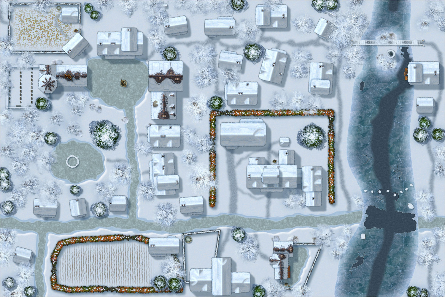
I am in awe of Sue's artistry in designing these annuals -- and what a tremendous gift to RPG gamers to have winter styles that match Forest Trails and Darklands City.


-
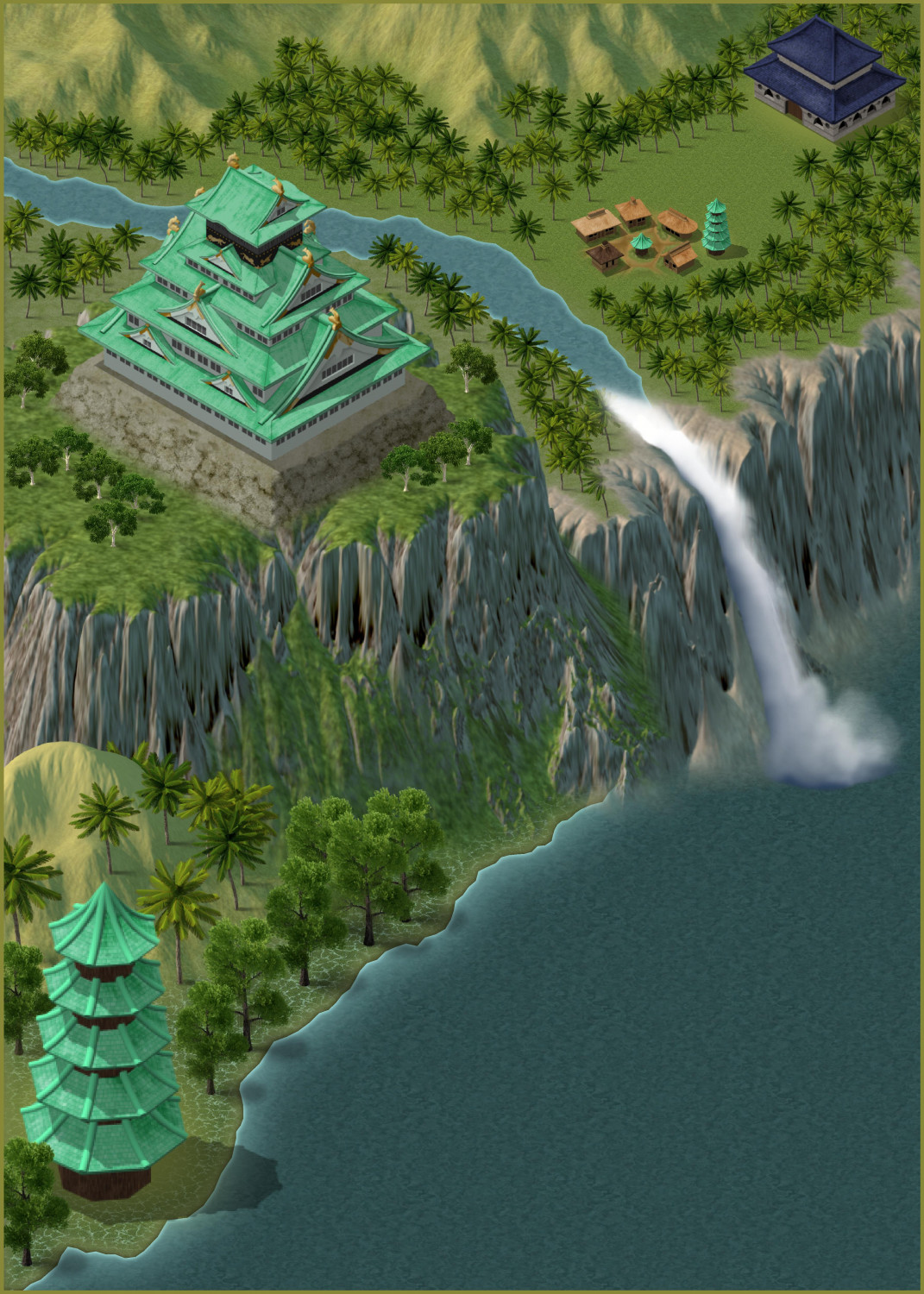
[WIP] Jungle Temple
Using Spectrum Overland, a temple in a tropical jungle...


-
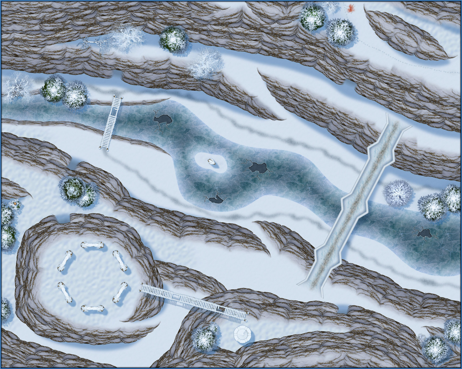
[WIP] Rise of the Crone-Mother
Here's the above-ground areas of the Frostmaidens' Cradle, lair of the alpine hags. The underground areas will make use of the Ice Caverns annual.
-
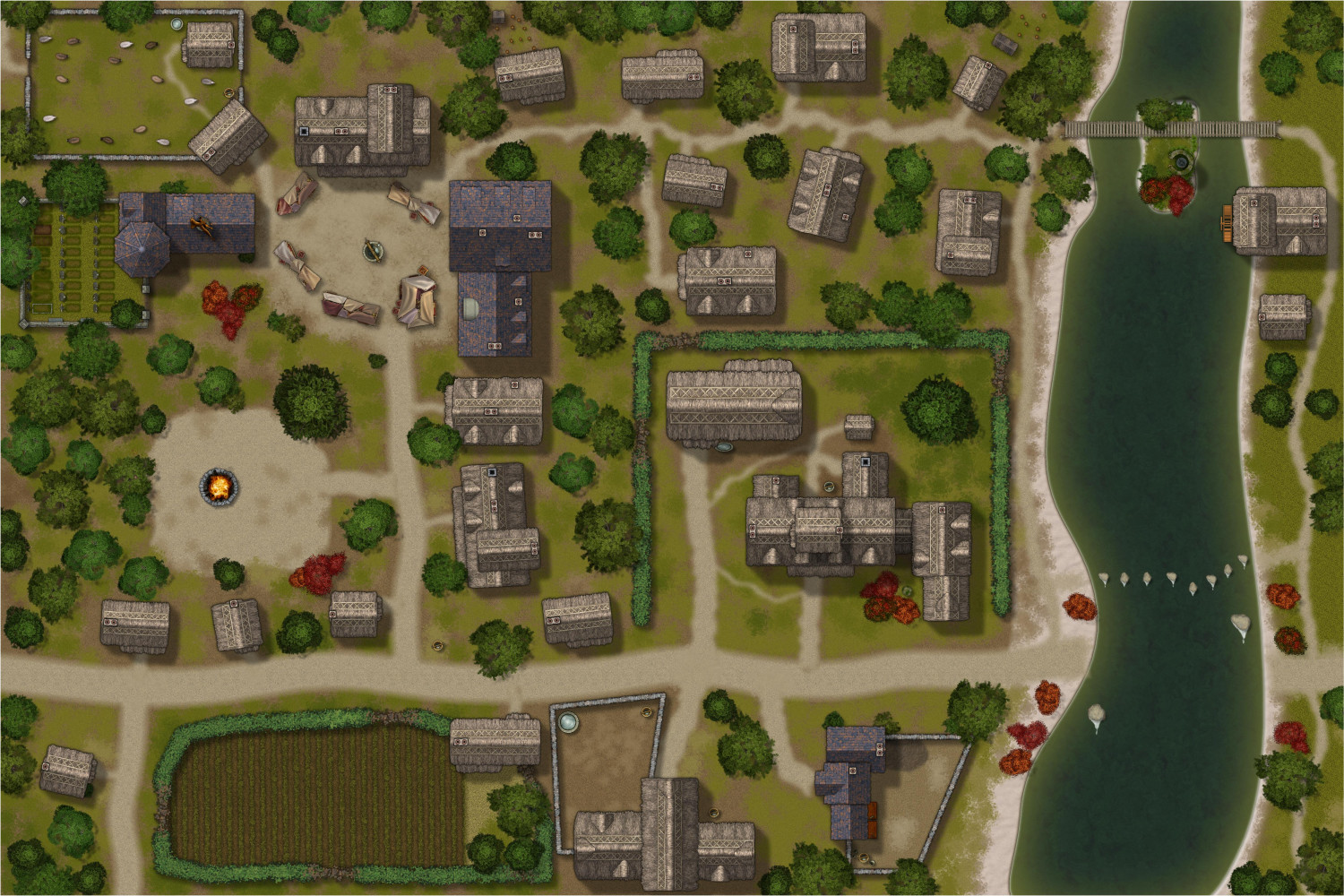
[WIP] Applevale
This is my first pass work-in-progress attempt to create a city map using an overland style (in this case, Handdrawn Fantasy) that Ricko does so magnificently.
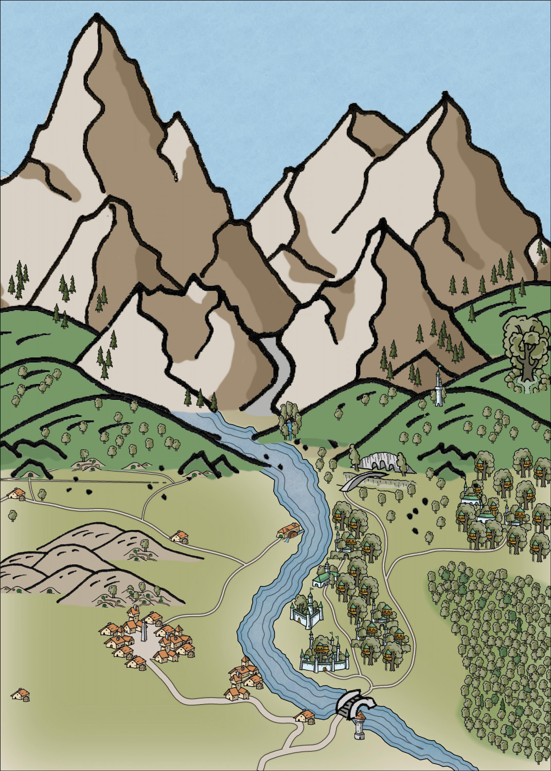
It's meant to be a community of halflings and elves living together harmoniously, albeit mostly on opposite sides of a river.
Not sure if something like this would work for the Atlas because the scaling is tricky (and if it's not suitable, that's okay -- I had fun doing it). The map is set at 5x7 miles but then I had to enlarge a lot of the symbols.


-
[WIP] Community Atlas: Kumarikandam - SE Tiantang Region
Oh, apologies! Can you use this FCW instead? There's one more toggle:
TOGGLE: "SHADOWS" layer to reveal/hide cliff shadows.


-
[WIP] - An audience with the King
I love, love, love Mike Schley's new throne symbols! Had to design a little throne room to show them off.
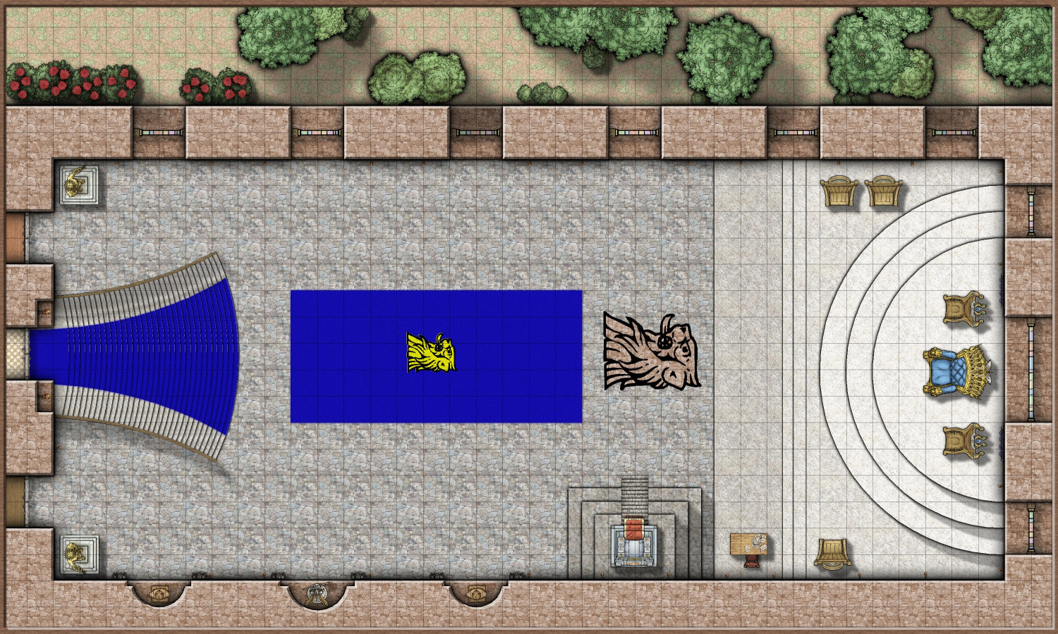
Most of my time was spent on the grand staircase on the western side. There were several possible approaches to getting it to flare out, and also have a carpet runner. Not sure if the approach I took (with heavy use of the Color Key cutout effect) was the best, but it works.
When the King is receiving petitioners, the room is mostly empty of furniture, as courtiers and petitioners are expected to stand. The king is flanked by two smaller thrones for his Queen and Heir Apparent. The Lord Chamberlain and Minister of Protocol are seated on the northern side of the dais, with the Lord Chancellor on the south side near a desk for the Royal Scribe to transcribe proceedings and draft writs and edicts as needed.
Another throne on a small dais is on the south side. This is called the Sedd Peryglus or Siege Perilous. In Arthurian legends, the Siege Perilous was a seat at King Arthur's Round Table that was left vacant for the knight destined to recover the Holy Grail. Here, it is enchanted with a permanent Zone of Truth spell that prevents anyone seated on it from knowingly lying. It is rarely used, for to be asked to sit there is tantamount to being declared a dishonorable oath breaker: swearing an oath to tell the truth should be sufficient for anyone of honor.
In the evening, tables will be brought in for a great feast. But alas! A great calamity is about to befell the kingdom.
A few quick sequel maps to come...

