


Royal Scribe
Royal Scribe
About
- Username
- Royal Scribe
- Joined
- Visits
- 9,944
- Last Active
- Roles
- Member
- Points
- 3,476
- Birthday
- February 5, 1968
- Location
- San Francisco, California
- Website
- https://legacy.drivethrurpg.com/browse/pub/31814/Royal-Scribe-Imaginarium
- Real Name
- Kevin
- Rank
- Mapmaker
- Badges
- 16
Latest Images

Reactions
-
Trouble with Layers, priority, etc.--help?
In fairness, it's an awfully long manual. It's great for reference, but I struggled when I tried to learn the software with just the manual. For me, the video tutorials were very helpful.
One of the things I struggled with, and this may be the same for you, was understanding how layers and sheets differ, and how layers differ from the other art design and desktop publishing software I was more experienced with.
In CC3, layers help with organizing similar things so that you can hide, reveal, or freeze them, but they have no impact on the order in which things are shown. You'll notice that the layers are all listed alphabetically because the order they appear in the list doesn't affect anything.
Sheets have the big impact here. The software renders things in order they appear on the list. In this screenshot, the BACKGROUND would render, then BACKGROUND HILL, then OUTSIDE SHADOW, etc.
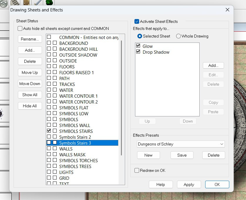
This allows you to control in how your symbols and drawn polygons sort, so that your floor will always be below your furniture, for example.
The Move to Front command only affects things on the same sheet (regardless of layer). If you have two symbols on the SYMBOLS LOW sheet, then the Move to Front command could force that symbol to be on top of the other one. Both symbols, however, will be above any other symbols on the SYMBOLS FLAT sheet (because the SYMBOLS FLAT sheet would render first, and then the SYMBOLS LOW). And both symbols would be below the regular SYMBOLS sheet, because it will render after the SYMBOLS LOW sheet.
Screen captures are always helpful, but I hope this gets you on the right track.


-
[WIP] Swamp Witch
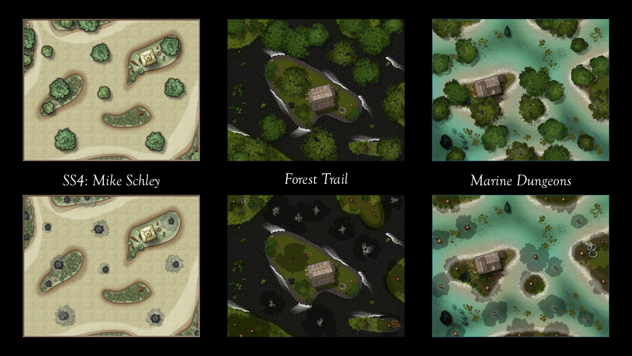
When I was coming up with "spooky season" mapping ideas, I was debating between a haunted house or a witch's lair in a swamp. Why not both?
That required experimenting with some different styles to try to create a swamp. (Let this serve as another plug for a jungle/swamp annual compatible with annuals like Creepy Crypts, Forest Trail, and Marine Dungeons.)
I wasn't sure which way to go...so I ended up doing three versions. One is in the Mike Schley Dungeon (SS4) style, the second used Forest Trails as the basis, and the third used Marine Dungeons (though the second two had to borrow a bit from DD3 and other styles).
I don't know a lot about swamps, but the images I've seen show a lot of trees both on dry land and in the water. In all three versions, I made it so that the tree tops could be hidden, both to create a battlemap version and also to show that some of the trees were growing out of the water and not just from patches of solid land.
Here are all three side by side, and then in the comments I will show each one in more detail.


-
[WIP] - An audience with the King
Oh no! Calamity! In the immortal words of Nancy Sinatra:
You keep playin' where you shouldn't be playin'
And you keep thinking that you'll never get burnt, ha!
Looks like someone's been messin' where the shouldn't have been a messin'.
And it gave me an opportunity to use not only the evil and broken thrones, but also some of Mike's other symbols from this year that I haven't had a chance to use yet.

-
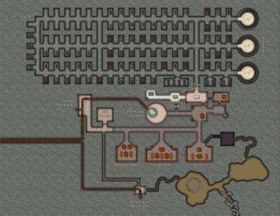
Seven Pines Lodge (1930s Floorplan)
Separate entrance for privacy makes sense.
I have done maps where I have discovered that I forgot to put in entrances to certain rooms. (My Sea Elves Outpost had three rooms with that problem!) Fortunately, the Color Key effect can solve that problem. If you look at the Outpost on the Atlas, you’d never know which rooms had forgotten doorways (until you turn off sheet effects, that is.)
-
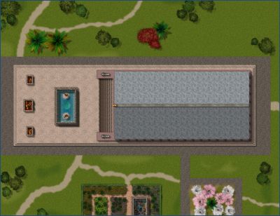
A small carpenter store
It's really great. I particularly like how you did the fence posts and railing. I can't think of anything I'd change or add.

-
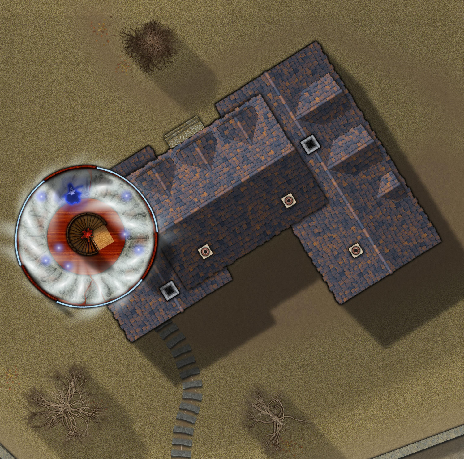
[WIP] Haunted Mansion
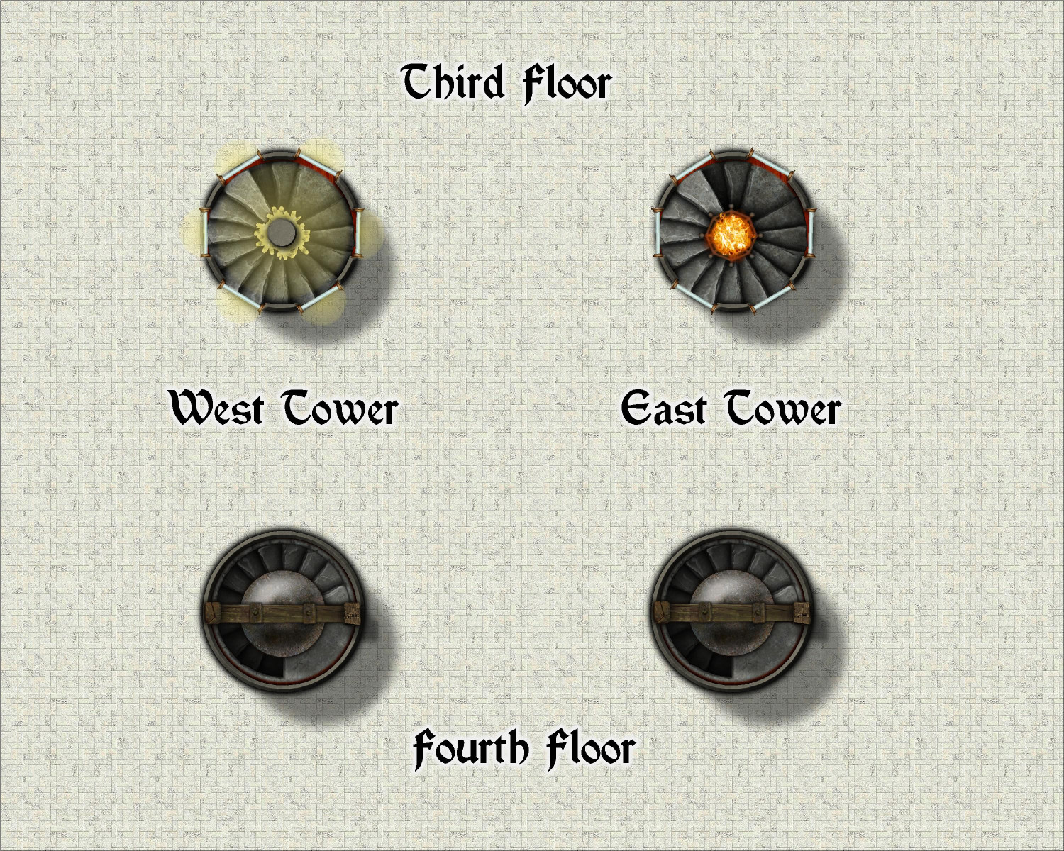
And here's the third and fourth levels of the church. The main part of the church is covered by a dome, but it's all open air from the balconies up. The only portions with stairs going higher than the second floor balconies are the two towers on the southern side.
Level three of the towers has a light source shining through the windows, like mini-lighthouses. I like the look of the brazier on the right, but it didn't quite make sense unless it was on the top floor (where I put bells). Even if it were something like the DND Continual Flame spell, where the magical fire emits light but not heat or smoke, it still doesn't make sense if it engulfs the inner wall of a stairwell that is continuing up. So I did an alternate version on the left side using luminescent crystals.
And then there are great bells on the fourth floor of the towers, which come from Dundjinni Archives.

-
[WIP] Haunted Mansion
Top story of the tower. On to the wine cellar (and the rest of the basement).

-
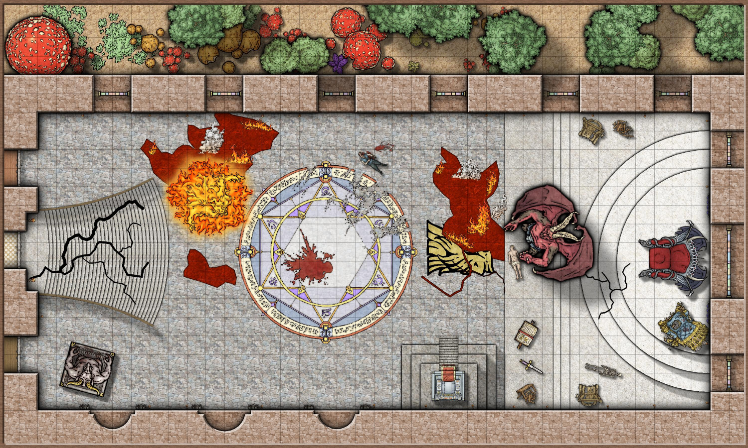
[WIP] Lair of the Red Wyrme
Maybe that’s what took out the one at the base of the erupting volcano.
-
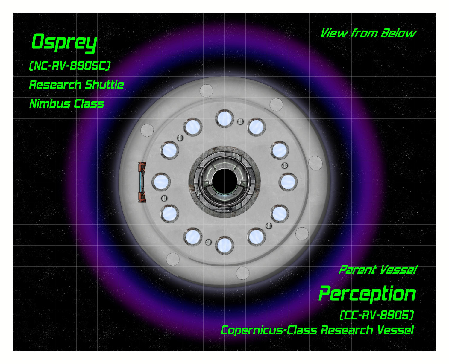
[WIP] Research Saucer Shuttle
Here is the saucer shuttle from below.
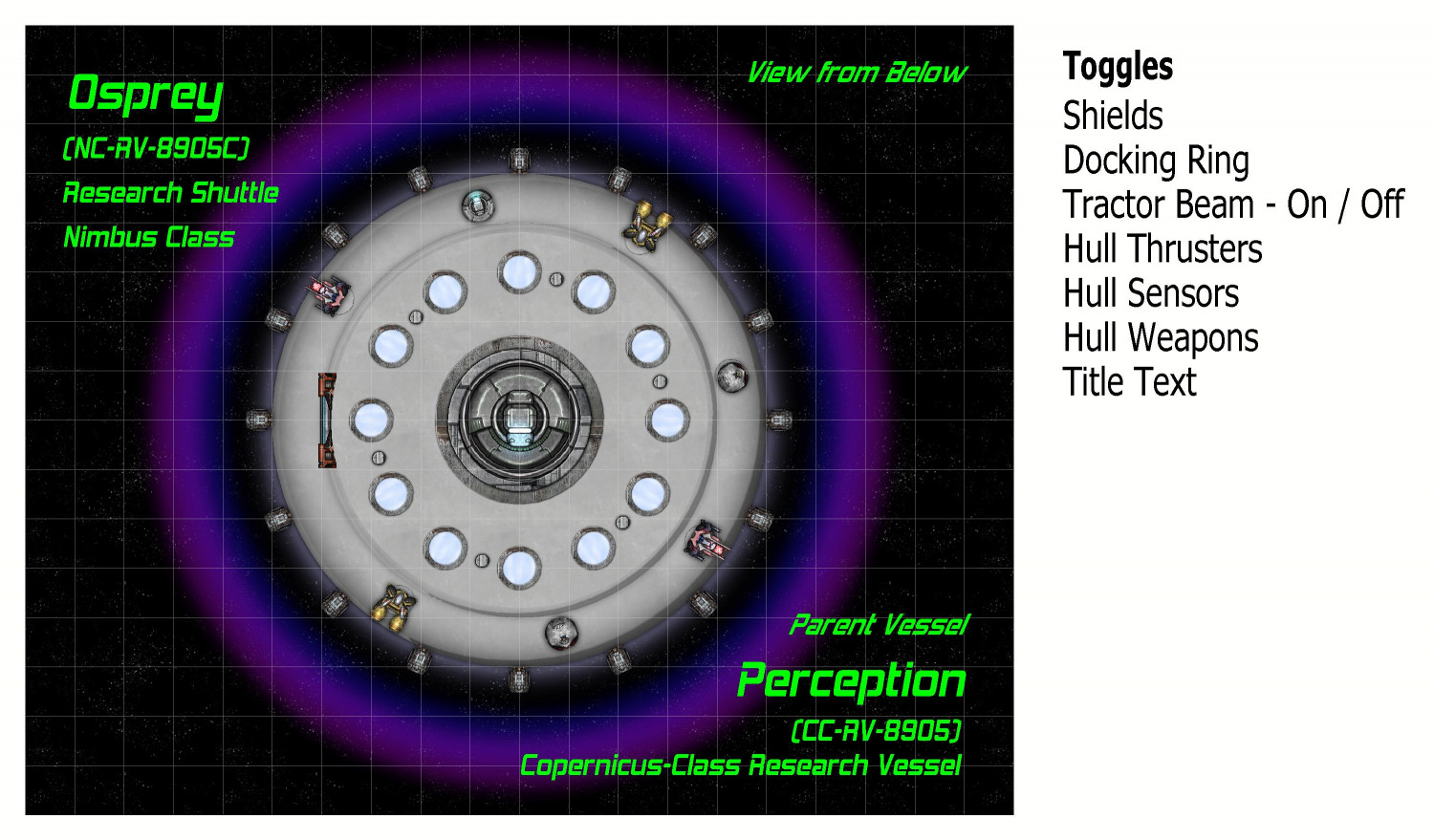
I named this shuttle The Osprey. It is of a class of saucer ships that I've named a Nimbus Class. These shuttles are assigned to either a space station or larger interstellar vessel. In this case, it is part of The Perception, a research ship from a class of ships that I am calling the Copernicus Class.
On the left side, the airlock hatch can be opened planetside to extend a ramp. The very center has a docking ring for connecting to The Perception or other vessels or space stations. The twelve glowing disks are meant to be some sort of magnetic propulsion thrusters (the side thrusters are more for steering and course correction, not liftoff or acceleration). They were made using one of the sun symbols that come with Cosmographer. And the six metal disks are meant to be places where retractable legs can extend when on planet.
The text labels on the right are for toggles in the FCW file. They are off the map border and normally don't print, but I wanted to show it to you. They are mostly on/off toggles, but the Tractor Beam is a little more complex, which I will get to. Here is the syntax for the thrusters, as demonstrated in Remy @Monsen's recent Village Battlemap tutorial. It toggles between hiding and unhiding the layer called "Symbols - Thrusters".
GOLAYER BACKGROUND
TOGL Symbols - Thrusters
NULL
As Remy's tutorial explains, the GOLAYER line is done to make sure you aren't on the layer you're trying to hide, because active layers cannot be hidden. And the NULL line is to make sure that toggling a layer is not your most recent command.
Here's the map with the center docking ring open:
The docking ring is actually two separate symbols, with the closed hatch symbol on top of the open hatch. The "Docking Ring" toggle hides or unhides the sheet that the closed hatch symbol is on, allowing the hatch to go back and forth between open and closed.
In addition to using the center hatch for docking with other vessels, a tractor beam can be activated to lift cargo or specimens into the shuttle (like cows or battered pickup trucks in the deserts of Nevada). Here is the tractor beam activated (it's one of the varicolor suns):
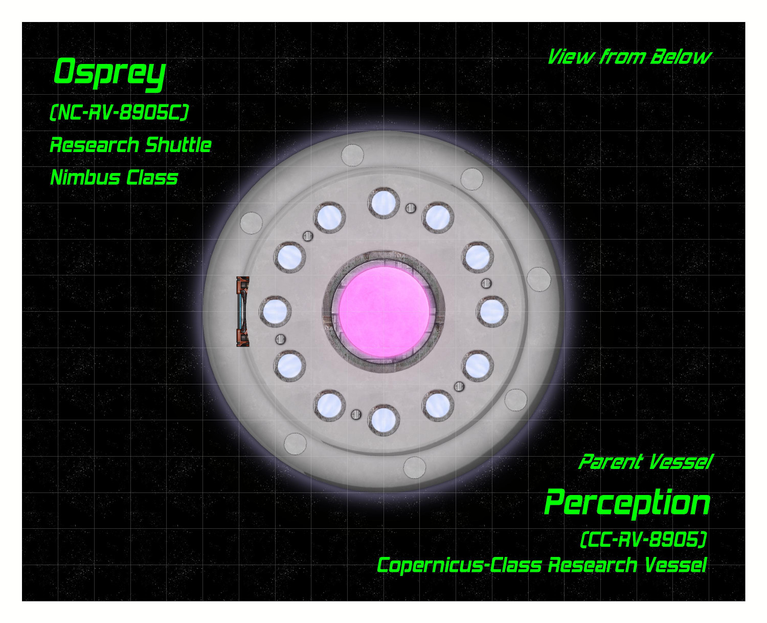
The toggling of the tractor beam was a little tricky. I suppose I could have made it just be on top of the hatch symbols, but I decided to make it as separate "on" and "off" options. Clicking "on" simultaneous hides the layer that both docking hatch symbols are on while unhiding the layer that the tractor beam is on. Here's the syntax for turning it on:
GOLAYER BACKGROUND
HIDE Docking Hatch
SHOW Tractor Beam
NULL
Clicking the "Off" link reverses this, hiding the tractor beam layer and showing the docking hatch layer.
On to the Habitat and Engineering decks!

-
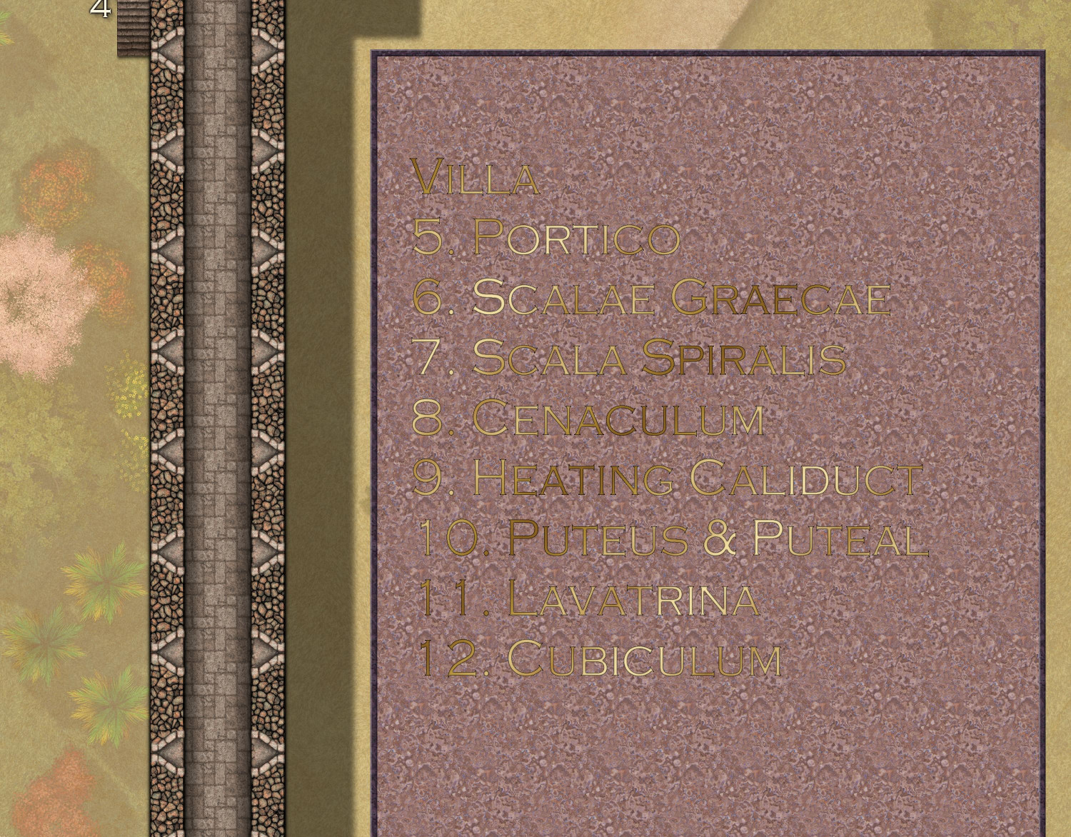
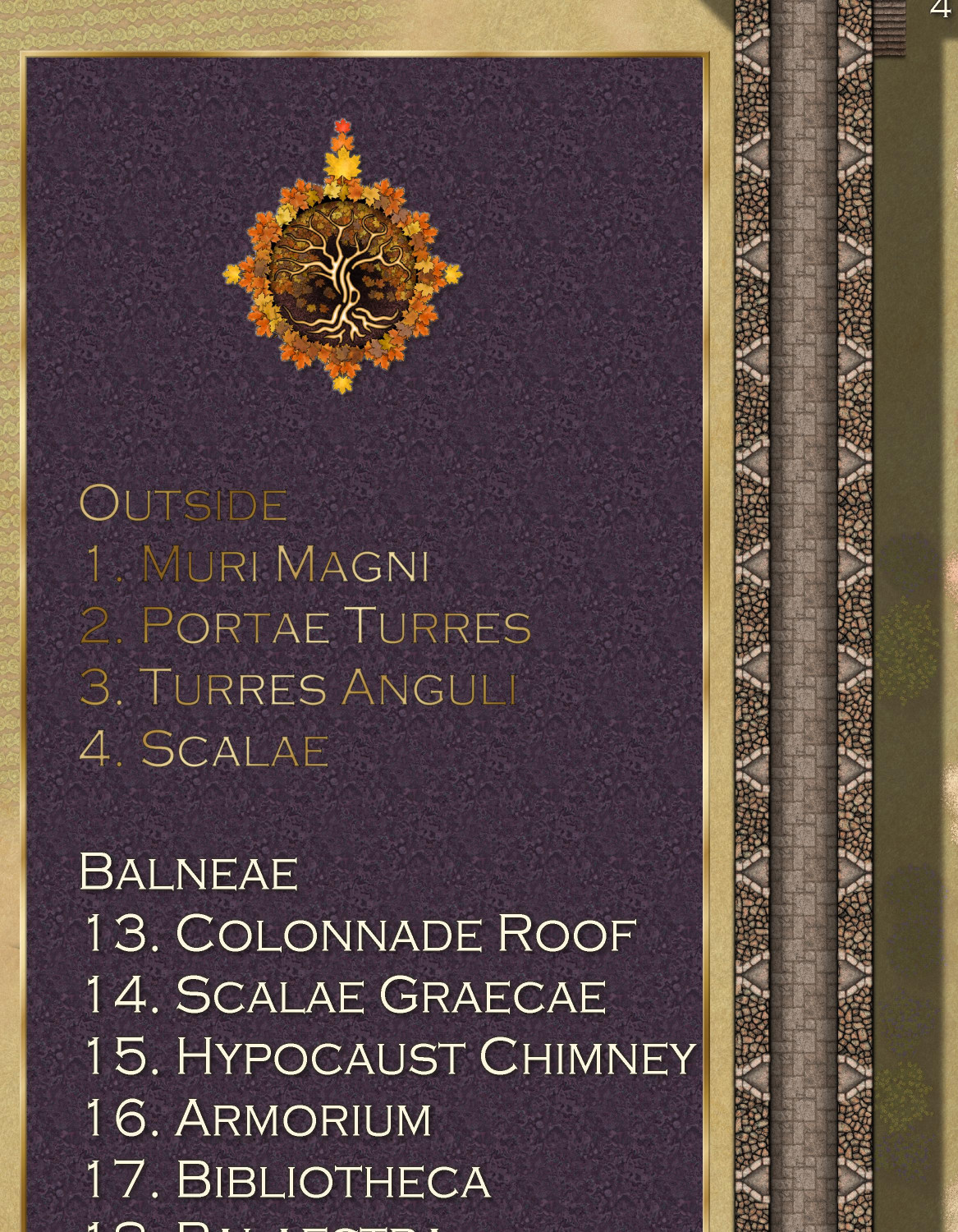
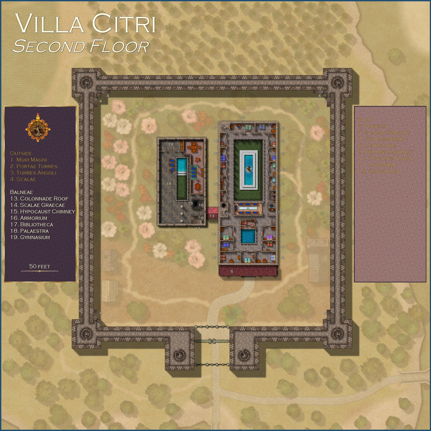
[WIP] Villa Citri (Roman-style villa)
I'm still toying with the idea of making the legend's text look like it's engraved, but I'm not sure if it shows up well enough?
I tried it out with Marine Dungeon's brass inlay that I love so much. Here it is with both the red marble on the right side and the black marble on the left (with the original colored text as a comparison). It looks good on the dark marble but only if you're zoomed in.
And then I tried it again with a goldleaf fill. As much as I love the brass (plus it's native to Marine Dungeons, so it's not added another annual to the mix), the goldleaf may be a little easier to read because it doesn't have the reflected light effect. This one also only really works with the darkest marble.
Brass Inlay

Goldleaf
Thoughts?


