


Royal Scribe
Royal Scribe
About
- Username
- Royal Scribe
- Joined
- Visits
- 9,940
- Last Active
- Roles
- Member
- Points
- 3,476
- Birthday
- February 5, 1968
- Location
- San Francisco, California
- Website
- https://legacy.drivethrurpg.com/browse/pub/31814/Royal-Scribe-Imaginarium
- Real Name
- Kevin
- Rank
- Mapmaker
- Badges
- 16
Latest Images

Reactions
-
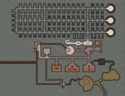
[WIP] The Sewers of Elmsbrook Township
These are the sewers for Elmsbrook, a town in the human kingdom of Powys in my campaign world. They’re intended to be fairly representative on the sewer systems in my kingdom – smaller villages might have a simpler system, but larger cities will have the same basic layout, but with more extensive canals.
I was hoping to get this done the same month that Sinister Sewers was released, and I barely did it. I still have work to do, and advice to collect, but thought I would post where this stands.
By the way, Sue: it worked putting everything for each level on its own layer, making it easy to display or hide different levels as needed.
In addition to using the symbols and fills from Sinister Sewers, this also uses a few things from Marine Dungeons (particularly the stairs and the bell at the bottom of the pit), and a few things from Forest Trails (leaves, the trees along the beach, and maybe some of the fills) and Creepy Crypts. Also: Sue spent a lot of time helping me come up with a technique to show clear water, but it really worked best close-up. At this scale, it made it look like black water. I ended up using a water fill from Creepy Crypts, but on its own water sheet with a 50% transparency effect added.
In my campaign world, fastidious elves have long understood at a high level the correlation between hygiene, sanitation, and the spread of diseases. (Even if they don’t have the tools to study microbiology and virology, they can study commonalities in infected populations to identify vectors of disease.) Dwarves first developed aqueducts and sewer technology. And it is said that orcs pioneered the use of flesh-eating oozes for waste management.
Oozes are amorphous creatures with an intelligence no greater than an ordinary garden slug, flowing through subterranean lairs to devour any creature or object they can dissolve while shunning things that provoke their flight reflex, like bright lights and extreme temperatures. I have made a few tweaks to oozes in my campaign world to make them better suited for deploying in sewers. I added immunity to poison and diseases. I also added a weakness: sunlight hypersensitivity where, like vampires, they can be damaged by exposure to sunlight. (This is why they avoid bright lights: a bright lantern won’t harm them, but it still triggers their flight reflex.) Sunlight can kill an ooze, causing their acids to neutralize and their bodily remains to collapse into a nutrient-rich goo that farmers often use to fertilize their crops.
Some items of note about specific oozes used in sanitation systems. Gelatinous Cubes can dissolve nonmagical soft tissue and vegetation, leaving behind undissolved bones, metal, glass, stone, and magical items of any sort, along with excess water stripped of anything edible. They cannot climb but can move up slopes with a grade of 25 degrees or less. Moving up a slope with a grade of 10 degrees or more requires the Cube to expel any indigestible materials or excess water. Black Puddings are far more dangerous. In addition to dissolving soft tissue and vegetation, they can also dissolve nonmagical bones, metal, but cannot dissolve glass, stone, or magical items. They can also climb any surface, even upside down. Sanitation workers employ bright lights to keep Black Puddings from escaping (and an ample food supply keeps them from seeking to escape). And finally, I created a new ooze called a Voracious Sullage. It’s a slow-moving, weaker version of the Gelatinous Cube, unable to maintain a cubic shape. It tends to stretch itself across small waterways so that anything edible flows to it (and anything it can’t eat gets expelled on the other side).
Here's a quick summary of how the sanitation system works. More specifics for each level of the sewer system will follow in the comments.
Surface (not shown): Storm drains at the intersections of major streets, with a manhole cover at one of the corners than allows maintenance workers to descend using rungs. There is also a large Waste Management Facility where residents can dispose of large objects that cannot be repaired or repurposed (such as items that cannot be chopped up for kindling). Maintenance workers throw these items into a giant pit nicknamed the Great Maw that is about 140 feet in diameter. The surface of this pit is in a building that is covered at night but open to the sky during the day. Bright luminescent crystals are placed near the mouth of the pit to frighten away the Black Pudding at the bottom of the pit.
Level 1: This level is immediately below the surface. Storm drains at major intersections deposit rainwater (along with other debris) here, where they run off to chutes that bring wastewater to Level 2.
Level 2: Wastewater from Level 1 is deposited here, where it helps push through human waste from outhouses and latrines that are connected to the sewer system. This sewage flows through chutes down to Level 3.
Level 3: Waste brought in from Levels 1 and 2 are treated here in two great chambers called Auditoriums. Numerous Gelatinous Cubes gobble up the waste, leaving behind items they cannot digest, and now-clean water stripped of contaminants. This purified water drops through chutes to Level 4.
Level 4: Primarily a passthrough level, and the lowest level that maintenance workers normally go.
Level 5: A Black Pudding lives at the base on the Great Maw, devouring any waste thrown into the pit. It can eat nonmagical flesh, vegetation, and metal, but cannot digest stone, glass, or magical objects of any sort. Water purified in Level 3 descends to this level, where some passes directly to the sea and the rest is used to flush out anything the Black Pudding cannot digest.
More details for each level in the comments.


-
[WIP] - The Griffon's Eyrie
I've been working on a larger dungeon map, but to take a little break, I decided to do an adventure map, a griffon's nest. I wanted it to be sort of isometric using an overland style, and ended up choosing a style I haven't worked with much before: Darkland Overland. I struggled with the nest and ended up turning to SS6, Mike Schley's isometric city style, using some varicolor hedges and hay bales (with some SS4 dragon eggs thrown in).
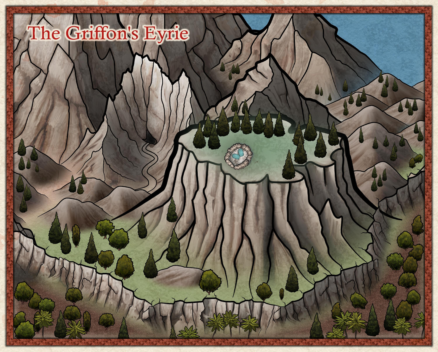
I may try it again in another style. Maybe Spectrum Overland? Or maybe a zoomed-in encounter map, but that will probably come after I finish the dungeon map I'm currently working on.


-
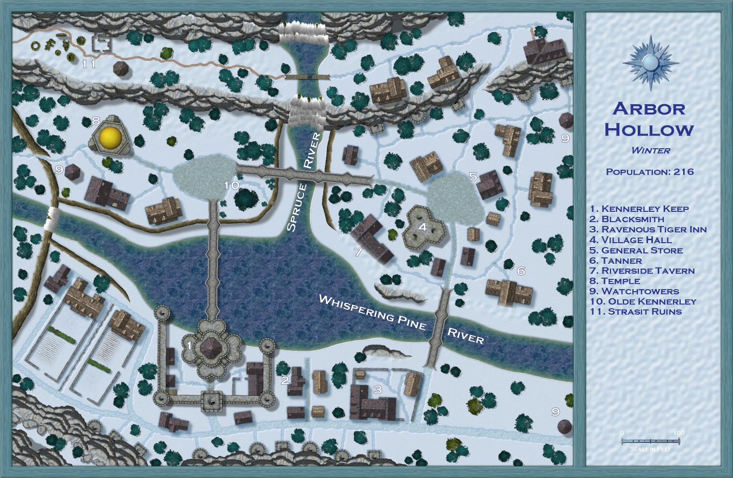
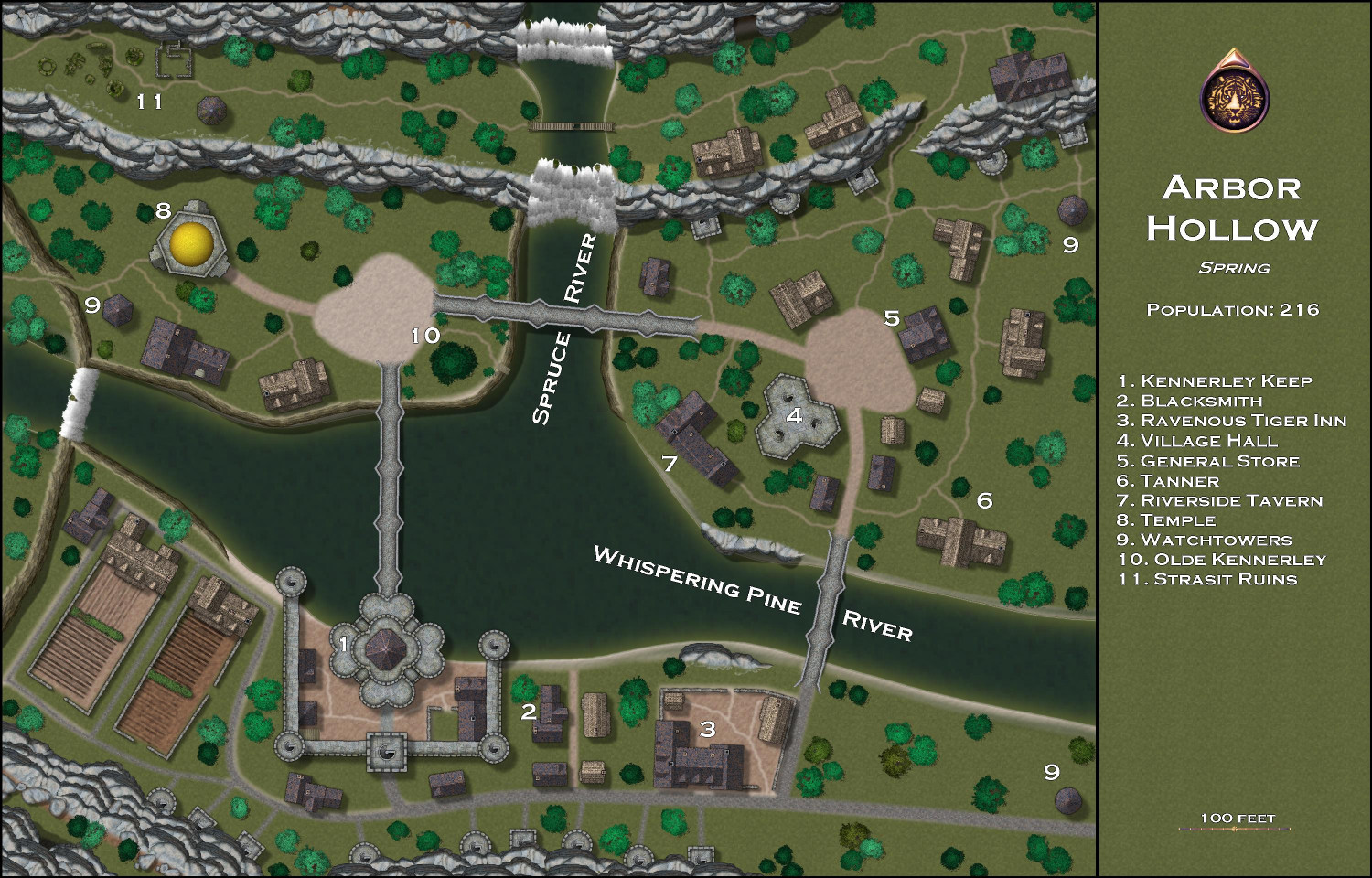
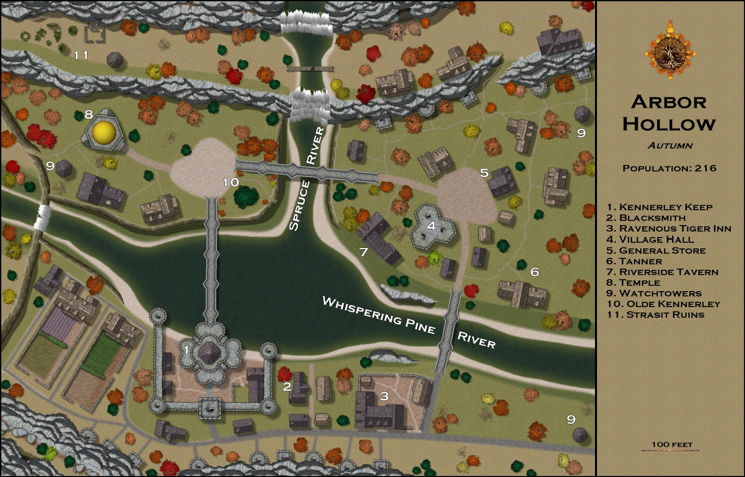
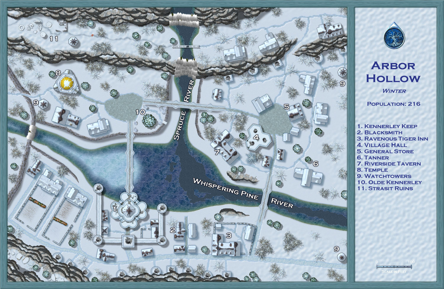
[WIP] Atlas Contest (potentially) - Arbor Hollow (summer, autumn, winter, spring)
Here is Winter so far. Still tons to do, but I've managed to get everything on their correct sheets, I think, and the imported sheets in the correct order. Converted the rivers to the iced-over versions. I will add breaks and cracks from Winter Trails later to the Spruce River and the lower part of Whispering Pines River, and then frost to the upper part of Whispering Pines River. Converted the paved roads to the default winter roads, and the dirt ones to the winter muddy roads. (You'll notice that one path at the ruins in #11 hasn't been converted yet. When I start to bring in style features from Winter Trails, I will make that into a path or maybe footsteps. Converted the crops to snow-covered counterparts. But the biggest changes are yet to come: swapping out the building, tree, and other symbols for their winter counterparts. I will have to look at the sample maps with the annual to get ideas for how to better display the label numbers.


-
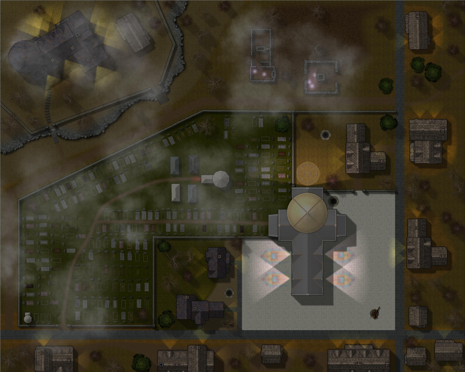
[WIP] Haunted Mansion
Here's a look at it at night, with lights added. I experimented with adding a moon like Jeff B did with his contest entry, but it was creating weird banding effects that I couldn't resolve. Instead, I played with the Shadow-Transparency in the Global Sun settings.
This is 35:
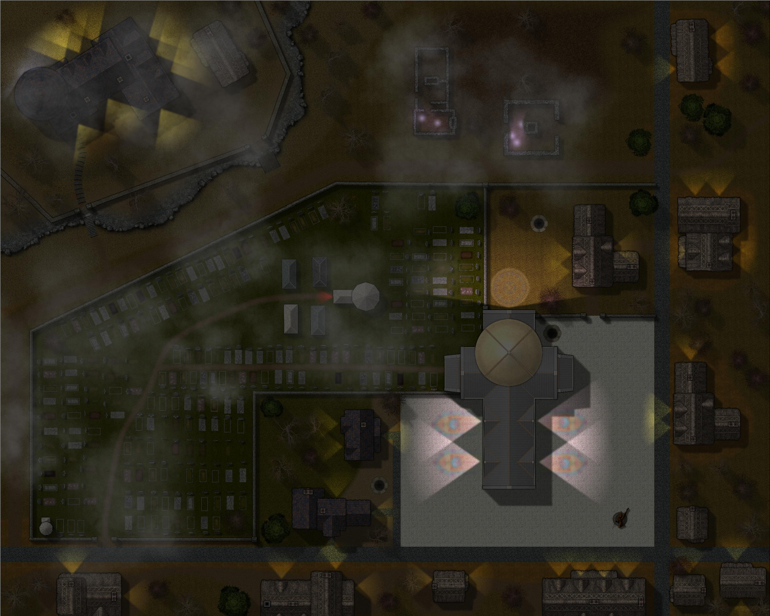
This is 50:
-
Community Atlas submissions: the Gold Coast (Doriant) and areas within it
Been out of commission with the flu the last few days, but on the mend now. I wanted to submit the Spring, Autumn, and Winter versions of my village of Arbor Hollow in case Remy finds it easier to process them at the same time as the Summer version, which was submitted as part of the Atlas contest.
Here are images, followed by the FCW files. The description is the same for each, but I will provide again here anyway.
-
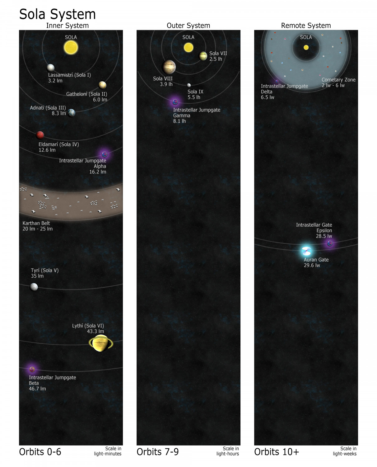
The Sola System: Adnati's star and celestial neighbors
Made some changes. Scaled the starfield background per Ralf's tip. Moved the asteroid belt to the Inner System where it could be showed off more dramatically. Added a comet zone in the Remote System, using comets from CA80 HighSpace Star Systems. Changed the glow on the wormhole to a light blue so it would pop more. Decided to add some intrastellar jumpgates (like man-made wormholes) within the solar system, and for those I used Singularity symbols from CA80. And since I was already dipping into that annual anyway, I decided to swap out the planet symbol for the Jupiter-like planet Lythí and replace it with a planet symbol with rings from CA80.


-
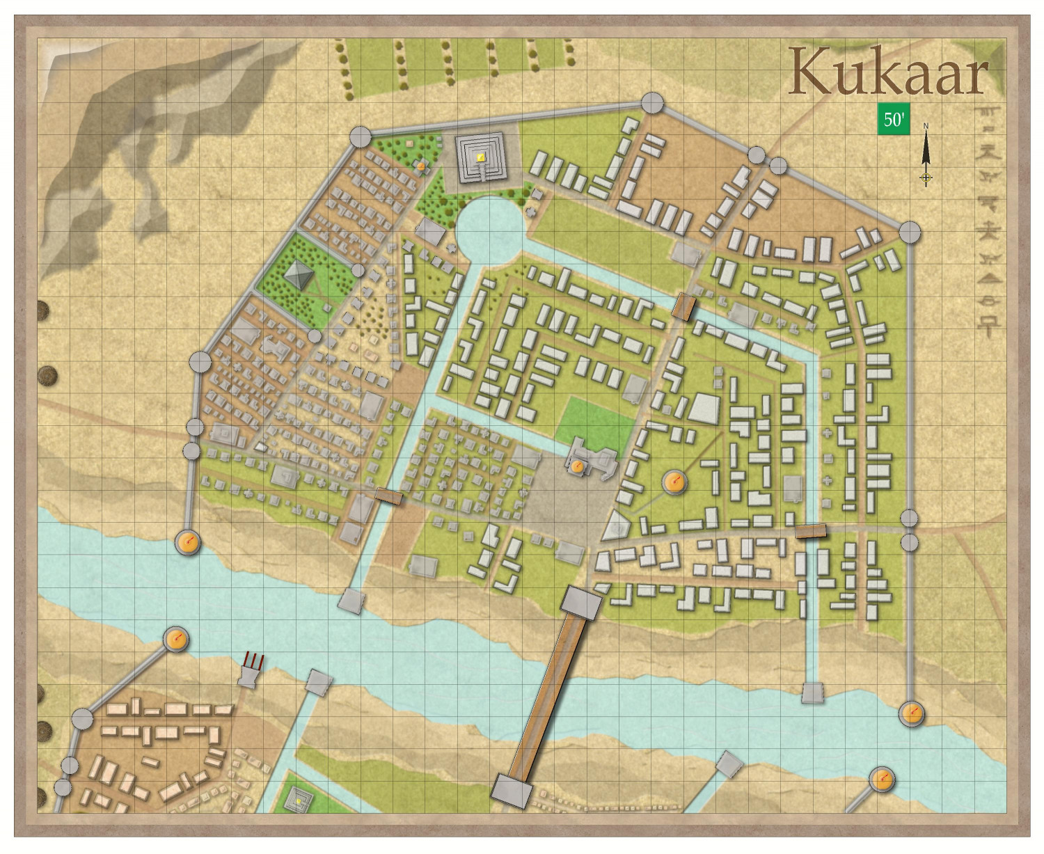
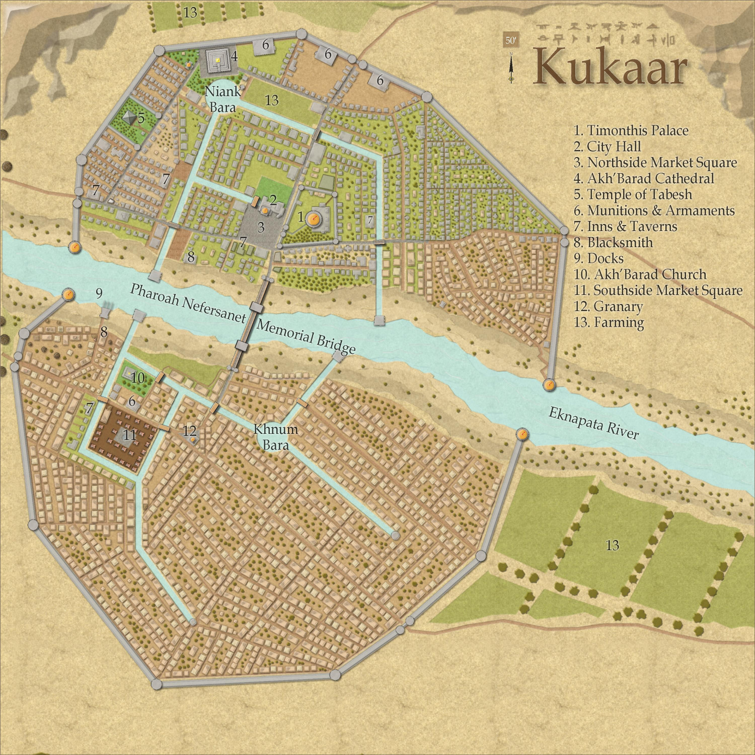
[WIP] Town of Kukaar (Ancient Cities Annual)
Slight tweak. Something was bothering me with some of the houses southwest of the circular part of the canals. Upon inspection, I discovered that those houses built with the Random Streets tool ended up on the BUILDINGS HIGHER sheet. I removed them entirely and replaced them with the house symbols on the appropriate BUILDINGS sheet. Let me know if you see anything else that looks off.

-
[WIP] The Candle & Kettle Inn in the village of Mapleford
Here's my Winter Solstice Holiday celebration map for the inn's main socializing room.
The idea is that their Winter Solstice celebration is a festival of lights -- light to banish the darkness on the longest night of the year, and light to welcome back the sun as the days start to get progressively longer. Trees get decorated with lights. Some use candles chemically treated to glow with different colors, but I'm going to say that the inn uses small scraps of luminescent crystals for their ornaments, decorating the outdoor fir tree, the hedges, and a smaller fir tree that was cut down and brought inside. The ornaments are the varicolor Will-o'-Wisp symbols from Creepy Crypts, which automatically go on a Symbols Torches sheet.
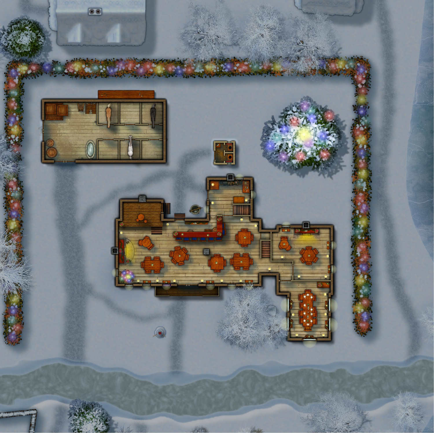
With this zoomed in version, you can see more of the decorations. The "poinsettias" are potted plants from DD3, with a small varicolor red DD3 bush dropped on top. We'll pretend that the ivy symbols I used for the greenery on the mantles is actually either fir branches or boughs of holly. There are a few chests beneath the tree inside, as this is a gift-giving holiday. And on benches set at most of the windows, a candle has been lit to banish the dark and welcome back the sun.
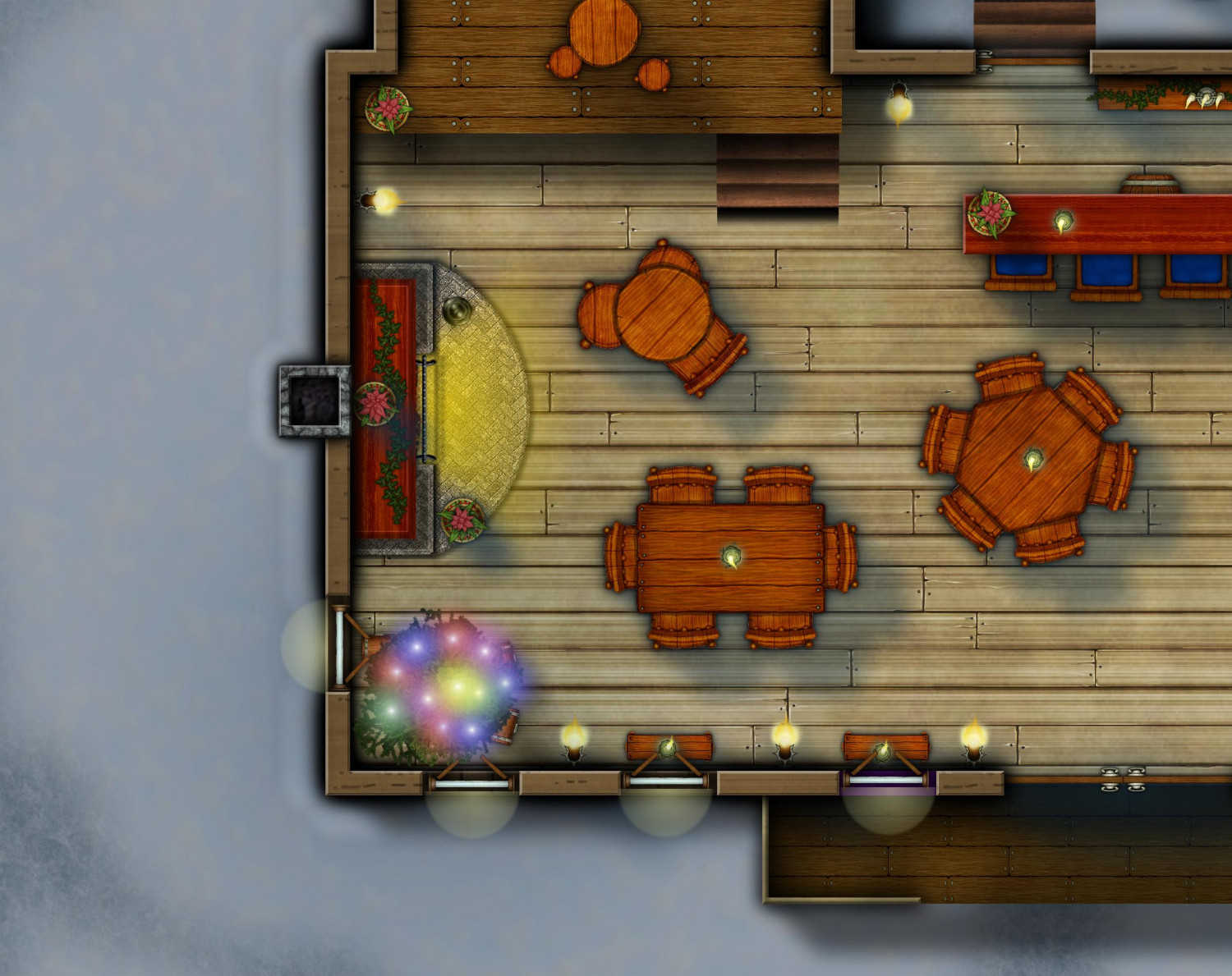
I plan to print these as 40x40 battlemap tiles, which means that CC3's lighting effects might get wonky if the light effect extends past a tile's border. So instead, I fudged it by layering a Solid 30 polygon over everything (except the Symbols Torches sheet) to simulate dusk. I then added the Color Key sheet effect to that sheet, copied the floors from the inn, barn, and privy to the Shadow sheet, and then turned them into a magenta polygon so that the insides were shown without the dusk. The glows from the windows are DD3 symbols.

-
Wish List: City/Dungeon Top-Down Mountain Peaks, Ridges & Crags
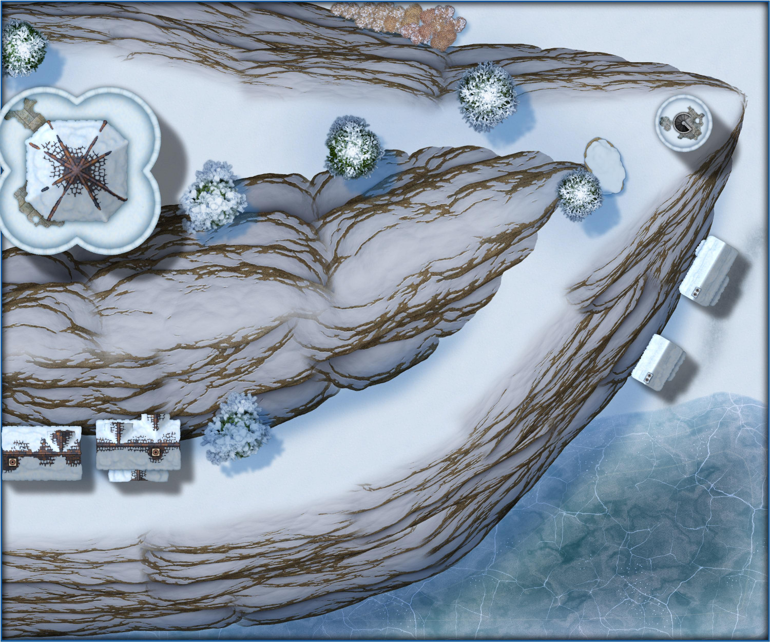
And not that we had any reason to think Winter Trail/Winter Village would be different, but just for fun, here's a sliver of an alpine village.
-
[Atlas Submission] - Doriant - Gold Coast - Eknapata Desert - Kukaar
Hi Remy @Monsen!
I have discovered an Atlas submission for the city of Kukaar that I either failed to tag you in or quite possibly failed to submit at all. My Apologies! This is ready to be added at your leisure.
This is for Doriant - Gold Coast - Eknapata Desert - Kukaar. You'll find Kukaar in pretty much the center of the Eknapata Desert map. It does not have an unusual toggles.
Thank you!


