Royal Scribe
Royal Scribe
About
- Username
- Royal Scribe
- Joined
- Visits
- 9,528
- Last Active
- Roles
- Member
- Points
- 3,353
- Birthday
- February 5, 1968
- Location
- San Francisco, California
- Website
- https://legacy.drivethrurpg.com/browse/pub/31814/Royal-Scribe-Imaginarium
- Real Name
- Kevin
- Rank
- Mapmaker
- Badges
- 16
Latest Images


Reactions
-
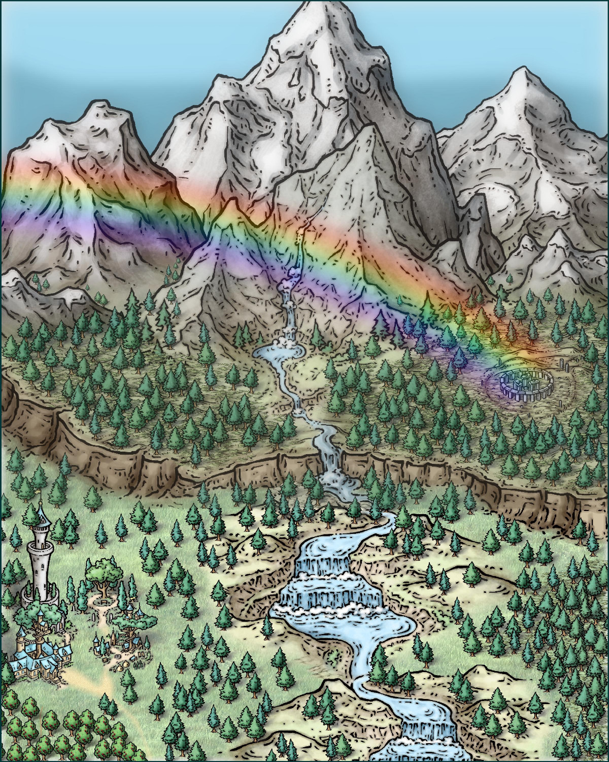
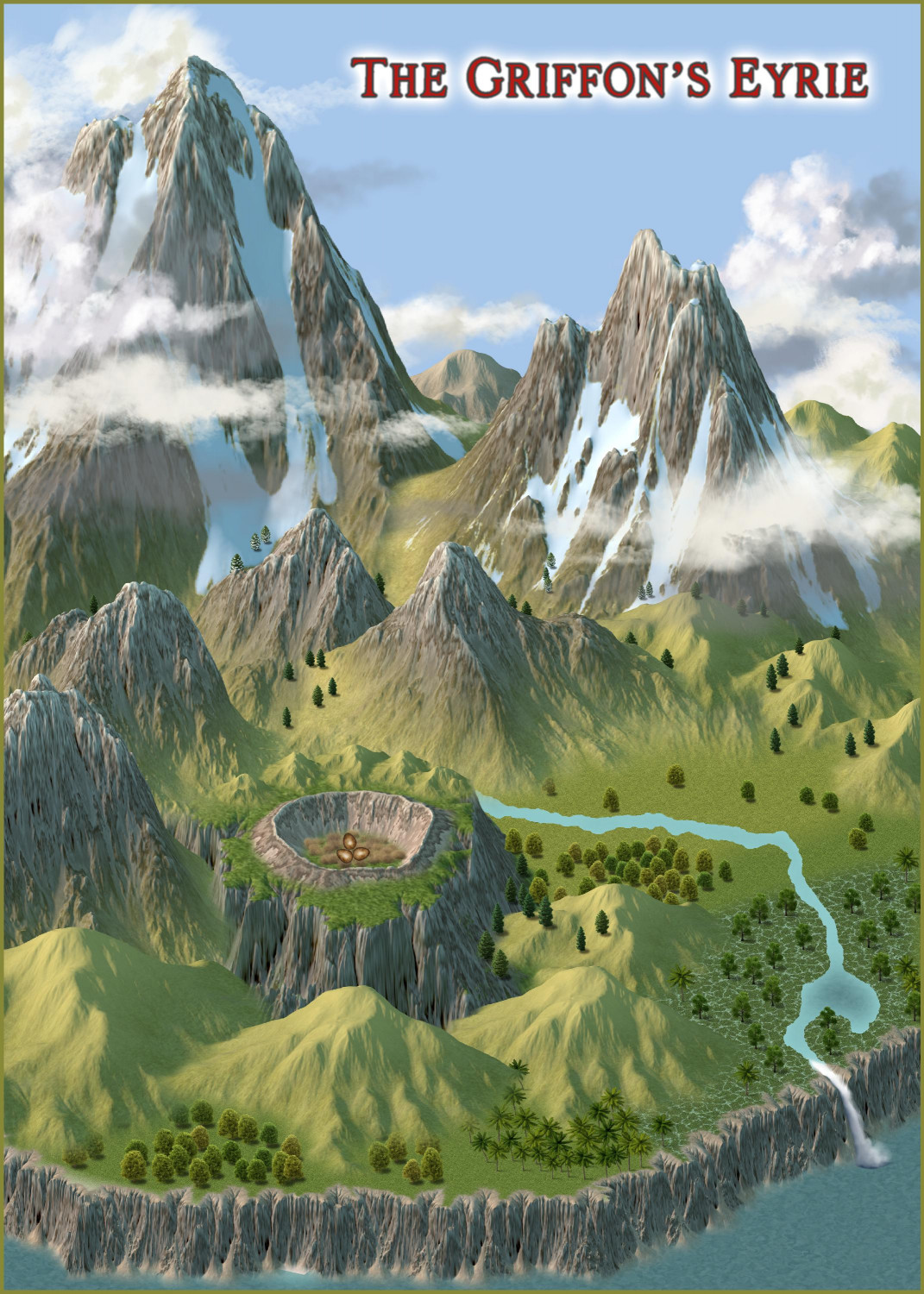
[WIP] The Griffon's Eyrie Redux: Spectrum Overland
Haven't had much time to get back to it, but here's a slight tweak. Added some trees, made the sky bluer, but the big change was to the lake. I wasn't fond of how it looked like the waterfall stuck into the lake, so now the river pools into a lake but then continues as a river until rushing rapids leads to a waterfall off the cliff.


-
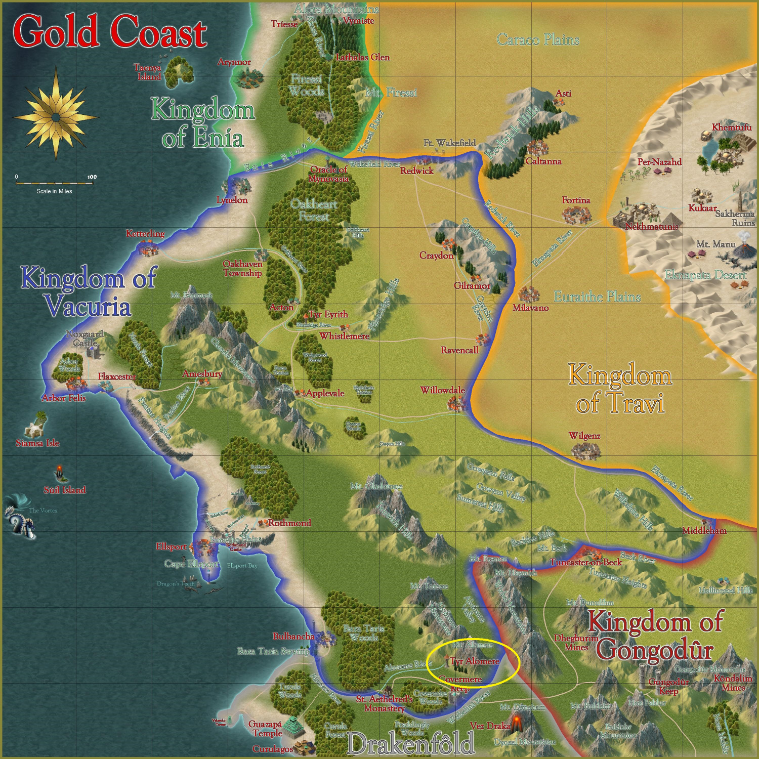
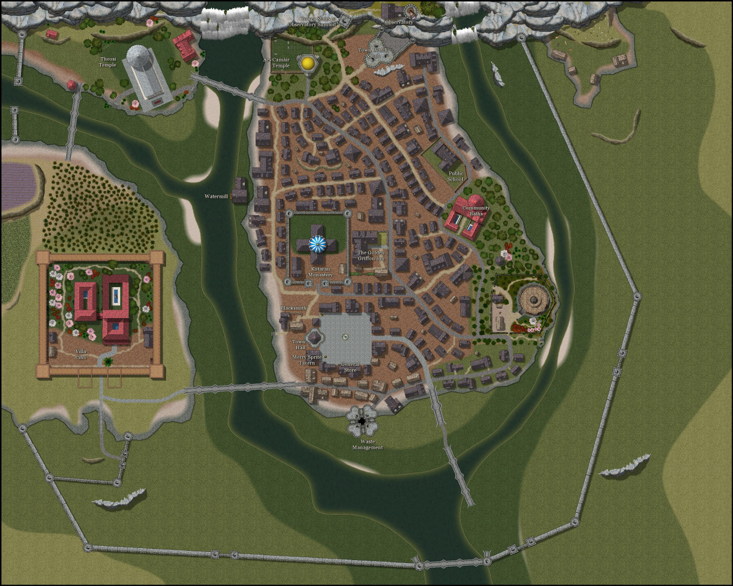
[WIP] Tyr Alomere Township
I have been out of town this week with family distractions, but I also had the week off of work, so I had a little time to dabble in mapping. I have been working on a township around the wizard's tower I mapped (you can find the exterior and interior maps of the tower in separate threads).
This is intended for the Atlas, in the Gold Coast region on the edges of the Kingdom of Vacturia, nestled in the foothills beneath Mt. Alomere. It is circled in yellow here:
The wizard's tower has been handed down through many generations to one of the wizard's apprentices (often but not always one of the wizard's own children). The town's economy has grown up around the presence of a mighty wizard in residence -- specifically catering to the adventurers and travelers who pass through. Many seek out the wizard for advice on an upcoming quest, or to decipher a prophesy. Some seek to have curses removed, magic items identified, or to stock up on potions and scrolls. The town, too, caters to the adventurers by providing services used by many adventurers. The blacksmith in particular has a busy trade not only in mending armor but also reselling used armor and arms bought from adventurers.
Since the town is in the foothills, I wanted to do some elevation changes. The wizard's tower was built on a Creepy Crypts base, so I continued with that, but also added cliffs and outcrops from Forest Trails and Darklands City.
I have been wanting to do a Roman-style villa for a while, so I decided to create a place for it here. I have added the RGB Matrix effect to the sheets the villa is on to make the Darklands City roof tiles redder.
I still have more to do, particularly thatched houses and farms closer to the walls. I wrote in labels but will replace them with larger numbers, with a legend off to the side.
Anyway, here's the township so far.


-
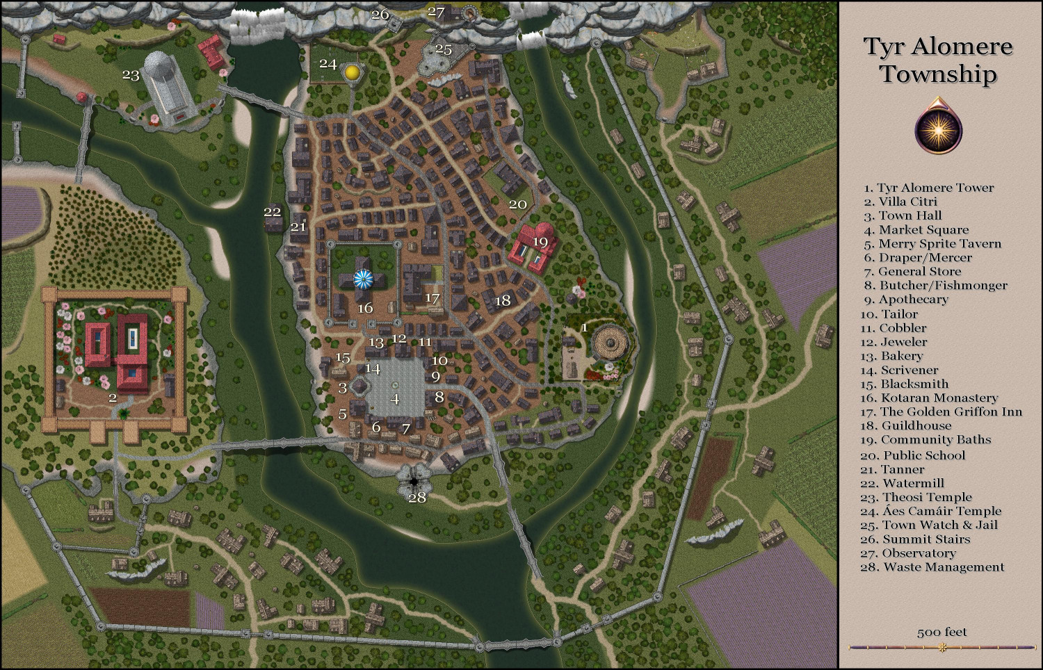
[WIP] Tyr Alomere Township
Properly labeled now.
Have to write up the full description, then do the same with all of the Wizard's Tower files, to get it ready to submit for the Atlas. I also want to design the sewers and the Villa Citri, but those can come later.

-
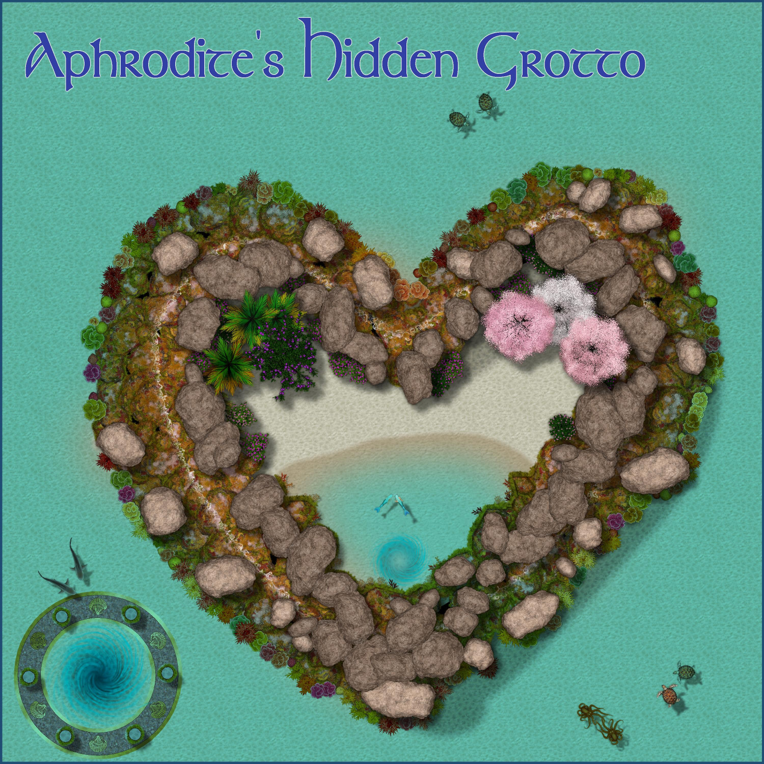
Aphrodite's Hidden Grotto
In honor of the day, I whipped together a quick shrine to everyone's favorite goddess of love, Aphrodite -- accessible through an underwater teleportation portal guarded by a pair of beguiled sharks.


-
Community Atlas 1000th map Competition - with Prizes [August/September]
I am ready to submit my dwarven mining village, Vidural Village & Mines.
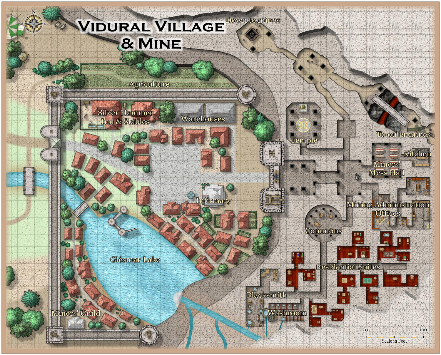
Primary Style: SS5 (Mike Schley City Style)
Toggles: "Roof" layer to hide/unhide the mountaintop to show or cover the mines below
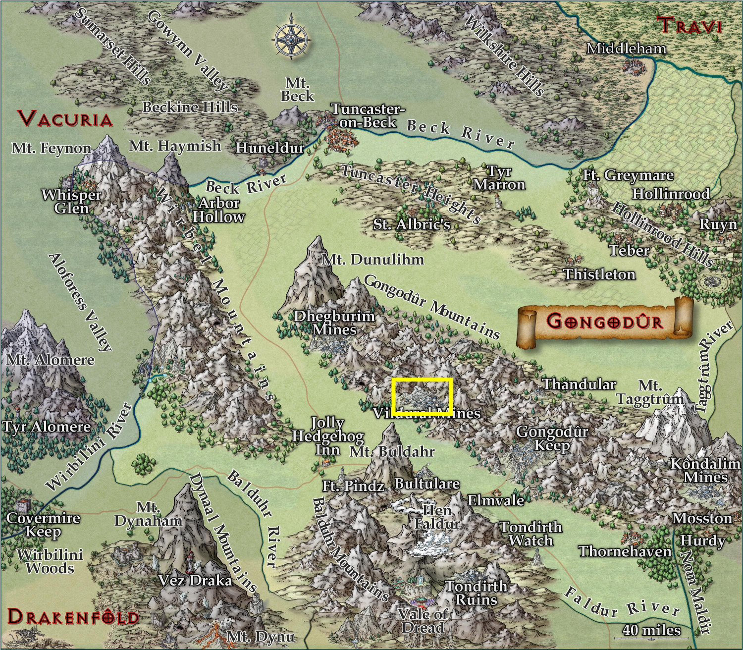
This is located in this yellow boxed area of the Kingdom of Gongadûr that was previously submitted in this thread.


-
Community Atlas 1000th map Competition - with Prizes [August/September]
I am ready to submit Yréas Kóltyn Village for the contest.
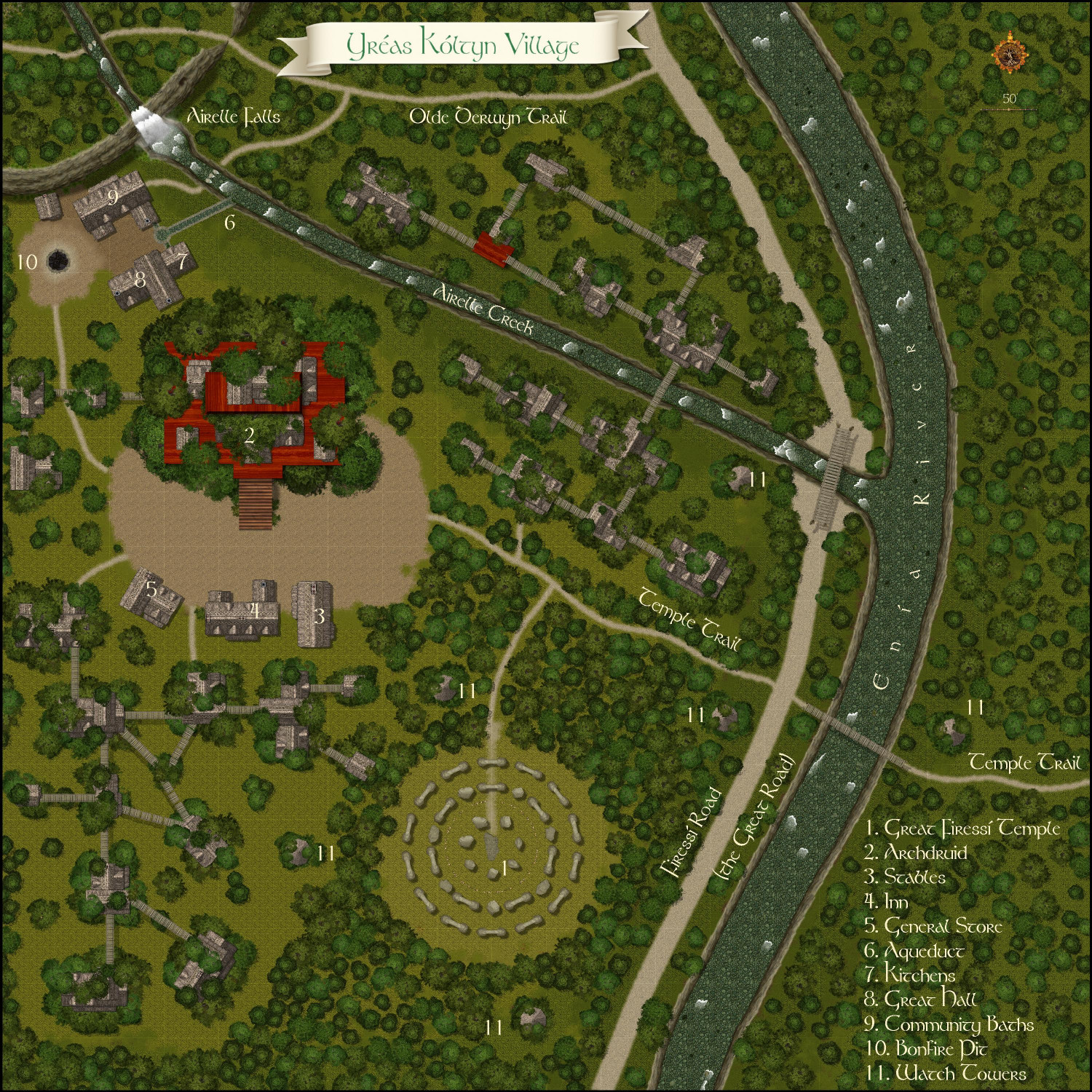
Primary Style: Forest Trail
Toggles: "Tree Canopy & Treehouses" to hide/unhide the trees to create a battlemap
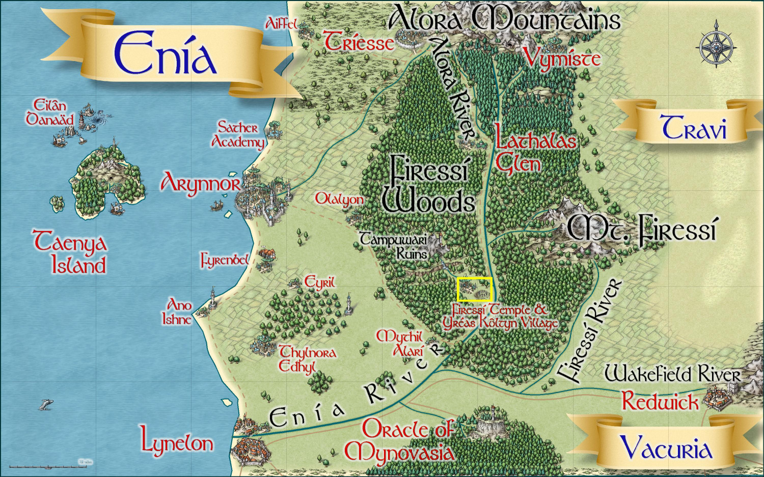
It is located in the yellow boxed area here (the parent map was previously submitted in this thread):

-
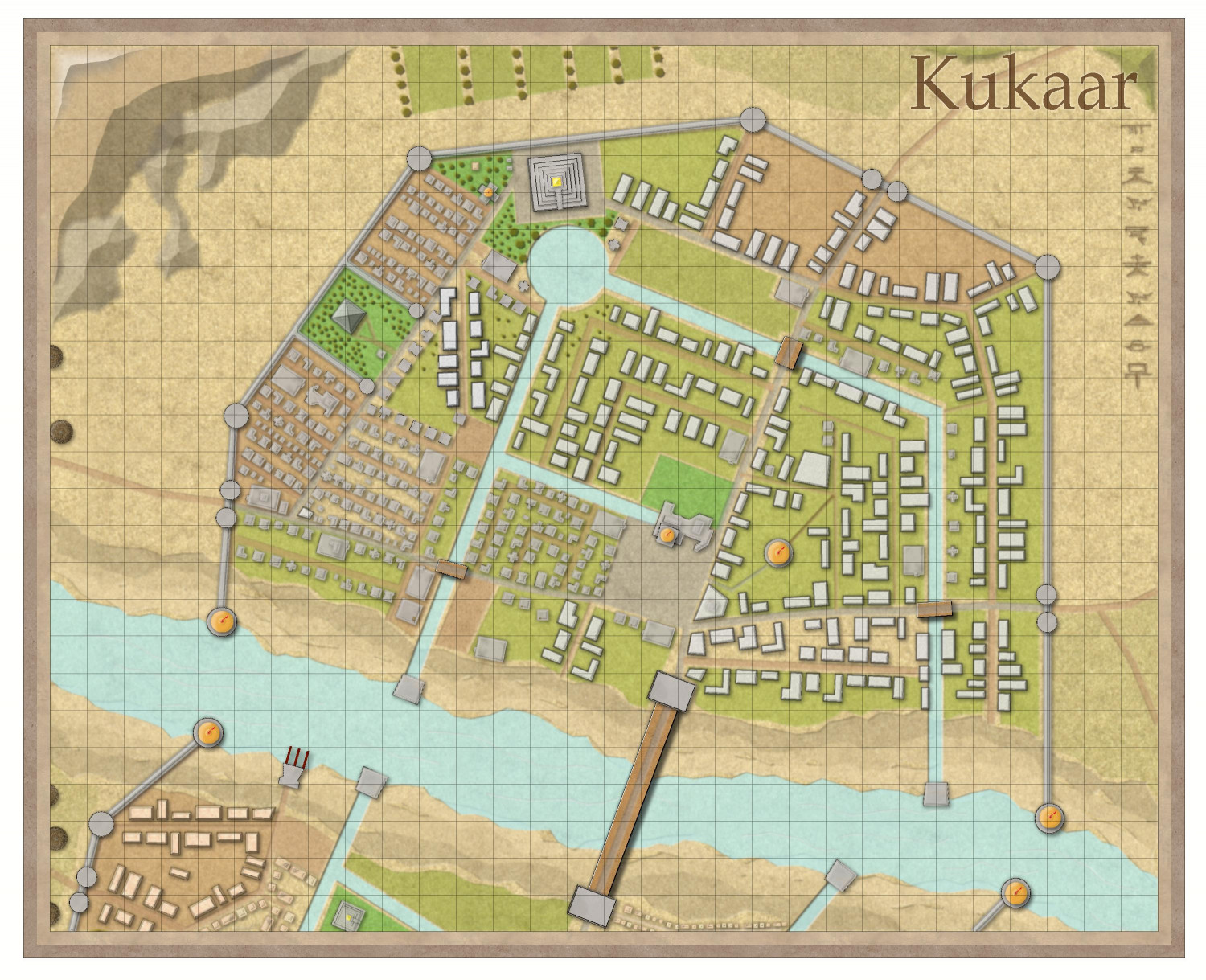
[WIP] Town of Kukaar (Ancient Cities Annual)
Took a stab at creating a town in the lovely new Ancient Cities style by @C.C. Charron. It isn't a whole town, just the North Bank area that is the more prosperous part of the town. Only a smidge of the poorer South Bank area is shown.


-
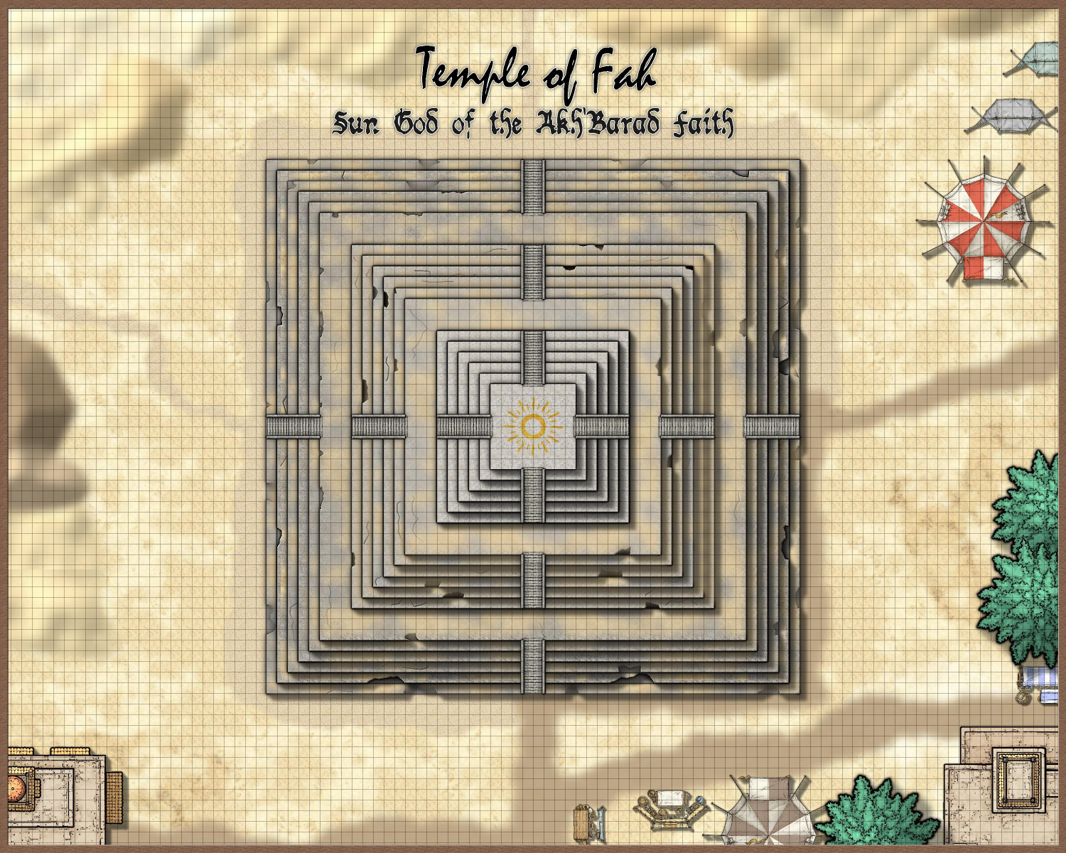
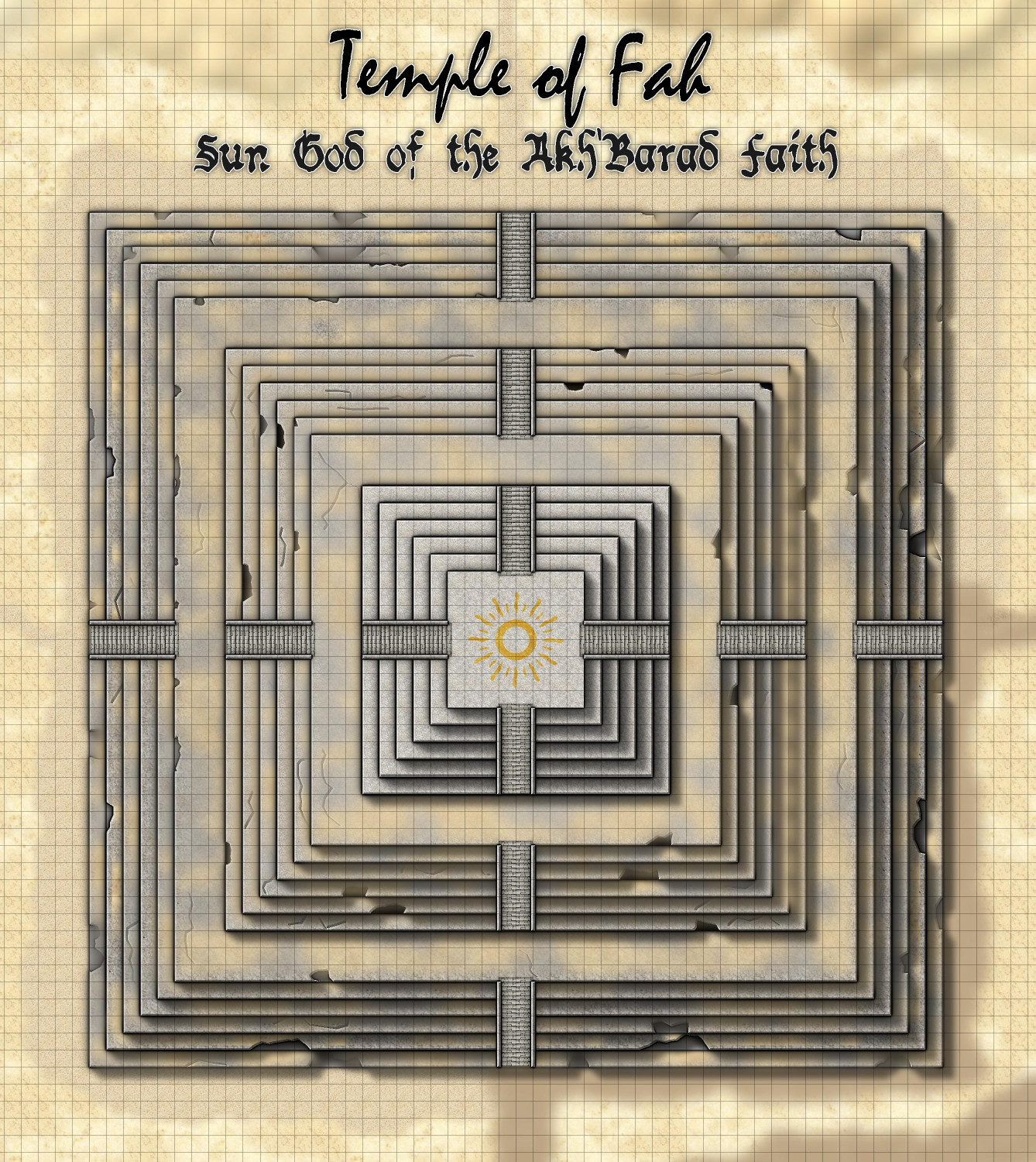
[WIP] Temple of Fah (May Annual: Stairs and Steps)
I tried the color key to nibble away at the textures, and it worked. But even better (and more obvious): I could, and did, add additional sandy patches to fill out the...fill.
But the color key suggestion gave me the idea of using it to nibble away at the temple itself, creating missing chunks (with magenta fractal polygons) and cracks (with a magenta fractal lines). I hope I didn't overdo it, but the nice thing about using the color key approach is that it's a lot easier to remove some of them than it would be to fix moving nodes around, for example.
I had already placed a gold inlay beneath each layer of the temple, but other than the very top, I didn't need it to be gold. I tried changing them to the Solid 10 and Solid 20 fills, but that allowed the pockmarks to return. So I changed it to a brown color and then added a gray inner glow.
If nothing else, the erosion takes your eye away from places where I missed fixing the repeating patterns of the texture.

-
[WIP] Temple of Fah (May Annual: Stairs and Steps)
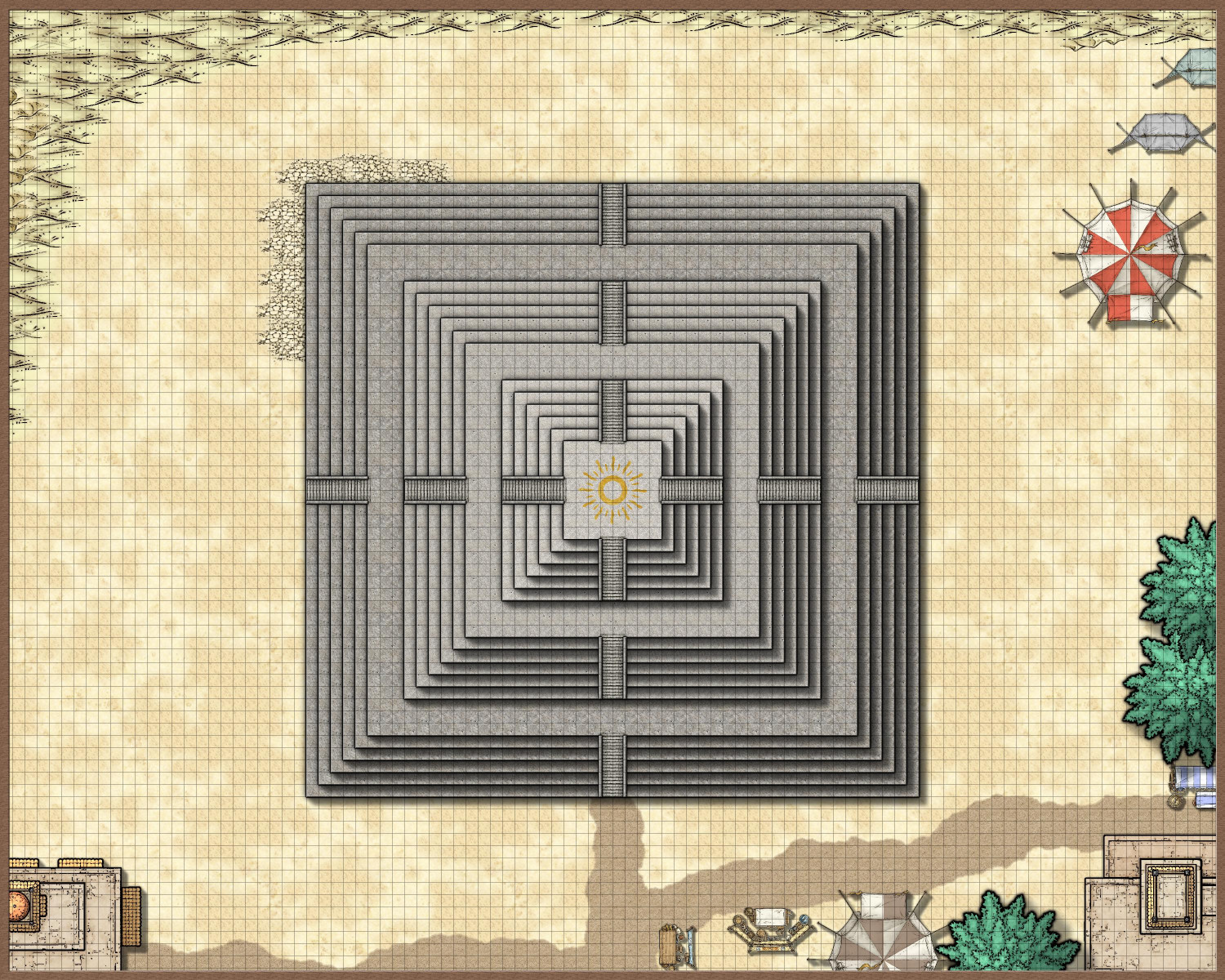
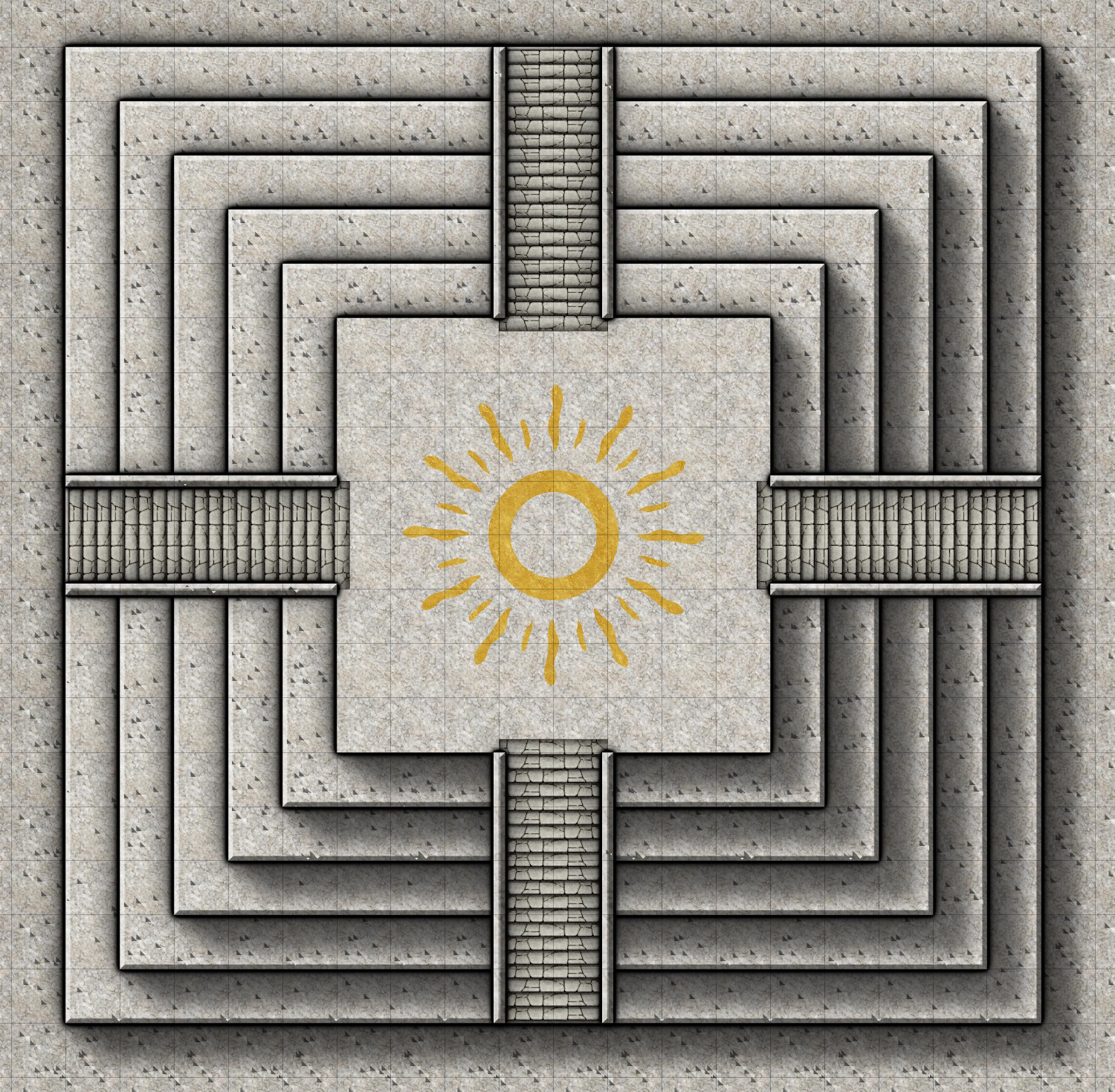
I was playing with the Stairs & Steps annual, and (inspired by a recent episode of The Amazing Race, which I'm finally getting caught up on), I started to design something inspired by the steps of El Peñón de Guatapé in Colombia. I ended up gravitating to Marine Dungeons to do it in, but for my first foray into using Stairs & Steps, I wanted to start with something in the Mike Schley style.
One of the human cultures in my campaign world is a desert culture with a religion loosely inspired by Egyptian mythology. (They also have a militaristic government where powerful noble houses sponsor warriors who fight in grand competitions every four years to accrue points used to determine the number of seats each noble house has in the ruling council. I came up with the idea 40 years ago when I first watched the Olympics on television, and the idea keeps coming back every four years.)
Anyway, their religious temples are in the form of pyramids and ziggurats, and the latest Stairs & Steps annual gave me the impetus to create a ziggurat in the desert. This is designed in SS4 Dungeons of Schley, with bits of SS5 Cities and Schley and SS3 Mike Schley Overland thrown in.
I am seeking aesthetic input on a few things:
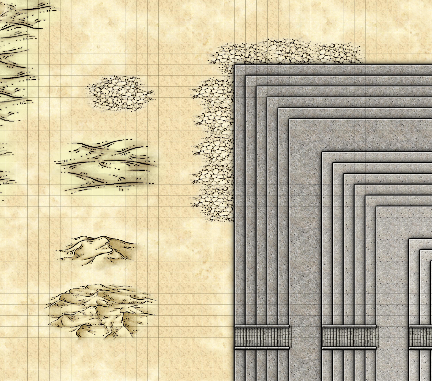
- For the desert terrain, I chose a sandy background as the default and added a layer of a sandy texture over it. But I have also been playing with the cracked seaflats, sand symbols, and dunes symbols. Thoughts on what works?
- I thought maybe putting the cracked seaflats around the border of the Ziggurat and then some dunes near the borders of the map. (One of the images I'm embedding zooms on some examples.) Should I put the sand symbol through? Just on the northwestern part away from the buildings? Not at all? I always triple-guess my aesthetic choices.
- Inspired by the bronze inlays in Marine Dungeons, I wanted to do something similar on the top of the ziggurat. I created a crude inlay representing the sun, but then used the goldleaf texture from Sue's Parchments. Do you think that works, or should I instead use the bronze texture from Marine Dungeons?
Here is the full map to date, with a few zoomed-in images to illustrate my questions. (Oh, I am aware of the pock-marks in the temple. I plan to put a layer of a dark gray color or maybe the goldleaf fill below each level of the ziggurat to fix that. But part of me wonders if the pock-marks actually make the ziggurat look weathered?)
-
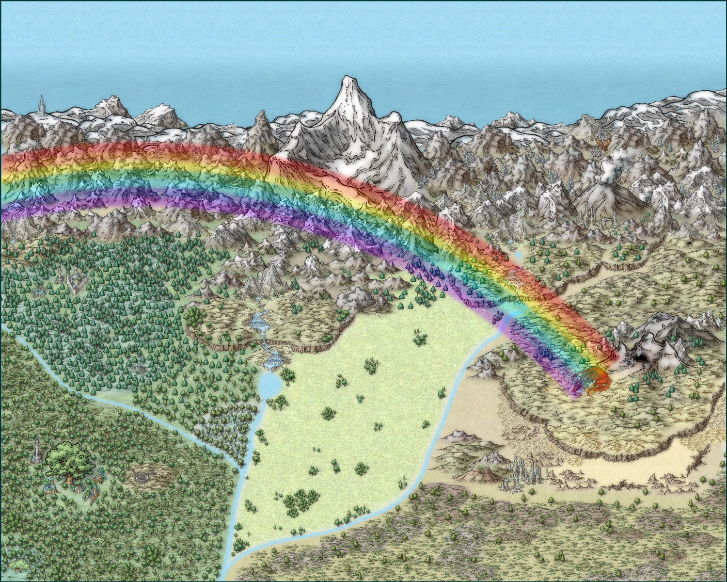
On leprechauns and rainbows and pots of gold
Ricko gave me some great tips -- fixing the waterfall in the first image (it needed to be more in the foreground), rotating some of the elven buildings to face the road, and adding trees to conceal where terrain/symbols connect. I hope I found all of the spots that needed trees! Here are my adjustments: