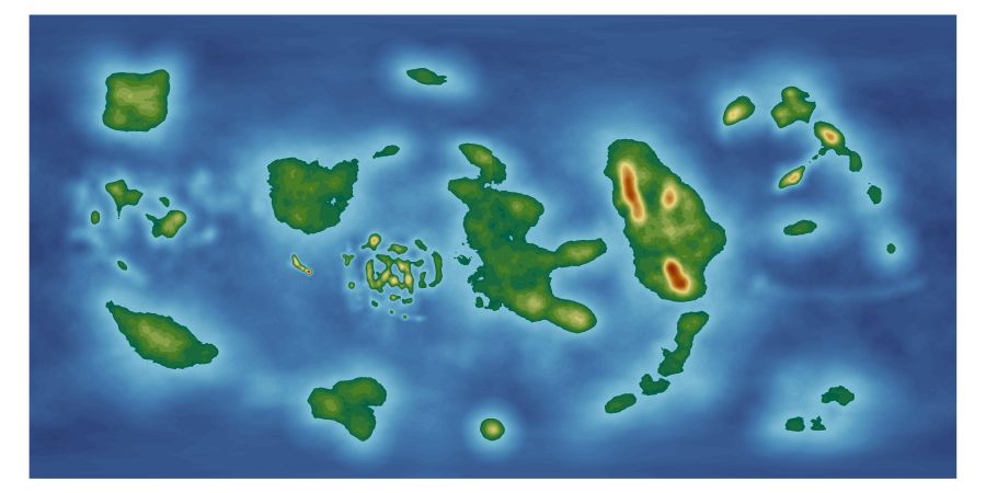
my Tunnels and Trolls world so far
 JimP
🖼️ 280 images Departed Legend - Rest in Peace
I'm in FT3 making decisions. Etc.
I keep selecting the wrong icons and have lowered when I meant to raise, etc.
Anyway, this is the jpg in ft3. Yes, the island, etc. whatever at the top looks kinda like a snail. I'm going to try and leave it that way.
900 pixels of a 5000 pixel wide map.
I keep selecting the wrong icons and have lowered when I meant to raise, etc.
Anyway, this is the jpg in ft3. Yes, the island, etc. whatever at the top looks kinda like a snail. I'm going to try and leave it that way.
900 pixels of a 5000 pixel wide map.


Comments
edit: I'm not sure how that vertical lines of hills got on the center continent... maybe I'll keep that to.
Please can you open the Map Projection dialog and just check that the top two numbers in these boxes are zero? If they are not, save your FT3 file first and then try setting them to zero. It may damage your editing, since it will shift the underlying roughness of the base map sideways, and it's up to you if you want to leave the line where it is or not. The thing is, though, that if you don't move it back to the edges you will get quite noticeable marks on that line in the end result.
I printed your help to pdf in case it happens again.
I used the lower and raise preset tools to break the line up.
It's very strange.
The above png is 47 megs and the bmp is 137 megs.
This 900 pixel jpg is 45 kilobytes.
In the meantime I've copied those notes I made above about the 'wrap line' into a revised version of the Supplementary Notes so that they don't get lost - if you want to download and reinstall the issue, they should all be there in the right place for you
I figured out where the vertical line came from. Looking at my original mbr file, there is a square on the ocean floor I accidently added and didn't edit out.
Now, to expunge it from my map. Well, the ft3 map.
If so, you don't have to worry about adjusting the 180 meridian like you do with a hand sculpted world. There's not such a join problem with a synthetic world
The instructions in the main Mapping Guide are the ones you need to follow.
Is there a way to fix that ? Or is this normal ?
Of course, I can remove some of them, and turn them back to bays.
( Looks kinda different ? Yup, I accidently wiggled the globe and moved it arround... argh. )
Zoom extents first, then export the map as a png. Open it briefly in GIMP, right click the layer and pick Alpha to selection, then go to the Image menu and pick Crop to Selection. That trims the transparent bit off around the edge. Export to itself and close GIMP.
How do you mean 'constant redraws'?
Not sure how that globe shift will affect things. Lets hope there's no line at the 180 degree meridian. Again - I never use the globe because it shifts the map. You know those two dialogs I asked you to check if they were zero up at the top of the thread? Are they still zero?