

AleD
AleD
About
- Username
- AleD
- Joined
- Visits
- 943
- Last Active
- Roles
- Member
- Points
- 826
- Birthday
- February 21, 1982
- Location
- Padova, Italy
- Real Name
- Alessandro Devigili
- Rank
- Surveyor
- Badges
- 9
Latest Images
Reactions
-
The beauty of (fake) Colli Euganei. A new WIP.
Thanks @Calibre :D!

-
The beauty of (fake) Colli Euganei. A new WIP.
I started to add some cities/villages and roads... I also changed the size: some extra place for map's name and cartouches ;)
Still a lot to do but I like how it is coming together!


-
Placement of trees
Hi!
What about using the symbols in area style? It works extremely well and you can customize it a lot... You can also create your own "Drawing tool" in few steps.
-
Quick Small Spectrum Map
I like it!
I am also using spectrum style to make a "small map".
I am sure there is a super well done video tutorial for that, or an article by Remy @Monsen, or a section in the Tome... So what I'll show you below may not be the best way.
- BTW, for placing less dense forest I created a new drawing tool. To do that I first went to the "Symbols in area..." command from the Draw menu.

Here you can decide the settings (eg. a small % ,Chance to Place to have less dense symbols... Or the scale and size).
Once you are done save the filling style (a .symfill file). Now you have a "filling style" (not sure that this is the proper therm) that you can use to create yout drawing tool:
In the Drawing tool menu:

Go to the Advanced>>

Here you can first select a tool similar to the one you need. Here I used the Woods Decid

Now click on New and chose a wise name (mine is Terrain Default Woods Decid SF, whis stay for "sparse forest).
Next step will be to click on Command to excecute, which will open this:

On the right of SYMFILLOAD replace the path and the .symfill file name with the one you created at the beginning. In the picture above you can see the one I created for the new drawing tool. I do not have the preview of the tool but it works. 😉
To whoever is more expert than me:
Please, feel free to correct, update and improve this short tutorial!
-
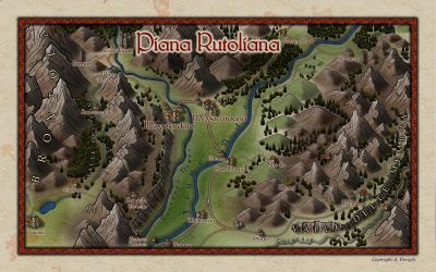
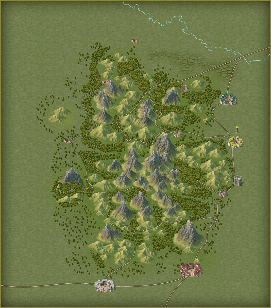
The beauty of (fake) Colli Euganei. A new WIP.
One of my dream as GM is to set up an adventure in the place where I met most of my RPG playing friends, the city of Padova, where I went to uni... For that, I was hoping to play the RuneQuest system, for which there is an expansion dedicated to the Italian medieval time -aroun 1200- when Federico II (Federico Ruggero von Hohenstaufen), the "Stupor Mundi", ruled in Italy.
So I was thinking to set the adventure around Padova city, making the characters to meet the evil Ezzelino III da Romano, the wise mage Michael Scot and maybe Francesco d'Assisi, all real personalities that were around at that time.
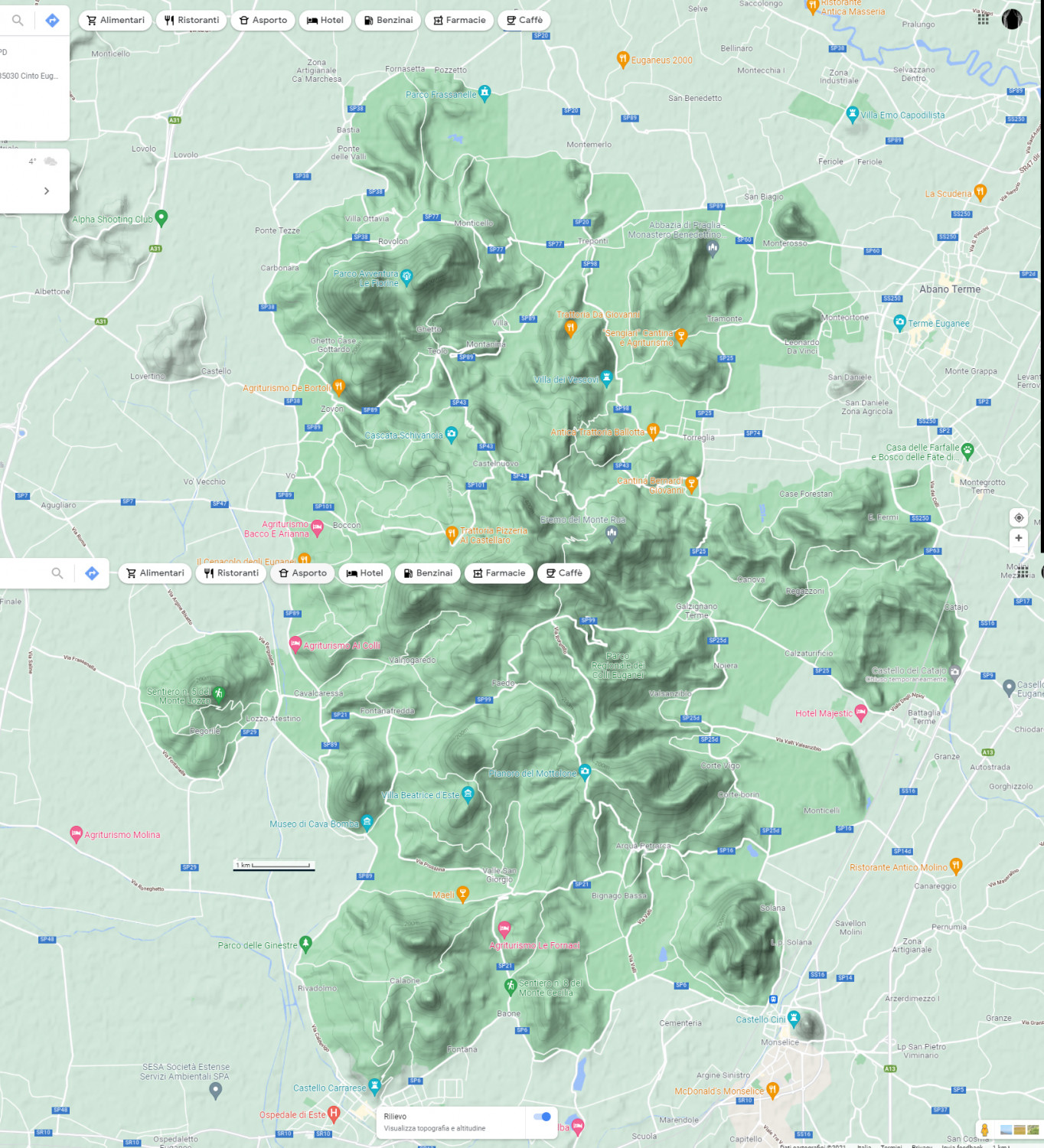
A place to visit vould be the Euganean Hills, the hilly area south of Padova were nice mediaval villages, castels, wine and food are still present.
So, I decided to produce a map, with a lot of inspiration from the reality:
My idea is not to keep is realistic: the small hills will be replaced with mountains... As a medieval illustrator may have done (or not? 🤔🤷♂️). Many more trees and extremely less streets will be around.
So, first step is to use the map from google as a background picture to decide where to put most of the stuff (main hills, cities, main streets, and so on)
So far i just added mountains and forest. This style looks really good to me for these kind of small scale maps (this is 18x20 Km):


![[Deleted User]](https://secure.gravatar.com/avatar/c75d9a245b74d9c59be0999ea81ca541/?default=https%3A%2F%2Fvanillicon.com%2F92add7f8c954488718110edc4896ad39_200.png&rating=g&size=200) and 6 others.
and 6 others.
