jmabbott
jmabbott
About
- Username
- jmabbott
- Joined
- Visits
- 2,281
- Last Active
- Roles
- Member
- Points
- 1,846
- Birthday
- March 1, 1963
- Location
- Penrith, NSW Australia
- Real Name
- Jim Abbott
- Rank
- Mapmaker
- Badges
- 12
Latest Images
Reactions
-
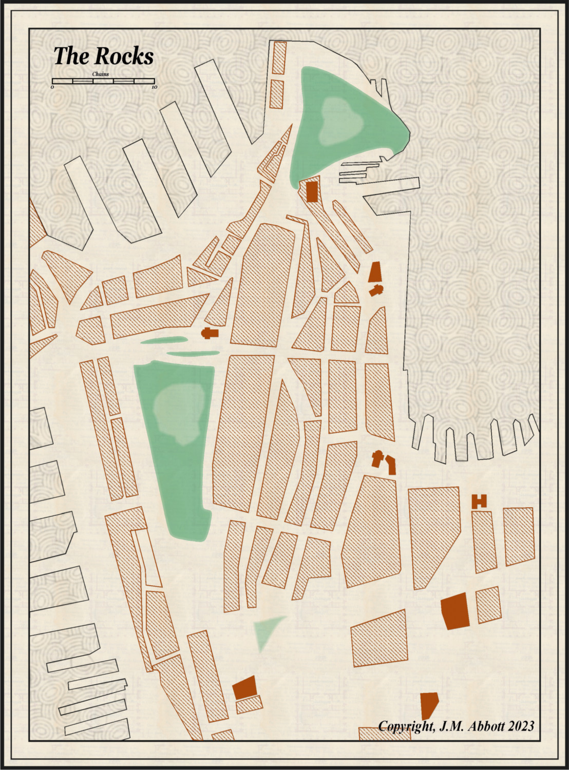
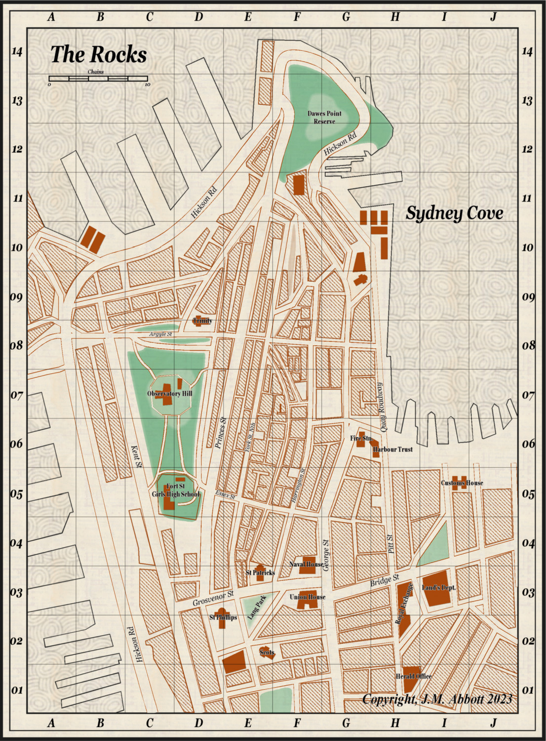
Live Mapping: 1930s Street Maps
Hi All,
This is nearly done. Last update before I finish it.
Just got to fix one, make that two, obvious errors (see if you can pick them), add in a street and 1 more building block (just to the right of Hickson St in the SW portion near the school) and the indexes for named buildings, places of worships and roads/streets.
All in all hasn't turned out too badly.


-
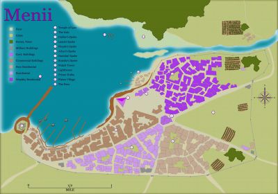
John Roberts Village by night
Seriously mate, your work is amazing. Every map you've posted is brilliant. These landscapes, I don't know what to say.

-
John Roberts Village by night
Exceptional!
The only thing I can think of, is where is the road? Surely there would be one over the bridge, else why build one...
-
Live Mapping: 1930s Street Maps
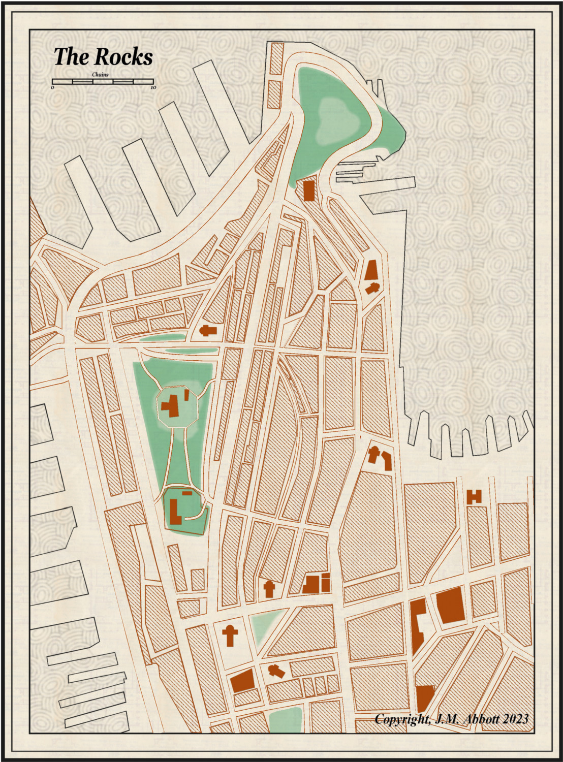
An update.
The to do list is:
- Break up some of the larger blocks to create alleys and such like.
- Add some buildings to the docks, particularly the long stretch on the eastern side.
- Label and create an index for streets and key buildings.
This is the 'player' version. When I'm ready I'll add scenario specific places to the GM layer(s).


-
Live Mapping: 1930s Street Maps
Ok. Found a newer map, there is handwritten date on it, 1923 which is closer to the era I need, that's a bit easier to work with: https://guides.sl.nsw.gov.au/maps/sydney
So, I'm re-doing the map, here's what I've come up with so far.