jmabbott
jmabbott
About
- Username
- jmabbott
- Joined
- Visits
- 2,281
- Last Active
- Roles
- Member
- Points
- 1,846
- Birthday
- March 1, 1963
- Location
- Penrith, NSW Australia
- Real Name
- Jim Abbott
- Rank
- Mapmaker
- Badges
- 12
Latest Images
Reactions
-
Fractal Coastlines CC3 Hex Overland
Our original plan, from 5 years ago, was to follow the east coast into Melbourne, then across to Tasmania to do the corners (we did the central parts in 2006) back to Melbourne then The Great Ocean Road to Adelaide, Kangaroo Island and follow the coast up to Perth. My wife's bowel cancer, all good now except from suffering LARS, meant we had to postpone to 2020.
Late 2019, as you know Quenten, bush fires absolutely ravaged the areas we planned to visit. We rescheduled to May, but rather than follow the coast to Perth, we would go directly via Dubbo (my sister and brother-in-law lived there at the time and were joining us) and then head up to Broome before coming back. But COVID hit and now is the first chance we've had. We modified the trip because a) it's quiet at my work ATM and the boss suggested taking my leave would be a good idea and b) we've got to be in Broken Hill mid-August for the Mundi-Mundi bash, a 3-day music festival in the outback.
We're really looking forward to it. I've got a 4x4 (unmodified) dual cab with a tray and canopy set-up and an Oztrail Camper 8 camper trailer. Originally we were going to just use our Oztrail Tourer 9 Plus tent but decided to get a CT for the extra comfort and storage (we're both in our early 60's and sleeping on an air mattress isn't as much fun as it used to be!).


-
We need a poll - What's Your Favorite Game Genre?
The Great One, Cthulhu, watches and waits for the end of days...
'Nuff said.

-
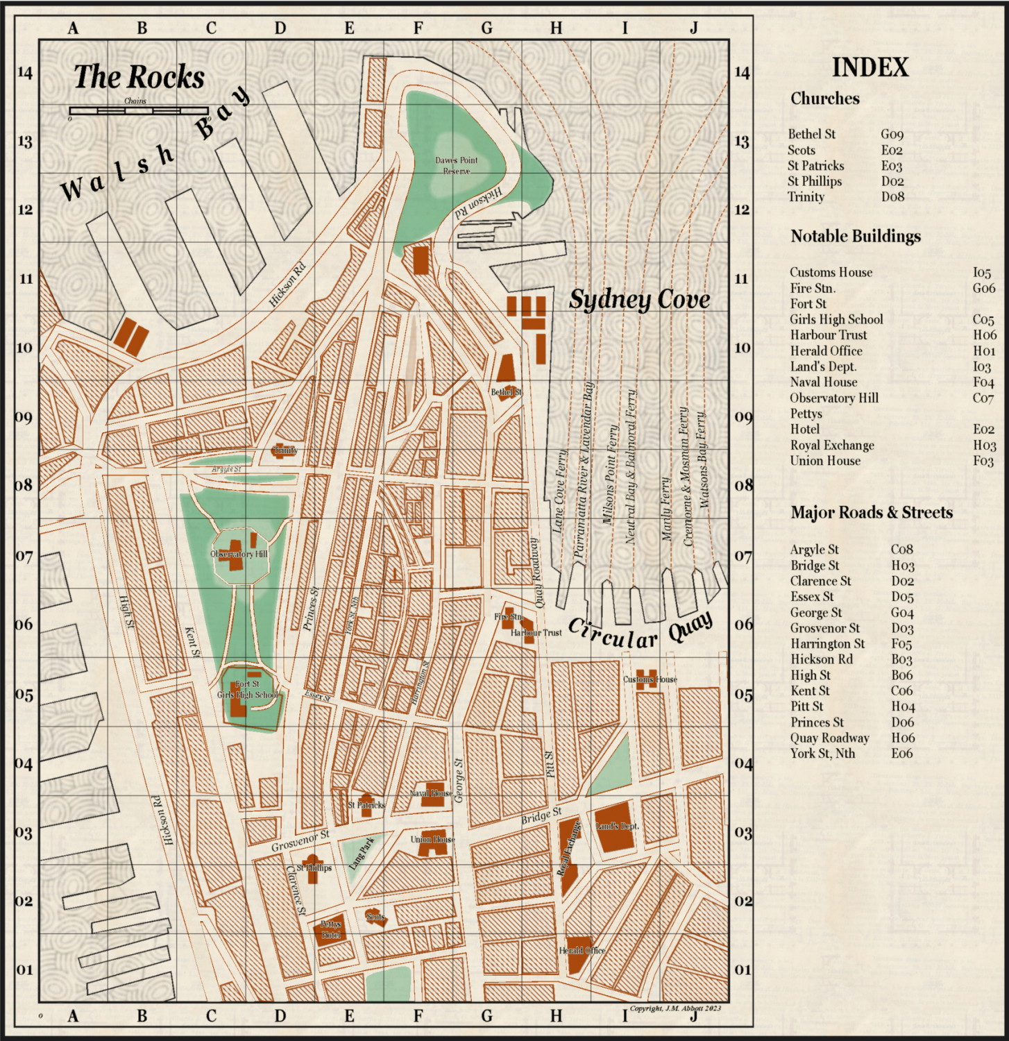
Live Mapping: 1930s Street Maps
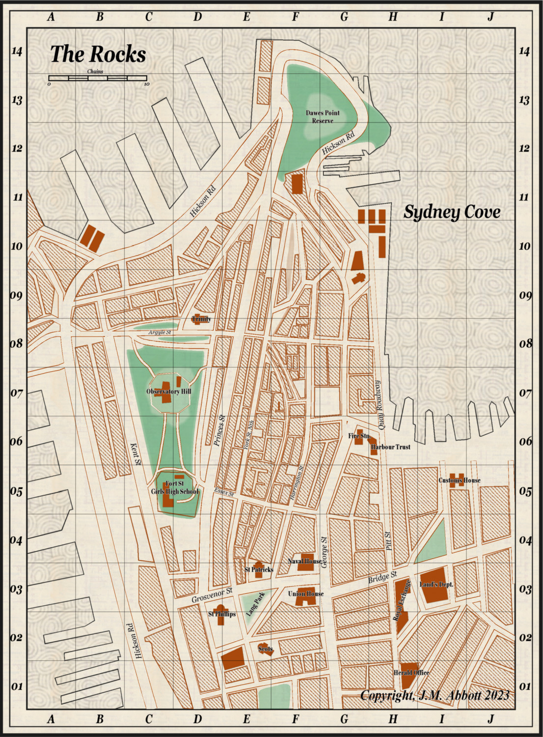
Ok folks. Here is the final version of The Rocks, 1923. Feel free to use for your home games if you ever get to Cthulhu Down Under!
Thanks to you all for your comments and suggestions, particualrly @Ralf: that tip re Circular Quay looks heaps better. I changed the colour of the glow on the text as well, it's hard to notice at this resolution but it does make a difference.


-
Live Mapping: 1930s Street Maps
Alrighty. Apart from trimming the grid to the "border" this is done as far as the mapping is concerned.
I am flumoxed as to why only a few streets show the a grid reference, which is incorrect BTW. I've attached the .FCW as well. If anyone can explain what I've done wrong and/or how to fix it that would be much appreciated.

-
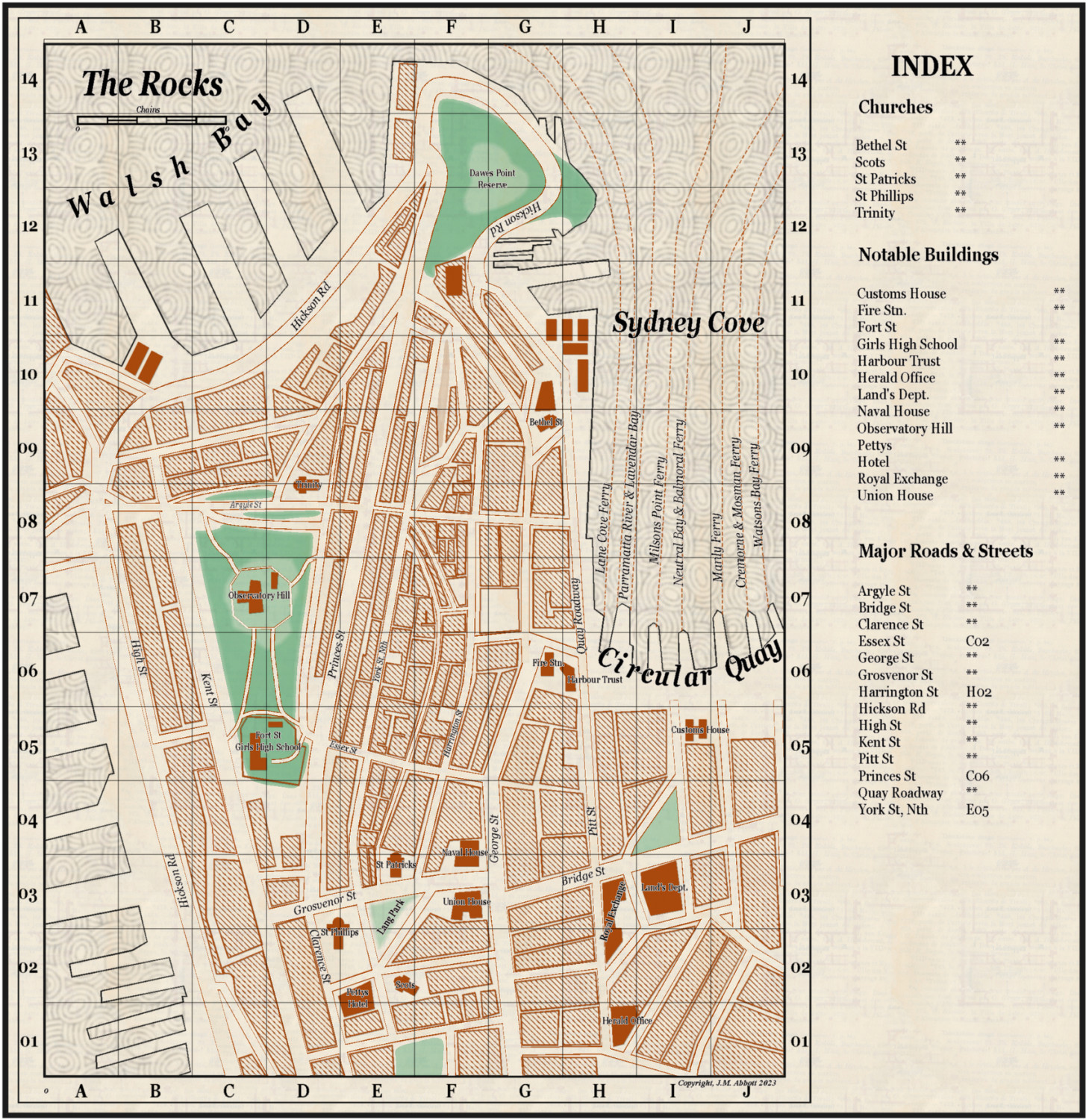
Live Mapping: 1930s Street Maps
Hi All,
This is nearly done. Last update before I finish it.
Just got to fix one, make that two, obvious errors (see if you can pick them), add in a street and 1 more building block (just to the right of Hickson St in the SW portion near the school) and the indexes for named buildings, places of worships and roads/streets.
All in all hasn't turned out too badly.