


Wyvern
Wyvern
About
- Username
- Wyvern
- Joined
- Visits
- 3,266
- Last Active
- Roles
- Member
- Points
- 5,585
- Rank
- Cartographer
- Badges
- 24
Latest Images


-
What's your rank and points?
Well, the whole rank and points thing in the current form has only been around since late 2020, when the Forum had a major overhaul. Higher ranks have the advantage of getting longer to edit your own posts, which is handy for those of us less adept at avoiding typos, without being a major difference. Beyond that, it's all just a bit of fun, really!

-
Live Mapping - Village Battlemap
Slightly terrifying to watch Remy wearing different thatched roofs as a hat at times on the livestream replay 😉🤠 (I'm taking time-out from catching-up to check-in here briefly!) The dormer one seemed to work best, though it's not especially stylish 😁.
Good stream though so far - even if I have just got a sneak preview of what the final map will look like by dropping-by here mid-replay!

-
Game Masters: Preferences for Labeling on Game Maps
Battlemaps for physical tabletop use shouldn't be labelled at all, because that distracts from the scenic element, and if the map's reasonably clearly drawn, the key features should be obvious anyway - that's largely the point, after all! If you'll need to add hidden elements, use cut-out markers you can drop-in on the map when & where appropriate (or use suitable 3D miniatures/items, like doors, treasure chests, etc.). The process/theory stands for VTT use as well, except everything is digital, of course.
As I've never used VTT, I can't advise much on that element, although hiding and showing features using the CC3+ Layers is straightforward enough in the FCW files, and easy enough too to store as separate digital images of the relevant views. I'd assume swapping between such separate images should be relatively simple in VTT, but I may be assuming too much on the part of such systems' designers, I realise! (Given that Windows still has to catch up with where some of the alternative PC systems then were 30+ years ago...)
The only labelled maps are the ones the GM needs to see, other than any props the players may be given/shown - such as a treasure map - and on such props the labels can be as clear or obscure as the needs of the game require.
-
Community Atlas: Kara's Vale, Ethra, Doriant
Level Ten:
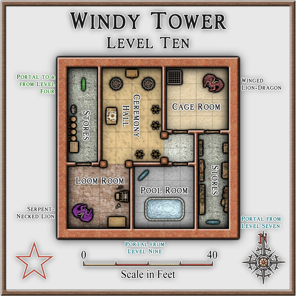
Some of the included elements were simply picked from the available symbols in the Mike Schley style, to flesh-out the bare bones original floorplans, although this level was largely populated from items randomly determined from those Story Engine card decks used earlier for the Kara's Vale map locations. The randomness of a level that has stores, an altar and huge braziers, a cage, a pool and a loom just appealed in that way weirdness sometimes can!
Level Eleven:
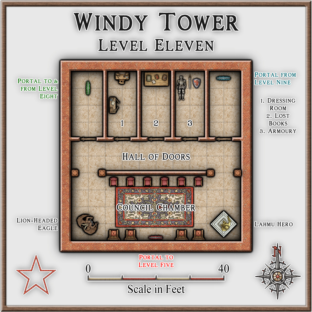
Which randomness was allowed to spill-over here too, with those three rooms of oddities in the north. Plus, be fair, this was the eleventh level in the group!
Bringing us finally to Level Twelve:
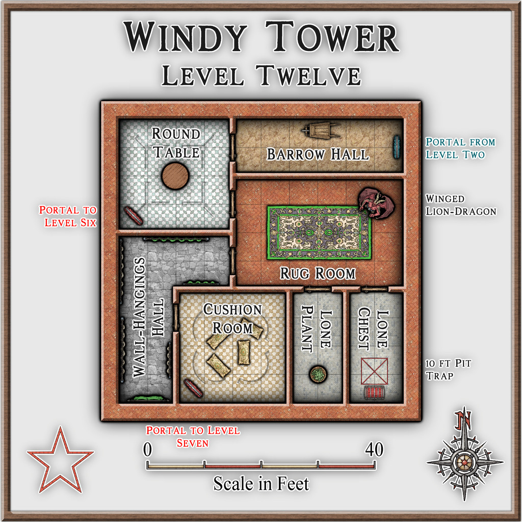
Did I mention the random weirdness? The Wall-Hangings Hall though was done deliberately, because it's a really odd shape for an empty passageway otherwise.
Which concludes the main Tower, leaving only Level Thirteen to come - perhaps next time...


-
Community Atlas: Kara's Vale, Ethra, Doriant
Back to the remaining half-dozen Tower levels with Level Seven:
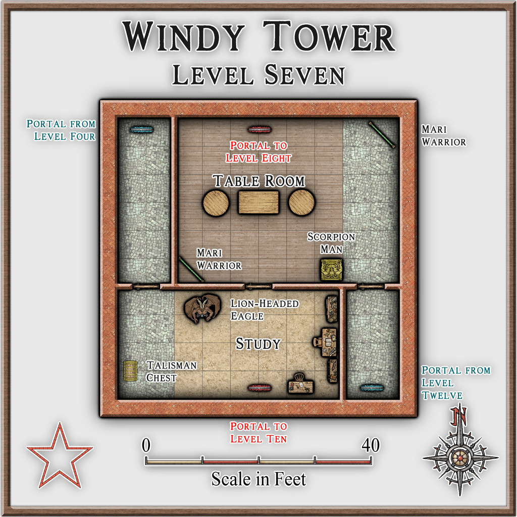
This is the level the magical, golden talisman is on, which is required to activate the portal to access Level Thirteen (coming-up on Level Nine below), and either it or the amulet from Level Two may be needed to regain access to the Tower, if left at any stage. I decided to only wall-off parts of the two outlying cobblestone-floor sections here (derived from the original floorplan), because that helped make this level feel a bit more weird.
Lots of leonine critters in ancient Mesopotamia! The Lion-Headed Eagle though is something special, as it was either a demi-god, or a full-fledged deity (possibly at a period antedating the early 3rd millennium BCE) called Imdugud (later Anzu), which had the form of a giant eagle with heavy claws, a lion's head, and, from at least one myth-text, shining, multicoloured feathers and magical powers.
The Scorpion-Man is a bow or spear-armed humanoid with a human torso, arms and head, set on a chitinous giant scorpion's lower body, legs and stinging tail.
Level Eight:
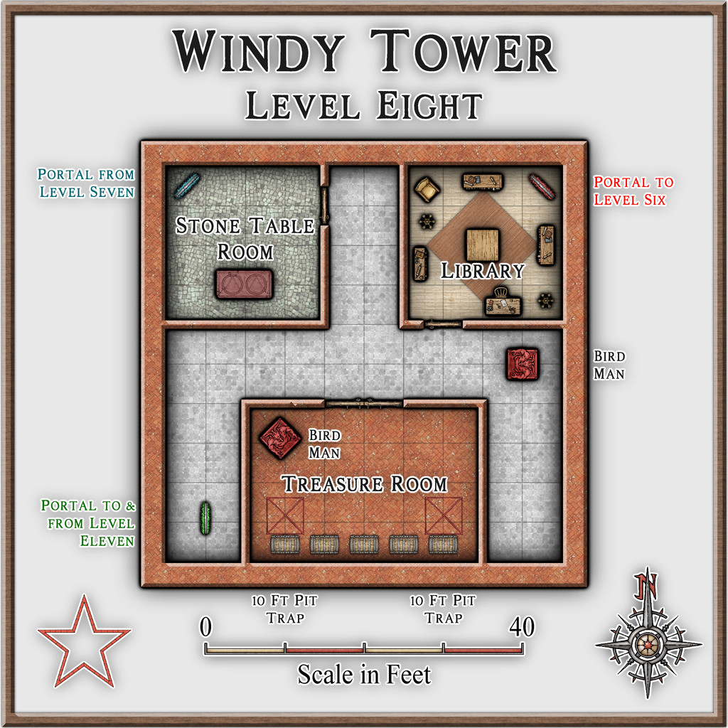
A fairly straightforward level here for once, except for a couple of floor pit traps in front of two of the treasure chests.
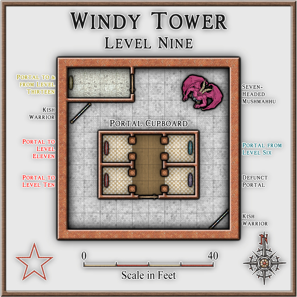
Level Nine:
Here we find the portal that goes to Level Thirteen, which of course is the dungeon map that started this set of maps off. That's dealt with by a separate map in the Atlas now, however. Plus for variety, we also have a non-functioning portal.
The Seven-Headed Mushmahhu probably needs an explanation. It's an imposing, hydra-sized creature with a huge lion's body, and seven, writhing, giant serpent necks and heads. Known from several variant artworks from the early 3rd millennium BCE, sometimes such a creature has a purely serpentine body as well, and in either form, one or more - though not all - its heads may be shown as dead. In its lion-bodied form, it has rays rising from its back, which might be magical defences, or simply fire/heat, which rays seem to form one of its own powers. Sometimes shown with one or two deities in combat with it too. It's basically the top predator in the Tower.

