Wyvern
Wyvern
About
- Username
- Wyvern
- Joined
- Visits
- 3,267
- Last Active
- Roles
- Member
- Points
- 5,585
- Rank
- Cartographer
- Badges
- 24
Latest Images


-
my Crestar, Northern Hemisphere, several continents, Zaggah nation
It depends how you see the mountain range Jim, I think. Not all mountain ranges are crowded with mountains in reality, after all. Some of the "empty" spots could be hidden valleys, or even plains, with impassible mountains all-round, like the classic Shangri-La.
If the Ash Mountains are more than a name (so something like volcanic ash), maybe the valleys there could be grey with ash too, where nothing will grow, say, if you want a little more variety. Or maybe a scatter of a few trees here and there (really as much for decoration as indicating any genuine small woods, perhaps).

-
Panzer sample thread
Well, as the trees are symbols, they can be easily resized and stacked as I suggested, just as they are now. I've worked this in some of the dungeon/small overland map styles, though of course it works better in some styles than others.

-
Community Atlas: Embra - Villages
Completing the circuit is Embra - Summerset in the northwest, with its small village of single-storey properties, the River Clack with a bridge (albeit the bridge seems detached from the village rather), both the main Clack Valley tributaries, plus a curiously unlabelled third tributary stream, which seems more significant than the named Silverburn (a deliberate choice!). However, dominating the map's centre are two substantial lakes and a marsh:

Next-up will be the first of Embra city's contents, the Enclosed Places.


![[Deleted User]](https://secure.gravatar.com/avatar/c75d9a245b74d9c59be0999ea81ca541/?default=https%3A%2F%2Fvanillicon.com%2F92add7f8c954488718110edc4896ad39_200.png&rating=g&size=200)


-
Community Atlas: Embra - Villages
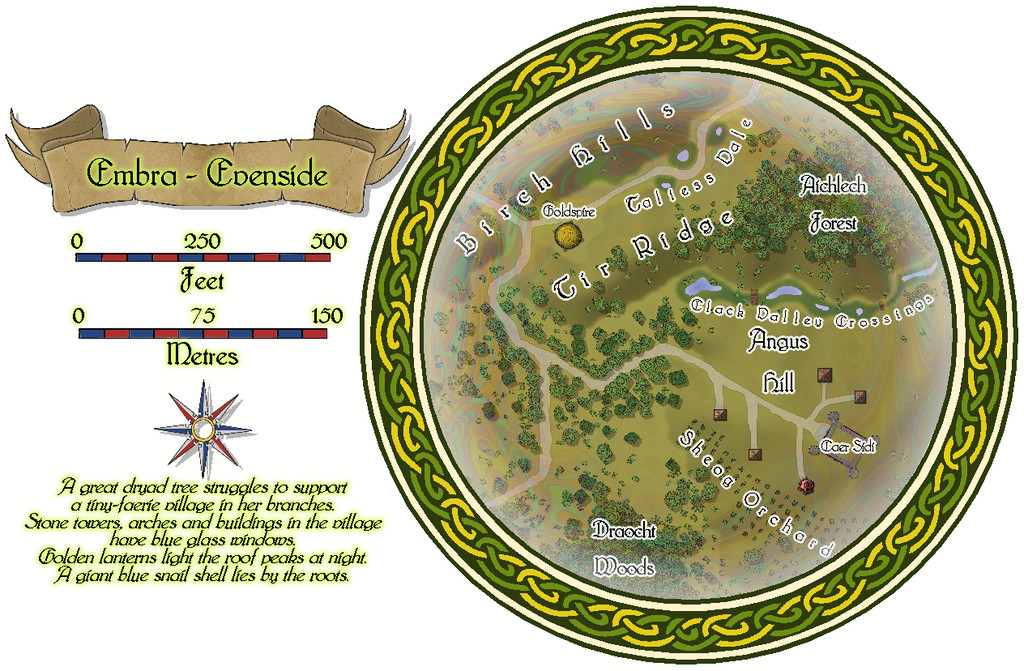
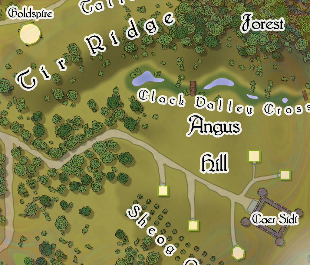
The western village of Embra - Evenside carries things to an even stranger place, now with a "castle", Caer Sidi, that is really just an elaborate stone fence around an open field! The Clack here isn't a stream, but a series of ponds linked by marshes that have a couple of bridges over the swampier spots. There's also a huge orchard, and a second dry valley with a scatter of marshy ponds along it too:
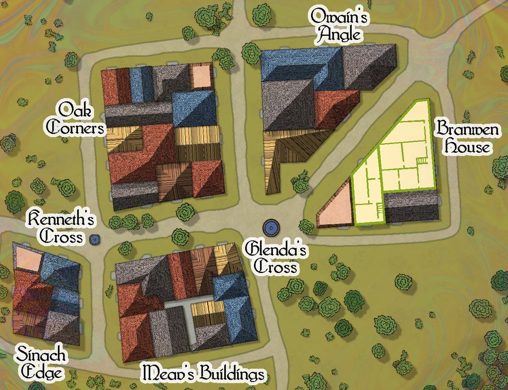
This is one map which I think especially benefits from a means to help identify which mapped items are genuine buildings:

-
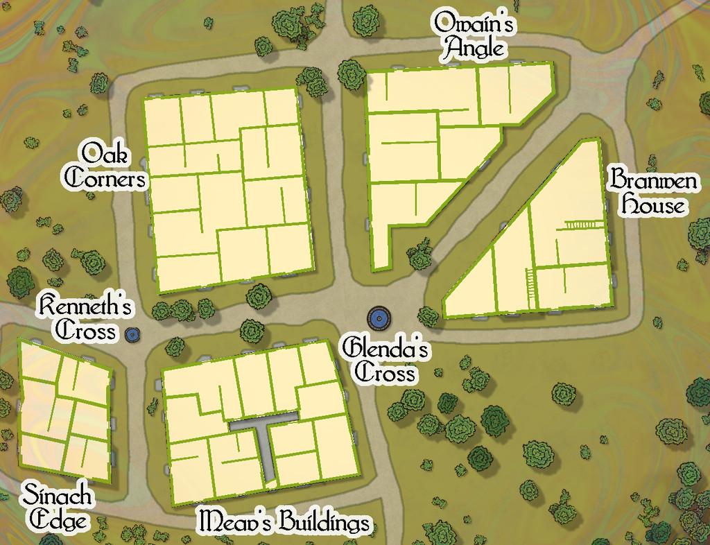
Community Atlas: Embra - Villages
Embra - Winterset in the southwest moves things towards a somewhat different nature, with many clustered properties, and no River Clack. Water comes instead from a pair of well-fountain pools at two midline crossroads, while the not-quite enclosed areas of Aine's Pastures are connected by a bridge that arches over the northern trail, a particularly obscure - thus clearly Faerie - feature:

The interior views show what the layout of the properties really is, although there are many fewer two-storey buildings, as the lower image here demonstrates: