


Wyvern
Wyvern
About
- Username
- Wyvern
- Joined
- Visits
- 3,267
- Last Active
- Roles
- Member
- Points
- 5,585
- Rank
- Cartographer
- Badges
- 24
Latest Images


-
Community Atlas: Embra - Enclosed Places
The fourth Place of Interest here is Lady's Hollow Floral Meadow:
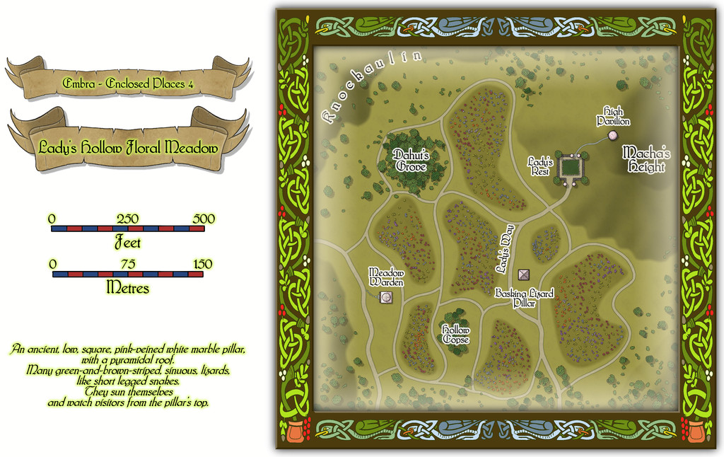
Again, the borders are especially subtly-defined here (the paths), and it is a little difficult to pick-out details at the usual Forum resolution, so this is just the map itself, now with the building interiors shown (albeit there's just the one building that has such an interior):
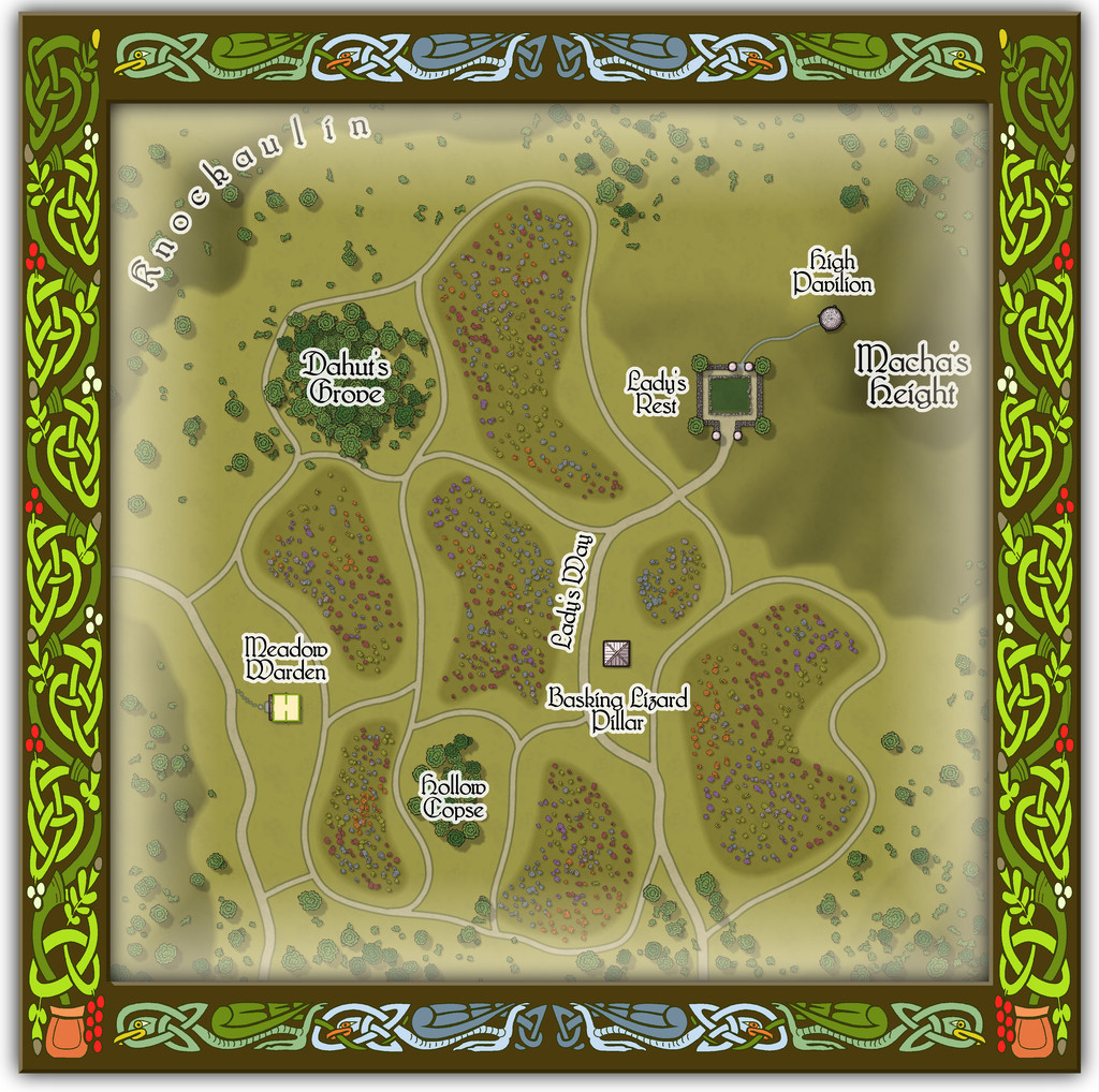
While there's probably less to explain overall from this map, there are a few features that benefit from some additional detailing - such as the castle-like garden of Lady's Rest and the High Pavilion dome - provided by the accompanying PDF and text files.

![[Deleted User]](https://secure.gravatar.com/avatar/c75d9a245b74d9c59be0999ea81ca541/?default=https%3A%2F%2Fvanillicon.com%2F92add7f8c954488718110edc4896ad39_200.png&rating=g&size=200)

-
Community Atlas: Embra - Enclosed Places
Enclosed Place of Interest 3 is the Floating Dale Park:
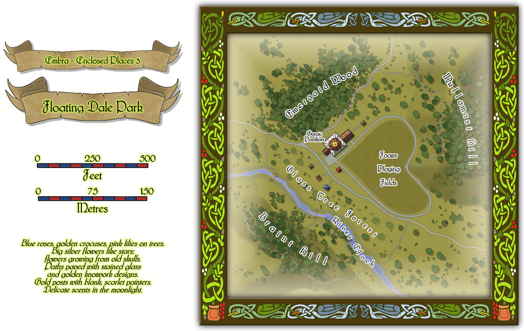
This can be used as a typical real-world park, with opportunities to wander around, or play outdoor games on the central Playing Fields, whose unusual shape may call to mind that Faerie outdoor games and sports may not be quite those familiar from the Mortal Realm.
There are a handful of surface-level buildings scattered around the map's centre, as one of the map toggles will reveal:

These include the Pavilion, where equipment for playing sports and games is available, as well as a restaurant in the central octagon beneath the building's dome. And yes, some of the vegetation is actually intended to be of living glass in Glass Tree Forest. And again yes, those ARE bridges made from rainbows over the River Clack. As ever, the text and PDF files will explain a little more about both facets, and others, from this map. In case this seems not very "Enclosed", there ARE boundaries to the Park which are deliberately less obvious than some.
-
Community Atlas: Embra - Enclosed Places
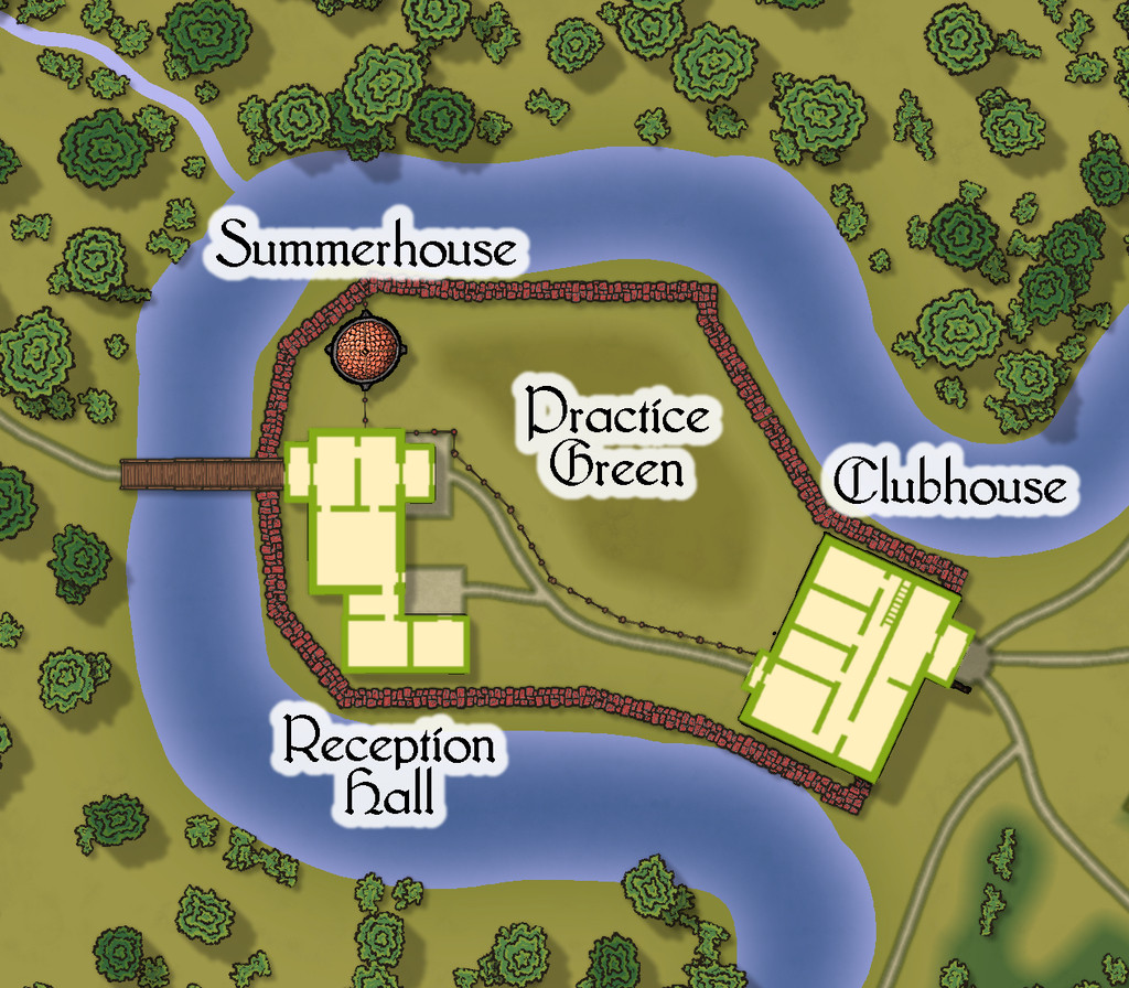
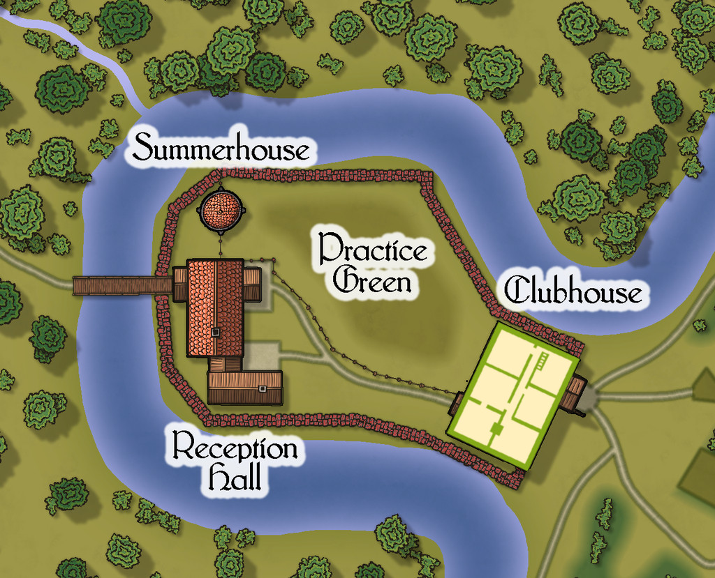
Place 2 is the "famous" Red Picket Golf Course (given Embra is, extremely loosely, derived ultimately from the real city of Edinburgh in Scotland, it proved impossible not to include something relating to golf in these maps of the Faerie city):

This time, there is the option to hide the labels for the course separately from any other map labels, to make the various hazards and obstacles easier to see, although the labelling is essential to work out what is meant to be where in terms of trying to complete the course:
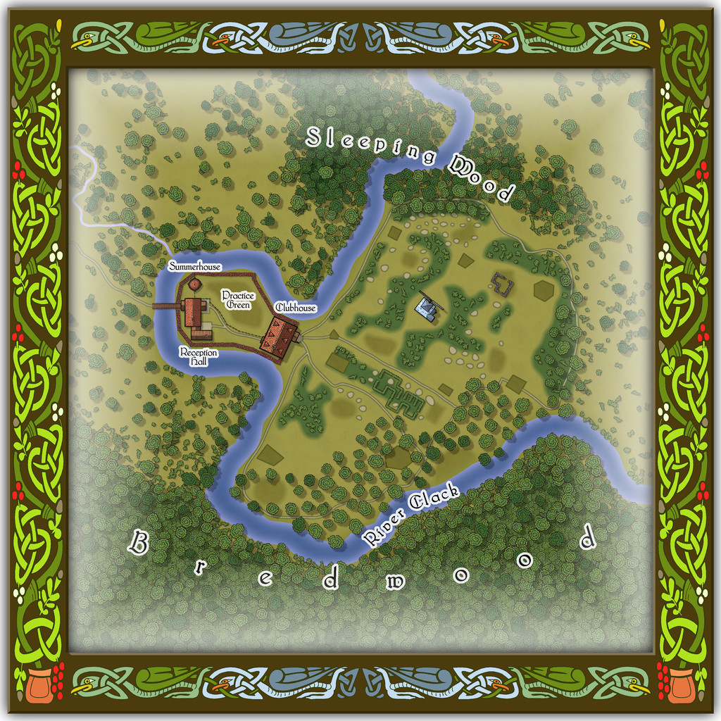
A small key has been provided with this map as well, to better clarify what the recurrent features of the course are meant to be. The PDF and text files for this map describe in detail the Faerie elements of the course, which plays as something like a cross between "real" golf and miniature or crazy golf, with fantasy aspects to-boot. Of course, those descriptions also explain why the course seems both a lot smaller and shorter than real-world golf courses (key word "seems"...), and that it may take players, non-Faerie players especially, days to complete a round of the nine holes. Benefits may accrue for those who do persist and finish the course, however. And they may find their time has not been nearly so wasted as they may have felt while still playing (Faerie time-dilation can work both ways, after all).
There are just a couple of buildings on the map, and these have been provided with internal-layout drawings via a couple more toggles in the Atlas FCW file for the ground floor, and the upper storey of the Clubhouse (only):


-
Community Atlas: Embra - Enclosed Places
Place 1 from this list is the Freed Haven Floral Garden:
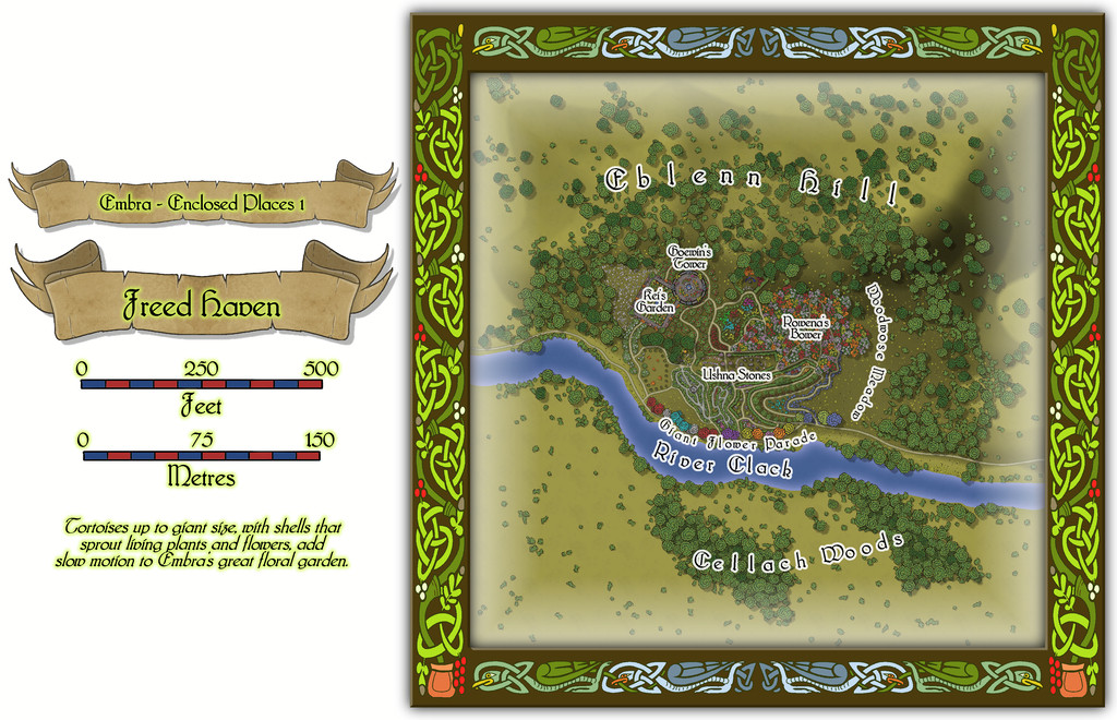
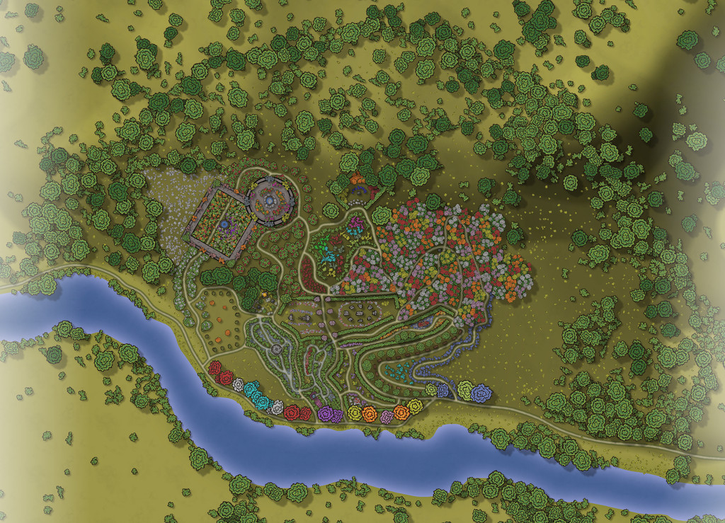
The general layout for all the "Places" maps is much as set by the "Villages" ones earlier, except obviously that the maps are now square (or occasionally rectangular). Although the scales have been retained, the unlabelled compass-rose has been omitted. While that decision was made partly for space reasons, it also follows along from the concept that in Faerie, sizes and directions need not be fixed. Plus the rectilinear borders provide clearer indications for such directions than the round "Village" map edges, should they be needed. The misty map edge is a reminder that the various Places in Embra do not link directly with one another, so visitors could go almost anywhere in the city from one Place to the next.
This map clearly has more detail in its middle than the usual Forum resolution will allow, so a closer view seems useful for that:
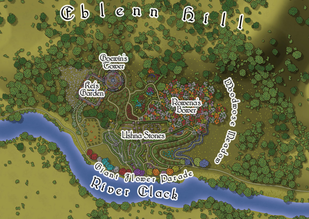
With all these maps, the intention is for there to be a toggle in the Atlas FCW version to allow the on-map labels to be turned off for greater clarity, given that sometimes the labels have had to be placed directly over the feature they're marking. There are though no buildings here - for all some elements might looks as if they should be (the accompanying text and PDF files explain more, and what the real nature of the not-buildings is):
-
Community Atlas: Embra - Enclosed Places
Having successfully negotiated the outer "ring" of Villages that comprise the initial appearance of the Faerie city of Embra when approaching it from beyond, using the "Official Guide" map, the first set of Places that might be encountered in the city proper are the Enclosed Places:
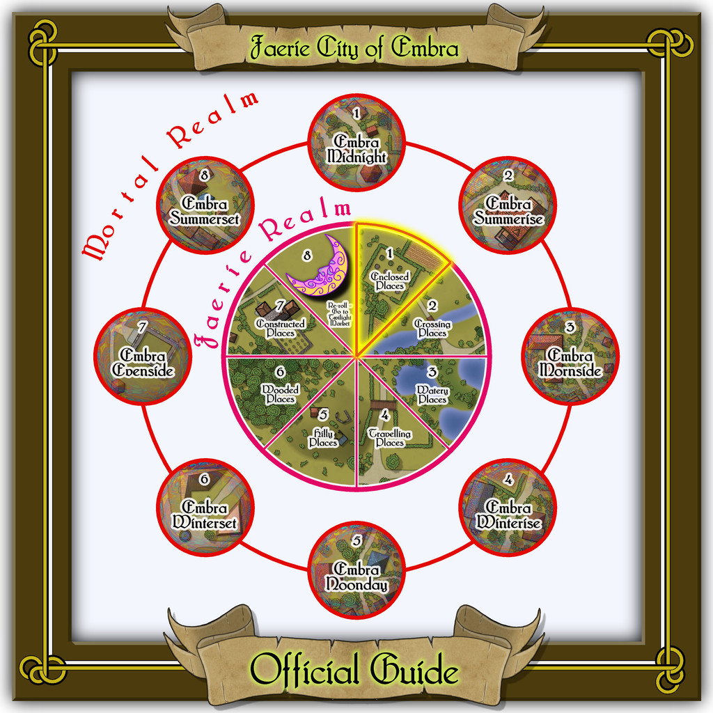
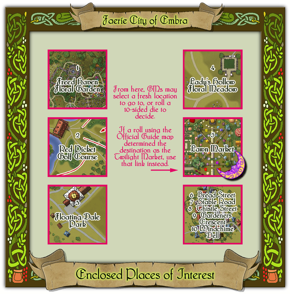
Or as we see from the new lower map, the Enclosed Places of Interest, following along from the "tourist's guide" style of naming for these link-maps.
The perceptive will immediately spot the new-look frame border decoration, this time reworked after part of one in the Dover Clip-Art "Celtic Borders on Layout Grids" hardcopy book, combined with one of the Dover interlace bird motifs. The link-spaces themselves are simply labelled extracts from the final maps, with a couple of reminder notes for how GMs could use random rolls to determine where the travellers might be going next from here. The PDF and text notes include a further reminder not to forget which number was rolled if the final "Streets" location was chosen, as that map condenses five places onto one map, whereas the others feature just one place each.
