Wyvern
Wyvern
About
- Username
- Wyvern
- Joined
- Visits
- 3,266
- Last Active
- Roles
- Member
- Points
- 5,584
- Rank
- Cartographer
- Badges
- 24
Latest Images


-
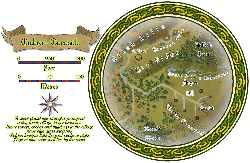
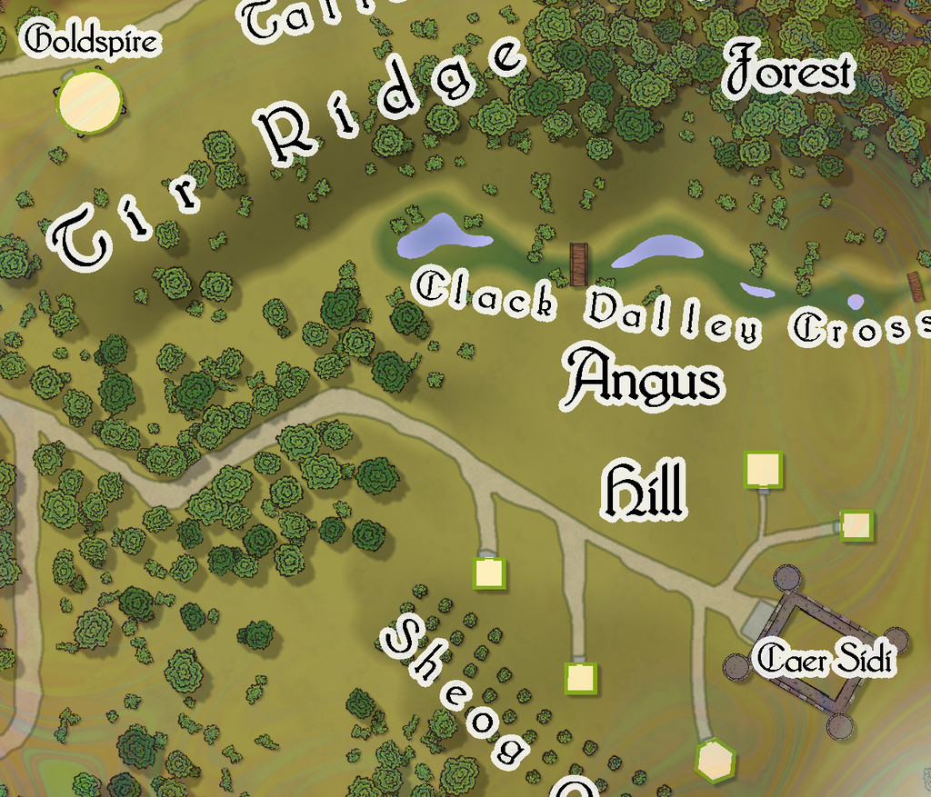
Community Atlas: Embra - Villages
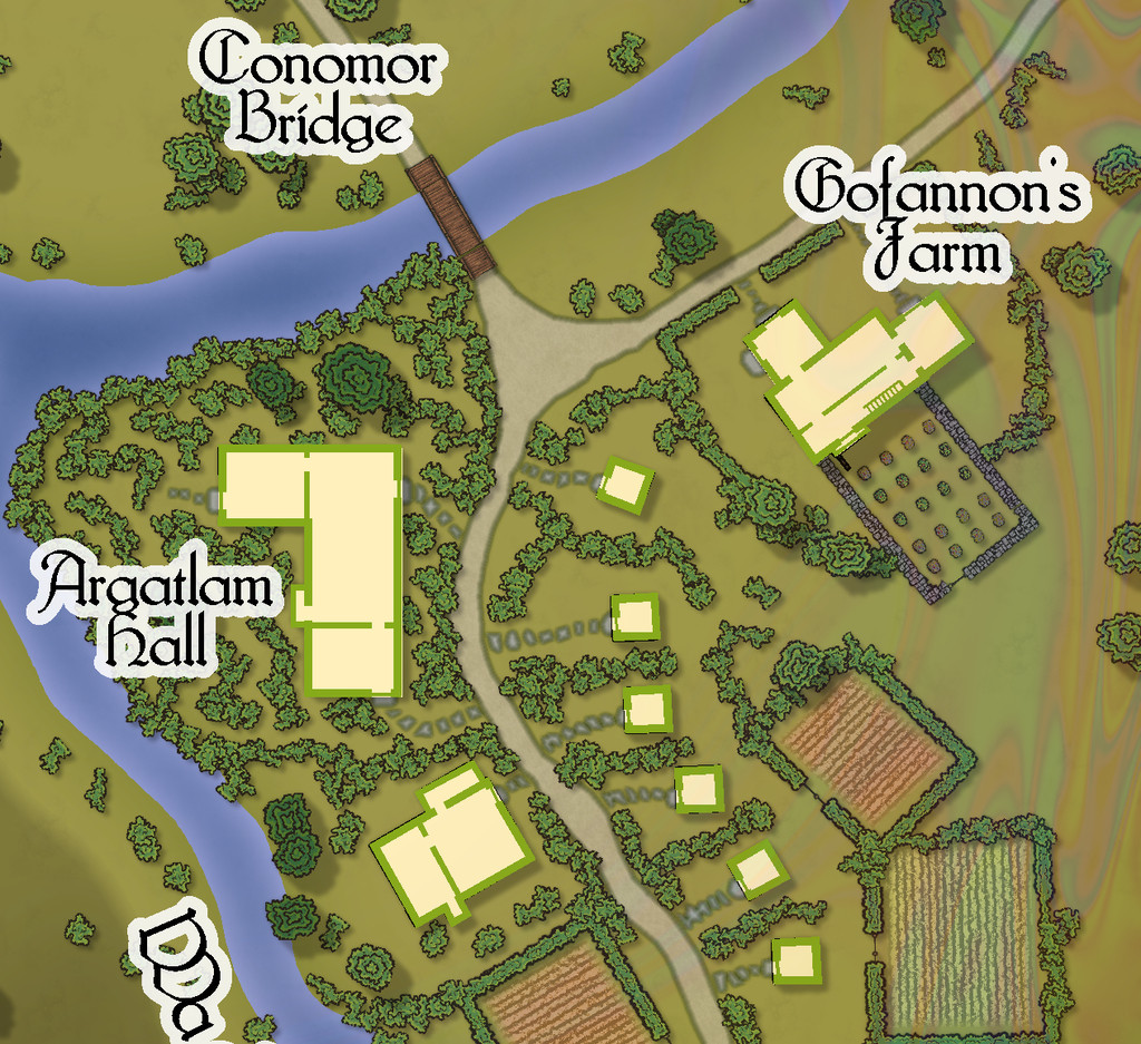
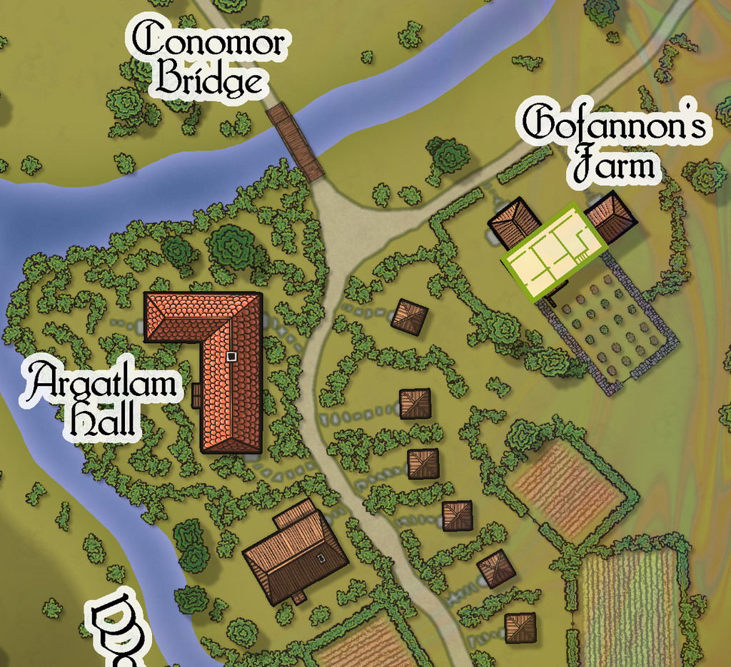
The western village of Embra - Evenside carries things to an even stranger place, now with a "castle", Caer Sidi, that is really just an elaborate stone fence around an open field! The Clack here isn't a stream, but a series of ponds linked by marshes that have a couple of bridges over the swampier spots. There's also a huge orchard, and a second dry valley with a scatter of marshy ponds along it too:
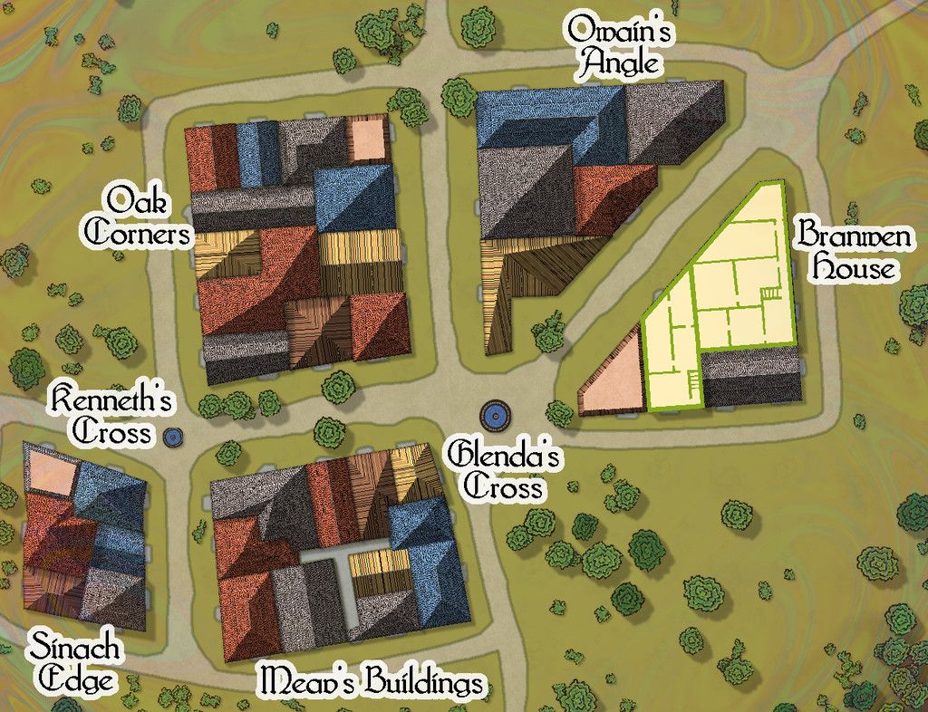
This is one map which I think especially benefits from a means to help identify which mapped items are genuine buildings:


![[Deleted User]](https://secure.gravatar.com/avatar/c75d9a245b74d9c59be0999ea81ca541/?default=https%3A%2F%2Fvanillicon.com%2F92add7f8c954488718110edc4896ad39_200.png&rating=g&size=200)

-
Community Atlas: Embra - Villages
Embra - Winterset in the southwest moves things towards a somewhat different nature, with many clustered properties, and no River Clack. Water comes instead from a pair of well-fountain pools at two midline crossroads, while the not-quite enclosed areas of Aine's Pastures are connected by a bridge that arches over the northern trail, a particularly obscure - thus clearly Faerie - feature:

The interior views show what the layout of the properties really is, although there are many fewer two-storey buildings, as the lower image here demonstrates:


-
Community Atlas: Embra - Villages
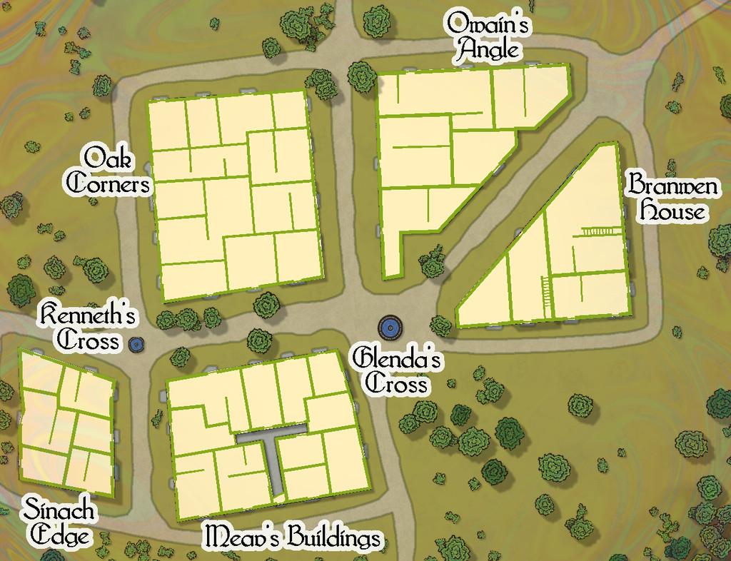
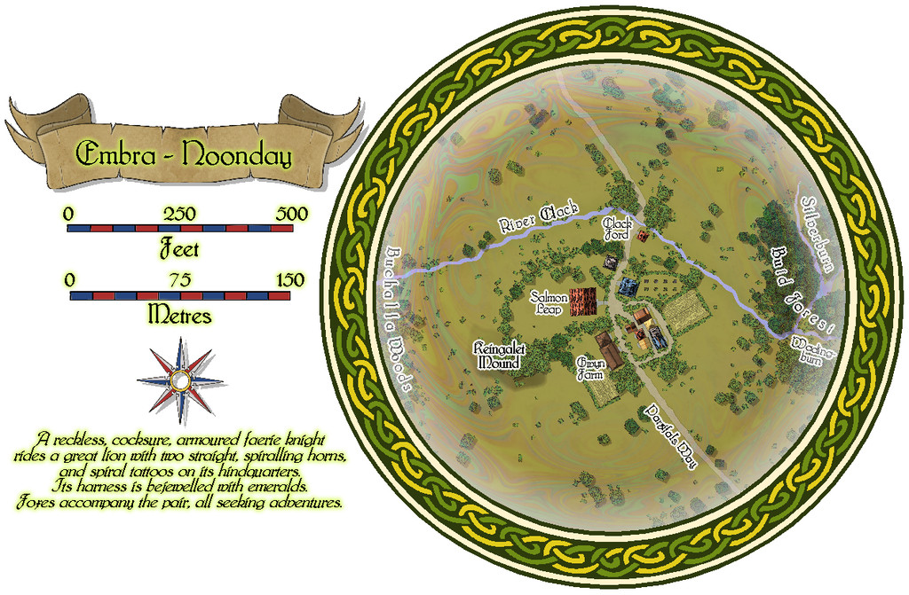
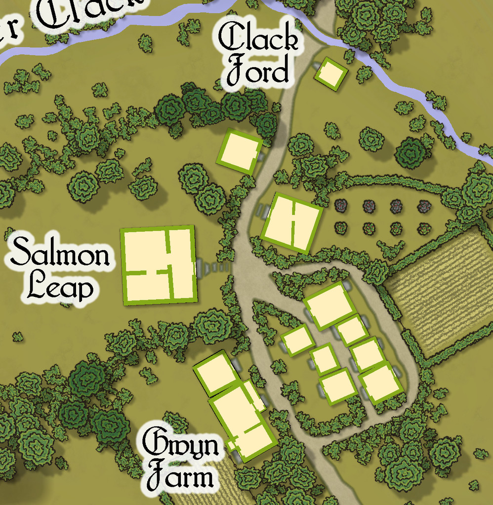
The southernmost village, Embra - Noonday, has a particularly narrow Clack stream, yet one that both the main near-Embra tributaries from the Clack Valley map, the Silverburn and Wadingburn, join by the east edge of this map:
Although there are more buildings this time, each is still only a ground-level property:
-
Community Atlas: Embra - Villages
Continuing the circuit of villages brings us to Embra - Winterise, on the southeastern side:
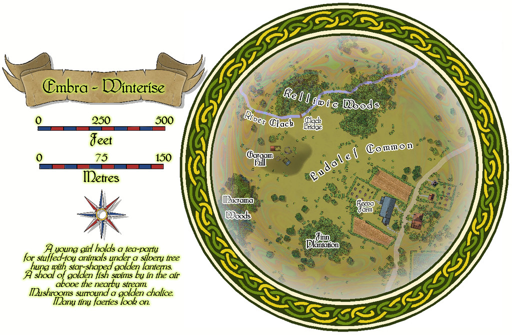
A neat little village on the road, that seems curiously separated from the narrow River Clack here, with its mysterious bridge that no track leads to, and some equally mysterious ruins atop Gargam Hill. This time, the properties are all of only a single-storey each:

-
Community Atlas: Embra - Villages
The eastern village is Embra - Mornside, a name partly influenced by the real-world district of Morningside in Edinburgh, although naturally, it also fits neatly into the general naming conventions here (none of which is merely coincidental!).
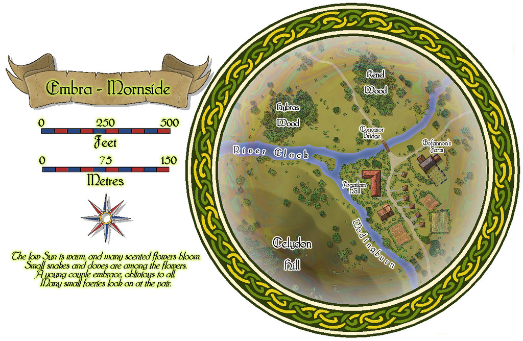
Now the broader Clack has a small island in it, and one of the tributaries from the Clack Valley map features as well, the Wadingburn, in an especially prominent form.
There are more buildings too, a mix of larger and smaller properties, one of which, Gofannon's Farm, has an upper storey: