Wyvern
Wyvern
About
- Username
- Wyvern
- Joined
- Visits
- 3,266
- Last Active
- Roles
- Member
- Points
- 5,584
- Rank
- Cartographer
- Badges
- 24
Latest Images


-
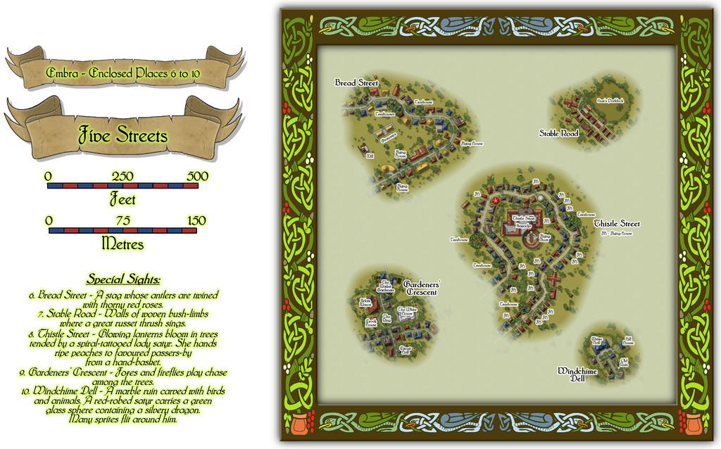
Community Atlas: Embra - Enclosed Places
The final Enclosed Places map condenses the remaining five Places, all streets, into a single drawing:
Lots to see here, so let's try a closer view of just the streets:
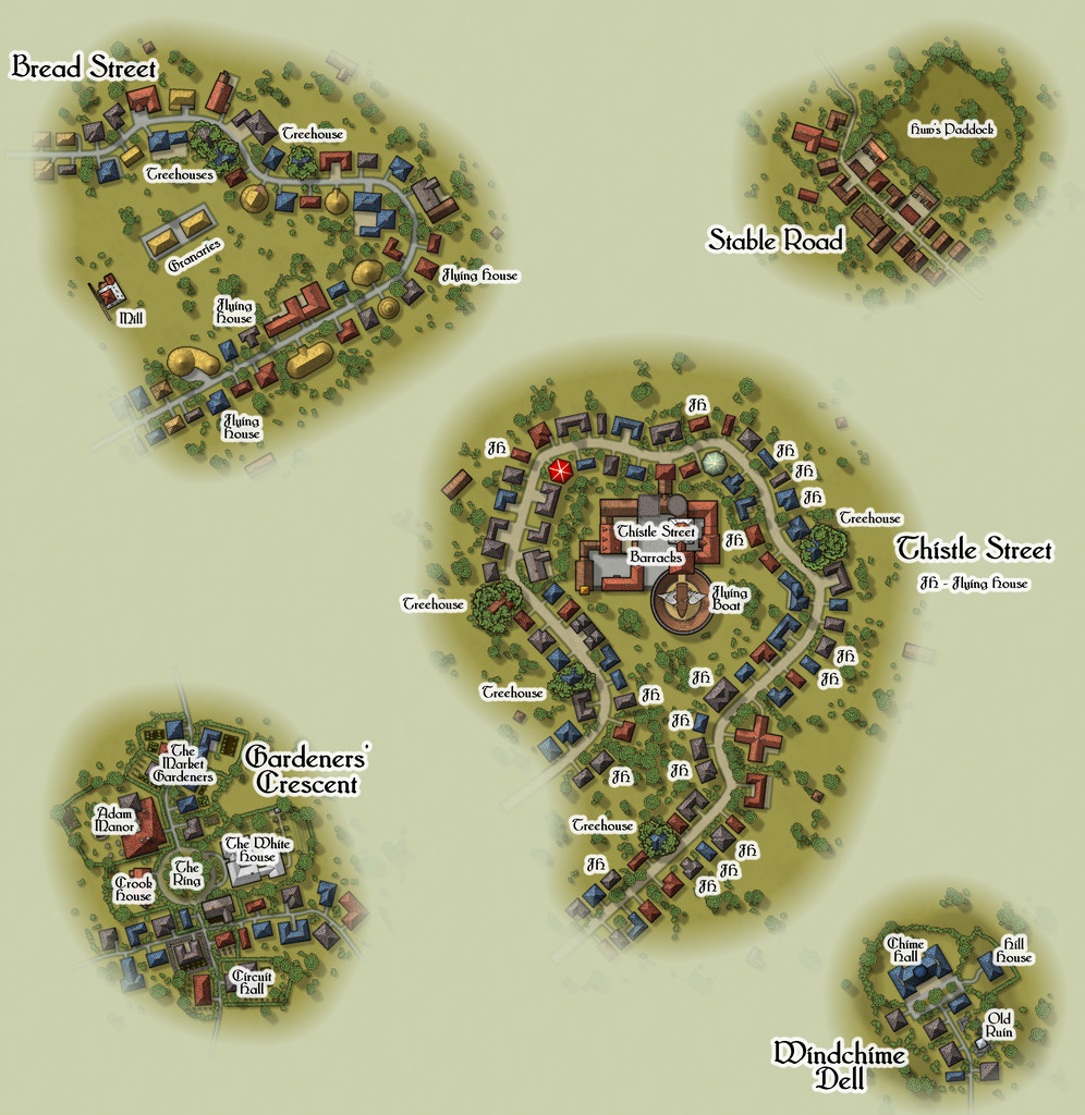
All the streets had to be designed in a rather different way to the other Places of course, as there were no Judges Guild products that provided plans for such things in isolation. As I noted previously, instead I reworked a set of tables for randomly generating caves and mines from another old Judges Guild text to decide on their lengths, widths, types and layouts, although that system ultimately was more "me" than "JG". Once the base layouts were designed and drawn into the CC3+ map, the streets were redrawn as proper CC3+ streets of the appropriate width and character, and then the CD3 random street options were used to populate them with a range of houses suitable for their overall names and natures.
The streets I came up with were often quite curvy, and the CD3 random street tool isn't too keen on curves and turns, and it can't really cope with junctions at all, so some of the random properties had to be moved, or removed, or adjusted, and sometimes redrawn using a combination of the base shapes that had been generated. Occasionally, some were swapped out for symbols, particularly where I wanted specific or important structures to be. I also decided early on that it wasn't going to be practical to provide interior drawings for all the properties involved - there were simply too many, and that ran the further risk of making them too much alike without a lot of care. I did contemplate doing interiors for selected properties, only to finally decide against that too. So if you need interiors, you'll have to come up with your own for these!
I'll not go into detail here as to what some of the items on these mapped streets are. The PDF and text files in the Atlas should help in that respect. However, it is worth drawing attention to the most significant structure, the Thistle Street Barracks, home to the Knights of the Thistle, Embra's military and police-force, in as much as any Faerie settlement needs such things. These Knights are not entirely my own invention either, as real-world Scottish knights of the realm are known as "Knights of the Thistle" too, though Embra's are naturally of a more magically Faerie kind.
As with all the other individual Places, the idea is these streets can be linked as loosely and in whatever ways GMs may desire to create fresh interpretations of Embra city.
And this is only the first collection of Places in Embra. There are six more such sets still to come!


![[Deleted User]](https://secure.gravatar.com/avatar/c75d9a245b74d9c59be0999ea81ca541/?default=https%3A%2F%2Fvanillicon.com%2F92add7f8c954488718110edc4896ad39_200.png&rating=g&size=200)

-
Community Atlas: Embra - Enclosed Places
The fifth Enclosed Place of Interest, and the last to be mapped as an individual in this group, is the Lawn Market, part of the Twilight Market. This is a much smaller map than any of the previous ones, because the base had been randomly decided as coming from the old Judges Guild "Temples Book I". As I mentioned in-passing when describing the development of the whole Embra mapping project for the Atlas earlier, the Temples book used a different scaling to any of the other JG texts I was using to determine the base drawings for all these maps. As perhaps might be anticipated, they were of a size to better suit such individual structures, not the small geographic areas of all the other books. I did though decide to enlarge it from its original size, as that would simply have been too small to fit very much by way of market features into. Thus we arrive at:
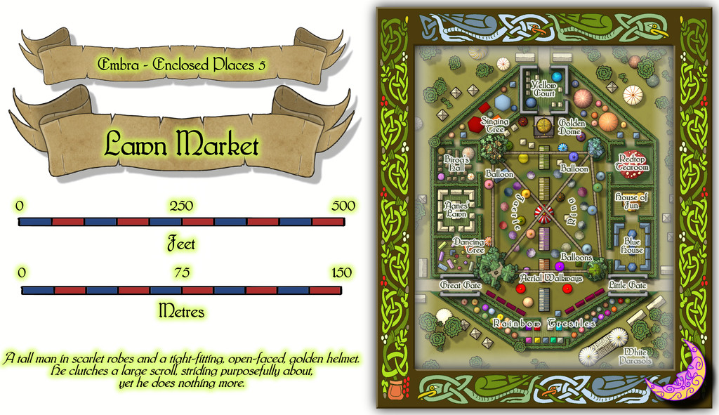
Again, this neatly demonstrates the difficulty in trying to emplace labels to identify specific small areas or items, hence the FCW toggle option to hide said labels for a clearer view:
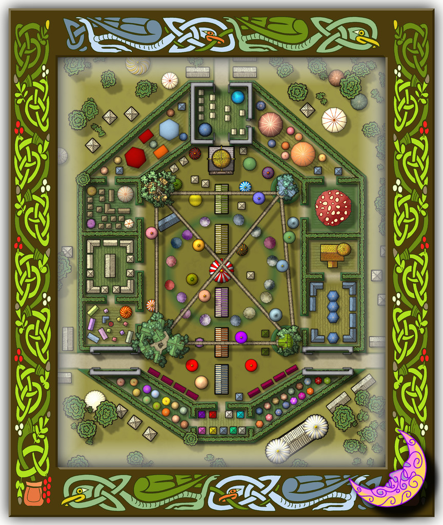
There are plenty of oddities here. Aerial walkways supported by themselves and platforms attached to four great trees, which all form a single living structure, with hot air balloons serving as market stalls for those using the walkways. Stone walls that actually aren't - well, they're not solid, but lattice-work frames that support living vegetation. Large numbers of tents and awning-covered stalls. Giant fungi housing more market stalls, and one even containing a three-floor tearoom. And a golden fun house that isn't a building at all, just a typical fairground structure, so there isn't an option to view the interiors of the buildings here, because there aren't any as such! It is though a great place to get a wonderful lawn. Just ask one of the lawn tailors to cut you a piece off whichever style of lawn you fancy of the size you need, and they'll slide it out from under the stalls so you can't even tell it's gone, and fold it up so you can carry it away easily in a pocket. This is Faerie, after all. PDF and text files will explain, as ever.
-
Community Atlas: Embra - Enclosed Places
The fourth Place of Interest here is Lady's Hollow Floral Meadow:
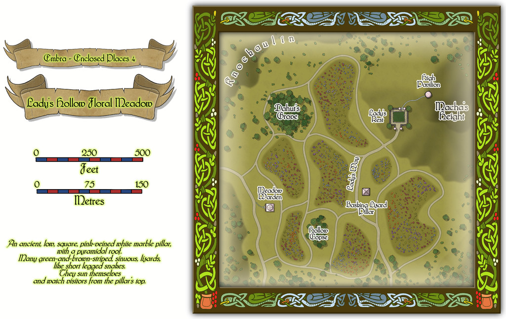
Again, the borders are especially subtly-defined here (the paths), and it is a little difficult to pick-out details at the usual Forum resolution, so this is just the map itself, now with the building interiors shown (albeit there's just the one building that has such an interior):
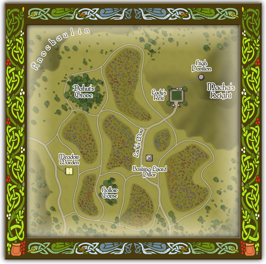
While there's probably less to explain overall from this map, there are a few features that benefit from some additional detailing - such as the castle-like garden of Lady's Rest and the High Pavilion dome - provided by the accompanying PDF and text files.
-
Community Atlas: Embra - Enclosed Places
Enclosed Place of Interest 3 is the Floating Dale Park:
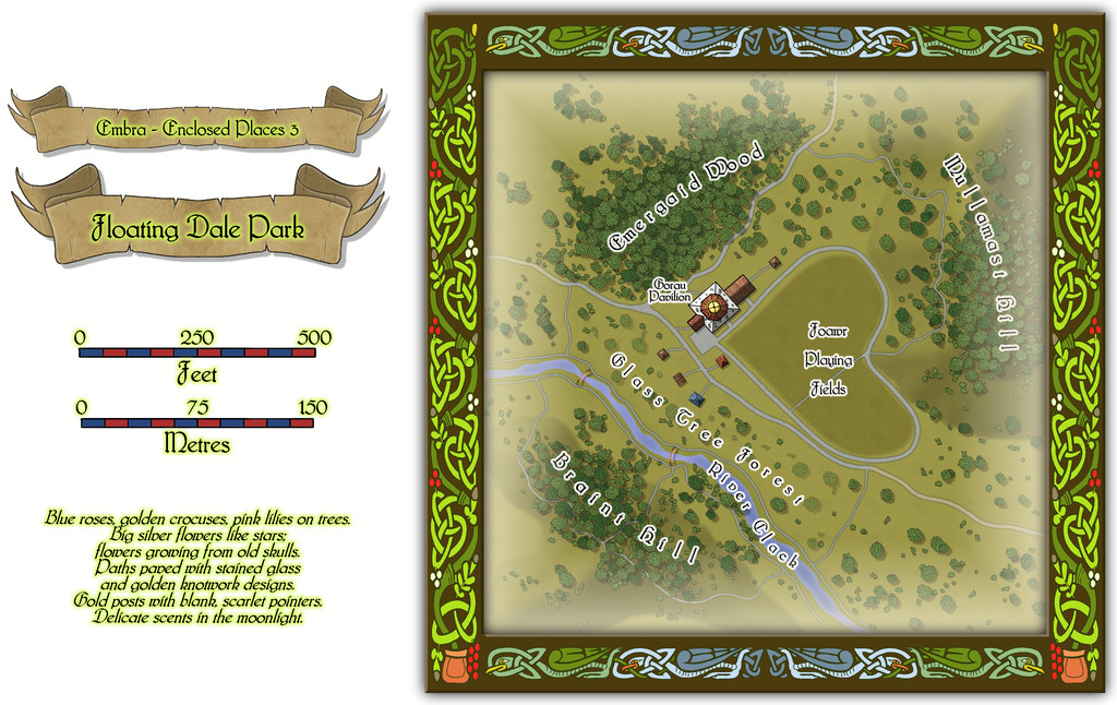
This can be used as a typical real-world park, with opportunities to wander around, or play outdoor games on the central Playing Fields, whose unusual shape may call to mind that Faerie outdoor games and sports may not be quite those familiar from the Mortal Realm.
There are a handful of surface-level buildings scattered around the map's centre, as one of the map toggles will reveal:

These include the Pavilion, where equipment for playing sports and games is available, as well as a restaurant in the central octagon beneath the building's dome. And yes, some of the vegetation is actually intended to be of living glass in Glass Tree Forest. And again yes, those ARE bridges made from rainbows over the River Clack. As ever, the text and PDF files will explain a little more about both facets, and others, from this map. In case this seems not very "Enclosed", there ARE boundaries to the Park which are deliberately less obvious than some.
-
Community Atlas: Embra - Enclosed Places
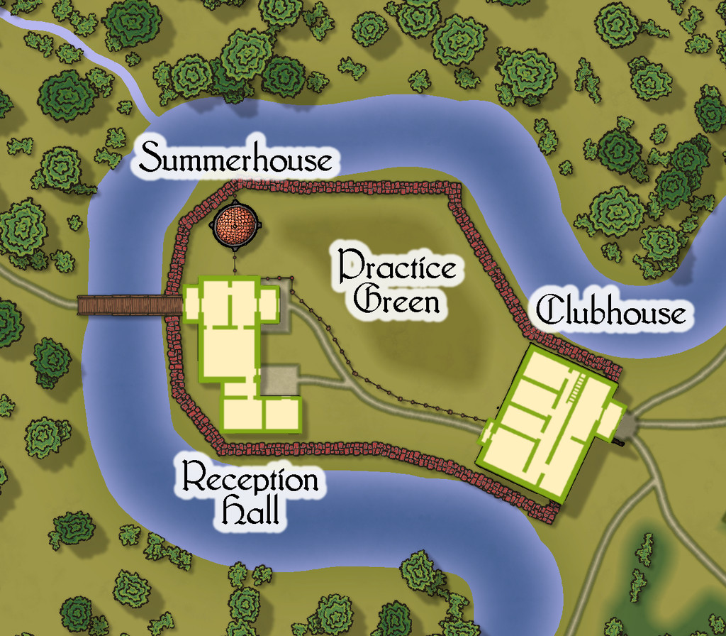
Place 2 is the "famous" Red Picket Golf Course (given Embra is, extremely loosely, derived ultimately from the real city of Edinburgh in Scotland, it proved impossible not to include something relating to golf in these maps of the Faerie city):

This time, there is the option to hide the labels for the course separately from any other map labels, to make the various hazards and obstacles easier to see, although the labelling is essential to work out what is meant to be where in terms of trying to complete the course:
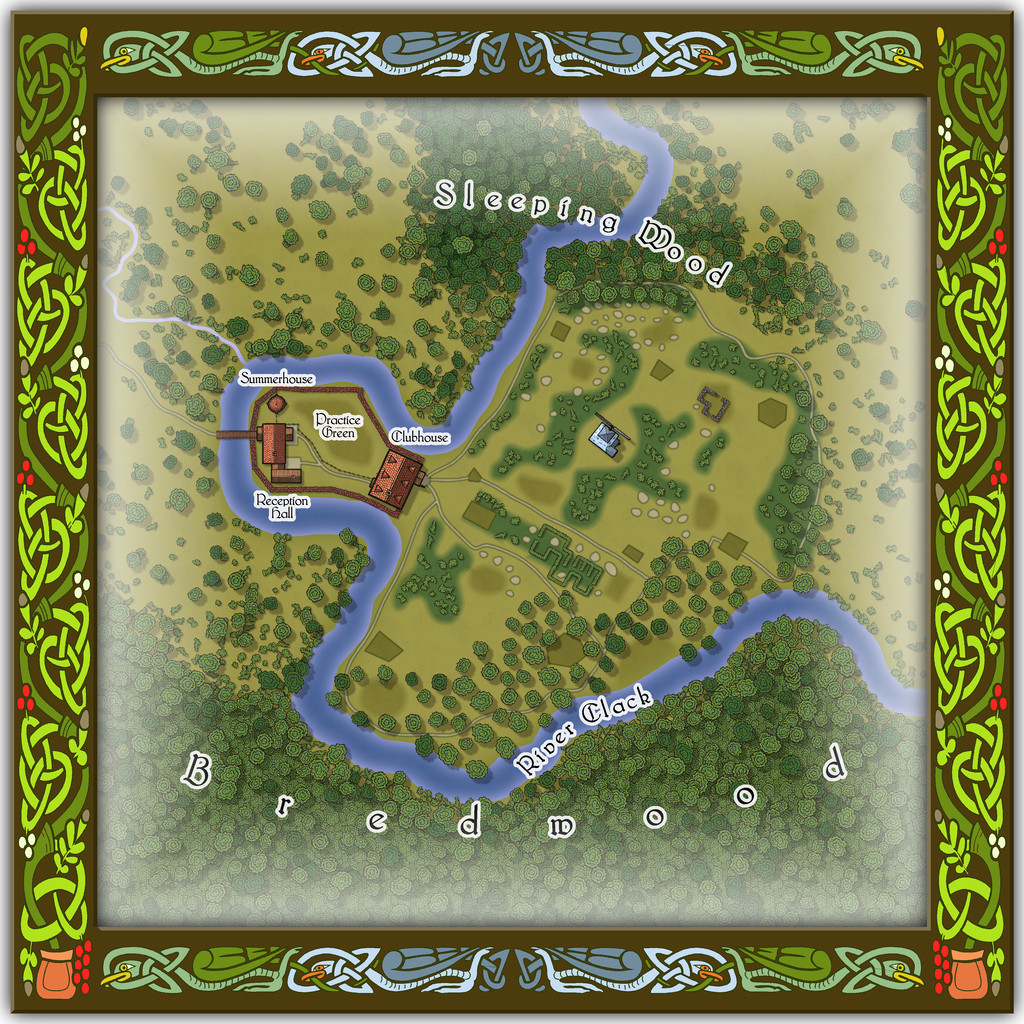
A small key has been provided with this map as well, to better clarify what the recurrent features of the course are meant to be. The PDF and text files for this map describe in detail the Faerie elements of the course, which plays as something like a cross between "real" golf and miniature or crazy golf, with fantasy aspects to-boot. Of course, those descriptions also explain why the course seems both a lot smaller and shorter than real-world golf courses (key word "seems"...), and that it may take players, non-Faerie players especially, days to complete a round of the nine holes. Benefits may accrue for those who do persist and finish the course, however. And they may find their time has not been nearly so wasted as they may have felt while still playing (Faerie time-dilation can work both ways, after all).
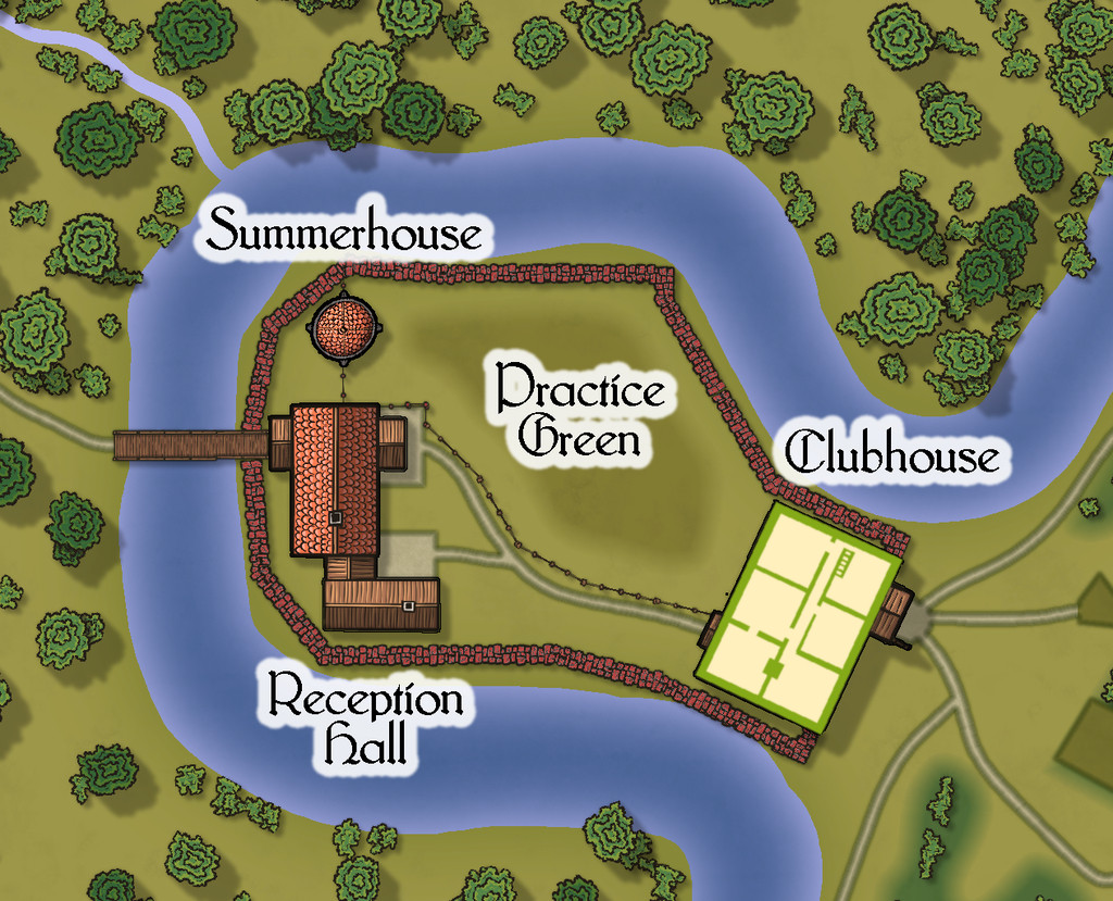
There are just a couple of buildings on the map, and these have been provided with internal-layout drawings via a couple more toggles in the Atlas FCW file for the ground floor, and the upper storey of the Clubhouse (only):