


Wyvern
Wyvern
About
- Username
- Wyvern
- Joined
- Visits
- 3,266
- Last Active
- Roles
- Member
- Points
- 5,585
- Rank
- Cartographer
- Badges
- 24
Latest Images


-
Community Atlas: Embra - Constructed Places
However, the sixth built Place is one more suited to indoor musical performances without such adaptations, Spring Festival Hall:
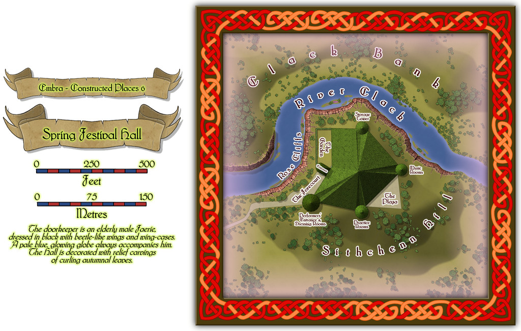
The bright green roof tiles are all made in the shapes of unfurling, fresh, spring leaves, to contrast with the walls and ceilings of the Hall, that bear relief-carved autumnal foliage instead (Embra; what else would one expect by this stage?).
Inside, only the layout plan for the surface-level is provided. Most of the towers have higher, and lower, floors too, which are not illustrated, and which also like to change at times, as the accompanying written notes indicate:
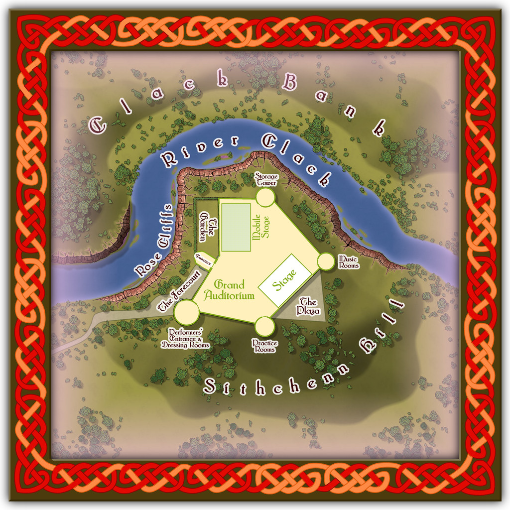
Folding doors allow performances to be enjoyed outdoors on The Plaza or in The Garden, while the Mobile Stage can be raised or lowered to allow more seating in the Grand Auditorium. Despite its odd shape, the internal acoustics are excellent. If you want to perform here - and have the skill to do so - it might help to have befriended some of the musicians from Glass Harmonica Way first (see the Watery Places Streets map). Plus of course, any excuse to use some more of Sue's wonderful red sandstone cliffs!

![[Deleted User]](https://secure.gravatar.com/avatar/c75d9a245b74d9c59be0999ea81ca541/?default=https%3A%2F%2Fvanillicon.com%2F92add7f8c954488718110edc4896ad39_200.png&rating=g&size=200)

-
Community Atlas: Embra - Constructed Places
The fifth Constructed Place moves us into the "entertainment" quarter (if Embra had such a thing, at least), the actors' village of Stubble Chin Theatre. Subtlety isn't really in it, with Sorceress' Hill and Verdant Wood adjoining one another, but theatricals often feel the need to make a clear statement, it's said...
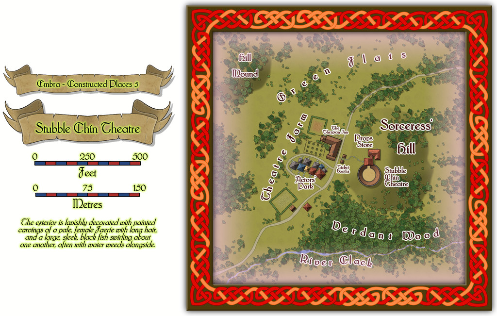
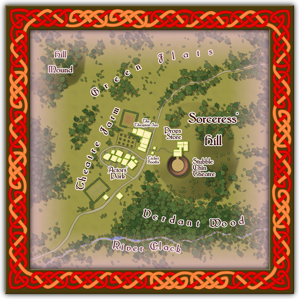
The Theatre itself is an open-air one, though it has a concealed clamshell cover that can be raised to move everything indoors when required, allowing for a greater variety of performances, not necessarily all of a theatrical nature.
-
Community Atlas: Embra - Constructed Places
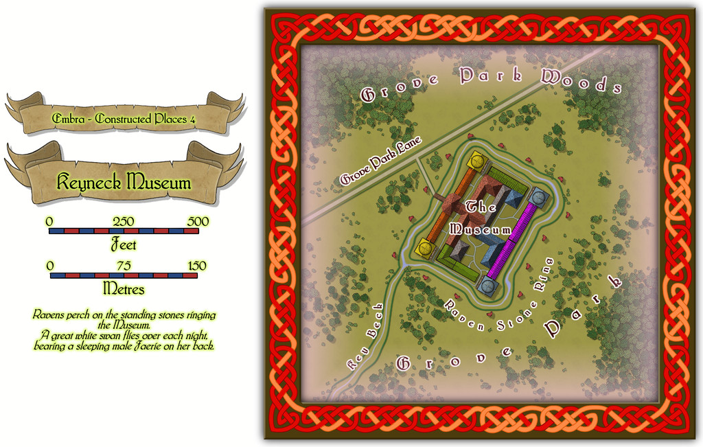
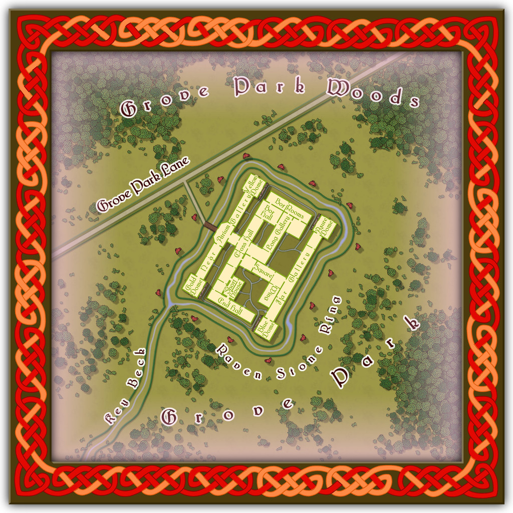
Next is the Keyneck Museum, full of wondrous artefacts gathered from across Nibirum and beyond, with displays that change from one visit to the next, although there seems nowhere here to store whatever isn't currently on show. Key Beck might intrigue visitors as well. The water flows in along the west side of the channel from the southwest, round the circuit of the Museum, and then out again down the east side of the channel. Narrow, isn't it? And maybe the name relates to the layout of the Museum buildings in relation to that channel. Possibly.
-
Community Atlas: Embra - Constructed Places
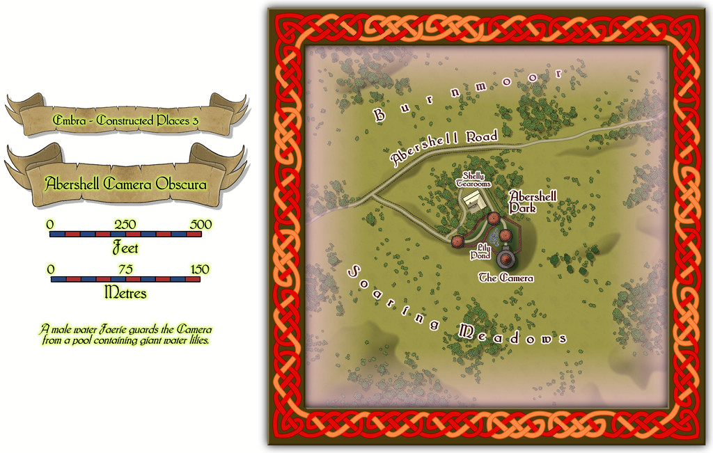
The third Constructed Place is the Abershell Camera Obscura, set in an apparently unlikely open zone, more suited to an observatory, one might think:
As ever, despite the random selection of base-maps for this series of drawings, the choice of what went where was solely my own, all of which decisions were made with the aim of providing additional puzzles for anyone trying to explore the city, when working to ordinary (i.e. non-Faerie) norms.
There are just two actual buildings here; the rest are open domes over the paths. Oh, and for those who might be interested, the Shelly Tearooms are famous for their exquisite range of ice-creams:
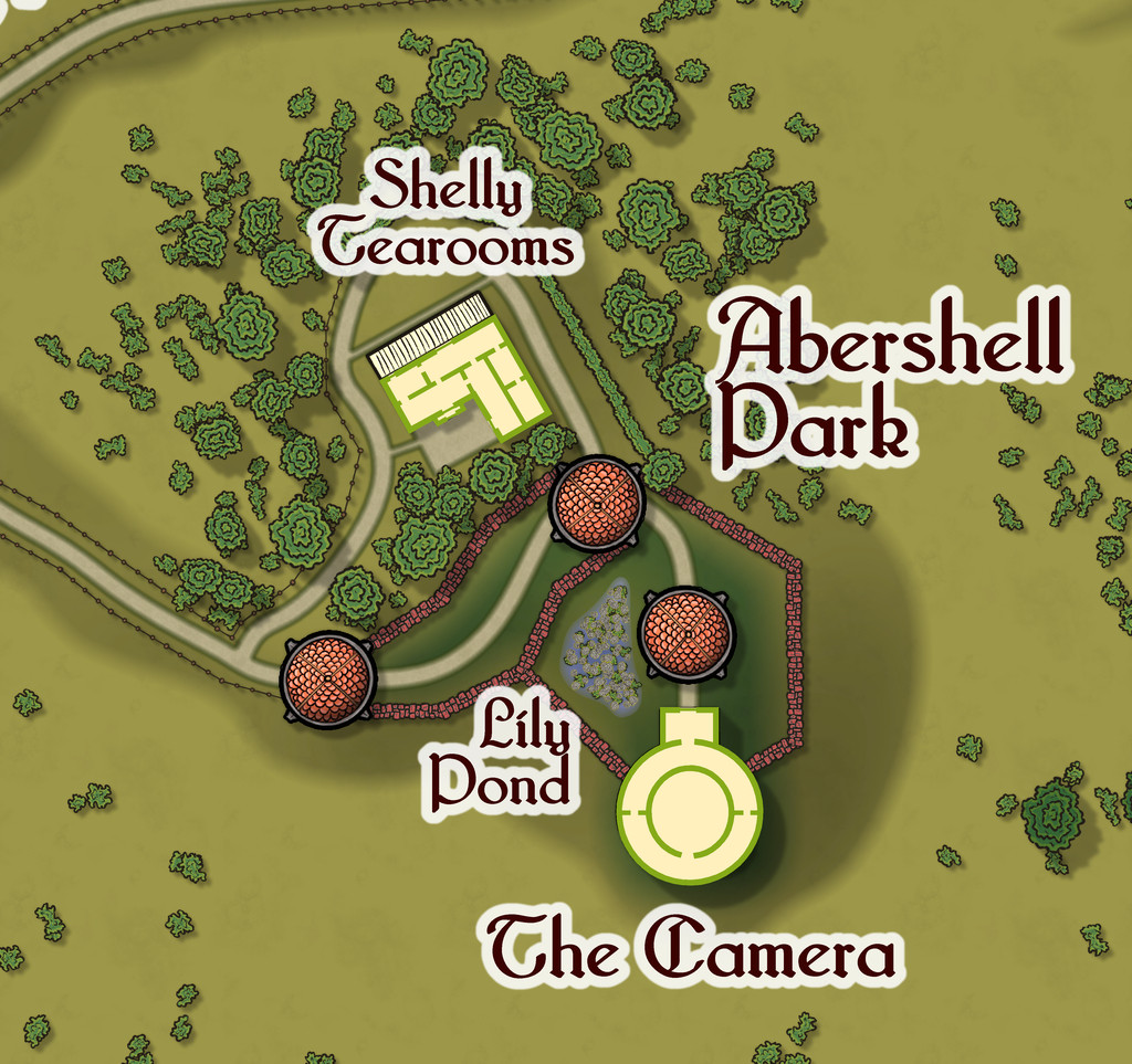
While the Camera shows views of the surrounding scene from its darkened inner chamber, as might be expected, under the care of the featured text's magically-skilled Water Faerie operator, it can show many other things and places too. And when you step out the door, that might be where you'll be. Only if the scene changes, the Camera building won't be there to take you back...
-
Community Atlas: Embra - Constructed Places
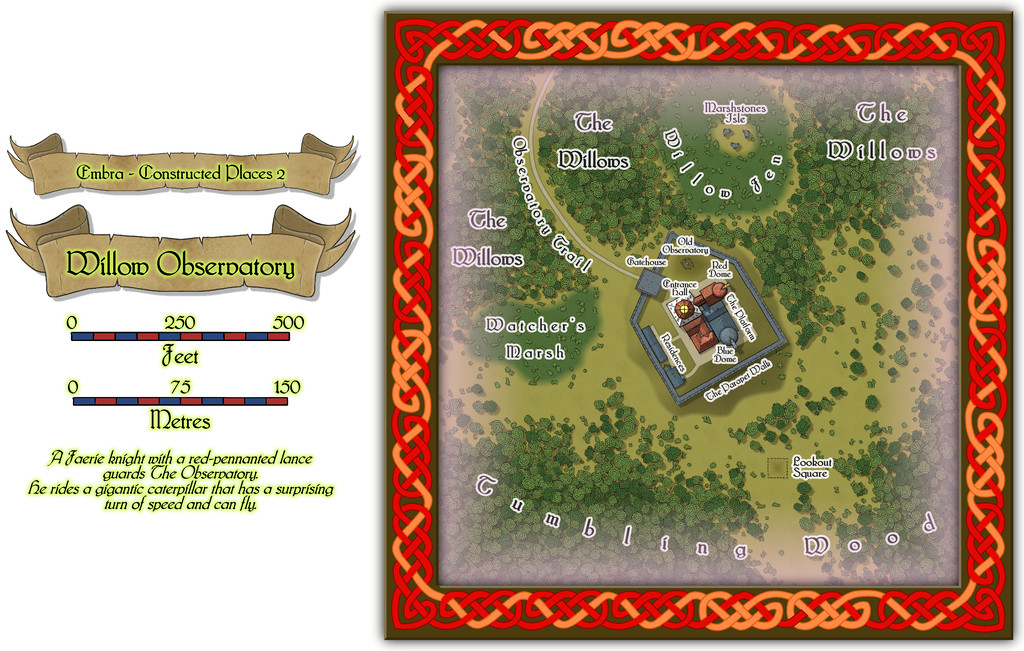
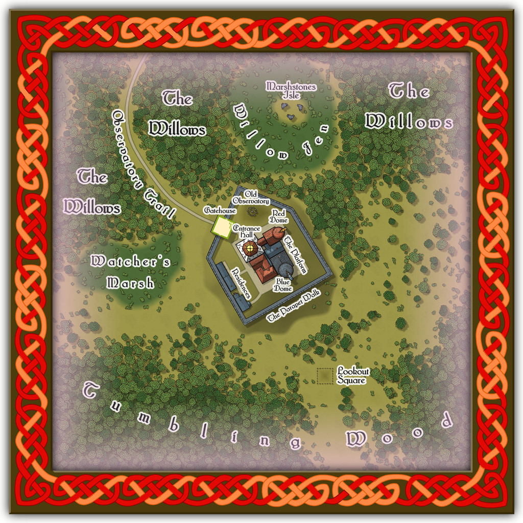
Place 2 is the Willow Observatory, inspired loosely by the real-world astronomical observatories at Edinburgh, Royal Observatory Edinburgh (which is some distance from the city itself) and Calton Hill Observatory, which is right in the city centre, and the consequent long tradition of watching the night sky from there. While some of that tradition was used to inspire what happens at Willow Observatory (including the annual summer activity of looking-out for dragon ghosts in the all-night-twilit northern sky; you'll have more luck trying a search for "noctilucent clouds", should you wish to learn more before the PDF and text files are available), the setting is purely Embra, as the misty marshes and woods nearby would scarcely seem conducive to dedicated sky-watching if anywhere else. And who knows what you might see on the planets of the Nibirum Solar System using one or other of the great magical telescopes here:
Building interiors:

And the upper interior floor for the Gatehouse:
Plus there are oddities nearby, all of which receive at least some discussion in the accompanying notes.
