


Wyvern
Wyvern
About
- Username
- Wyvern
- Joined
- Visits
- 3,266
- Last Active
- Roles
- Member
- Points
- 5,585
- Rank
- Cartographer
- Badges
- 24
Latest Images


-
Hexcrawling starter maps
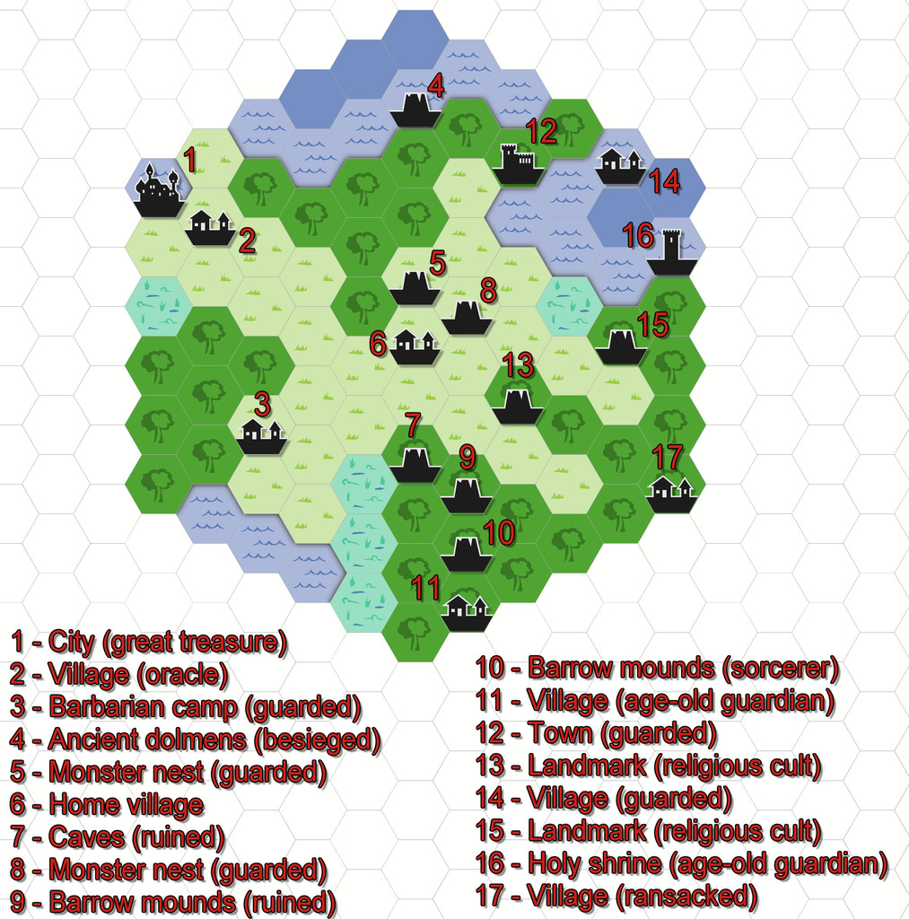
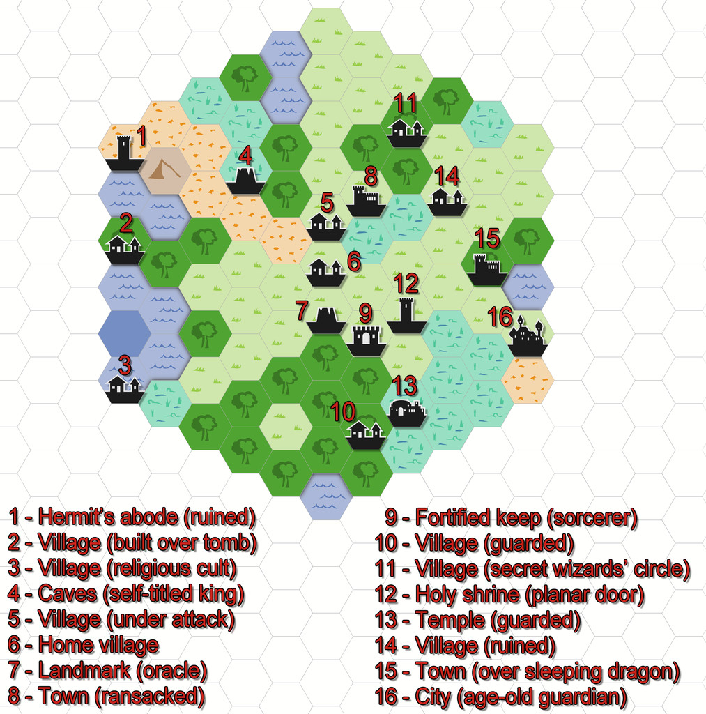
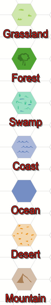
There's an obvious couple of problems here. One is there isn't a great enough diversity of symbols to cover even the fairly small range of non-settlement features that might be useful, and which only an expansion of the style (either by PF or personally) would solve. [There is a further issue here too, in that none of the location symbols actually work to the standard snap grids used in this Annual. I'm not sure if that may have been amended since I downloaded my copy, however. I ended up having to place most by eye alone, certainly.]
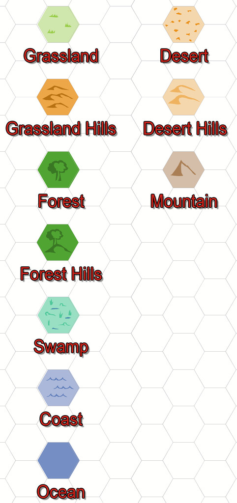
The other is that anything placed in a coastal hex looks as if it's really in the sea, because that's just how hex maps of this sort work. That though is something I could resolve. Plus as I'd been randomly rolling terrain up, I'd noticed there was no "Hills" option in the current ShadowDark tables, so decided to tweak that a little to include some.
So the maps, and additional keyed terrains, came to look like this:
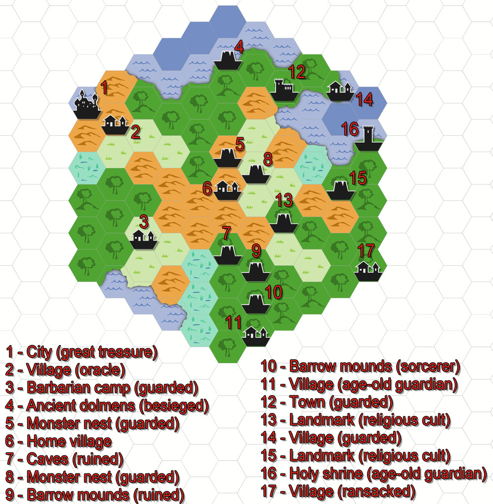
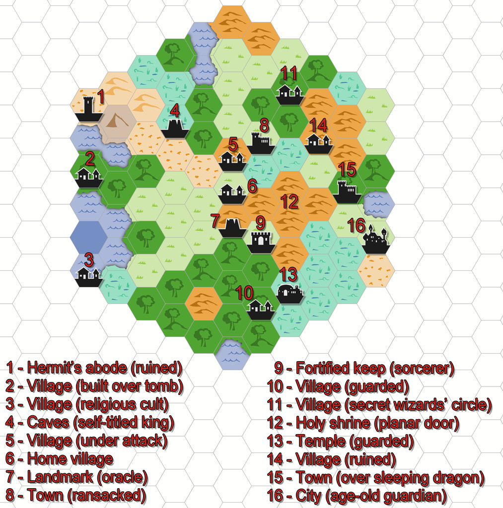
All I did for the coasts was add a small section of land from each adjacent hex over the coastal sea.


-
Hexcrawling starter maps
Just to make sure I'm not leaving anyone behind here, some brief explanation. From the early days of RPGs, those running the games have been encouraged to design areas for the players to explore, frequently using random generation systems to do so. "Hexcrawling" is the overland version of this, where each hex represents a fixed distance (if sometimes a little vaguely defined, given a hexagon is not the same size from its centre all around), commonly 5 or 6 miles, though larger or smaller sizes than this are not infrequent. What are now called "Old School Rules" (OSR) RPG systems often make use of this technique, and these have seen a particular upsurge in popularity this year, following ongoing problems from the current owners of "Dungeons & Dragons".
One of the unexpectedly phenomenal successes of recent times in the OSR line has been a new RPG called "ShadowDark", which presents a very streamlined update on the OSR theme, that incorporates improvements from modern RPGs more generally. I've been very taken with the whole ShadowDark RPG conception, particularly as the Core Rules include everything needed to play the game, such as a random generation system for hexcrawls.
Last weekend, I did a couple of small test areas, to see how the system worked (hexes here are 6 miles in size), and although the system which will appear in the printed Core Rules has been tweaked a little since then, I prepared the maps in CC3+ through the week, to see how they'd look, using the 2010 Overland Hex style. These are the basic maps as generated by the random system rolls, with a list of their contents, and a separate key:


-
[WIP] Continent Map using CC3+ MS Overland and other resources
Map labelling's always tricky. There's an inevitable trade-off between clarity, precision and how much information you need to/want to present. Colour-coding the settlement names, as you've done here, is a useful trick, and maybe just using that with a map legend to say which colour means what realm might be sufficient at this smaller scale. The larger-scale text labels still seem a little too distracting, for all their faded transparency, to me, but the important thing is that you're happy with the end result, of course! And the maps DO look good!

-
Expansion to Ellis Prybylski Watercolor Style
Yes please to the Elf, Dwarf, Halfling and Orc structures, plus ruins, ships, icy elements, a volcano-mountain, variant settlement features (including for different cultures)! And after those, also perhaps:
- Magical site markers
- Battlefield marker, and a more general flag-style marker, to highlight important sites that don't fit to specific structure types.
- Oasis symbols for the deserts.
- Two more bridges at different angles to the current one - one running straight down the page, the other angled down from top left to lower right.
- I really like the Henge and Tomb hill markers, as they look good on any terrain. Another such marker with a cave mouth would be very useful.
- Some Mountain Peak symbols without the snowy tops (so grey mountains, just no white caps).
- Seeing the animal and creature comments, just the actual creature without any associated terrain would be better, as usable anywhere. Snag is, going down this route is liable to lead to requests for a lot more "resources" style markers - domesticated creatures and crops, minerals, etc.
- Some jungle-style trees, perhaps including mangroves, as well as the fruit trees Monsen mentioned.
I'll probably think of others later, but these are what're coming to mind right away. It's a wonderful style, and it would be excellent to see it expanded as far as possible in future, I think.
And thank you very much for creating it!


-
Community Atlas: Dendorlig Hall - A Sort-Of D23 Dungeon for Nibirum
Having at last managed to map the exterior region beyond the Hall to its south, Dendorlig Vale, and having just discussed it on the Forum, it seemed a good idea to update the state-of-play with the Hall itself today as well. My handwritten notes currently have reached area 201, while the type-up of these has reached area 160, all of which is easier to tell now, as I'm past the point where some areas were being written and typed-up out of sequence. The map continues to be amended in minor ways, notably in the placement of the area number-labels, after these, as noted previously, were enlarged some time ago.
Today's notes cover what was partly shown in the lower right corner of the previous sample map-segment here, the places formerly occupied by The Pegasus Club and the areas adjoining it (not all of which were directly related to the Club in their previous use). This is the map segment covering the areas involved:
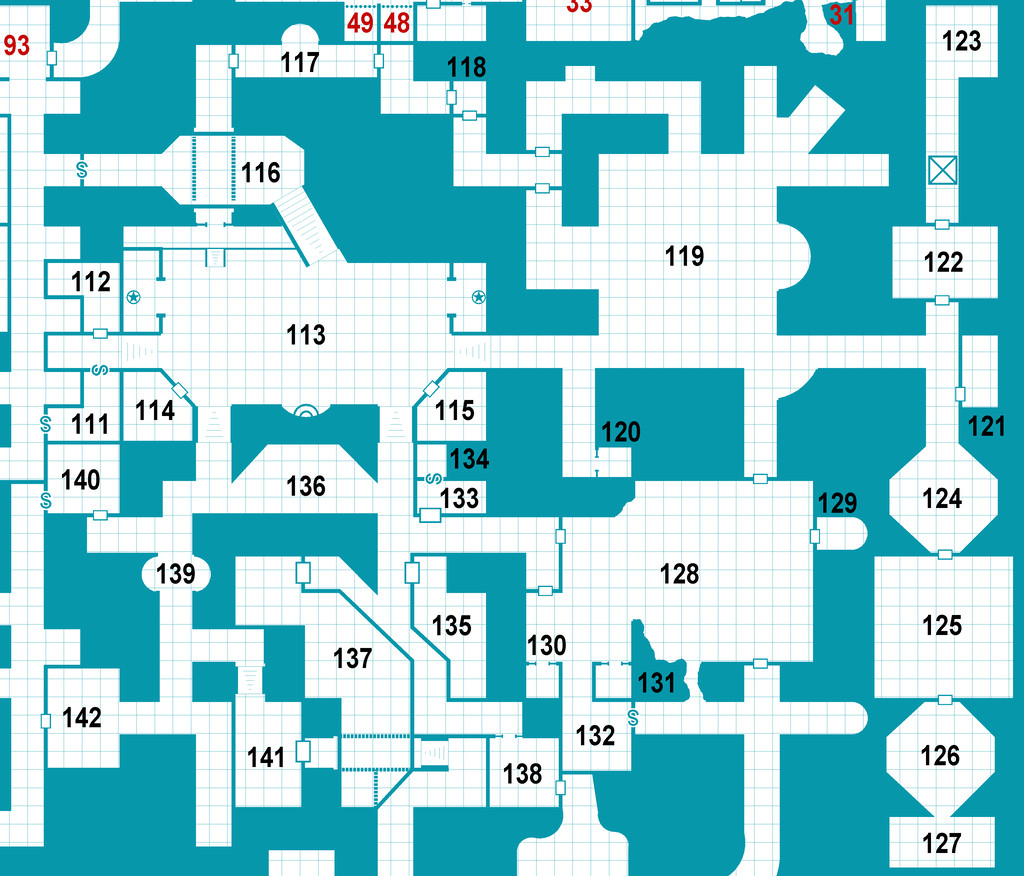
And these are the extracted PDF notes to go with the same areas (only):
As usual, both map and notes are subject to further amendment subsequently, as the text hasn't been fully checked still, while the project remains ongoing. Indeed part of the earlier notes posted here, which mentioned Dendorlig Vale, have been altered slightly too following the mapping of that external region, to reflect how the map actually turned out, rather than how it seemed it might earlier!
Further updates should follow, if all goes to plan.
[EDIT: And if only I'd realised this would have had the Forum-added note "28 Days Later", I might have made some post-apocalyptic comment as well 😉. Too late now though...]

