


Wyvern
Wyvern
About
- Username
- Wyvern
- Joined
- Visits
- 3,266
- Last Active
- Roles
- Member
- Points
- 5,584
- Rank
- Cartographer
- Badges
- 24
Latest Images


-
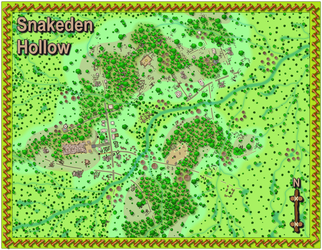
[WIP] Community Atlas: Snakeden Swamp, Lizard Isle, Alarius - Dedicated to JimP
Resuming where we left off, the next phase was to add the external segment at the map's right side. Rather than redraw that, I simply copied and pasted what was required from the Snakeden Hollow map, added, and in some cases amended, the relevant sheet effects to better fit this different map-view scaling, and adjusted the cliff to be a simple line, separating interior from exterior.
The vegetation looks a bit sparse there now, so that may need adjusting too later on. I also had to add an extra mask segment to hide the wall shadow from the new cliff line near the top, where it was showing on the interior of the rock. Other tweaks seemed likely as well, but I wanted to get on with the complexities of the internal layout, so switched to that.
Which brings us to something of a hiatus in screenshots, because this process turned out to be a lot more complex than expected. Looks great as a simple hand-sketched view - five minutes to draw that... Yeah, right! Basically, it turned into two full sessions spread across a couple of days, with a lot of switching and changing, during which I completely forgot I was meant to be recording such things as I went along.
So, imagine a burst of gentle harp-music, water-on-glass visuals, as we fade back to where this got me finally:
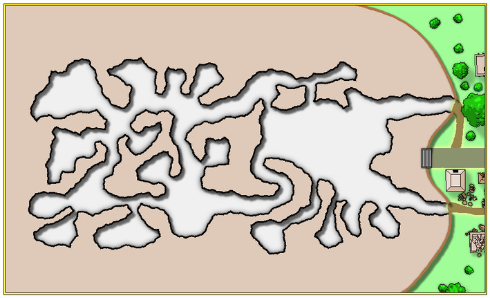
Main obvious change, aside from the range of new features, is that the interior floor colouring has been darkened. At the same time, much of the internal wall shadows have been reduced significantly, while still helping to differentiate the various levels in a more subtle way than the original shadows. In practical terms though, the whole interior floor has been redrawn as separate pieces, because it proved impossible to retain the complete original floor even for the lower part (darker, extensive, left-hand segment, except the darkest cave's floor there). That was largely because of the glows on each floor element, and the stair symbols, interfering with one another. Several now have separator sheets and underlying mask polygons added, to further help keep things clean.
At which point, I remembered I should have been taking more screenshots, so here's one where the changes are so subtle you may be hard-pressed to spot them:
The well's been added as a first test for how the internal lower symbols would look (lower right, on yet another new sheet) and the basal shadows for the two sets of stairs in the darker leftward part of the drawing have gone. Well, masked now, at least, to look less steep-drop-floaty!
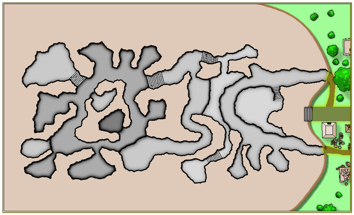
It was about this point I stood-back and examined the map as a whole for once, always useful in the latter stages, to see how things are working together as a complete map, not just how individual bits are holding up when zoomed-right in to fine-tune things. Which made me realise I was struggling to differentiate between the separate internal solid wall blocks and the floor levels. Thus with a few clicks, the interior rock colouring was changed to:

Some further amendments have been made as well. The tunnel through the raised floor in the large right-side cavern has been added (no, it hadn't been forgotten, although earlier I had forgotten the steps up on the south side of that extended raised platform, leading to the rounded cavern at its end, during the unrecorded mapping sessions). The other changes are likely too subtle to be spotted, adding masking patches to tone-down the upper-level shadowing glow by the three small drop-lines at the cave-mouths in the left-hand section. I tested a similar idea on the longer ledges as well, but felt those looked better without them in the end - as they are here. That mild shadowing suggests a slight dip towards the drop-line that seems to help fool the eye better.
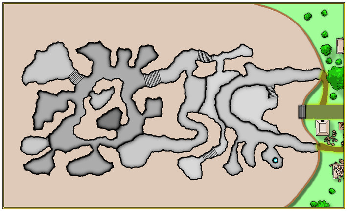
With that all completed, it was time to start adding some symbols to give a little more life to the whole, as well as a scaling grid for the interior (I decided against adding one for the outside too, as this is really a map of the interior, after all). A couple of sloping-passage arrows were added along the way:
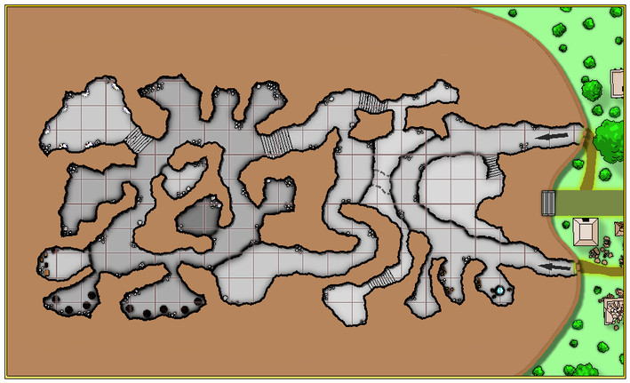
The wall shadows mask had to be extended to hide unwanted bits of the grid, although because the original mask followed the complexities of the fractal cave wall, that proved unworkably slow and impossible to control by the normal node-editing processes, so fresh patches of suitably-coloured polygons were dropped-in instead. After which (higher-res map now - must be approaching the end!) it was time to break-out the labels, north pointer, etc.:
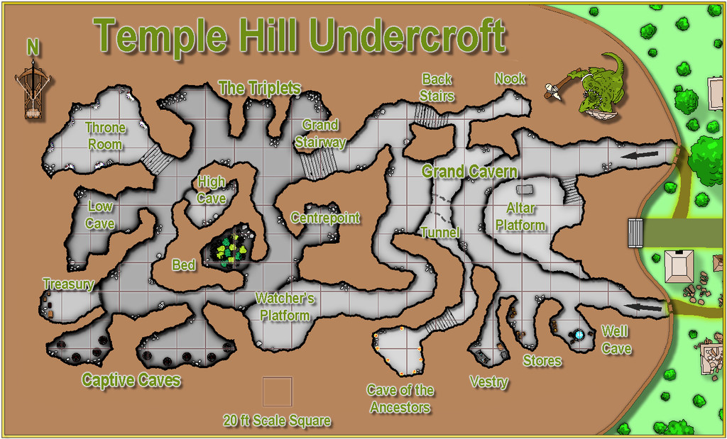
Plus a decorative SS2 Lizardman. And sans grid:

On the CC3+ version, these labels all looked fine and clear. As soon as these JPG test versions were done, it was obvious the labels weren't working nearly so nicely. I also didn't like the faintness of the scale square here. So more changes followed to reach these final versions (unless I decide otherwise before submission to the Atlas, anyway!), with and without the grid:

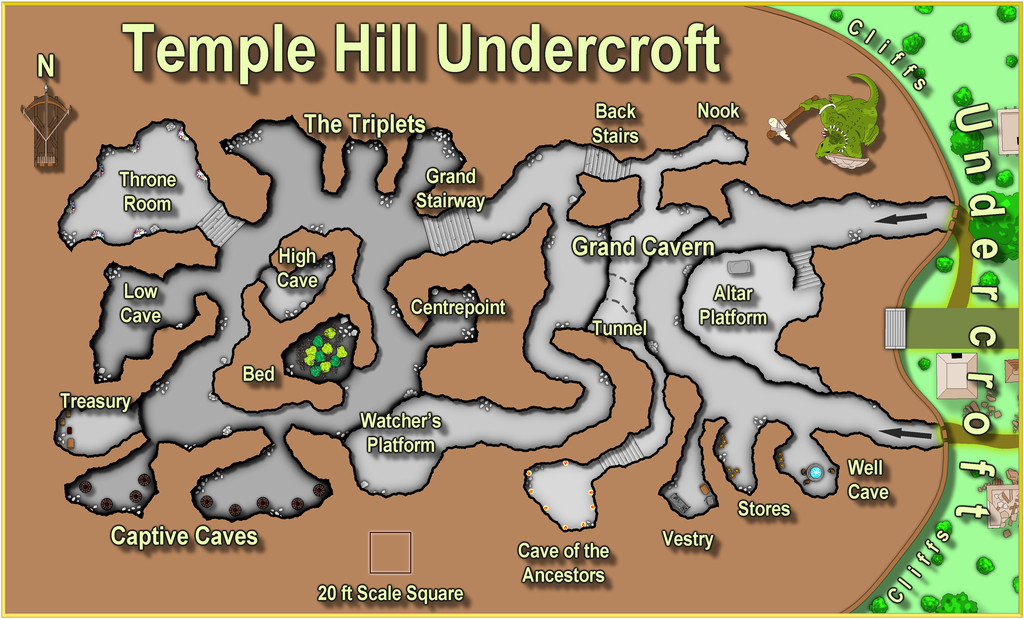
A trio of external labels were added in the process too.
Now I need to make some progress getting the notes for all three of these typed-up and finalised so they can head-off to further swell Remy's queue of maps for the Atlas!
I'll post again when that's done.
Oh, and the critter in the Undercroft. It's a huge, serpent-bodied, 20-headed hydra!


-
[WIP] Community Atlas: Snakeden Swamp, Lizard Isle, Alarius - Dedicated to JimP
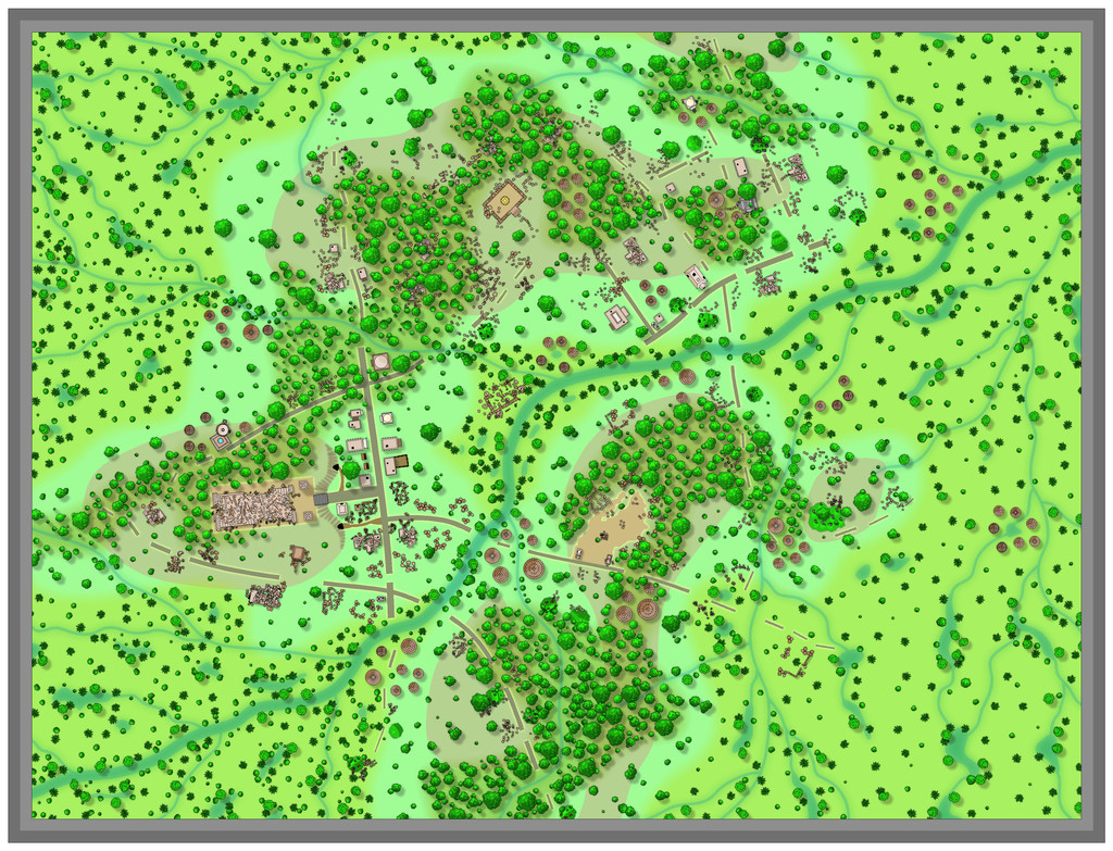
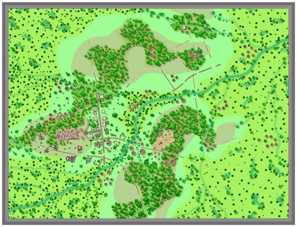
The final stages of mapping took a bit longer than expected, as that top area, still incomplete last time, had been allocated more ruins and features than many other spots. Along with this, the additional minor stream channels were emplaced in the swamp too, with a few more shrubs and trees in places:
I'd always intended to replace the map border with something more rustic, like that for the Snakeden Swamp map earlier, and settled on the angled fence-line symbols from the options available in the CD3 Vector Shaded style. They also look like sharp teeth a little, a happy accident. Getting these to look right took quite a degree of trial and error though, and while the corners don't perfectly match on this final version, I was happy with that, because I didn't really want the frame to look too perfect anyway - Lizardfolk fences, after all!
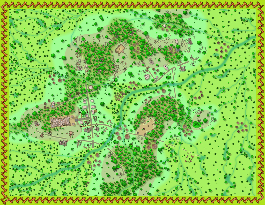
After which it was time to start thinking of labelling the map, adding a north pointer and a scale. Unfortunately, there aren't options for the latter two in this style, so alternatives from what symbols were available had to be drafted-in, again with some experimentation, and tweaking of effects:
At this point, the pale brown lettering seemed fine. However, when some place-name labels started being added across the map, it rapidly became clear that both this colouring and the black shadow and glows were interfering with the effects on the mapped symbols, creating irritating bleed-through lines on parts of the text. More experiments followed to adjust both to something that was still sufficiently clear, yet which wasn't equally causing such problems. Which turned out to be this:
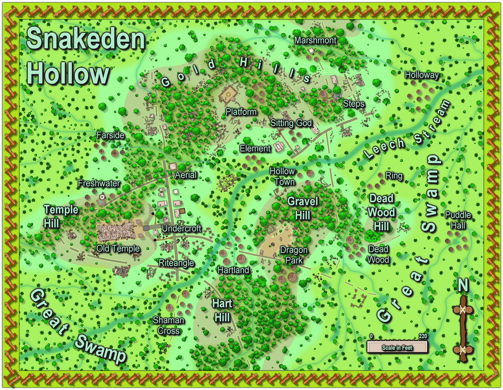
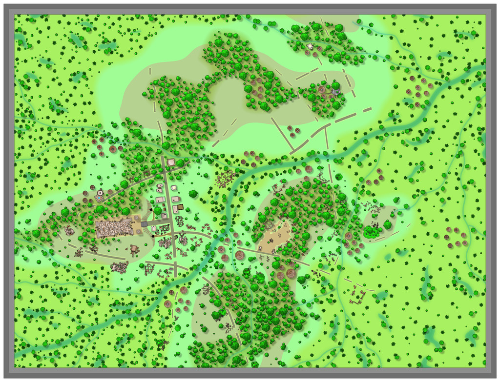
With this map finished, it's now time to head underground, since although the little square surface map with the cliff-line (the area now labelled as "Undercroft") was the original dice design that prompted these maps, it was obvious to me from the outset that the two cave entrances in the cliff would demand more attention - as to be shown next time, if all goes to plan!


-
[WIP] Community Atlas: Snakeden Swamp, Lizard Isle, Alarius - Dedicated to JimP
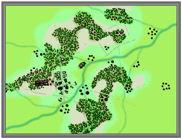
Here we see the first segment of "new" ruins being added, around the originating dice-map segment in the lower centre-left:
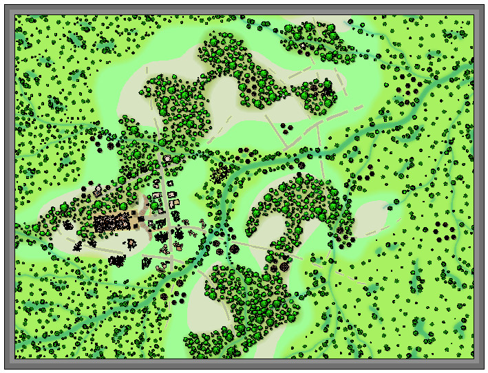
It was at about this point I realised it was growing harder to define the road lines, and where the hill contours were, a problem that worsened when the vegetation scatter began to be added around those previously clearer areas. Thus a lengthy spell of experimentation, changing the effects and colouring involved, followed. That in turn needed more features adding elsewhere, using the central section adjoining that already completed, just to make sure everything still worked OK. The results of all that:
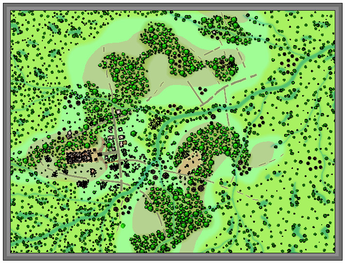
Which only brought up a further issue, as it's obvious that the reduced-resolution images are all looking rather too dark and messy now, especially over those ruined structures. So more experimentation followed with higher-res images and some antialiasing, to get to this degree of clarity (same image as above):
Following all of which, there wasn't much time to do more than a few further additions ahead of today's postings, which is where things are currently:
Not too far from completion now, at least, albeit still with the labelling to begin, not to mention those extra streams!
-
[WIP] Community Atlas: Snakeden Swamp, Lizard Isle, Alarius - Dedicated to JimP
The surface map for Snakeden Hollow presented an unusual challenge, as there is no equivalent to the old CC2 style for city-type maps available with CC3+. Source Maps Cities - City Map is perhaps the closest we get, although the symbol options for that alone are rather limited, and don't have options to easily show, or create, ruins, which I'd need for what this map's to illustrate. Instead, I opted for the CD3 Vector Shaded style, using the Vector Classic symbols. These provide a very large range of options in a clean, simple, drawn look; in fact if anything, it's difficult to hold in mind exactly what's where among the series of extensive symbol catalogues in this style. There are five different sets of options just for trees, for example, each in a separate catalogue (there is a sixth, but I think that's a duplicate). As this wasn't a style I've done anything with before, I spent some time - the equivalent of a full mapping session - simply exploring the range of symbols available, and also the drawing tools, to get a better feel for what was available.
In the meantime, I'd also sketched out a general layout for the ruined settlement. The Inkwell dice design was to form one tiny segment of that whole, as I was influenced by the symbol from the Lizard Isle map that showed there to be a substantial ruin here. You can get an impression of the Inkwell design's appearance and original size from the Seer's Hall Village map in Ezrute (as this is the intact version of the Snakeden ruin die-face), discussed on the Forum here earlier. However, during the planning process for this map, I decided it might be better to double its size in this case, partly to stop it from being lost here, partly to make the surviving buildings a bit larger and more imposing. The Inkwell dice designs aren't specifically scaled, although there is a basic assumption that the subterranean ones will be scaled to around 100 feet per side.
That settlement sketch-plan was determined initially using the standard Shadowdark RPG's system for randomly generating settlements, as far as its layout and some additional major structures were concerned, with more additions from the old Judges Guild ruins system, presented almost 50 years ago now (groan...) in their first "Wilderlands" products, all tweaked appropriately. This led to the sketch-map becoming so cluttered and confused that even I'm not sure what all the scribbles mean now, thus I've avoided showing it on any of the following WIP images! I have though left the little Ruins dice sketch design on the first two screenshots, to help give a degree of orientation and scaling.
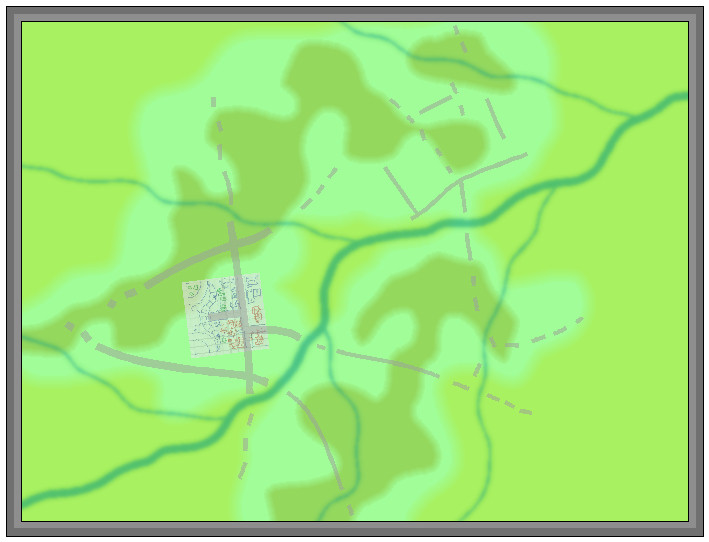
As with the area map, on creating the new CC3+ file, I found there were several sheets with effects already on them, so again this was going to be a more relatively sophisticated map than I'd earlier anticipated. The shots that follow are also of a reduced size, as previously, as they're really little more than impressions of progress at this stage. This one's with the base terrain colours and main streams sketched-in:

For a bit better clarity, I've turned off the transparency effect on the bitmap sheet with the dice-design sketch. The yellow-green towards the edges is the general swamp terrain, the darker green where the jungle-woods are going, and the "other" green is the basic background.
Next came the road-lines:
Again, these are simply to indicate the general layout at this point, and their relative widths. These were soon to be altered, as the widths were simplified here to get the lines drawn quickly.
Next, some contours were added to help suggest the "Hollow" aspect from the place-name - hence why those swampy patches were drawn as they were too - and the first elements from the Inkwell dice-face were added as well:
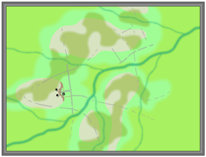
There are no suitable escarpment symbols available to fit what was needed here for the cliff-face, so I simply dropped one into the map at an appropriate scale size nearby, and drew a set of suitably-spaced and sized lines for the cliff-face as sketched, and then discarded the symbol.
Moving on, the rest of that small square segment was completed, a process that included finding and testing various of the rubble, ruins and similar options spread among several symbol catalogues. The perceptive may notice too an experiment in adding a second height contour to some of the hills. Ultimately, that was dropped as showing nothing useful, once more symbols and elements were filled-in elsewhere. It does feature on the next couple of images before that decision was made though.
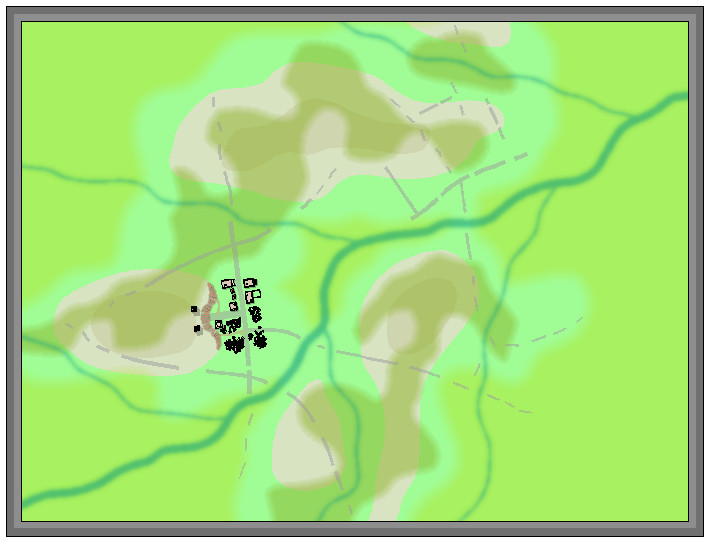
There is a reason too why the ruins are chiefly on the southern side of that little square area, which will only be revealed later!
Various fresh symbol elements were added at this stage, including where the main Lizardfolk groups are situated across the settlement (hut clusters), a few more ruins and still-standing buildings, some of which were from the main new features randomly added during preparation, and the start of the vegetation symbols.
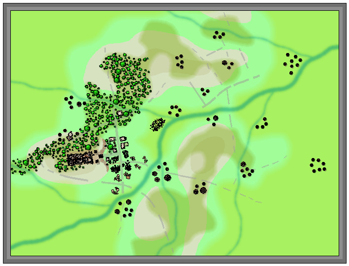
Of course, at this point, nothing is too firmly-fixed, but I was liking how the trees worked with the whole. Wasn't so sure about leaving the base vegetation colouring behind the trees at this point, although this was the stage I realised the higher contour colours just weren't working with the tree cover.
So this is where I'm up to currently, with all the trees set-up across the woody areas (there will be more elsewhere in time, though less densely), the higher contours gone, and decisions to be made next as to how best to show the swamp vegetation. More to follow...

-
Vignette in CC3
Fascinating to see this discussion.
I did something similar to what Sue describes (without using the Blend Mode option), while taking advantage too of Sue's Transparent Dome symbols, a couple of years ago for the Faerie City of Embra in the Community Atlas. I used both round and square variants on the theme to "mist-out" the edges. This topic, on the village versions of the city, shows the circular variant, and all the maps can be viewed and downloaded via the Atlas website, of course (Embra Official Guide page). You can find all the other topics discussed with images on the Forum as well, should you wish - just search for "Embra"!

