


Wyvern
Wyvern
About
- Username
- Wyvern
- Joined
- Visits
- 3,303
- Last Active
- Roles
- Member
- Points
- 5,647
- Rank
- Cartographer
- Badges
- 24
Latest Images


-
Community Atlas: Temple of Nidag, Stormwatch, Emerald Crown Forest, Alarius
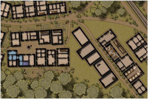
The next step was to add fireplaces to the remaining properties, as their placement determines where the doors, windows and interior walls can go:
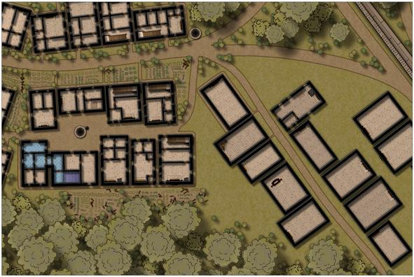
The first exterior pathways have been added too, and though it may not be obvious at this resolution, there's a spiral staircase in one corner of the second "under development" house on the left of the street, which will go into the dungeon level below eventually. That mid-building fireplace in the fourth left-side property is going to be interesting to work around!
After adding another descending spiral stair to the fifth left-side structure, I started developing the main bar feature of the series of inn buildings on the street's right side. This also connects with the adjacent property to its northeast, though I haven't finalised exactly what this property will be yet; perhaps another bar-room, or an entertainments room:
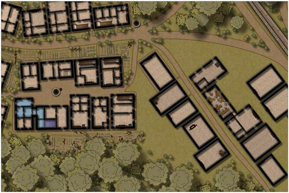
The range of fitments in the bar-room are there so I don't later forget what I was meant to be doing here, of course.
And then the inn started to develop in an unexpected direction...
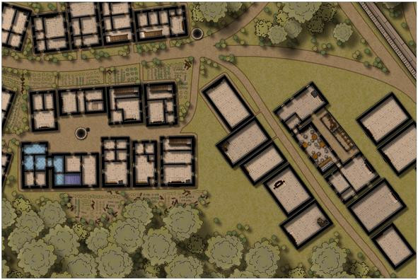
Aside from connecting it to the kitchen-house (first building on the street's right), which was always intended, now there's a fence-enclosed narrow yard, with a latrine block and woodstore, together with a gate nearest the curving road off to the northwest (probably hard to spot at this res).
After which, the pathways around all these right-side buildings were drawn, and some bushes added:
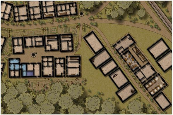
Oh yes, and we now have a stable block for the inn! While it may be hard to tell here, this has been provided with a cobblestone floor, instead of the usual wood planking, and those hay piles look somewhat less strident on higher-res images (I hope!).
Followed swiftly by more external paths, a little more vegetation cover, and a staff house at the east end of the "inn-side" of the street:
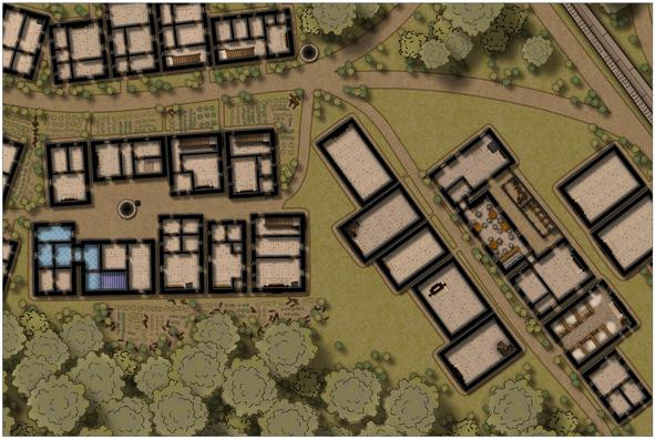
Lastly for today's update, are the outer wall and internal fittings for the two northern map-edge properties:
More shortly, with luck!


-
[WIP] The Candle & Kettle Inn in the village of Mapleford
Yes, those dormers come in very handy for hiding unwanted chimneys; done this myself before for a tropical settlement map in the Atlas!
-
A Monastery by the Sea
Often, shadowing problems like this can be improved by softening the appearance of the shadows, to make them more subtle (increased transparency, reduced size, altered colouring, adjusted blurring are all possibilities).
The bridge shadow's showing an odd gap, and its presence illustrates that a shadow effect stacked on another one starts to look odd - the bridge is further from the sea than the cliff bases, yet its shadow is more distinct, for instance.
One option to escape that double-shadowing trap might be to use the existing shadow effect lines and areas to redraw the shadow as a separate polygon, and then turn off the shadow effects entirely. Using one of the "Solid" bitmap fills might work for this, or just a normal darker grey polygon with a suitable transparency effect.
There's also the possibility of adding some extra shadow effects to the little rocks in the sea, as they currently don't have any shadows, which makes them look a little odd where they're exposed to the light. If they're all only low-lying rocks though, they'd cast negligible shadows from this viewpoint anyway, so that may be a shadow effect too far 😉.

-
How Do You Find the Right Symbols for Your Maps?
There are some basic geometric vector shapes available in the Symbols => Maps => Other folder, as "Geometry.fsc". These have a fixed colour, however, but if you have the CA62 Geometry.fsc symbol catalogue as well (it's in the same folder), that has varicolor options for the same basic shapes. That might expand your vector symbol options sufficiently.
As for converting colour maps to black-and-white, try adding an RGB Matrix Process effect set to "Gray", and see how well that works. You may need to adjust the full-colour version of the map to keep the contrast sufficiently clear in the greyscale view, but you can turn it on and off as required for exporting images of the map.
-
SVG exports?
Fractal Terrains can export as an SVG, apparently, BUT it's not available as standard, and it may not work properly. There's a trick to it, and caveats - see this Forum post by a certain J Slayton from 2022. Your safer bet though might be using an online converter from one or other of the CC3+ "Save as..." options instead, as Scott mentioned already.
