


WeathermanSweden
WeathermanSweden
About
- Username
- WeathermanSweden
- Joined
- Visits
- 3,737
- Last Active
- Roles
- Member
- Points
- 459
- Location
- South of Lübeck in northern Germany
- Website
- https://www.astroinfo.se
- Real Name
- André Franke
- Rank
- Surveyor
- Badges
- 6
Latest Images
Reactions
-
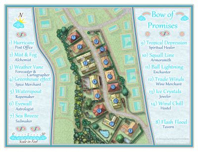
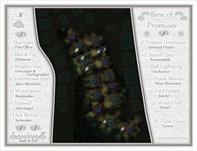
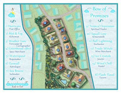
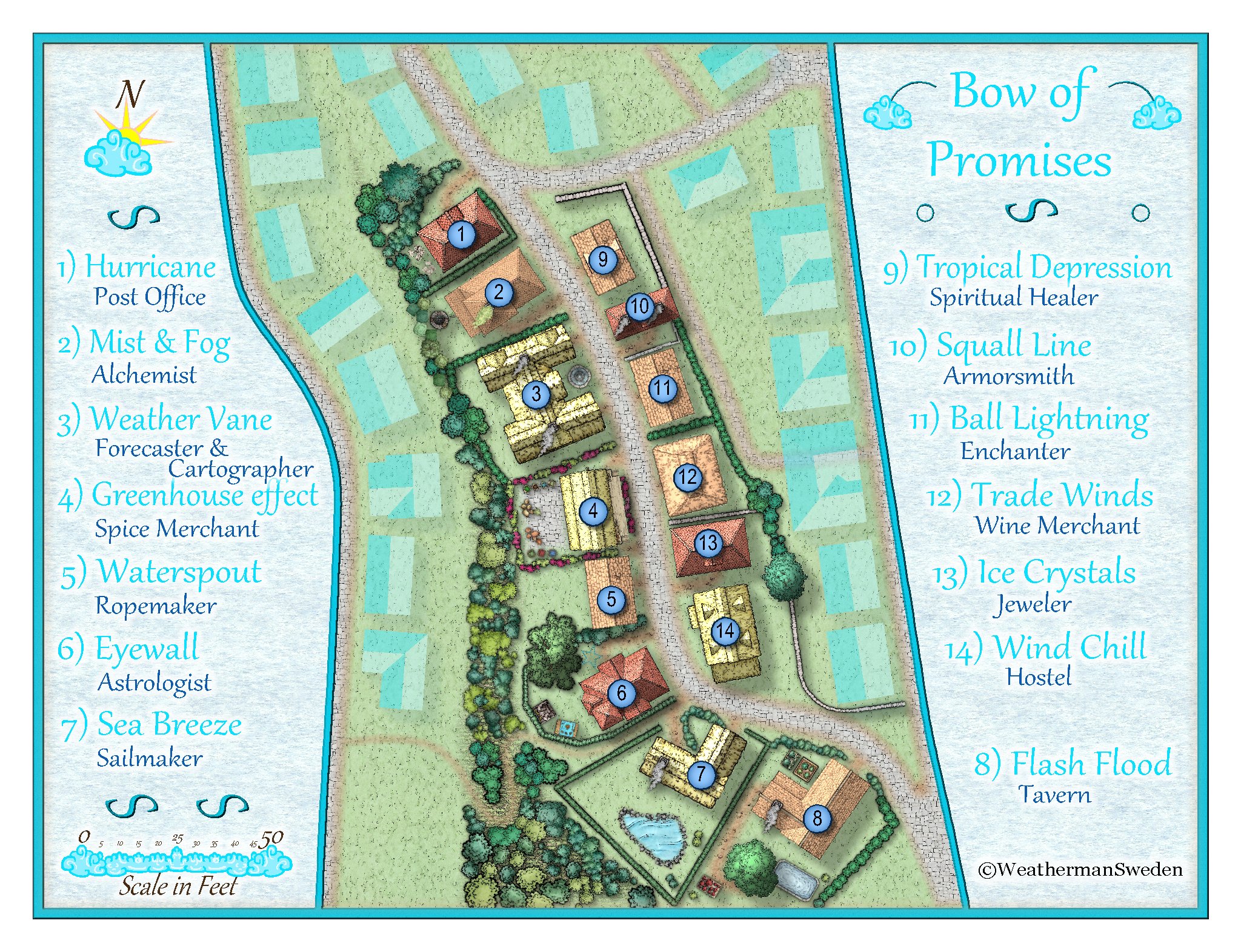
October challenge: Bow of Promises (Street) WIP
I recently watched Remy's video tutorial about making night version maps of existing day versions. So I gave it a try and ended here:
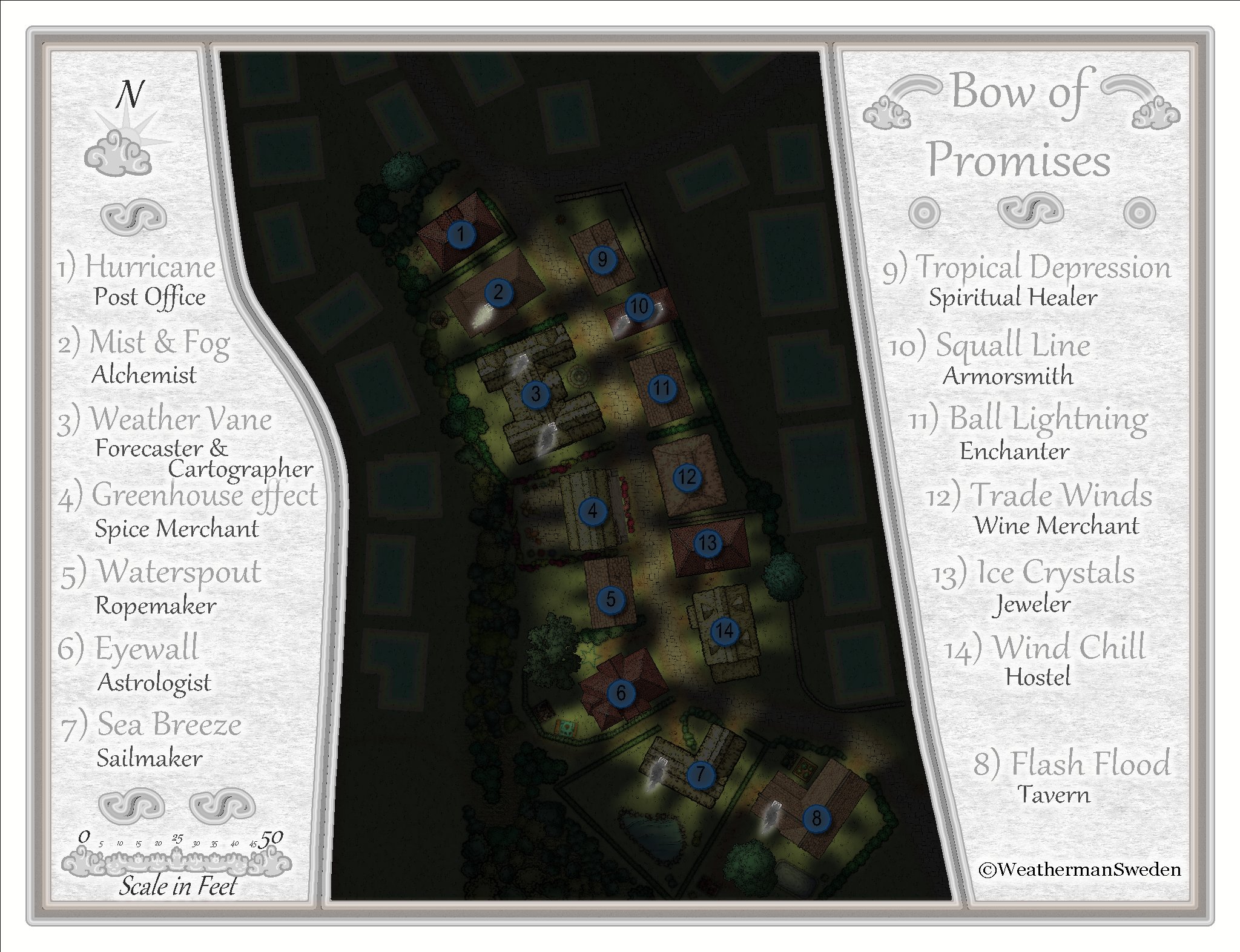
By now the environment is lit up only by light from inside the houses. I thought about placing some light sources outside but could not find matching symbols for that. There are open fire symbols but placing them near all the houses with thatched roofs seem kind of dangerous...?


![[Deleted User]](https://secure.gravatar.com/avatar/c75d9a245b74d9c59be0999ea81ca541/?default=https%3A%2F%2Fvanillicon.com%2F92add7f8c954488718110edc4896ad39_200.png&rating=g&size=200)


-
October challenge: Bow of Promises (Street) WIP
@Monsen Yes, it is ment to be a more peaceful part of the town...but as you say - who knows what is hidden behind the houses in the bushes or the cellars of the houses...
But that is up to the user of the map - that easily can be turned into a "dark-bow" area thanks to the fantastic possibilities with sheet effects. Already by simply turning of the "rainbow-effect" you get a rather neutral map with a slightly cold touch (matching the cities geographical position on Nibirum)
@Loopysue Thank you Sue for your kind words!
For me one of the most difficult things was the decision where to end the map and how much of the environment should be shown. At the same time I felt that the surrounding buildings should not distract to much from the place / street that should be mapped. And most fun was/is testing sheet effects ☺️

-
October Community Challenge - City Streets - VOTING POLL in first post
I would like to take location 6, please.
-
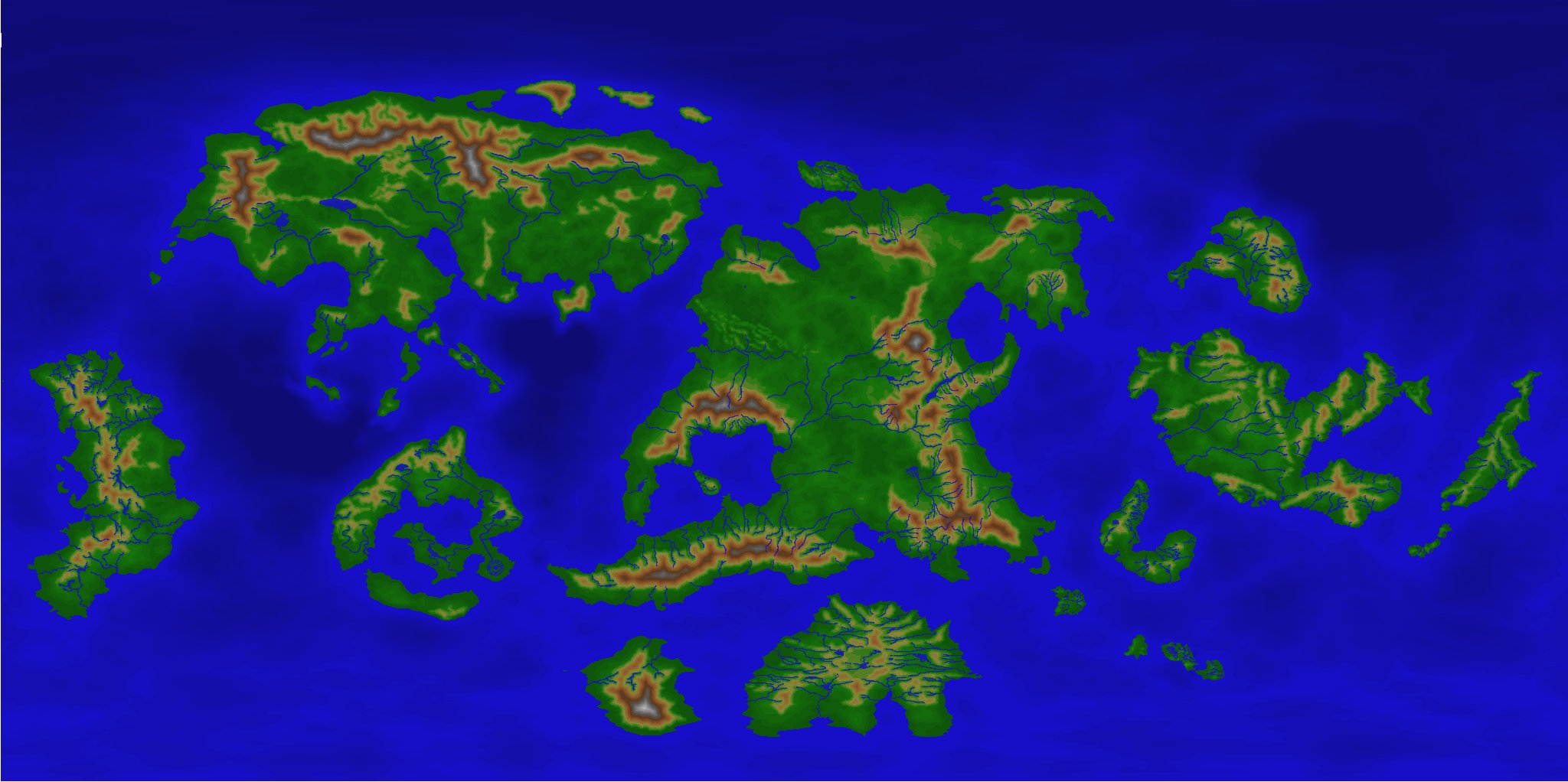
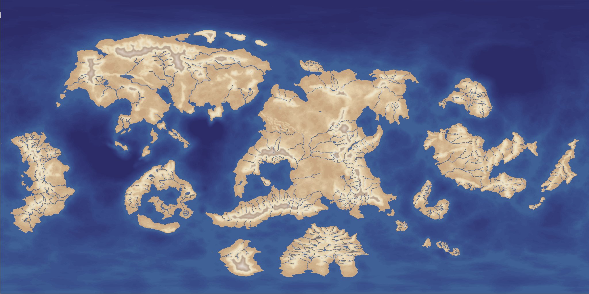
[WIP] Community Atlas - Topographical map of Nibirum with ocean currents
@mike robel You can read more about the 32/16 colour schemes here:
I use 16 colours for the sea and 32 for the land. I created special export sets for FT3 so that you can change the colours of your CC3+ maps as easy as in FT3. I use the colours 224-239 for the sea and 192-223 for the land - after inspiration of @Loopysue who introduced using colours at that range for height contours...
So you can get the Nibirium world even in classical CC2 colours (called for Basic in FT3):
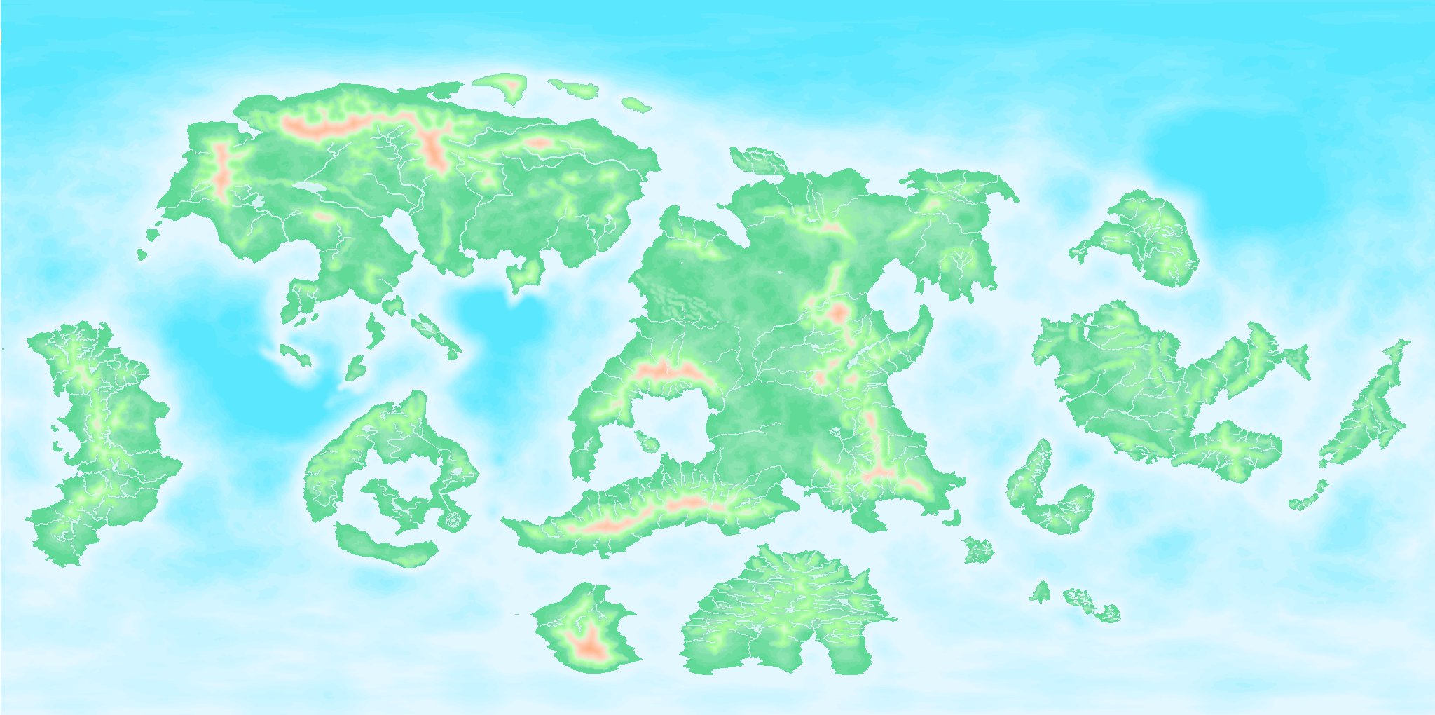
or even the classical FT3 default look:
...only by typing
PALLOAD filenameThank you to all the input from all here.
It will take some time - because many times you have to do even other things that have nothing to do with mapping at all...?
-
[WIP] Community Atlas - Topographical map of Nibirum with ocean currents
@Monsen Remy, can a script change the colour palette of a map automatically when clicking on a button or something like that?
My map uses (as you already may have suspected...) one of my 32/16 colour schemes (based on Sue's schemes) so that the user easily can change the whole appearance of a map by changing the palette in the FCW file.
Natural:
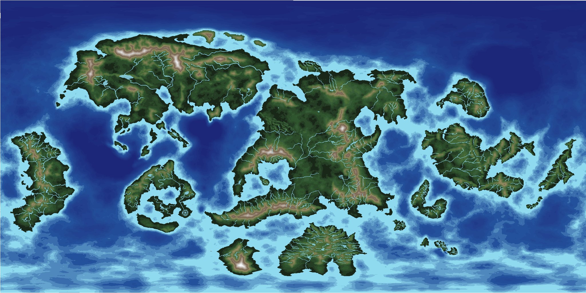
Desert:
Parchment dark:

and so on...
Or what about just a Mars look like one ?:
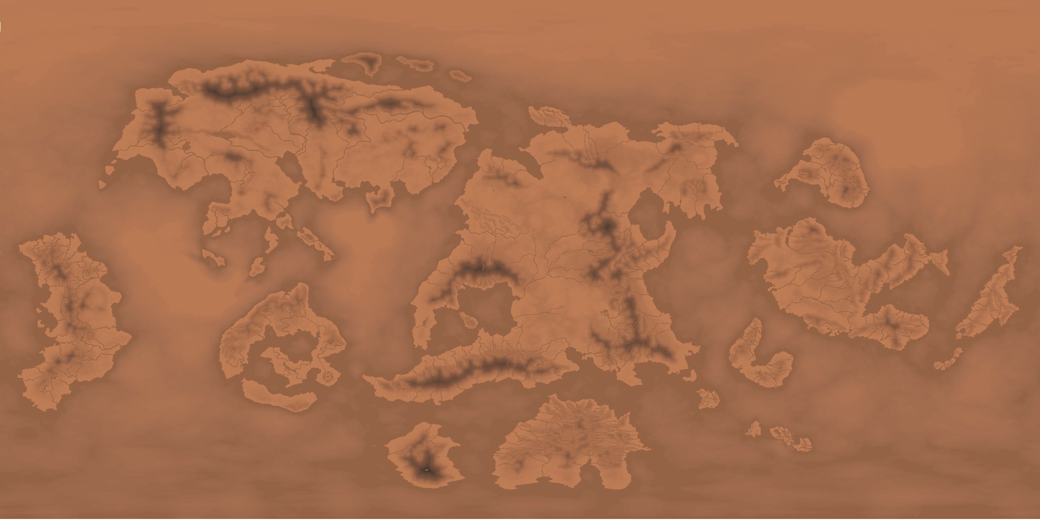
Just in case someone has a need / use for this...or over 100 other variants... ?


