


WeathermanSweden
WeathermanSweden
About
- Username
- WeathermanSweden
- Joined
- Visits
- 3,737
- Last Active
- Roles
- Member
- Points
- 459
- Location
- South of Lübeck in northern Germany
- Website
- https://www.astroinfo.se
- Real Name
- André Franke
- Rank
- Surveyor
- Badges
- 6
Latest Images
Reactions
-
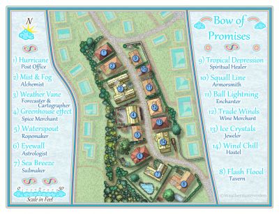
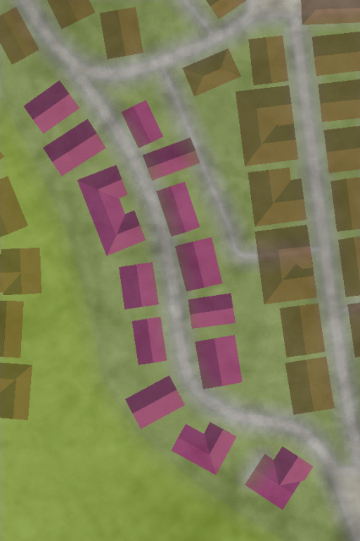
October challenge: Bow of Promises (Street) WIP
Location 6 in Dunor City
Why did I choose location 6?
Back when the challenge started there where 20 locations where streets should be mapped. I wanted to map a location with a little more space around the houses and where my passion for wind and weather could come in.
Where do I find location 6 in Dunor?
Location 6 is situated in the western part of Dunor just at the foot of the castle hill. The next parallel street in the west leads up to Dunor Castle. To the south the street of location 6 leads to a marketplace that is connected to the harbour of Dunor where all the sailing and trading ships arrive and depart.
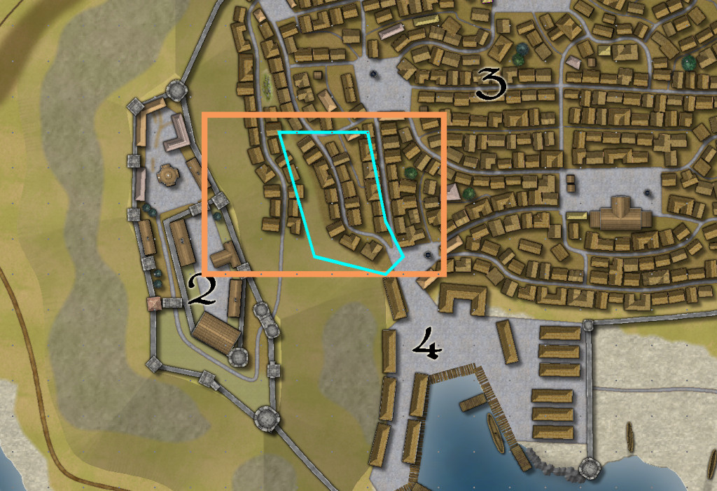
So at least when you arrive by ship - this street is one of the first you will pass on your way further in to town. The street is also one of the streets that you may pass on your way to the harbour - on your way to explore or travel around the world. Maybe you follow rumors that tell of immeasurable treasures or promises to start a new better life somewhere else.
And with this in mind and the aim to establish a connection to wind and weather the name for the street was chosen:
Bow of Promises Street
The picture above shows location 6 with its surrounding and the map below shows the houses that I will focus on: 14 buildings / houses along the street
What mapping style?
Mapping at this scale is somewhere in between cities an dungeons/floorplans. So I chose the Schley style that offers plenty of symbols at both scales.
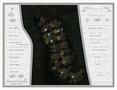
And this is the actual state of the map:
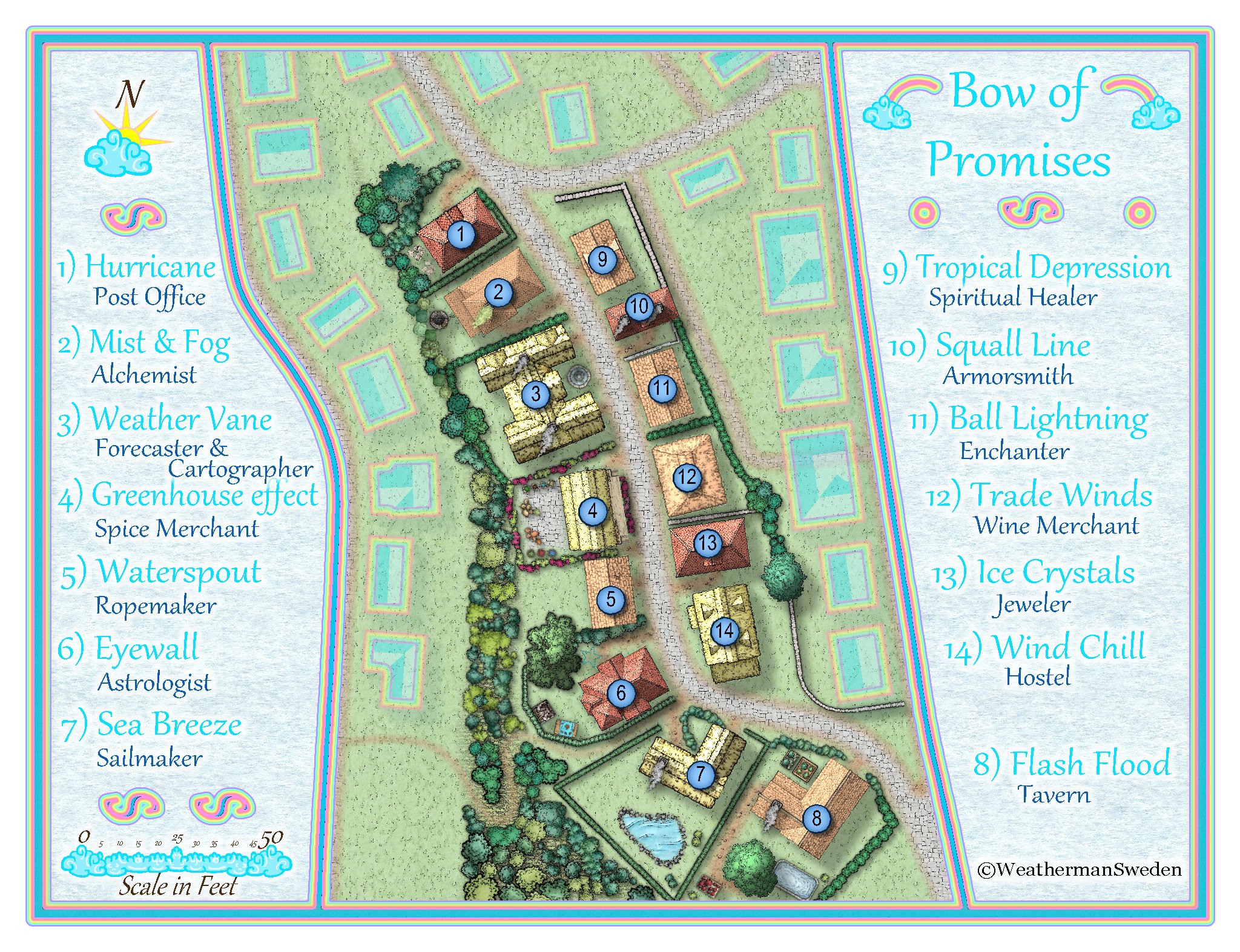
What do you think? Any suggestions? By the way...this is my first fantasy city map...


![[Deleted User]](https://secure.gravatar.com/avatar/c75d9a245b74d9c59be0999ea81ca541/?default=https%3A%2F%2Fvanillicon.com%2F92add7f8c954488718110edc4896ad39_200.png&rating=g&size=200)


-
Gettysburg
@mike robel The purple belongs to the "non existing" 16 colours that the 32 colour scheme not make use of. Both the brown and the green palette schemes use 48 colours, but the brown-green scheme does only use 32. I have now sent you a 48 colour version of that scheme in a PM. That should work and replace the purple area with dark brown colours.

-
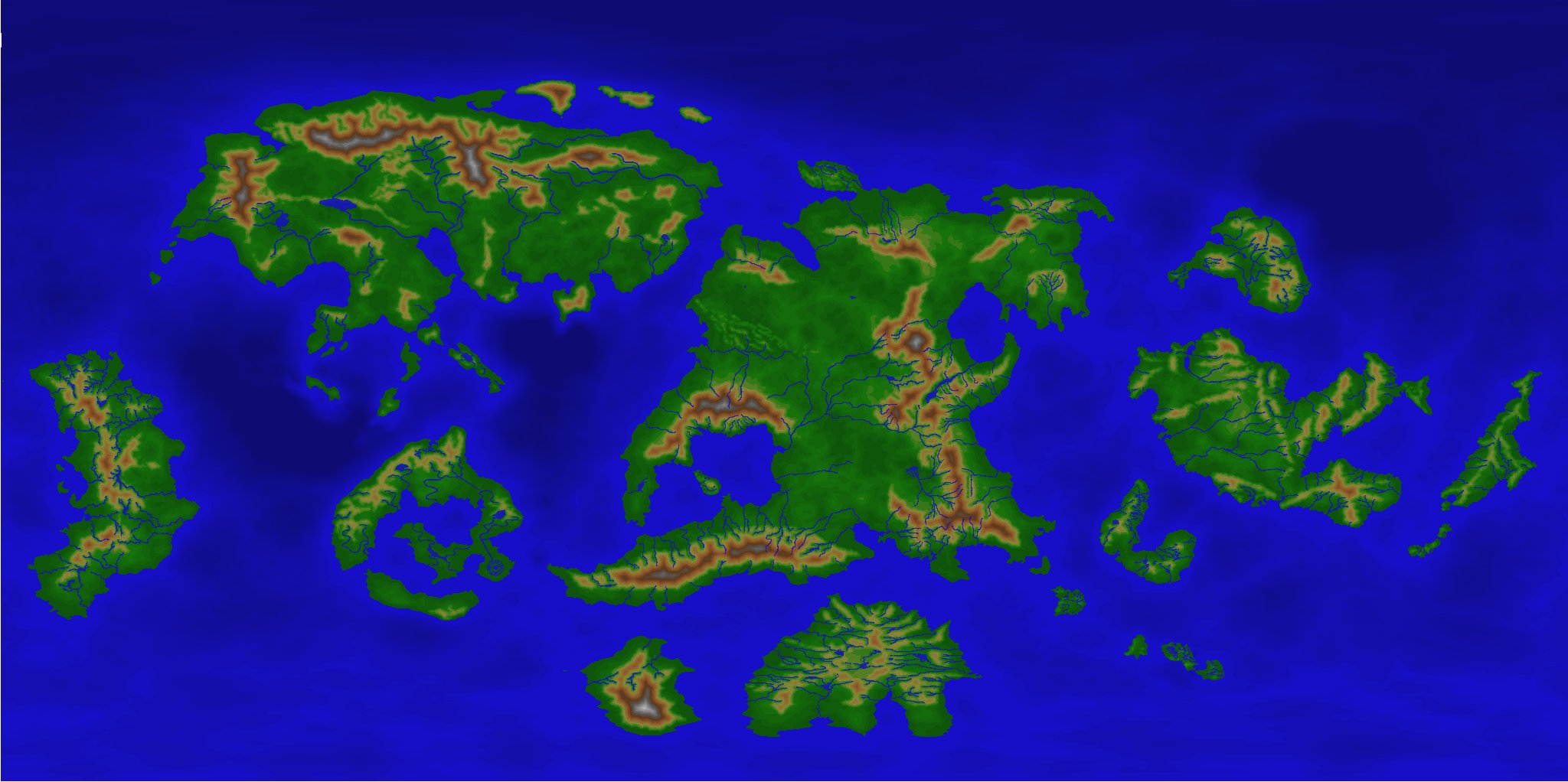
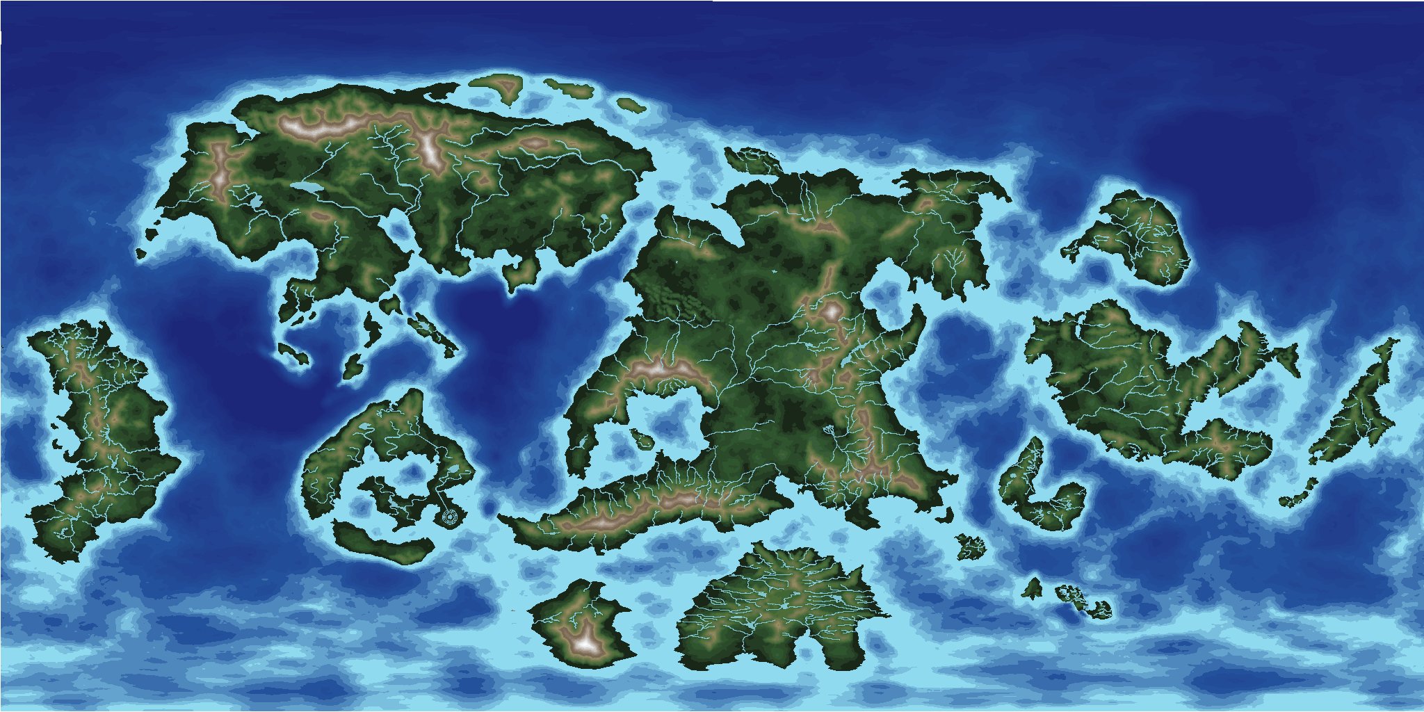
[WIP] Community Atlas - Topographical map of Nibirum with ocean currents
@mike robel You can read more about the 32/16 colour schemes here:
I use 16 colours for the sea and 32 for the land. I created special export sets for FT3 so that you can change the colours of your CC3+ maps as easy as in FT3. I use the colours 224-239 for the sea and 192-223 for the land - after inspiration of @Loopysue who introduced using colours at that range for height contours...
So you can get the Nibirium world even in classical CC2 colours (called for Basic in FT3):
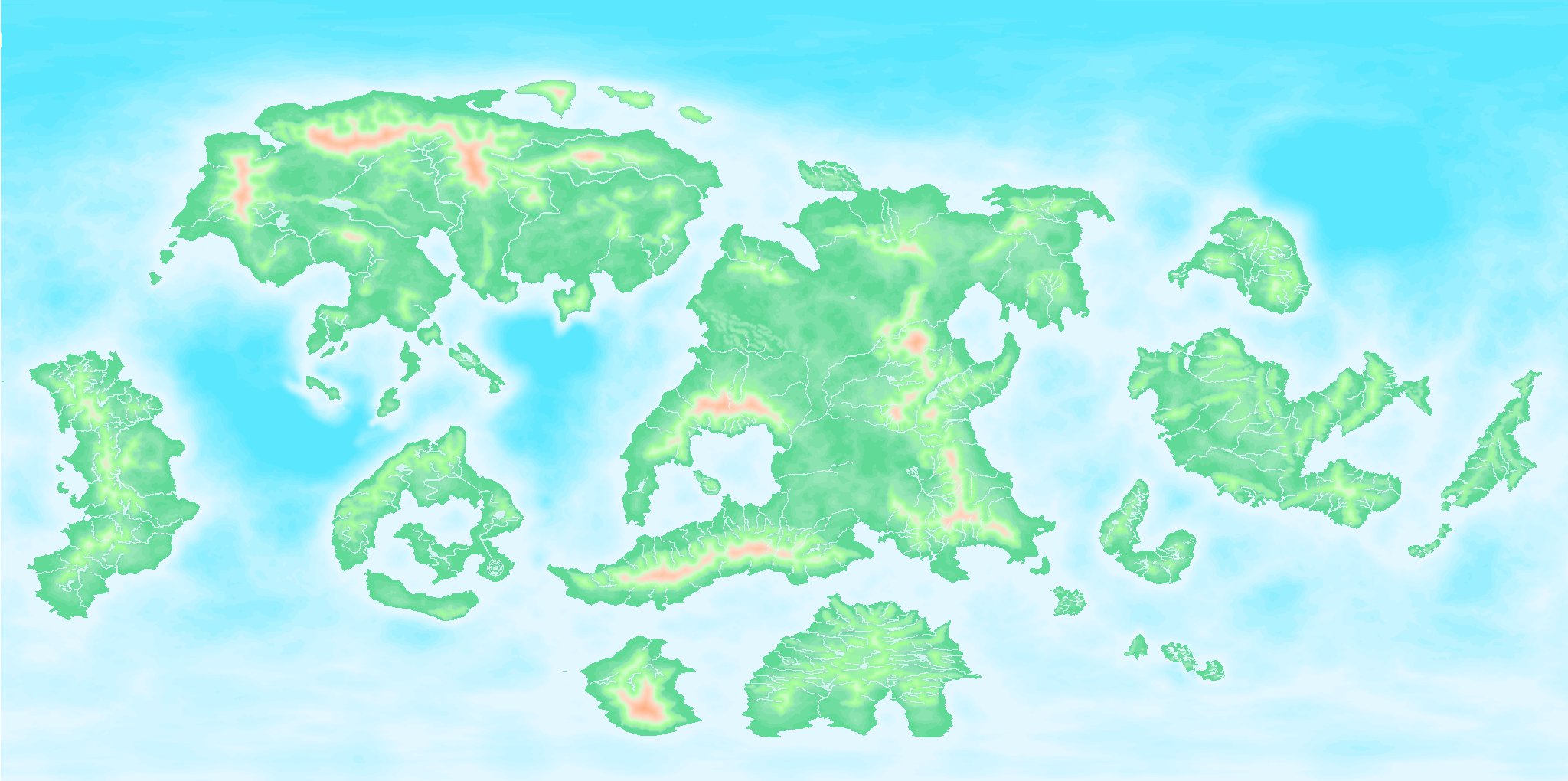
or even the classical FT3 default look:
...only by typing
PALLOAD filenameThank you to all the input from all here.
It will take some time - because many times you have to do even other things that have nothing to do with mapping at all...?
-
[WIP] Community Atlas - Topographical map of Nibirum with ocean currents
@Monsen Remy, can a script change the colour palette of a map automatically when clicking on a button or something like that?
My map uses (as you already may have suspected...) one of my 32/16 colour schemes (based on Sue's schemes) so that the user easily can change the whole appearance of a map by changing the palette in the FCW file.
Natural:
Desert:
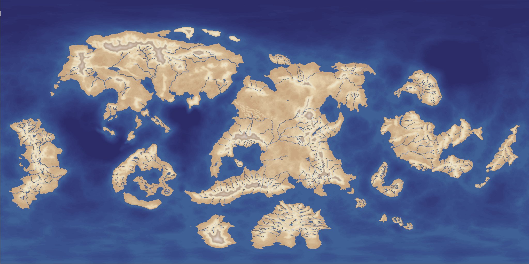
Parchment dark:

and so on...
Or what about just a Mars look like one ?:
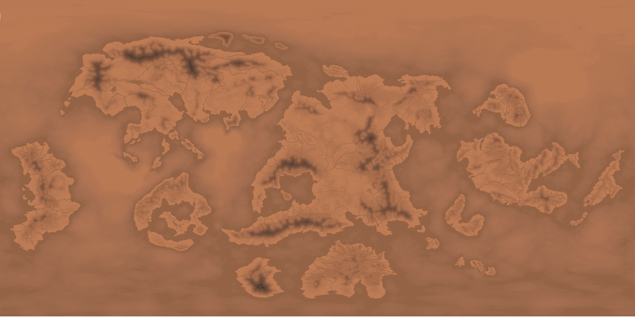
Just in case someone has a need / use for this...or over 100 other variants... ?


-
[WIP] Community Atlas - Topographical map of Nibirum with ocean currents
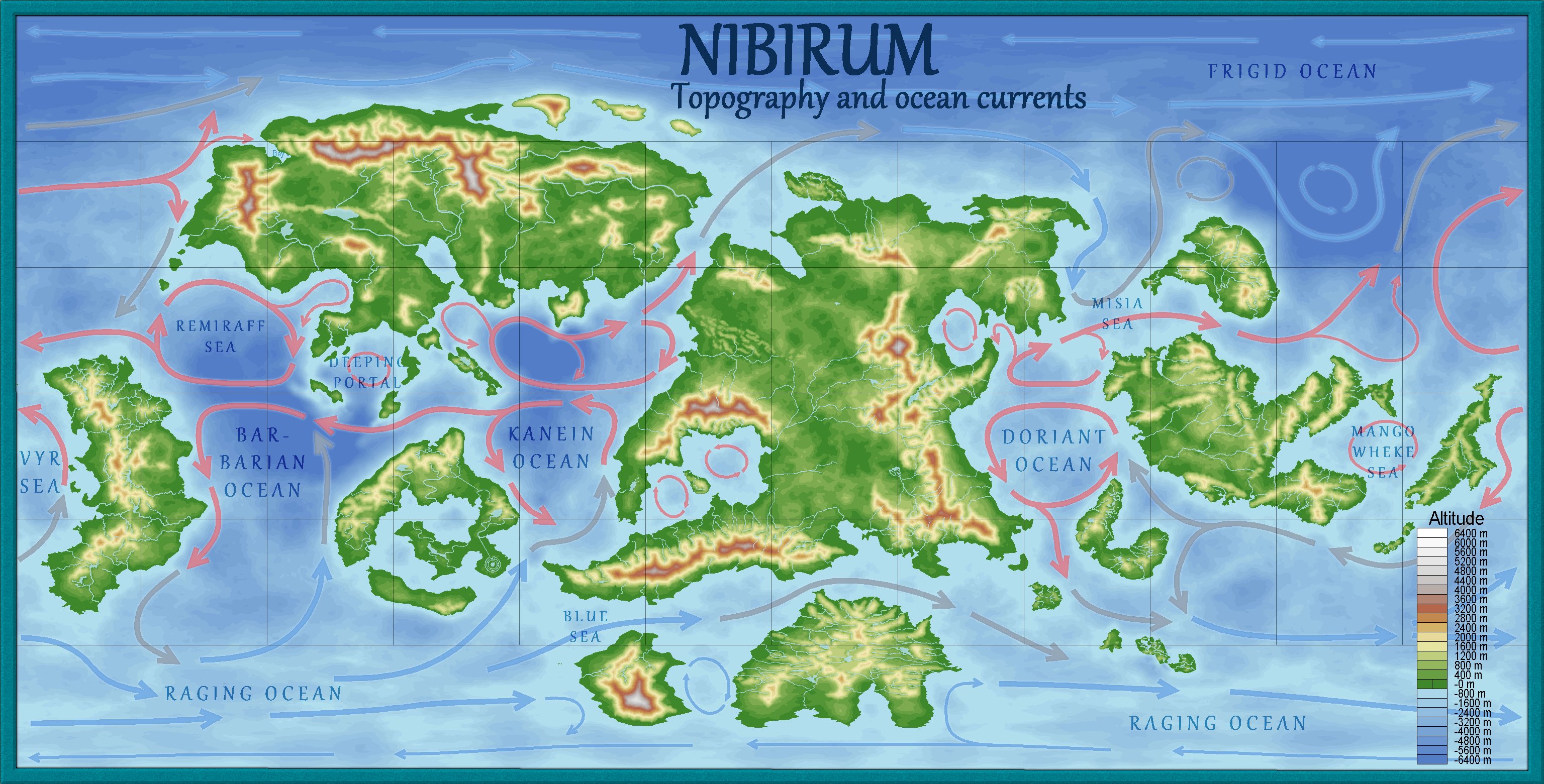
This is the latest version. I ask my self if there is something missing? Should there be a scale on this map? Should the map contain the names of the continents? Thinking about adding "prevailing winds"...
Should major drifts be named?
Something else I should think of before the map can be part of the community atlas?
I made at least a check for consistency so that the eastern part matches the western part...
...as a meteorologist I am thinking more of questions - where would hurricanes likely develop and can Tornado-Alleys be found on Nibirum...?
...will the weather be fine when traveling to northern Alarius...
