


Monsen
Monsen
About
- Username
- Monsen
- Joined
- Visits
- 723
- Last Active
- Roles
- Administrator
- Points
- 9,029
- Birthday
- May 14, 1976
- Location
- Bergen, Norway
- Website
- https://atlas.monsen.cc
- Real Name
- Remy Monsen
- Rank
- Cartographer
- Badges
- 27
Latest Images


-
Top down trees & vegetation for Dungeon Designer?
There are trees in regular DD3 style too. Just click the :DD2SKIRMISH: button. CA50 also added additional trees and vegations for this style.

-
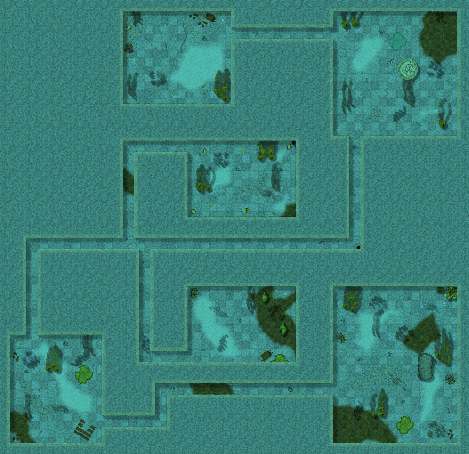
The Sunken Temple
Here's the basement level below the underwater temple. Also flooded obviously, so I used marine dungeons for that too.
I took some liberties with this one too, for example I used lots more sea plants that would naturally grow in a place with basically no light at all. I've found that when using this style, if you want it to actually feel underwater, you may need to overdo some things that might not be completely natural.
Had a bit of fun with this place. Considering the players had to use spells to breath and move efficiently underwater, they were on a timer. Unfortunately, they are quite high level by now, so with the spells active, they were more or less able to ignore the environment. But the timer meant they couldn't just decide to rest to heal up and recover spells, and several spell slots had already been used up for the underwater support spells. Also meant that Dispel Magic suddenly became the most deadly spell in the book.
(Hi Res)

![[Deleted User]](https://secure.gravatar.com/avatar/c75d9a245b74d9c59be0999ea81ca541/?default=https%3A%2F%2Fvanillicon.com%2F92add7f8c954488718110edc4896ad39_200.png&rating=g&size=200)


-
Pen & wash question
Well, it is easy to know what's up when you are at the bottom.

-
Does Size Settings Matter for Output?
It doesn't matter at all. Units in CC3+ are meant to represent real world sizes, so you make the map in 240 x 180 if it is 240 by 180 miles (or feet/meters/kilometers depending on map type) or 2400 x 1800 if it is 2400x1800 miles.
For an overland map, symbol scale will vary, as you pointed out yourself, and many drawing tools have line width expressed as fraction of map size, meaning they will vary too.
For dungeon/city maps, the larger map will give you a larger area to work with, since symbol scale don't vary with map size.

-
YAWIP: Sea Star, a Dark city seaport
I wasn't suggesting you use the actual ferraris fills, just pointed you to that style to show an example of how it can be laid out.
I guess the fills do work out there though, but I would seriously lower the scales of the fills, they're way to large the way they are now. Also, aligning the fills to follow the road (or something else) will give a more organic look rather than have them all perfectly horizontal. If you look at the ferraris style example I liked to, it also uses rows of threes/bushes on the border of the fields. This both looks good, and is often done in real life too.

