Monsen
Monsen
About
- Username
- Monsen
- Joined
- Visits
- 726
- Last Active
- Roles
- Administrator
- Points
- 9,029
- Birthday
- May 14, 1976
- Location
- Bergen, Norway
- Website
- https://atlas.monsen.cc
- Real Name
- Remy Monsen
- Rank
- Cartographer
- Badges
- 27
Latest Images


-
XP Programming
I've edited the first tutorial now, updated it for VS 2022 and tested it on both Windows 10 and 11, so everything should be correct there.
As for the part 2 project, seems like there was an error there where the project no longer contained the references to the XP toolkit, and was otherwise reverted to default values, which is why the includes didn't work. The project needed to be changed to use an installed SDK, and the XP references put back in. I've uploaded a fixed version now.
I've also made a minor change to my CC3+ XP template, now it should default to the latest installed SDK instead of targeting a specific version. You can download the new one using the same link as before.

-
XP Programming
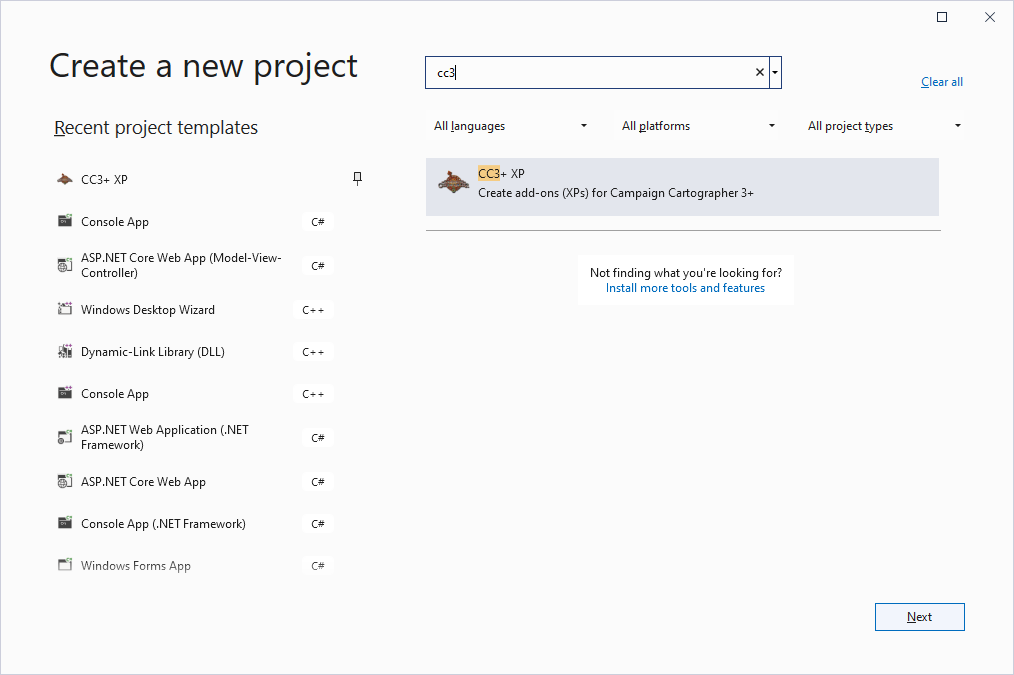
Filters doesn't work with custom templates unfortunately, but it should be easy to locate just by typing cc3 in the search box.
I'll mention that when I rewrite the tutorial. That first part was written before I made the template at all, so the mentions of it was just edited in later.
-
Error Message with Ancient Tombs Isometric Map Style
I don't think you actually need Perspectives to take advantage of the issue itself, since it comes with proper symbols for both walls and floors. But you need it to use the 3D projection command, and it also gives the advantage that you can draw additional isometric shapes manually.

-
Community Atlas - Haddmark - Peredur
Well, I guess the climate fits the bill for the Kalmar Union....

-
How to create a custom template?
Ralf had a blog series about this:
He also has a live mapping session with the topic:
If you own the Tome, there is also a tutorial on this starting on page 154