


Monsen
Monsen
About
- Username
- Monsen
- Joined
- Visits
- 723
- Last Active
- Roles
- Administrator
- Points
- 9,029
- Birthday
- May 14, 1976
- Location
- Bergen, Norway
- Website
- https://atlas.monsen.cc
- Real Name
- Remy Monsen
- Rank
- Cartographer
- Badges
- 27
Latest Images


-
Facebook login going away - Please read if you use Facebook to log into this forum
Due to changes in requirements from Facebook, the option to use your Facebook account to login to this forum is no longer available.
We apologize for the inconvenience.
What does this mean for me?
First of all, this only affects users that use their Facebook account to log into these forums. Most of our users do not, and do not need to do anything.
But for the users who have been using Facebook login, this means they will need to switch to use the regular username/password login instead.
Your forum account will not have changed. Even if you created it using Facebook login in the first place, an account was still created on this forum, using the email address from your Facebook account. This means that even if you cannot use the Facebook login button anymore, you can still login using your email address as your username. If you don't know your password, since you normally wouldn't have been using this when using the Facebook login, you can simply use the forgot password feature with your email address to set a new one. (Note: Your forum password is NOT the same as your Facebook password, Facebook only provided us your email address to create the account, they don't share your password).
If you need any help, please contact help@profantasy.com and we will help you to ensure continued access to the forums.
Alternatives
The Google login plugin will still remain active. If your google account uses the same email address as your Facebook account, you should be able to switch seamlessly to that one, although you do need to know the password to your account (se above) to associate the Google login with your existing account for the first time. Otherwise, for easy login, I recommend picking a unique password for the forum that you don't use anywhere else and just save the credentials in your browser for the standard login.


-
Which is the proper way to remove walls in the connection between areas?
What is created initially depends on what tools you use. If you use the basic tools (path, poly, etc) in the right-hand toolbars, they only create a single entity, either a line or a polygon, depending on the tool (Of course, if you draw using a polygon tool, but has line width greater than 0, it will appear as a hollow shape with an outline, looking more like a line than a poly, but it is still a polygon)
If you draw something using one of the drawing tools (usually accessed from the buttons in the top right, or the symbol catalog window) it may or may not draw two entities, depends completely on the tool. Some only draw a wall, some only draw a floor, and some draw both.
If you use the dungeon room/corridor tool, it will always make two entities, wall and floor.
In the cases where the tool created two entities, these are separate, and needs to be edited separately.
You can usually easily identify if something is one or two entities by using the List command from the Info menu. If it goes straight form 0 selected entities to 2 selected entities when you click on the edge, you know you are dealing with overlapping entities (probably a floor and a wall), and the info you get when executing the command should give the details on the entities.
When you use break on a polygon, it turns into a path (a line), which means it is no longer a polygon, and obviously therefore have no surface area to fill anymore, which is why the fill disappears.

-
Modern Map support
You should be well on your way with CC3+ and SS3. Do note that SS3 is a generic modern set, it doesn't have anything in specific for superhero, but on the other hand, most of the specific stuff would be the superheroes themselves anyway, the rest is mostly standard modern. Of course, no symbol pack is ever going to have every single symbol you're ever going to need, but these are a good start.
We currently don't have any other sets for modern available, but for Sci-Fi, there is Cosmographer 3. Note that the art style in Cosmographer 3 is a bit different from SS3 since they are by different artists. You can mix and match in the same map if you want to, but they were not designed with that purpose in mind.
There are some free community provided packs, and while mostly focusing on fantasy, some of them (CSUAC and Dundjinni archives mostly) also have some modern and futuristic symbols.
And, as Sue said above, you can use any .png file as a symbol, so you can find and add symbols from other sources you may have access to.
-
Community Atlas: The Haunted Cloud Mesa Area of Kraken Island, Forlorn Archipelago
Maps now added to the atlas. Thanks Wyvern.

-
Community Atlas: Gruvrå's Mine, Serkbergen, Peredur
Thanks @Wyvern , maps have now been added to the atlas
-
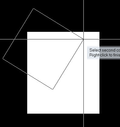
Changing the room placement crosshair color
The crosshair isn't actually a color. It is drawn as the negative color (XOR) for anything it is over, so when over a dark background, it is light, and over a light background it is dark.

-
Problem with red marks appearing on maps
The first one seems to have red areas that look like terrain and not Xs.
It's just an illusion caused by the shape of the poly, the size of the red X, and the fact that it is in the background partially covered by other fills. Look closer at it, and you'll see the sharp straight edges between the red X and the white background.

-
Community Atlas City of Tartateos - Shipyards District
Personally, I feel it needs more clearly defined streets. The continuous cobblestone fill looks a bit weird and unnatural to me. Even if a city did use cobbles for all it's streets (which is uncommon in itself), having it wall-to wall everywhere looks out of place, especially in places outside the main thoroughfares, like back alleys and backyards.

-
How long have you been using Campaign Cartographer?
Interesting. I don't know exactly when CC2 (The first Windows version) arrived, but the earliest ads I could find were from 1997, several years earlier. Do you remember why you went for the DOS version at that time?
-
Altering GUI for larger tools
There are a couple of things you can change. For example, you can get larger toolbar icons by clicking the :TOOLSICON: button, and you can change the size of the symbol display by clicking the options button on top of the symbol catalog.
The rest of the GUI is set up using standard Windows sizes, and follows whatever scaling setting you set in Windows. (With some exceptions, like the text size in the blue info window.
